Great Whinscale

Hill, Mountain in Cumberland Copeland

England

Great Whinscale

Eskdale
Eskdale Credit: Mick Garratt

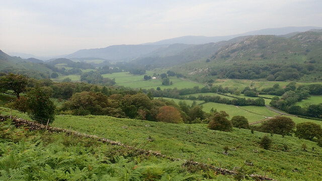
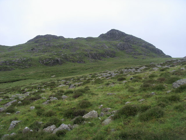
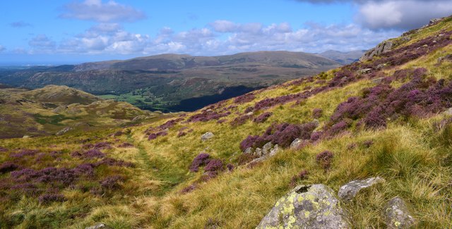
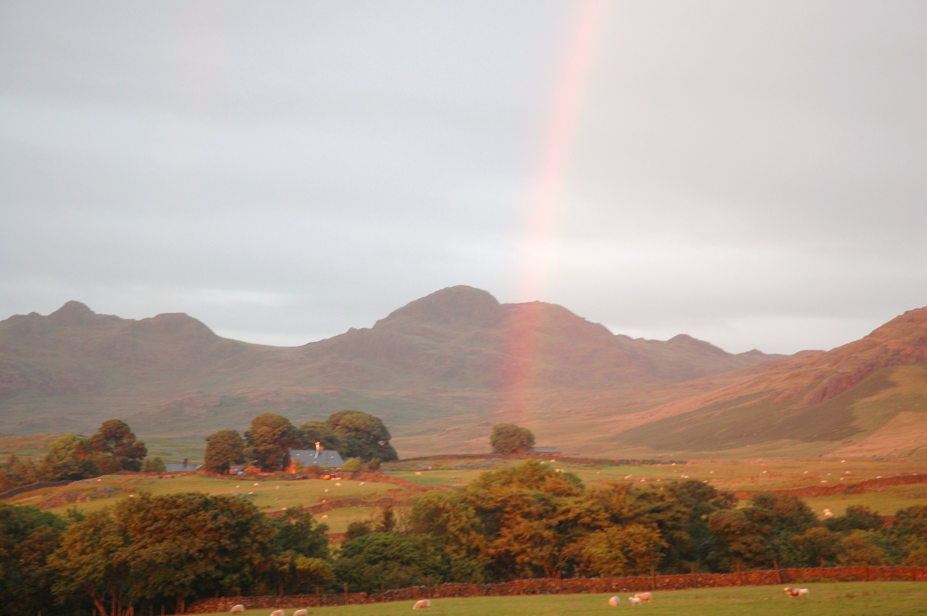
Great Whinscale is a prominent hill located in the county of Cumberland, England. Situated in the Lake District National Park, it forms part of the picturesque landscape that attracts tourists and outdoor enthusiasts from around the world. Rising to an elevation of approximately 1,250 feet (380 meters), it offers breathtaking panoramic views of the surrounding area.

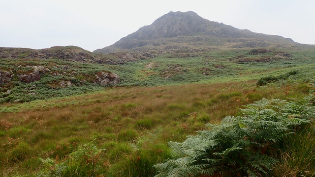
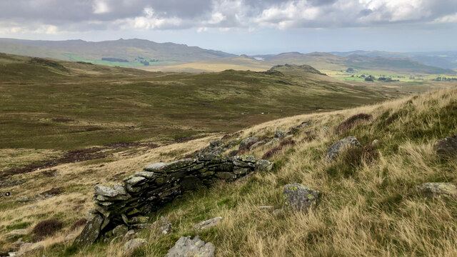
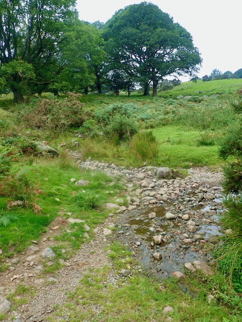
The hill is characterized by its rugged and rocky terrain, with steep slopes and craggy outcrops. It is primarily composed of volcanic rocks such as andesite and basalt, which were formed during ancient volcanic eruptions. These geological features provide a unique and diverse habitat for flora and fauna, making it an important area for conservation.

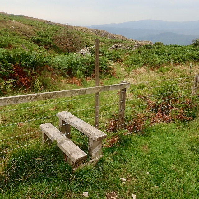
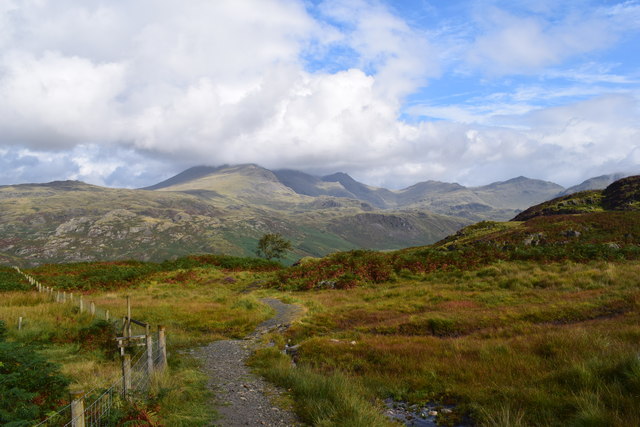
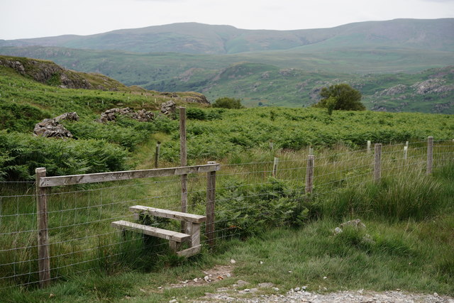
Great Whinscale is a popular destination for hillwalking and hiking, with several well-marked trails leading to its summit. The ascent can be challenging, but the reward is the awe-inspiring vistas of the Lake District, including distant peaks, valleys, and lakes such as Derwentwater and Bassenthwaite Lake.

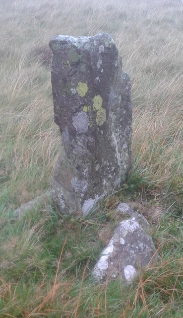
The hill is also steeped in history, with evidence of prehistoric settlements and ancient mining activities in the surrounding area. As visitors explore the hill, they may come across remnants of old mine workings, adding an intriguing historical dimension to their experience.

Overall, Great Whinscale is a natural gem that offers visitors a chance to immerse themselves in the beauty of the Lake District while experiencing the thrill of conquering its heights.

If you have any feedback on the listing, please let us know in the comments section below.

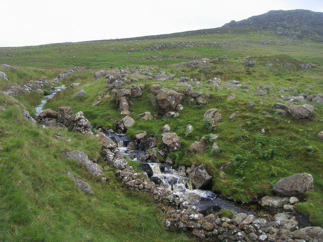
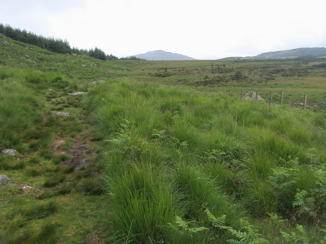
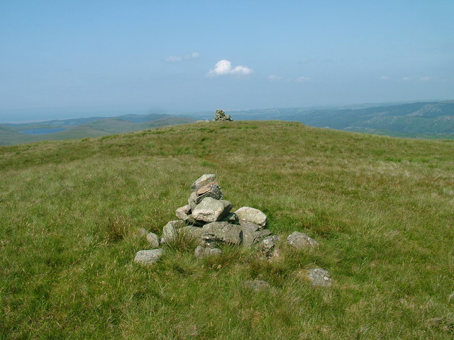
Great Whinscale Images

Images are sourced within 2km of 54.37978/-3.2361758 or Grid Reference SD1998. Thanks to Geograph Open Source API. All images are credited.

Eskdale
Eskdale
Stile, Spothow Gill
Stile, Spothow Gill
Harter Fell
Harter Fell
Stream crossing, Grassguards Gill
Wormshell How
Wormshell How
Small bield, Green Crag
Crossing Grassguards Gill Crossing Grassguards Gill the path heading to Green Crag
Crossing Grassguards Gill
Crossing Grassguards Gill the path heading to Green Crag
Spothow Gill Spothow Gill by the bridleway to the Duddon Valley below Dow Crag
Spothow Gill
Spothow Gill by the bridleway to the Duddon Valley below Dow Crag
Bridleway to Duddon Valley Bridleway to Duddon Valley below Harter Fell
Bridleway to Duddon Valley
Bridleway to Duddon Valley below Harter Fell
Green Crag From Long Crag looking to Green Crag
Green Crag
From Long Crag looking to Green Crag
The Eskdale/Dunnerdale path. A lovely place.
The Eskdale/Dunnerdale path.
A lovely place.
Heathery flanks of Harter Fell Gaining height on route to the summit.
Heathery flanks of Harter Fell
Gaining height on route to the summit.
Coniferous plantation near to Kepple Crag Kepple Crag is beside the trees on the south side of Harter Fell. The view is from a path beside Grassguards Gill where OS mapping shows there to be more coniferous plantings - now, (September 2017), clear-felled.
Coniferous plantation near to Kepple Crag
Kepple Crag is beside the trees on the south side of Harter Fell. The view is from a path beside Grassguards Gill where OS mapping shows there to be more coniferous plantings - now, (September 2017), clear-felled.
Old Boundary Marker on Ulpha Fell, Eskdale parish Parish Boundary Marker in parish of Eskdale (Copeland District), Ulpha Fell, 500 metres North of Green Crag Summit.

Surveyed

Milestone Society National ID: CU_ULPESK02pb
Old Boundary Marker on Ulpha Fell, Eskdale parish
Parish Boundary Marker in parish of Eskdale (Copeland District), Ulpha Fell, 500 metres North of Green Crag Summit. Surveyed Milestone Society National ID: CU_ULPESK02pb
Stile by the Path Beyond the stile lies a track to Spothow Gill, with Eskdale hidden by the foreground ridge.
Stile by the Path
Beyond the stile lies a track to Spothow Gill, with Eskdale hidden by the foreground ridge.
Path to Eskdale The path leads down to Eskdale, at Jubilee Bridge. Harter Fell lies out of picture, to the right.
Path to Eskdale
The path leads down to Eskdale, at Jubilee Bridge. Harter Fell lies out of picture, to the right.
View Towards Harter Fell Seen from the path which links Eskdale and the Duddon Valley.
View Towards Harter Fell
Seen from the path which links Eskdale and the Duddon Valley.
Public Bridleway/stream crossing
Show me another place!

Great Whinscale is located at Grid Ref: SD1998 (Lat: 54.37978, Lng: -3.2361758)

Administrative County: Cumbria

District: Copeland

Police Authority: Cumbria

What 3 Words

///lifetimes.tapes.weds. Near Seascale, Cumbria

Related Wikis

Green Crag

Green Crag is a fell in the English Lake District. It stands between Eskdale and the Duddon valley in the Southern Fells. == Topography == The headwaters...

Birkerthwaite

Birkerthwaite is a village on Birker Fell, Eskdale, Cumbria, England. == See also == List of places in Cumbria == External links == Media related to Birkerthwaite...

Great Worm Crag

Great Worm Crag is a hill in south west of the English Lake District, north of Ulpha, Cumbria. It is the subject of a chapter of Wainwright's book The...

Woolpack walk

The Woolpack Walk is a challenge walk which starts and finishes at the Woolpack Inn, Eskdale in the Lake District of England. The route covers 30 km (18...

Nearby Amenities

Located within 500m of 54.37978,-3.2361758
The Pike
Place: locality
Lat/Long: 54.3771209/-3.2340988
Crook Crag
Place: locality
Lat/Long: 54.3789545/-3.2341652
Great Whinscale
Place: locality
Lat/Long: 54.3800135/-3.2364978
The data included in this document is from www.openstreetmap.org. The data is made available under ODbL.

Have you been to Great Whinscale?

Leave your review of Great Whinscale below (or comments, questions and feedback).