Gask Hill

Hill, Mountain in Midlothian

Scotland

Gask Hill

Scald Law and the Grain Burn A feeder for the Grain Burn runs down from a quiet, shallow valley below Scald Law.
Scald Law and the Grain Burn Credit: Callum Black

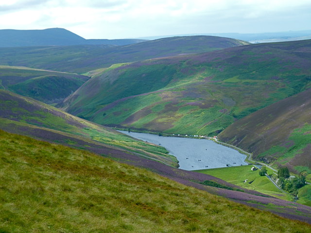
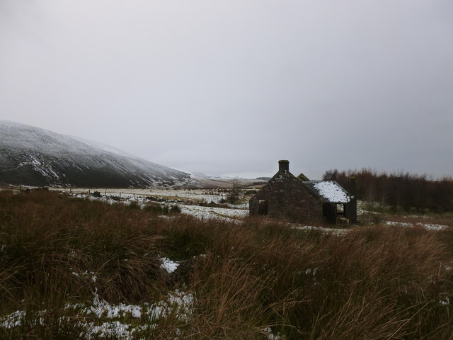
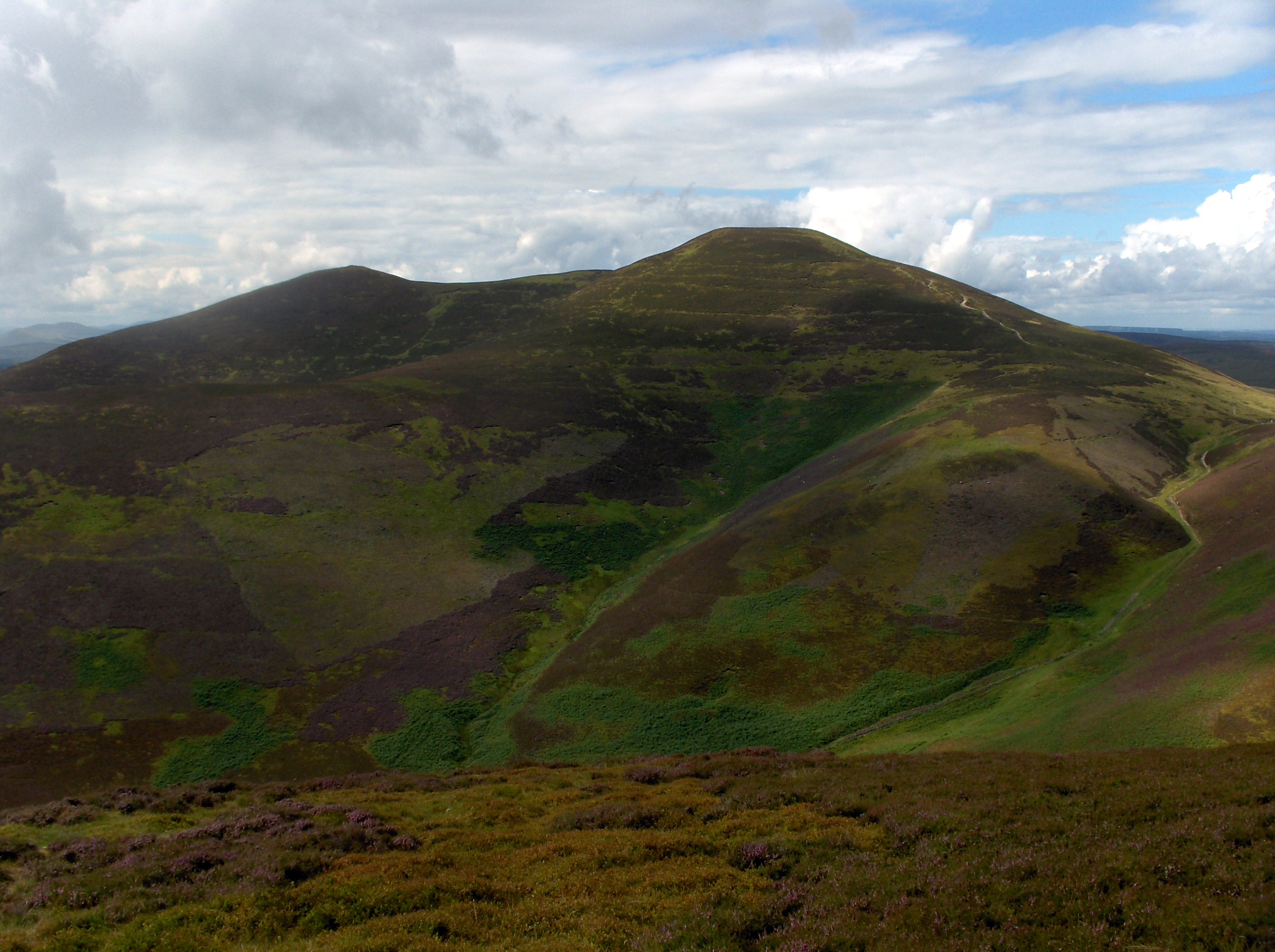
Gask Hill is a prominent hill located in the Midlothian region of Scotland. Situated southwest of the town of Gorebridge, it is part of the Moorfoot Hills range. With an elevation of 367 meters (1,204 feet), Gask Hill offers stunning panoramic views of the surrounding countryside and provides an excellent vantage point for visitors.

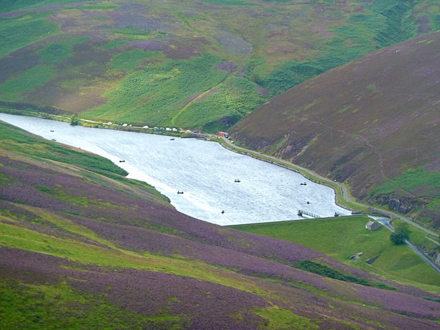
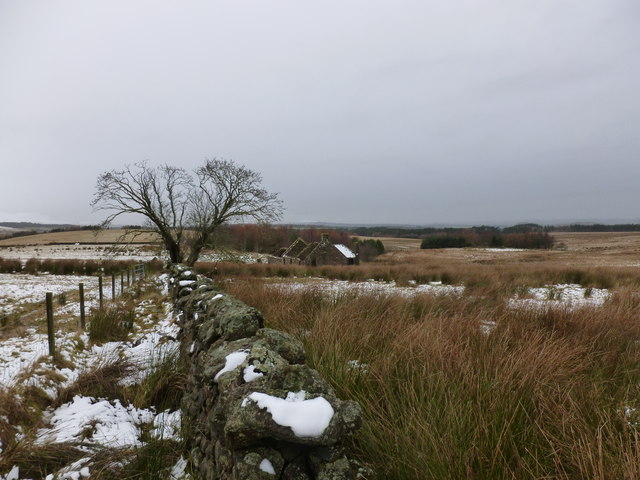
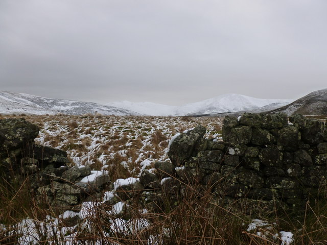
The hill is primarily composed of rugged moorland terrain, covered in heather and grasses, which adds to its natural beauty. It is a popular destination for hikers, walkers, and nature enthusiasts who enjoy exploring the scenic landscapes of the area.

Gask Hill is easily accessible, with several footpaths and trails leading to its summit. While the ascent is not particularly challenging, it can be steep in certain sections, so proper hiking gear and footwear are recommended.

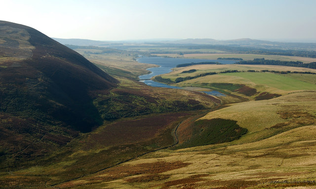
At the top of Gask Hill, visitors are rewarded with breathtaking views of Midlothian and the surrounding regions. On clear days, it is possible to see as far as the Pentland Hills to the north and the Firth of Forth to the east. The hill's location also offers a great opportunity for birdwatching, with various species of birds often spotted in the area.

Overall, Gask Hill provides an excellent outdoor recreational experience for visitors of all ages and abilities. Its natural beauty, coupled with its accessibility and panoramic views, make it a popular destination for both locals and tourists seeking to explore the scenic landscapes of Midlothian.

If you have any feedback on the listing, please let us know in the comments section below.

Gask Hill Images

Images are sourced within 2km of 55.852765/-3.2868444 or Grid Reference NT1962. Thanks to Geograph Open Source API. All images are credited.

Scald Law and the Grain Burn A feeder for the Grain Burn runs down from a quiet, shallow valley below Scald Law.
Scald Law and the Grain Burn
A feeder for the Grain Burn runs down from a quiet, shallow valley below Scald Law.
View of Loganlea Reservoir from Turnhouse Hill summit
Loganlea Reservoir from the footpath on Turnhouse Hill Nine boats with fishermen can be seen on the loch, their cars parked on the private road at the far side. Fishing is permitted by licence only. The 19th century reservoir provides drinking water for Edinburgh.
Loganlea Reservoir from the footpath on Turnhouse Hill
Nine boats with fishermen can be seen on the loch, their cars parked on the private road at the far side. Fishing is permitted by licence only. The 19th century reservoir provides drinking water for Edinburgh.
The Logan Burn flows into the Loganlea Reservoir
Stile on the descent from Scald Law
Black Hill & Threipmuir Reservoir Black Hill, Threipmuir Reservoir and former Ice Age Glacial Channel
Black Hill & Threipmuir Reservoir
Black Hill, Threipmuir Reservoir and former Ice Age Glacial Channel
Burn above The Howe, Pentland Hills Black Hill and part of Gask Hill (R) are catching the sunlight on a windy but sunny day.
Burn above The Howe, Pentland Hills
Black Hill and part of Gask Hill (R) are catching the sunlight on a windy but sunny day.
Descending to The Howe, Pentland Hills The track from Carnethy and Scald Law gives a fine view of the Logan Burn with the narrow defile of Green Cleuch bending round to the right.
Descending to The Howe, Pentland Hills
The track from Carnethy and Scald Law gives a fine view of the Logan Burn with the narrow defile of Green Cleuch bending round to the right.
The Logan Burn at The Howe The burn enters Loganlea Reservoir here and exits at the NE end to flow down to Glencorse Reservoir.
The Logan Burn at The Howe
The burn enters Loganlea Reservoir here and exits at the NE end to flow down to Glencorse Reservoir.
On the road by Loganlea Reservoir Returning to Flotterstone after an invigorating windswept walk on the ridge over Turnhouse Hill and Carnethy. A few years ago the road was a gravel surfaced track.
On the road by Loganlea Reservoir
Returning to Flotterstone after an invigorating windswept walk on the ridge over Turnhouse Hill and Carnethy. A few years ago the road was a gravel surfaced track.
Looking uphill to the col between Carnethy Hill and Scald Law Thin snow cover and frost on a winter afternoon in the Pentland Hills.
Looking uphill to the col between Carnethy Hill and Scald Law
Thin snow cover and frost on a winter afternoon in the Pentland Hills.
Scald Law from the slopes of Carnethy Hill The well-worn track up Scald Law begins in the col below, where the Kirk Road passes between Scald Law and Carnethy Hill. The hill beyond is West Kip.
Scald Law from the slopes of Carnethy Hill
The well-worn track up Scald Law begins in the col below, where the Kirk Road passes between Scald Law and Carnethy Hill. The hill beyond is West Kip.
Drystane dyke and rowan tree at Craigentarrie Craigentarrie is an abandoned farmstead and traces of rig and furrow cultivation can be found in the surrounding ground.
Drystane dyke and rowan tree at Craigentarrie
Craigentarrie is an abandoned farmstead and traces of rig and furrow cultivation can be found in the surrounding ground.
Abandoned steading at Craigentarrie There has been a house on this site since at least the 18th Century, but the farmstead is now abandoned and in a state of disrepair.

Further details of the site can be found at:

<span class="nowrap"><a title="http://canmore.rcahms.gov.uk/en/site/307407/details/craigentarrie/" rel="nofollow ugc noopener" href="http://canmore.rcahms.gov.uk/en/site/307407/details/craigentarrie/">Link</a><img style="margin-left:2px;" alt="External link" title="External link - shift click to open in new window" src="https://s1.geograph.org.uk/img/external.png" width="10" height="10"/></span>
Abandoned steading at Craigentarrie
There has been a house on this site since at least the 18th Century, but the farmstead is now abandoned and in a state of disrepair. Further details of the site can be found at: LinkExternal link
Gap in the wall, Craigentarrie Looking towards a distant snow-covered Turnhouse Hill and Carnethy Hill.
Gap in the wall, Craigentarrie
Looking towards a distant snow-covered Turnhouse Hill and Carnethy Hill.
Logan Burn near The Howe Loganlea Reservoir can be seen behind the house at The Howe.
Logan Burn near The Howe
Loganlea Reservoir can be seen behind the house at The Howe.
Black Hill View Towards Allermuir Hill Name: Black Hill
Hill number: 1815
Height: 501m / 1644ft
Area: 28A: Firth of Forth to the River Tweed
Class: Ma,5D
Grid ref: NT 18825 63172
Summit feature: cairn
Drop: 184m
Col: 317m  NT176624
Black Hill View Towards Allermuir Hill
Name: Black Hill Hill number: 1815 Height: 501m / 1644ft Area: 28A: Firth of Forth to the River Tweed Class: Ma,5D Grid ref: NT 18825 63172 Summit feature: cairn Drop: 184m Col: 317m NT176624
Scald Law Climbed up from Balerno after Black Hill.
Name: Scald Law
Hill number: 1807
Height: 579m / 1900ft
Area: 28A: Firth of Forth to the River Tweed
Class: Ma,5D
Grid ref: NT 19169 61080
Summit feature: tiny cairn 2m N of trig point
Drop: 312m
Col: 267m  NT167541
Scald Law
Climbed up from Balerno after Black Hill. Name: Scald Law Hill number: 1807 Height: 579m / 1900ft Area: 28A: Firth of Forth to the River Tweed Class: Ma,5D Grid ref: NT 19169 61080 Summit feature: tiny cairn 2m N of trig point Drop: 312m Col: 267m NT167541
Show me another place!

Gask Hill is located at Grid Ref: NT1962 (Lat: 55.852765, Lng: -3.2868444)

Unitary Authority: Midlothian

Police Authority: The Lothians and Scottish Borders

What 3 Words

///earphones.iterative.locals. Near Penicuik, Midlothian

Related Wikis

Loganlea Reservoir

Loganlea Reservoir is a small reservoir in the Pentland Hills, Midlothian, Scotland, UK. The Logan Burn connects the reservoir with Glencorse Reservoir...

Carnethy Hill

Carnethy Hill, the second highest of the Pentland Hills, is a hill 3 miles (5 km) north-west of Penicuik, Scotland. It lends its name to the Carnethy 5...

Scald Law

Scald Law is a hill in Midlothian, Scotland. At 579 metres (1,900 ft) it is the highest of the Pentland Hills. The hill is composed of Devonian volcanic...

Battle of Rullion Green

The Battle of Rullion Green took place on 28 November 1666, near the Pentland Hills, in Midlothian, Scotland. It was the only significant battle of the...

Nearby Amenities

Located within 500m of 55.852765,-3.2868444
Gask Hill
Ele: 412
Natural: peak
Wikidata: Q24661216
Lat/Long: 55.8528384/-3.286838
The data included in this document is from www.openstreetmap.org. The data is made available under ODbL.

Have you been to Gask Hill?

Leave your review of Gask Hill below (or comments, questions and feedback).