Broad Crag

Hill, Mountain in Cumberland Copeland

England

Broad Crag

Wormshell How
Wormshell How Credit: Mick Garratt

Broad Crag is a prominent hill located in the county of Cumberland in Northwest England. It is part of the larger Scafell Pike range, which forms the highest peak in England. Standing at an elevation of 934 meters (3,064 feet), Broad Crag is often considered a subsidiary summit of Scafell Pike, located just 1 kilometer to the northeast.

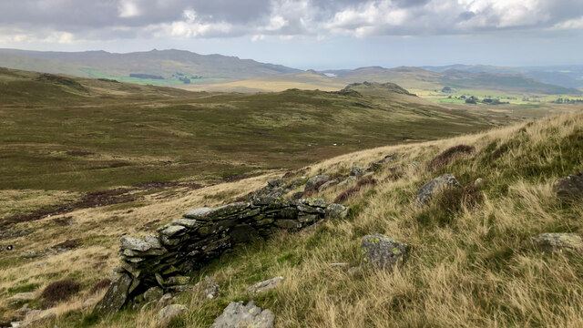
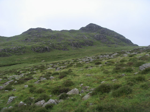
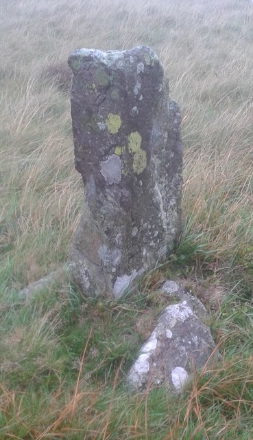
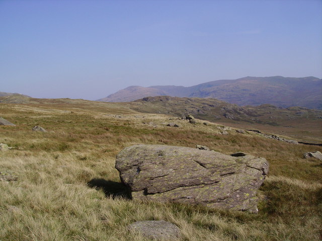
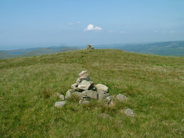
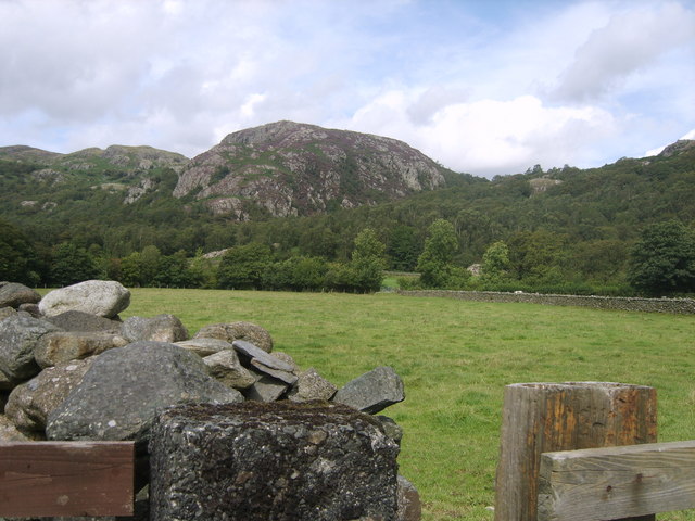
Broad Crag is renowned for its rugged and rocky terrain, characterized by steep slopes and craggy outcrops. The hill is part of the Lake District National Park, which attracts numerous hikers and mountaineers each year. Its challenging topography offers a thrilling experience for those seeking adventure.

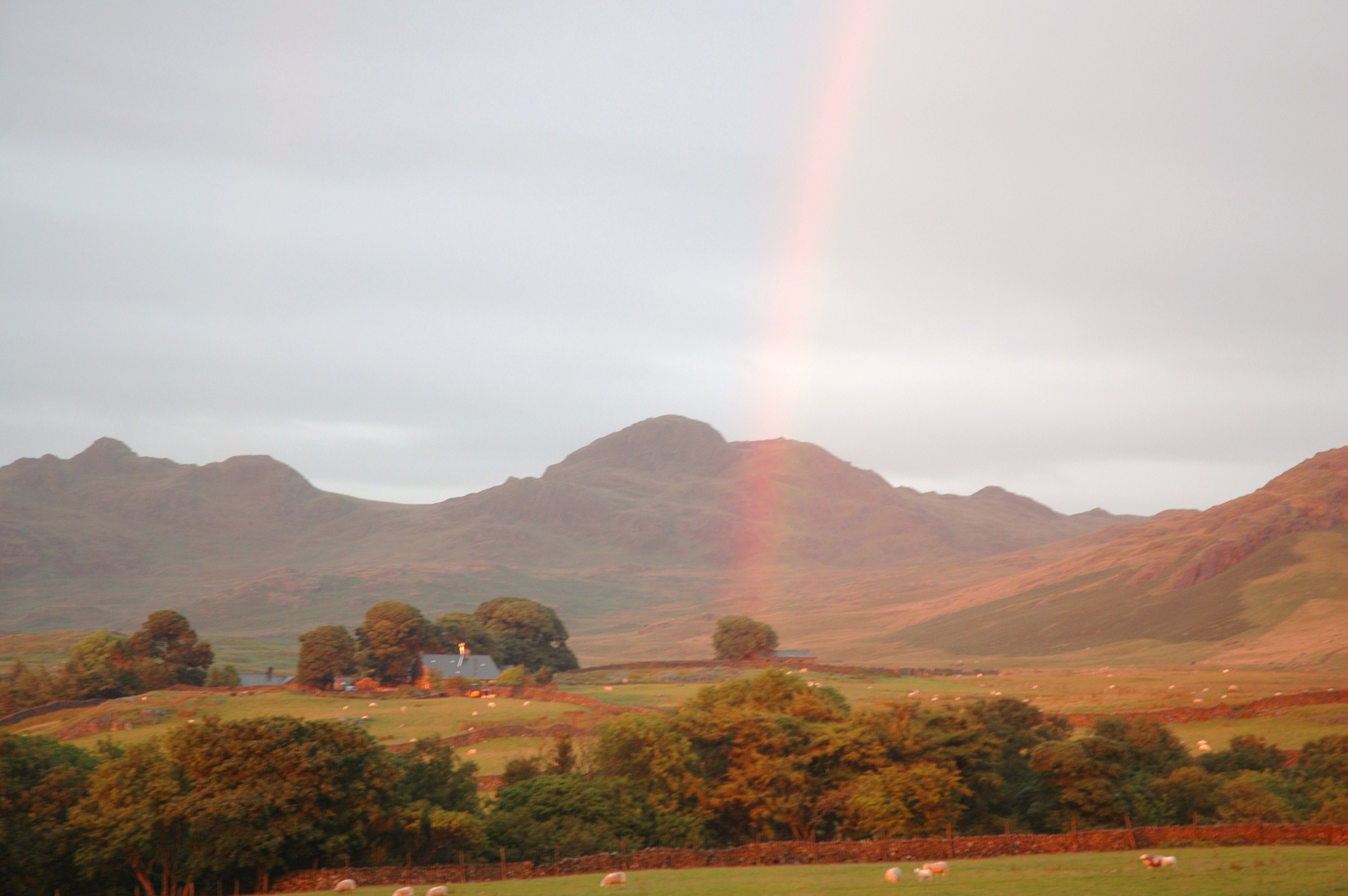
The ascent to Broad Crag often begins from Wasdale Head, a small village at the western edge of the Lake District. From there, walkers can follow various routes that lead to the summit. Due to its proximity to Scafell Pike, many hikers choose to combine the two summits in a single outing.

The views from Broad Crag are truly breathtaking, with panoramic vistas of the surrounding mountains and valleys. On a clear day, one can admire the picturesque beauty of Wastwater, the deepest lake in England, nestled amidst the dramatic landscape.

Although Broad Crag may not have the same elevation as its neighboring Scafell Pike, it still offers a challenging and rewarding ascent. Its rugged beauty and stunning views attract outdoor enthusiasts from far and wide, making it a popular destination within the Lake District.

If you have any feedback on the listing, please let us know in the comments section below.

Broad Crag Images

Images are sourced within 2km of 54.369687/-3.2405366 or Grid Reference SD1997. Thanks to Geograph Open Source API. All images are credited.

Wormshell How
Wormshell How
Small bield, Green Crag
Green Crag From Long Crag looking to Green Crag
Green Crag
From Long Crag looking to Green Crag
Old Boundary Marker on Ulpha Fell, Eskdale parish Parish Boundary Marker in parish of Eskdale (Copeland District), Ulpha Fell, 500 metres North of Green Crag Summit.

Surveyed

Milestone Society National ID: CU_ULPESK02pb
Old Boundary Marker on Ulpha Fell, Eskdale parish
Parish Boundary Marker in parish of Eskdale (Copeland District), Ulpha Fell, 500 metres North of Green Crag Summit. Surveyed Milestone Society National ID: CU_ULPESK02pb
Stone group south of Great Arming How Looking south east, flank of Green Crag (SD2098) on the right These stones can hardly have been carried by glacier or fallen off Great Arming How. Who knows anything about them?
Stone group south of Great Arming How
Looking south east, flank of Green Crag (SD2098) on the right These stones can hardly have been carried by glacier or fallen off Great Arming How. Who knows anything about them?
Farmtrack near Ellerbeck Bridge. Looking SE from SD 177 986.
Farmtrack near Ellerbeck Bridge.
Looking SE from SD 177 986.
Small barn near between Ellerbeck Bridge and Birkerthwaite Looking E from the footpath at SD 178 984.
Small barn near between Ellerbeck Bridge and Birkerthwaite
Looking E from the footpath at SD 178 984.
Farmland between Birkerthwaite and High Ground Area S of western Eskdale.  Looking S from the footpath at SD 178 984.
Farmland between Birkerthwaite and High Ground
Area S of western Eskdale. Looking S from the footpath at SD 178 984.
Sheepfold Camp The disused sheepfold provides added shelter for the wild camper.
Sheepfold Camp
The disused sheepfold provides added shelter for the wild camper.
Green Crag
Green Crag
Low Birker Tarn
Low Birker Tarn
Smallstone Beck
Smallstone Beck
Sheepfold In the wall which runs on the southern flank of Great Worm Crag. Coniston fells on the skyline.
Sheepfold
In the wall which runs on the southern flank of Great Worm Crag. Coniston fells on the skyline.
Sam's Cairn Broad Crag Cairn on Broad Crag. Green Crag on the skyline.
Sam's Cairn Broad Crag
Cairn on Broad Crag. Green Crag on the skyline.
Great Crag Birker Fell From near Highford Beck
Great Crag Birker Fell
From near Highford Beck
Sike Moss Birker Fell Needless to say very wet. Looking towards the Scafells.
Sike Moss Birker Fell
Needless to say very wet. Looking towards the Scafells.
On the flanks of Great Worm Crag Looking towards Morecambe Bay
On the flanks of Great Worm Crag
Looking towards Morecambe Bay
Boulder Great Worm Crag Looking towards Iron Crag
Boulder Great Worm Crag
Looking towards Iron Crag
Show me another place!

Broad Crag is located at Grid Ref: SD1997 (Lat: 54.369687, Lng: -3.2405366)

Administrative County: Cumbria

District: Copeland

Police Authority: Cumbria

What 3 Words

///openly.renamed.booms. Near Seascale, Cumbria

Related Wikis

Green Crag

Green Crag is a fell in the English Lake District. It stands between Eskdale and the Duddon valley in the Southern Fells. == Topography == The headwaters...

Great Worm Crag

Great Worm Crag is a hill in south west of the English Lake District, north of Ulpha, Cumbria. It is the subject of a chapter of Wainwright's book The...

Birkerthwaite

Birkerthwaite is a village on Birker Fell, Eskdale, Cumbria, England. == See also == List of places in Cumbria == External links == Media related to...

Wallowbarrow Crag

Wallowbarrow Crag is a hill of 292 metres (958 ft) in the Lake District, England. It is on the west of the Duddon Valley, across the valley from the village...

Nearby Amenities

Located within 500m of 54.369687,-3.2405366
Meeting Hill
Place: locality
Lat/Long: 54.3690033/-3.2443158
Grey Stone
Place: locality
Lat/Long: 54.368748/-3.234988
The data included in this document is from www.openstreetmap.org. The data is made available under ODbL.

Have you been to Broad Crag?

Leave your review of Broad Crag below (or comments, questions and feedback).