Crailzie Hill

Hill, Mountain in Peeblesshire

Scotland

Crailzie Hill

Old drove road near Romanno Hope This track forms part of the Cross Borders Drove Road, a long-distance walking route between Harperrig, south-west of Edinburgh, and Hawick.
Old drove road near Romanno Hope Credit: Alan O'Dowd

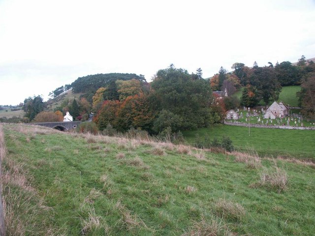
Crailzie Hill is a prominent hill located in Peeblesshire, a historic county in the Scottish Borders region of Scotland. Rising to an elevation of approximately 412 meters (1,352 feet), it is classified as a hill rather than a mountain. It is situated near the village of Eddleston, about 5 kilometers (3 miles) southwest of the town of Peebles.

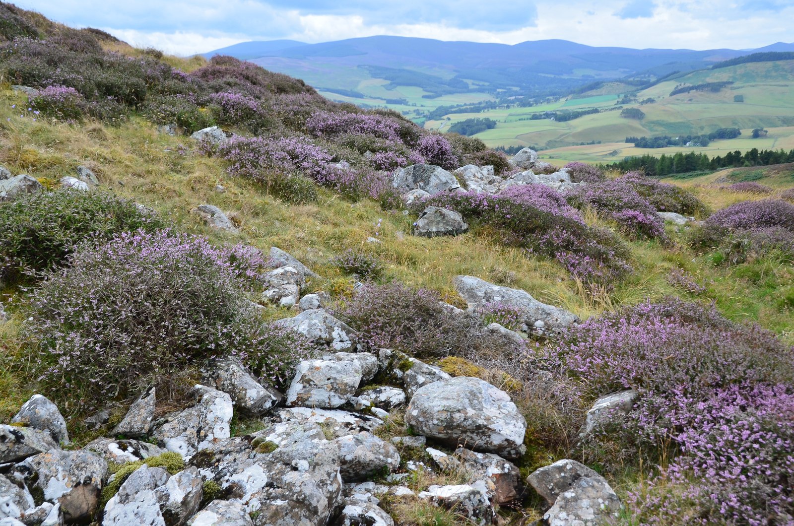
The hill is known for its picturesque views and is a popular destination for hikers and nature enthusiasts. It offers a variety of walking routes, ranging from easy to moderate difficulty, making it accessible to a wide range of visitors. The summit of Crailzie Hill provides panoramic vistas of the surrounding countryside, including the lush green valleys and rolling hills that characterize the Peeblesshire landscape.

The hill is covered in a mix of grasses, heather, and scattered woodland, adding to its natural beauty. Its diverse flora and fauna make it an ideal habitat for a range of wildlife, including birds, mammals, and insects. Visitors may spot species such as red grouse, buzzards, and roe deer while exploring the hill.

Crailzie Hill also has historical significance, with nearby archaeological sites indicating human activity in the area dating back thousands of years. The hill is therefore not only a place to enjoy the natural environment but also an opportunity to connect with the rich history and heritage of Peeblesshire.

If you have any feedback on the listing, please let us know in the comments section below.

Crailzie Hill Images

Images are sourced within 2km of 55.693927/-3.2838634 or Grid Reference NT1945. Thanks to Geograph Open Source API. All images are credited.

Old drove road near Romanno Hope This track forms part of the Cross Borders Drove Road, a long-distance walking route between Harperrig, south-west of Edinburgh, and Hawick.
Old drove road near Romanno Hope
This track forms part of the Cross Borders Drove Road, a long-distance walking route between Harperrig, south-west of Edinburgh, and Hawick.
Ford on the Fingland Burn near Romanno Hope This track forms part of the Cross Borders Drove Road, a long-distance walking route between Harperrig, south-west of Edinburgh, and Hawick.
Ford on the Fingland Burn near Romanno Hope
This track forms part of the Cross Borders Drove Road, a long-distance walking route between Harperrig, south-west of Edinburgh, and Hawick.
Track on Green Knowe A view down the valley of the Flemington Burn, with the low winter sun highlighting old sheepfolds on the hillsides.
Track on Green Knowe
A view down the valley of the Flemington Burn, with the low winter sun highlighting old sheepfolds on the hillsides.
Mist rolling over forested hillsides above the Flemington Burn It was a day of stark contrasts between bright winter sunshine and banks of mist.
Mist rolling over forested hillsides above the Flemington Burn
It was a day of stark contrasts between bright winter sunshine and banks of mist.
Sunlight and mist on Hag Law A mixture of low winter sunlight and banks of mist made for some atmospheric conditions.
Sunlight and mist on Hag Law
A mixture of low winter sunlight and banks of mist made for some atmospheric conditions.
Bridge timber by Fingland Burn Before too long it looks as though a footbridge will be built here in Romanno Hope.
Bridge timber by Fingland Burn
Before too long it looks as though a footbridge will be built here in Romanno Hope.
Valley of the Fingland Burn The burn rises on the western slopes of Wether Law in the Cloich Hills and joins the Flemington Burn a few hundred metres downstream.
Valley of the Fingland Burn
The burn rises on the western slopes of Wether Law in the Cloich Hills and joins the Flemington Burn a few hundred metres downstream.
Confluence of the Fingland and Flemington Burns The Flemington Burn rises on the east side of Wether Law in the Cloich Hills, here meets the Fingland Burn and flows southwest to the Lyne Water.
Confluence of the Fingland and Flemington Burns
The Flemington Burn rises on the east side of Wether Law in the Cloich Hills, here meets the Fingland Burn and flows southwest to the Lyne Water.
Gate into Cloich Forest On the path from Romannobridge, also on the Cross Borders Drove Road.
Gate into Cloich Forest
On the path from Romannobridge, also on the Cross Borders Drove Road.
Path in Cloich Forest The path from the Flemington Burn to the forest road near Courhope, also part of the Cross Borders Drove Road.
Path in Cloich Forest
The path from the Flemington Burn to the forest road near Courhope, also part of the Cross Borders Drove Road.
Forest ride, Harehope A view across the valley of the Lyne Burn to the grassy ridge above Deep Hope. The structures on the ridge are old road trailers now used for storing sheep feed. The Stobo hills are in the distance with Penvalla L of centre.
Forest ride, Harehope
A view across the valley of the Lyne Burn to the grassy ridge above Deep Hope. The structures on the ridge are old road trailers now used for storing sheep feed. The Stobo hills are in the distance with Penvalla L of centre.
Forest boundary, Crailzie Hill The western edge of Harehope Forest at the top of Wide Hope.
Forest boundary, Crailzie Hill
The western edge of Harehope Forest at the top of Wide Hope.
The col above Wide Hope Open hillside contrasts with the plantations of Harehope Forest on this col W of Crailzie Hill.
The col above Wide Hope
Open hillside contrasts with the plantations of Harehope Forest on this col W of Crailzie Hill.
Boundary wall, Wide Hope Shank Upland sheep walks on the ridge between the valleys of the Lyne Water and the Meldon.
Boundary wall, Wide Hope Shank
Upland sheep walks on the ridge between the valleys of the Lyne Water and the Meldon.
Wall junction, Stevenson Hill New fencing has been put in alongside both walls - compare with <a href="https://www.geograph.org.uk/photo/166538">NT1744 : Stevenson Hill</a> taken in 2006. Another addition is a small mast on the top of the hill, probably carrying an anemometer for a wind survey.
Wall junction, Stevenson Hill
New fencing has been put in alongside both walls - compare with NT1744 : Stevenson Hill taken in 2006. Another addition is a small mast on the top of the hill, probably carrying an anemometer for a wind survey.
From the southwest top of Wide Hope Shank Looking from the 462m spot height to the glen of Wester Happrew Burn and the part-forested ridge up to Ladyurd Hill with Penvalla to the left. The distant conical peak is possibly Worm Hill south of Broughton.
From the southwest top of Wide Hope Shank
Looking from the 462m spot height to the glen of Wester Happrew Burn and the part-forested ridge up to Ladyurd Hill with Penvalla to the left. The distant conical peak is possibly Worm Hill south of Broughton.
Storage trailers above Deep Hope There are half a dozen of these old NCL (National Carriers Ltd) road trailers on the hillside, used as storage for sheep feed. The heather moors around Hundleshope Heights are on the skyline.
Storage trailers above Deep Hope
There are half a dozen of these old NCL (National Carriers Ltd) road trailers on the hillside, used as storage for sheep feed. The heather moors around Hundleshope Heights are on the skyline.
Hill pasture above Deep Hope A look back along the fence towards the plantations of Harehope Forest.
Hill pasture above Deep Hope
A look back along the fence towards the plantations of Harehope Forest.
Show me another place!

Crailzie Hill is located at Grid Ref: NT1945 (Lat: 55.693927, Lng: -3.2838634)

Unitary Authority: The Scottish Borders

Police Authority: The Lothians and Scottish Borders

What 3 Words

///blunders.range.leans. Near West Linton, Scottish Borders

Nearby Locations

Crailzie Hill

Related Wikis

Black Meldon

Black Meldon is a prehistoric site, a hillfort near the village of Lyne and about 4 miles (6 km) west of Peebles, in the Scottish Borders, Scotland. It...

White Meldon

White Meldon is a prehistoric site, a hillfort near the village of Lyne and about 4 miles (6 km) west of Peebles, in the Scottish Borders, Scotland. It...

Newlands, Scottish Borders

Newlands is a parish in the Tweeddale committee area of the Scottish Borders council area, in southeastern Scotland. == Geography == Newlands is on the...

Drochil Castle

Drochil Castle is a ruined castle in the Scottish Borders. It is located above the Lyne Water, 10 kilometres (6.2 mi) north-west of Peebles, and 8 kilometres...

Nearby Amenities

Located within 500m of 55.693927,-3.2838634
Crailzie Hill
Ele: 476
Natural: peak
Lat/Long: 55.6939592/-3.2827182
The data included in this document is from www.openstreetmap.org. The data is made available under ODbL.

Have you been to Crailzie Hill?

Leave your review of Crailzie Hill below (or comments, questions and feedback).