Colvin's Knowe

Hill, Mountain in Fife

Scotland

Colvin's Knowe

Lumphinnans Road, Lochgelly
Lumphinnans Road, Lochgelly Credit: Richard Webb

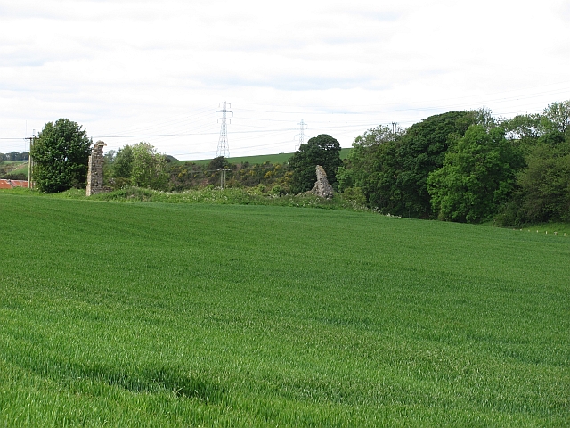
Colvin's Knowe is a hill located in Fife, Scotland. It is situated in the Lomond Hills, which form part of the larger Ochil Hills range. With an elevation of 522 meters (1,713 feet), Colvin's Knowe is one of the prominent peaks in the area.

The hill offers breathtaking panoramic views of the surrounding countryside, including the Firth of Tay and the Firth of Forth. On clear days, it is even possible to see as far as the Angus Glens and the Grampian Mountains to the north.

Colvin's Knowe is a popular destination for hikers and nature enthusiasts. There are several well-marked trails that lead to the summit, offering a range of difficulty levels to accommodate different skill levels. Along the way, visitors can admire the diverse flora and fauna that thrive in this picturesque landscape.

The hill is also of historical significance, with remnants of ancient settlements and burial cairns scattered across its slopes. Archaeological excavations have revealed evidence of human activity dating back thousands of years, providing valuable insights into the region's past.

Colvin's Knowe is easily accessible from nearby towns and villages, with parking facilities available at the base of the hill. It offers a peaceful and tranquil escape from the hustle and bustle of everyday life, making it an ideal spot for those seeking solitude or a scenic outdoor adventure.

If you have any feedback on the listing, please let us know in the comments section below.

Colvin's Knowe Images

Images are sourced within 2km of 56.111598/-3.3027077 or Grid Reference NT1991. Thanks to Geograph Open Source API. All images are credited.

Lumphinnans Road, Lochgelly
Main Street, Lochgelly
Shop to let, Main Street, Lochgelly
Main Street, Lochgelly
The Avenue, Lochgelly There is house building in progress on the right and the stubble field lies between town and bypass so will almost certainly be built upon in the future.
The Avenue, Lochgelly
There is house building in progress on the right and the stubble field lies between town and bypass so will almost certainly be built upon in the future.
Lochgelly Industrial Park
A92, Lochgelly Dual carriageway between the M90 and Glenrothes.
A92, Lochgelly
Dual carriageway between the M90 and Glenrothes.
Loch Gelly Close to the town of Lochgelly is Loch Gelly (often called the 'Gelly Loch' to distinguish it from the town). After a long period with little rain the loch is well down.
Loch Gelly was once a hive of activity. Up until the early 1990s it was a popular place for water skiers to display their skills. Lochgelly Water Ski Club hosted some very prominent championships, especially in the 1970s and 80s.
Loch Gelly
Close to the town of Lochgelly is Loch Gelly (often called the 'Gelly Loch' to distinguish it from the town). After a long period with little rain the loch is well down. Loch Gelly was once a hive of activity. Up until the early 1990s it was a popular place for water skiers to display their skills. Lochgelly Water Ski Club hosted some very prominent championships, especially in the 1970s and 80s.
Layby under construction On the minor road between Auchtertool and Loch Gelly (designated as the K11) several new small laybys have been introduced. Why so many on what is a not-very-busy road is a bit of a mystery to me - similar roads in the area do not have any laybys.
Layby under construction
On the minor road between Auchtertool and Loch Gelly (designated as the K11) several new small laybys have been introduced. Why so many on what is a not-very-busy road is a bit of a mystery to me - similar roads in the area do not have any laybys.
New layby On the minor road between Auchtertool and Loch Gelly (designated as the K11) several new small laybys have been introduced. Why so many on what is a not-very-busy road is a bit of a mystery to me - similar roads in the area do not have any laybys.
New layby
On the minor road between Auchtertool and Loch Gelly (designated as the K11) several new small laybys have been introduced. Why so many on what is a not-very-busy road is a bit of a mystery to me - similar roads in the area do not have any laybys.
Wind turbines near Cowdenbeath The turbines are at Little Raith wind farm, near the Mosmorran chemical plant. Viewed from Cowdenbeath railway station footbridge.
Wind turbines near Cowdenbeath
The turbines are at Little Raith wind farm, near the Mosmorran chemical plant. Viewed from Cowdenbeath railway station footbridge.
A92 between Cowdenbeath and Lochgelly
Little Raith Wind Farm Nine x 2.75MW turbines; for information see <a href="https://www.geograph.org.uk/photo/5288260">NT1790 : Welcome to Little Raith Wind Farm</a>.
Little Raith Wind Farm
Nine x 2.75MW turbines; for information see NT1790 : Welcome to Little Raith Wind Farm.
Little Raith Wind Farm Five of the nine 2.75MW turbines <a href="https://www.geograph.org.uk/photo/5288260">NT1790 : Welcome to Little Raith Wind Farm</a>.
Little Raith Wind Farm
Five of the nine 2.75MW turbines NT1790 : Welcome to Little Raith Wind Farm.
Mossmorran chemical plant Looking east from the northern entrance.
Mossmorran chemical plant
Looking east from the northern entrance.
Mossmorran Chemical Plant The northern side of the complex, seen from an entrance from the A909.
Mossmorran Chemical Plant
The northern side of the complex, seen from an entrance from the A909.
Rough pasture near Mossmorran With gorse and rushes.
Rough pasture near Mossmorran
With gorse and rushes.
Show me another place!

Colvin's Knowe is located at Grid Ref: NT1991 (Lat: 56.111598, Lng: -3.3027077)

Unitary Authority: Fife

Police Authority: Fife

What 3 Words

///decorator.playfully.pans. Near Lochgelly, Fife

Nearby Locations

Colvin's Knowe

Related Wikis

Nearby Amenities

Located within 500m of 56.111598,-3.3027077
Generator Method: wind_turbine
Generator Output Electricity: 2.75 MW
Generator Source: wind
Generator Type: horizontal_axis
Power: generator
Lat/Long: 56.1088803/-3.2965271
Generator Method: wind_turbine
Generator Output Electricity: 2.75 MW
Generator Source: wind
Generator Type: horizontal_axis
Power: generator
Lat/Long: 56.1077923/-3.3027326
Generator Method: wind_turbine
Generator Output Electricity: 2.75 MW
Generator Source: wind
Generator Type: horizontal_axis
Power: generator
Lat/Long: 56.1118393/-3.2993333
Generator Method: wind_turbine
Generator Output Electricity: 2.75 MW
Generator Source: wind
Generator Type: horizontal_axis
Power: generator
Lat/Long: 56.1105621/-3.3054987
Easter Lochhead
Historic: ruins
Lat/Long: 56.1087575/-3.2998478
Power: pole
Lat/Long: 56.1157517/-3.3008596
Power: pole
Lat/Long: 56.1154865/-3.2998906
Power: pole
Lat/Long: 56.1151831/-3.2990504
Power: pole
Lat/Long: 56.1148768/-3.2982168
Power: pole
Lat/Long: 56.1145646/-3.2973669
Power: pole
Lat/Long: 56.1142553/-3.2965251
Power: pole
Lat/Long: 56.1133566/-3.2966665
Power: pole
Lat/Long: 56.1124338/-3.2967779
Power: pole
Lat/Long: 56.1116283/-3.2969237
Power: pole
Lat/Long: 56.1110335/-3.2966014
Power: pole
Lat/Long: 56.110382/-3.2962474
Power: pole
Lat/Long: 56.1097664/-3.2959458
Easter Lochhead
Place: locality
Lat/Long: 56.108578/-3.2998637
Colvin's Knowe
Place: locality
Lat/Long: 56.1131174/-3.3059762
The data included in this document is from www.openstreetmap.org. The data is made available under ODbL.

Have you been to Colvin's Knowe?

Leave your review of Colvin's Knowe below (or comments, questions and feedback).