Craigdilly

Hill, Mountain in Peeblesshire

Scotland

Craigdilly

Megget Reservoir The reservoir was opened on 30th September 1983 and under normal conditions has an area of water surface of 259Ha (640 acres).
Megget Reservoir Credit: Walter Baxter

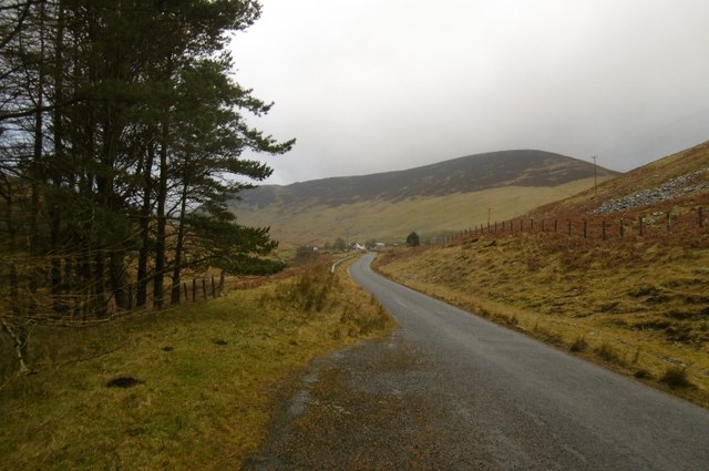
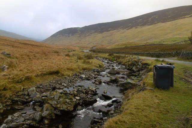
Craigdilly is a small hill located in Peeblesshire, Scotland. Situated approximately 3 miles southeast of the town of Peebles, it offers a picturesque landscape and stunning views of the surrounding countryside.

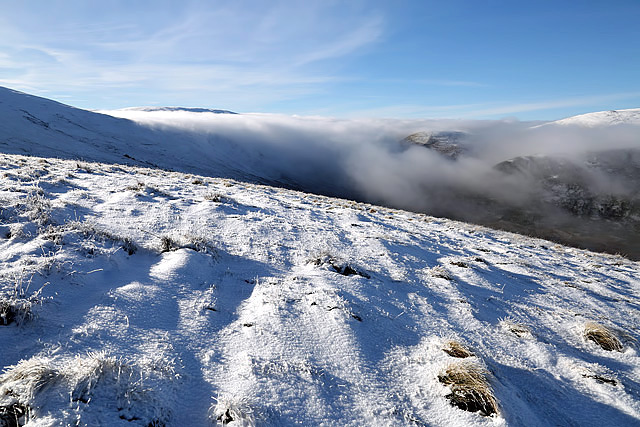
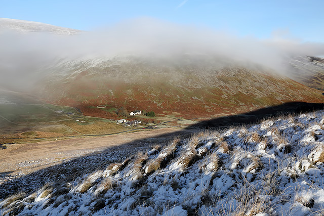
With an elevation of around 372 meters (1,220 feet), Craigdilly is not classified as a mountain but rather a hill. It is part of the rolling hills and undulating terrain characteristic of the region. The hill is covered in heather, grasses, and scattered trees, creating a beautiful patchwork of colors throughout the year.

The ascent to the summit of Craigdilly is moderately challenging, with a well-defined path leading visitors through the rugged terrain. The climb takes approximately 1-2 hours, depending on fitness levels, and rewards hikers with panoramic views of the Scottish Borders and the River Tweed.

At the summit, there is a trig point that serves as a marker and offers a perfect spot for taking in the breathtaking scenery. On clear days, it is possible to see as far as the Pentland Hills, the Lammermuir Hills, and even the distant peaks of the Southern Uplands.

Craigdilly is a popular destination for both locals and tourists who seek a peaceful and rewarding outdoor experience. The hill provides ample opportunities for nature lovers, walkers, and photographers to immerse themselves in the stunning Scottish countryside and enjoy a sense of tranquility away from the hustle and bustle of everyday life.

If you have any feedback on the listing, please let us know in the comments section below.
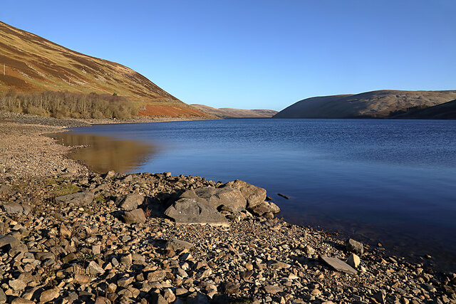
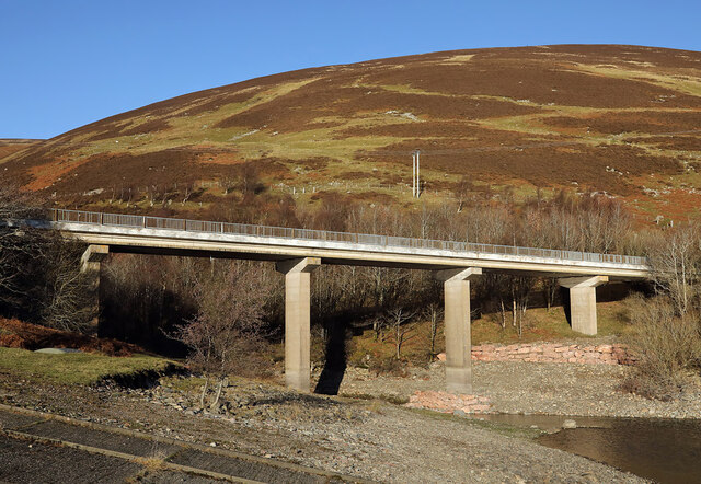
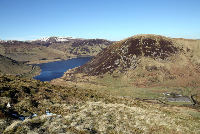
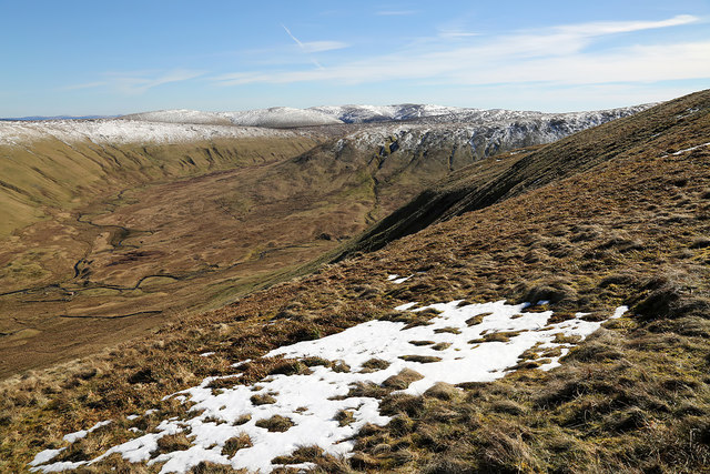
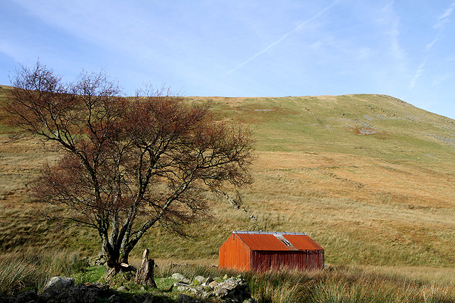
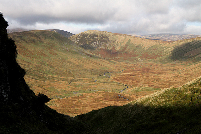
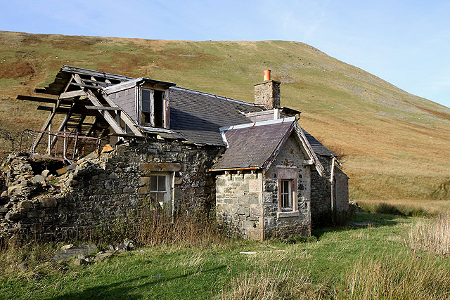
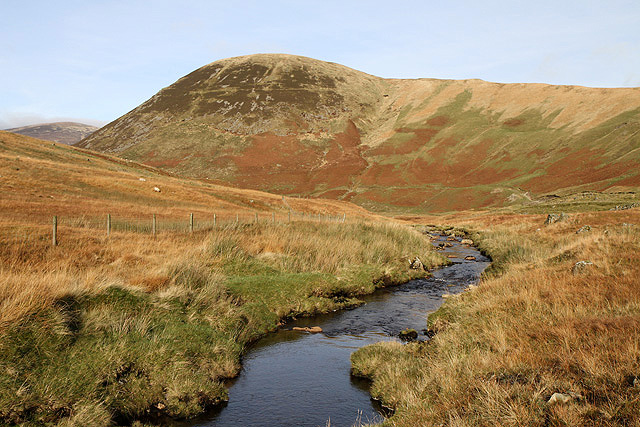
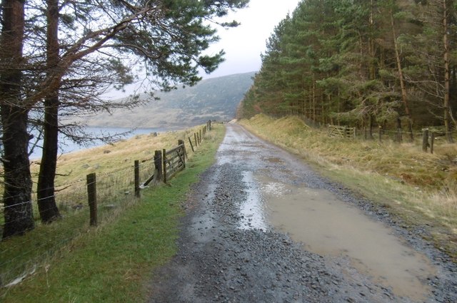
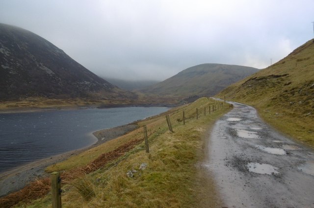
Craigdilly Images

Images are sourced within 2km of 55.47292/-3.2892138 or Grid Reference NT1820. Thanks to Geograph Open Source API. All images are credited.

Megget Reservoir The reservoir was opened on 30th September 1983 and under normal conditions has an area of water surface of 259Ha (640 acres).
Megget Reservoir
The reservoir was opened on 30th September 1983 and under normal conditions has an area of water surface of 259Ha (640 acres).
A road bridge over the Linghope Burn This is where the Linghope Burn flows into Megget Reservoir.
A road bridge over the Linghope Burn
This is where the Linghope Burn flows into Megget Reservoir.
Crumley Hill This is near the summit looking towards Megget Reservoir with Craigdilly centre right and Winterhopeburn Farm down on the far right.
Crumley Hill
This is near the summit looking towards Megget Reservoir with Craigdilly centre right and Winterhopeburn Farm down on the far right.
On the lower southeast slopes of Five Cairns Hill The view straight ahead is to Red Scar on Lochcraig Head <a href="https://www.geograph.org.uk/photo/1496701">NT1818 : Red Scar on Lochcraig Rig</a> with the Winterhope Burn down on the left.
On the lower southeast slopes of Five Cairns Hill
The view straight ahead is to Red Scar on Lochcraig Head NT1818 : Red Scar on Lochcraig Rig with the Winterhope Burn down on the left.
A shed at Winter Hope This red corrugated iron shed is by the derelict cottage at Winterhopeburn. Crumley Hill is in the background.
A shed at Winter Hope
This red corrugated iron shed is by the derelict cottage at Winterhopeburn. Crumley Hill is in the background.
Winter Hope The Winterhope Burn runs through this sheltered valley into Megget Reservoir. Crumley Hill is on the left with Craigdilly in the central background. This was viewed from Red Scar on Lochcraig Rig. For a view of Red Scar from Five Cairns Hill, see <a href="https://www.geograph.org.uk/photo/1496701">NT1818 : Red Scar on Lochcraig Rig</a>.
Winter Hope
The Winterhope Burn runs through this sheltered valley into Megget Reservoir. Crumley Hill is on the left with Craigdilly in the central background. This was viewed from Red Scar on Lochcraig Rig. For a view of Red Scar from Five Cairns Hill, see NT1818 : Red Scar on Lochcraig Rig.
The derelict building at Winterhopeburn This farm cottage on the west side of the Winterhope Burn has fallen into disrepair. Crumley Hill is in the background.
The derelict building at Winterhopeburn
This farm cottage on the west side of the Winterhope Burn has fallen into disrepair. Crumley Hill is in the background.
The Winterhope Burn This is a view downstream towards Craigdilly.
The Winterhope Burn
This is a view downstream towards Craigdilly.
Dead for Cauld This is at the northern slopes of the hill in late November.
Dead for Cauld
This is at the northern slopes of the hill in late November.
Meggethead from Dead for Cauld This small farm is at the southwest end of Megget Reservoir.
Meggethead from Dead for Cauld
This small farm is at the southwest end of Megget Reservoir.
Megget road Near the end of the reservoir and approaching the original road at Meggethead.
Megget road
Near the end of the reservoir and approaching the original road at Meggethead.
Megget Water Flowing past the carefully tethered bins of Winterhope. It was very windy.
Megget Water
Flowing past the carefully tethered bins of Winterhope. It was very windy.
Road to Winterhopeburn Long access road to the cottage and farm buildings at Winterhopeburn. The road was built following the flooding of the old road up to the original Winterhopeburn further up the glen.
Road to Winterhopeburn
Long access road to the cottage and farm buildings at Winterhopeburn. The road was built following the flooding of the old road up to the original Winterhopeburn further up the glen.
Road to Winterhope A new road, the old one was flooded by the reservoir.
Road to Winterhope
A new road, the old one was flooded by the reservoir.
Head of Megget Reservoir One of the two main feeders for the reservoir - Winterhope Burn.
Head of Megget Reservoir
One of the two main feeders for the reservoir - Winterhope Burn.
Sheep, Winterhope Sheep beside the flooded lower part of Winter Hope. Megget Reservoir was rather agitated by a strong wind funnelling down Winter Hope. I was blown off the road a little later.
Sheep, Winterhope
Sheep beside the flooded lower part of Winter Hope. Megget Reservoir was rather agitated by a strong wind funnelling down Winter Hope. I was blown off the road a little later.
(New) Winterhopeburn The original Winterhopeburn is a ruined cottage further up Winter Hope.  The current house and farm buildings are more recent. No house or buildings are shown on 1950s mapping but the first edition of the 1:50,000 Ordnance Survey sheet 72 does show a house here. The road in the foreground has yet to make it onto the OS 1:50,000 map.  

A Harvey map has yet to be issued publicly, but searching for Original Mountain Marathon 2015 images will show some very useful up to date mapping of the area.
(New) Winterhopeburn
The original Winterhopeburn is a ruined cottage further up Winter Hope. The current house and farm buildings are more recent. No house or buildings are shown on 1950s mapping but the first edition of the 1:50,000 Ordnance Survey sheet 72 does show a house here. The road in the foreground has yet to make it onto the OS 1:50,000 map. A Harvey map has yet to be issued publicly, but searching for Original Mountain Marathon 2015 images will show some very useful up to date mapping of the area.
Winterhope Burn Looking up Winterhope on a very windy morning. Sheep were getting agitated so I stopped here, changed plans and went for a walk up Craigdilly instead - that was fun, especially the staying on the ground bit.
Winterhope Burn
Looking up Winterhope on a very windy morning. Sheep were getting agitated so I stopped here, changed plans and went for a walk up Craigdilly instead - that was fun, especially the staying on the ground bit.
Show me another place!

Craigdilly is located at Grid Ref: NT1820 (Lat: 55.47292, Lng: -3.2892138)

Unitary Authority: The Scottish Borders

Police Authority: The Lothians and Scottish Borders

What 3 Words

///punters.matchbox.beakers. Near Ettrick, Scottish Borders

Nearby Locations

Craigdilly

Related Wikis

Megget Reservoir

Megget Reservoir is an impounding reservoir in the Megget valley in Ettrick Forest, in the Scottish Borders. The 259 hectares (640 acres) reservoir is...

Megget

Megget is a former chapelry or parish containing the valley of Megget Water, now forming the westernmost part of the parish of Yarrow, Selkirkshire in...

Craigierig

Craigierig is a village on the Megget Reservoir, in the Scottish Borders area of Scotland, in the former Selkirkshire. Places nearby include the Glengaber...

Loch Skeen

Loch Skeen or Loch Skene is a loch in Dumfries and Galloway in the south of Scotland. It is located about 10 miles to the north-east of Moffat and feeds...

Nearby Amenities

Located within 500m of 55.47292,-3.2892138
Craigdilly
Ele: 586
Ele Ft: 1923
Munro: no
Natural: peak
Lat/Long: 55.4729711/-3.2889497
The data included in this document is from www.openstreetmap.org. The data is made available under ODbL.

Have you been to Craigdilly?

Leave your review of Craigdilly below (or comments, questions and feedback).