Crumley Hill

Hill, Mountain in Peeblesshire

Scotland

Crumley Hill

New fence on Talla East Side The boundary of the Talla and Gameshope area managed by the Border Forest Trust, see <a href="https://www.geograph.org.uk/photo/7209729">NT1420 : Border Forest Trust information board at Talla Water</a>.
New fence on Talla East Side Credit: wrobison

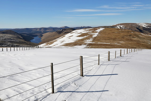
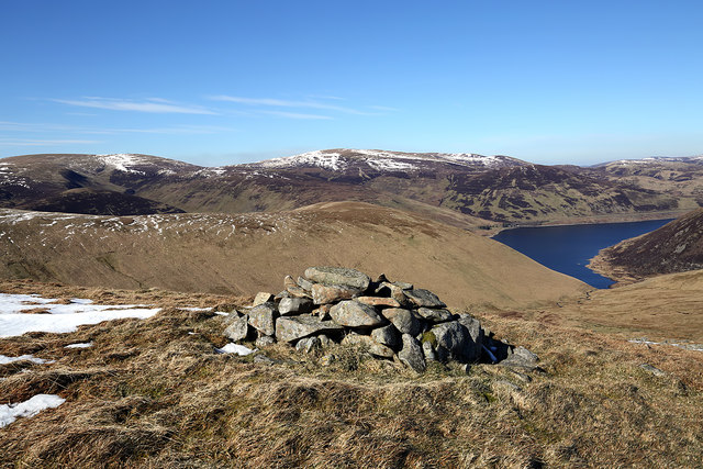
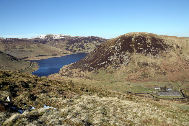
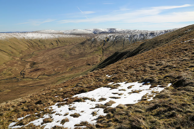
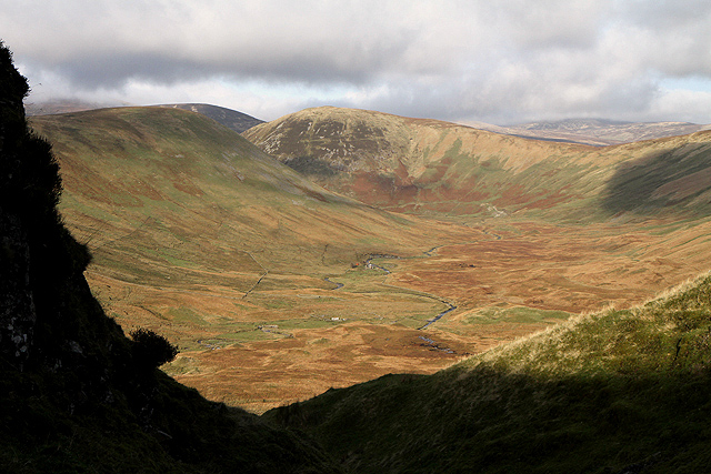
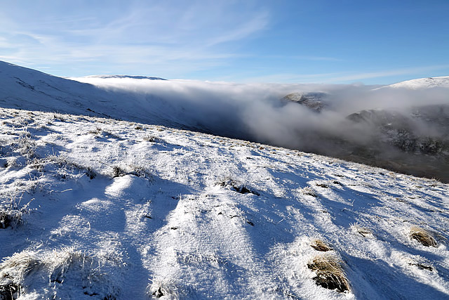
Crumley Hill is a prominent hill located in Peeblesshire, Scotland. It is part of the larger Moffat Hills range and stands at an impressive height of 536 meters (1,759 feet) above sea level. The hill's summit offers breathtaking panoramic views of the surrounding landscape, making it a popular destination for hikers, nature enthusiasts, and photographers.

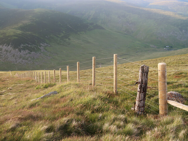
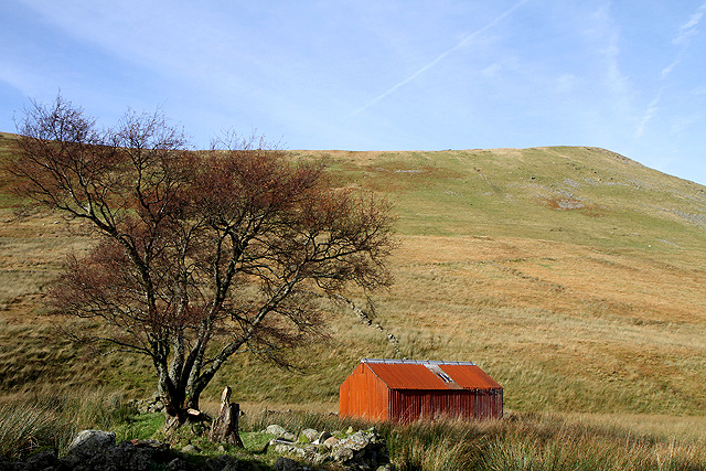
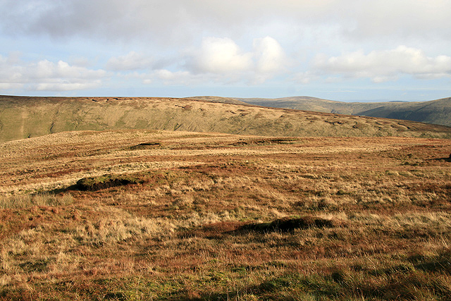
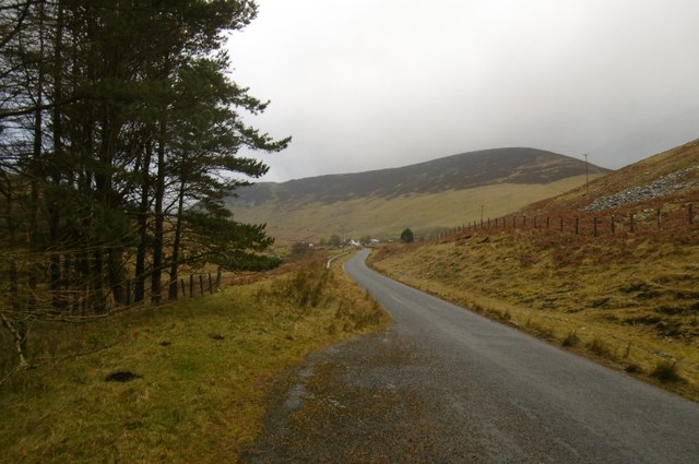
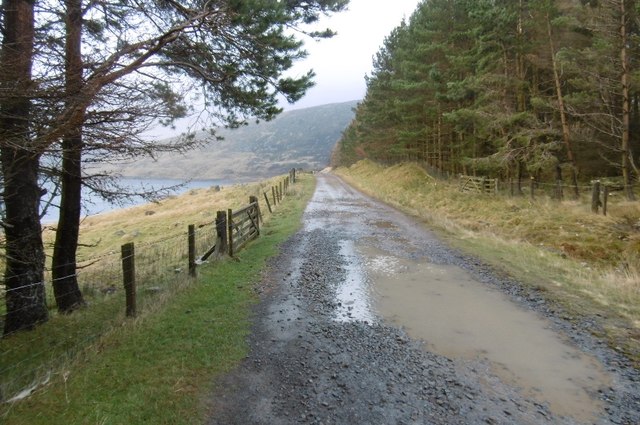
Crumley Hill is characterized by its rolling green slopes, covered in heather and scattered with rocky outcrops. The terrain is relatively steep, especially towards the summit, providing a challenging but rewarding hiking experience. The hill is accessible through various hiking trails that wind their way up through the picturesque countryside.

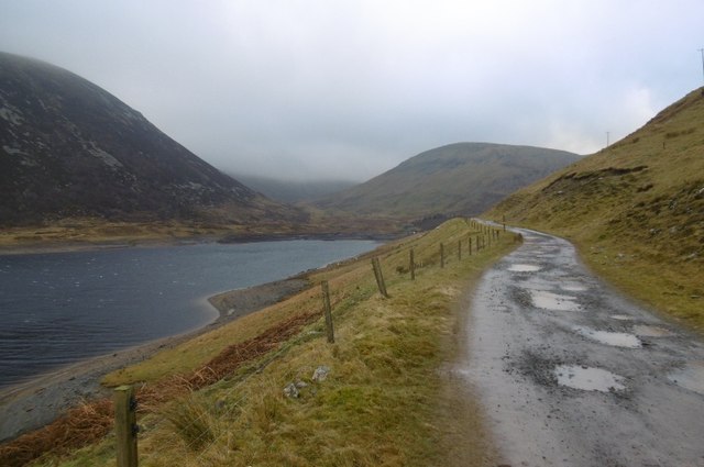
The hill is home to a diverse range of flora and fauna, including rare species of birds, small mammals, and a variety of wildflowers. The surrounding area also boasts several winding streams and small lochs, adding to the natural beauty and tranquility of the landscape.

Despite its relatively modest height, Crumley Hill holds historical and cultural significance. It is believed to have been used as a meeting place for local communities in ancient times, and remnants of prehistoric settlements have been found in the vicinity. Additionally, the hill has been mentioned in local folklore and legends, further adding to its allure and intrigue.

Crumley Hill provides a fantastic opportunity for outdoor enthusiasts to immerse themselves in the natural beauty of Peeblesshire, offering stunning views, diverse wildlife, and a glimpse into the region's rich history.

If you have any feedback on the listing, please let us know in the comments section below.
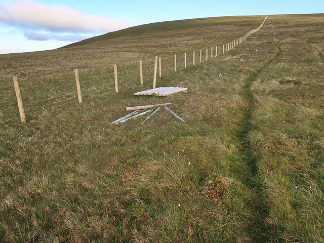
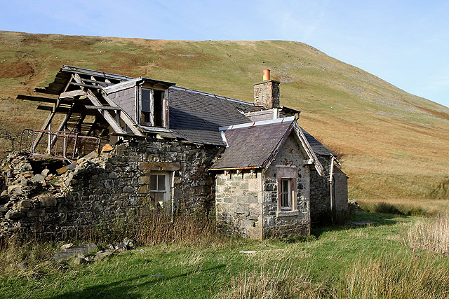
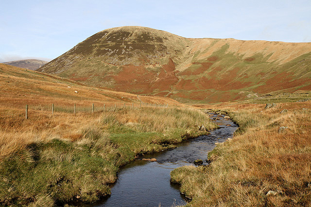
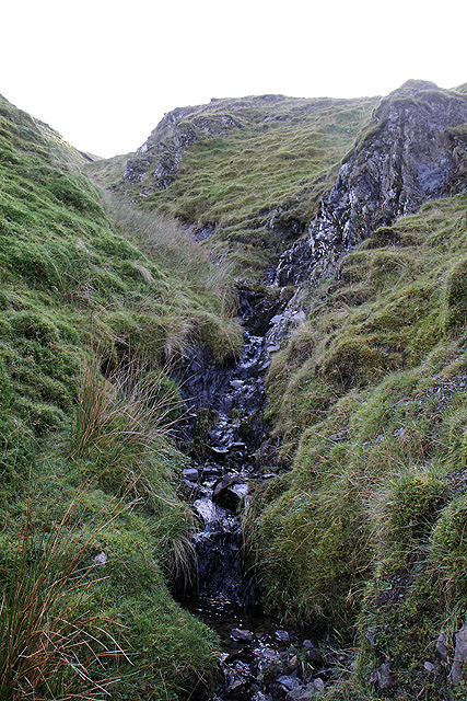
Crumley Hill Images

Images are sourced within 2km of 55.463774/-3.2950047 or Grid Reference NT1819. Thanks to Geograph Open Source API. All images are credited.

New fence on Talla East Side The boundary of the Talla and Gameshope area managed by the Border Forest Trust, see <a href="https://www.geograph.org.uk/photo/7209729">NT1420 : Border Forest Trust information board at Talla Water</a>.
New fence on Talla East Side
The boundary of the Talla and Gameshope area managed by the Border Forest Trust, see NT1420 : Border Forest Trust information board at Talla Water.
New fence on Nickies Knowe Looking down the steep slopes to the Megget Water and Meggethead the white building on the right. The fence is on the boundary of the Talla and Gameshope area managed by the Border Forest Trust, see <a href="https://www.geograph.org.uk/photo/7209729">NT1420 : Border Forest Trust information board at Talla Water</a>.
New fence on Nickies Knowe
Looking down the steep slopes to the Megget Water and Meggethead the white building on the right. The fence is on the boundary of the Talla and Gameshope area managed by the Border Forest Trust, see NT1420 : Border Forest Trust information board at Talla Water.
Snow on Talla East Side This is a view towards Nickies Knowe with Talla Reservoir on the far left. There were large patches of snow on the tops on a lovely March day for hill walking.
Snow on Talla East Side
This is a view towards Nickies Knowe with Talla Reservoir on the far left. There were large patches of snow on the tops on a lovely March day for hill walking.
A cairn on Five Cairns Hill Megget Reservoir is in the right background.
A cairn on Five Cairns Hill
Megget Reservoir is in the right background.
Crumley Hill This is near the summit looking towards Megget Reservoir with Craigdilly centre right and Winterhopeburn Farm down on the far right.
Crumley Hill
This is near the summit looking towards Megget Reservoir with Craigdilly centre right and Winterhopeburn Farm down on the far right.
On the lower southeast slopes of Five Cairns Hill The view straight ahead is to Red Scar on Lochcraig Head <a href="https://www.geograph.org.uk/photo/1496701">NT1818 : Red Scar on Lochcraig Rig</a> with the Winterhope Burn down on the left.
On the lower southeast slopes of Five Cairns Hill
The view straight ahead is to Red Scar on Lochcraig Head NT1818 : Red Scar on Lochcraig Rig with the Winterhope Burn down on the left.
A shed at Winter Hope This red corrugated iron shed is by the derelict cottage at Winterhopeburn. Crumley Hill is in the background.
A shed at Winter Hope
This red corrugated iron shed is by the derelict cottage at Winterhopeburn. Crumley Hill is in the background.
Winter Hope The Winterhope Burn runs through this sheltered valley into Megget Reservoir. Crumley Hill is on the left with Craigdilly in the central background. This was viewed from Red Scar on Lochcraig Rig. For a view of Red Scar from Five Cairns Hill, see <a href="https://www.geograph.org.uk/photo/1496701">NT1818 : Red Scar on Lochcraig Rig</a>.
Winter Hope
The Winterhope Burn runs through this sheltered valley into Megget Reservoir. Crumley Hill is on the left with Craigdilly in the central background. This was viewed from Red Scar on Lochcraig Rig. For a view of Red Scar from Five Cairns Hill, see NT1818 : Red Scar on Lochcraig Rig.
The derelict building at Winterhopeburn This farm cottage on the west side of the Winterhope Burn has fallen into disrepair. Crumley Hill is in the background.
The derelict building at Winterhopeburn
This farm cottage on the west side of the Winterhope Burn has fallen into disrepair. Crumley Hill is in the background.
The Winterhope Burn This is a view downstream towards Craigdilly.
The Winterhope Burn
This is a view downstream towards Craigdilly.
A small burn in Red Scar This gully is at the northeast end of Lochcraig Rig. For a view of the gully from Five Cairns Hill, see <a href="https://www.geograph.org.uk/photo/1496701">NT1818 : Red Scar on Lochcraig Rig</a>.
A small burn in Red Scar
This gully is at the northeast end of Lochcraig Rig. For a view of the gully from Five Cairns Hill, see NT1818 : Red Scar on Lochcraig Rig.
Lochcraig Rig This is at the northeast end of the ridge looking over to The Strypes.
Lochcraig Rig
This is at the northeast end of the ridge looking over to The Strypes.
Dead for Cauld This is at the northern slopes of the hill in late November.
Dead for Cauld
This is at the northern slopes of the hill in late November.
Megget road Near the end of the reservoir and approaching the original road at Meggethead.
Megget road
Near the end of the reservoir and approaching the original road at Meggethead.
Road to Winterhopeburn Long access road to the cottage and farm buildings at Winterhopeburn. The road was built following the flooding of the old road up to the original Winterhopeburn further up the glen.
Road to Winterhopeburn
Long access road to the cottage and farm buildings at Winterhopeburn. The road was built following the flooding of the old road up to the original Winterhopeburn further up the glen.
Road to Winterhope A new road, the old one was flooded by the reservoir.
Road to Winterhope
A new road, the old one was flooded by the reservoir.
Head of Megget Reservoir One of the two main feeders for the reservoir - Winterhope Burn.
Head of Megget Reservoir
One of the two main feeders for the reservoir - Winterhope Burn.
Sheep, Winterhope Sheep beside the flooded lower part of Winter Hope. Megget Reservoir was rather agitated by a strong wind funnelling down Winter Hope. I was blown off the road a little later.
Sheep, Winterhope
Sheep beside the flooded lower part of Winter Hope. Megget Reservoir was rather agitated by a strong wind funnelling down Winter Hope. I was blown off the road a little later.
Show me another place!

Crumley Hill is located at Grid Ref: NT1819 (Lat: 55.463774, Lng: -3.2950047)

Unitary Authority: The Scottish Borders

Police Authority: The Lothians and Scottish Borders

What 3 Words

///branching.nicely.remembers. Near Ettrick, Scottish Borders

Nearby Locations

Crumley Hill Winter Hope

Related Wikis

Megget Reservoir

Megget Reservoir is an impounding reservoir in the Megget valley in Ettrick Forest, in the Scottish Borders. The 259 hectares (640 acres) reservoir is...

Loch Skeen

Loch Skeen or Loch Skene is a loch in Dumfries and Galloway in the south of Scotland. It is located about 10 miles to the north-east of Moffat and feeds...

Megget

Megget is a former chapelry or parish containing the valley of Megget Water, now forming the westernmost part of the parish of Yarrow, Selkirkshire in...

Dob's Linn

Dob's Linn is a small steep valley in Dumfries and Galloway, just north of the A708 road between Moffat and Selkirk, in Scotland. It is part of the Grey...

Have you been to Crumley Hill?

Leave your review of Crumley Hill below (or comments, questions and feedback).