Deans Hill

Hill, Mountain in Peeblesshire

Scotland

Deans Hill

Old drove road above Romannobridge This forms part of the Cross Borders Drove Road, a long distance walking route from Harperrig, south-west of Edinburgh, to Hawick.
Old drove road above Romannobridge Credit: Alan O'Dowd

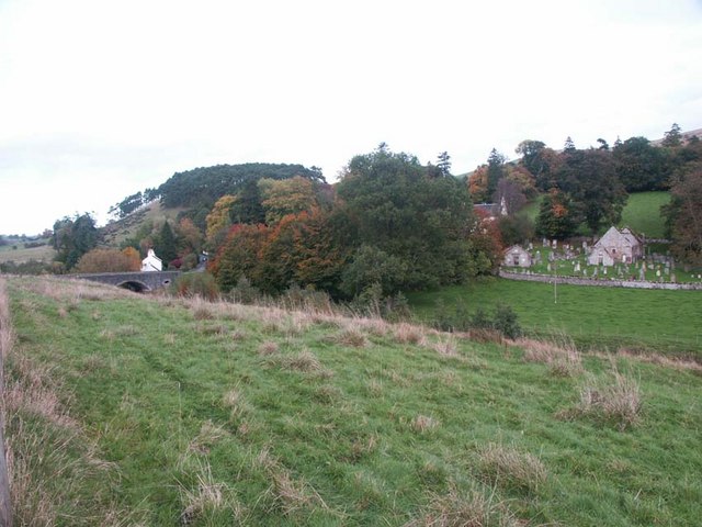
Deans Hill is a prominent geographical feature located in Peeblesshire, Scotland. It stands at an elevation of approximately 400 meters (1312 feet) above sea level and is part of the picturesque Southern Uplands range. The hill is situated near the village of Eddleston and offers stunning panoramic views of the surrounding countryside.

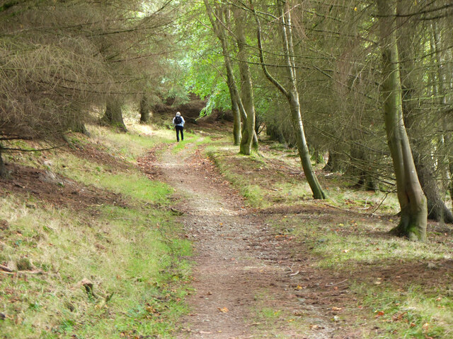
Deans Hill is primarily composed of sedimentary rocks, with the underlying strata consisting of layers of sandstone and shale. These rock formations have been shaped by millions of years of erosion, resulting in gentle slopes and undulating terrain. The hill is covered in lush green vegetation, including heather, grasses, and scattered stands of birch and pine trees.

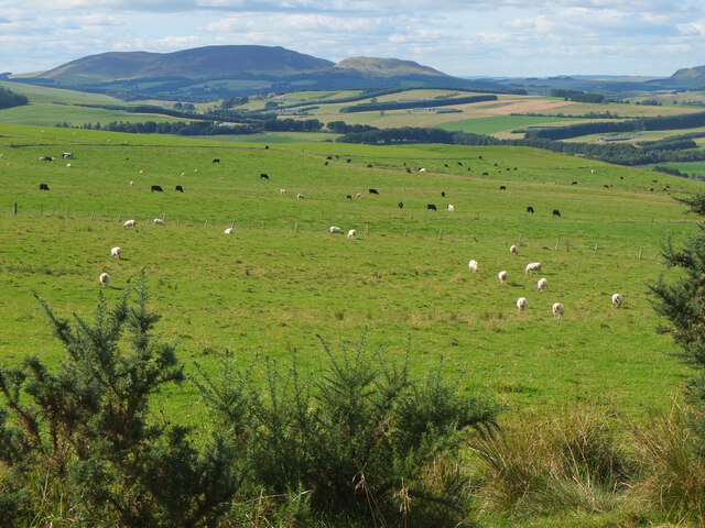
The summit of Deans Hill provides breathtaking vistas of the rolling hills and valleys of Peeblesshire. On a clear day, it is possible to see as far as the Pentland Hills to the northwest and the Moffat Hills to the south. The area is also home to a diverse range of wildlife, including red deer, foxes, and various bird species.

Deans Hill is a popular destination for outdoor enthusiasts and hikers, offering a range of trails and paths for exploration. The ascent to the summit can be challenging but rewarding, with opportunities for bird watching and nature photography along the way. The hill is easily accessible by road, with ample parking available at the base.

Overall, Deans Hill is a natural gem in Peeblesshire, offering visitors the chance to immerse themselves in the region's stunning landscapes and enjoy the tranquility of the Scottish countryside.

If you have any feedback on the listing, please let us know in the comments section below.
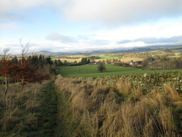
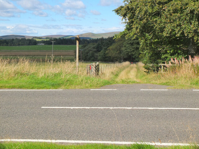
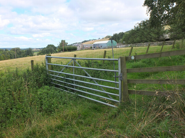
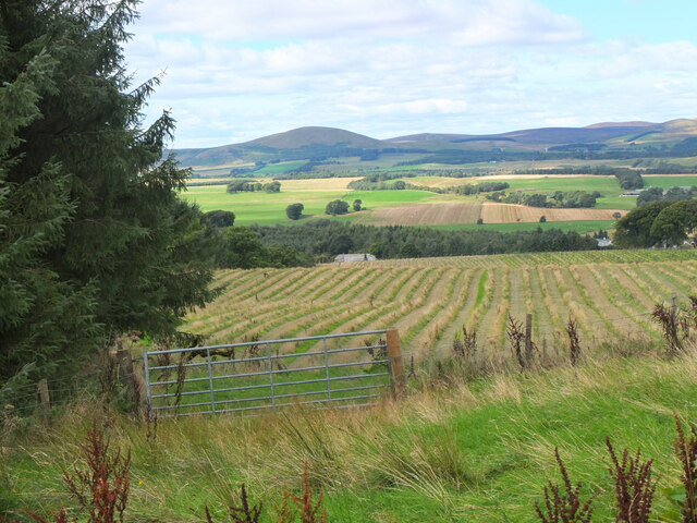
Deans Hill Images

Images are sourced within 2km of 55.723854/-3.3056708 or Grid Reference NT1848. Thanks to Geograph Open Source API. All images are credited.

Old drove road above Romannobridge This forms part of the Cross Borders Drove Road, a long distance walking route from Harperrig, south-west of Edinburgh, to Hawick.
Old drove road above Romannobridge
This forms part of the Cross Borders Drove Road, a long distance walking route from Harperrig, south-west of Edinburgh, to Hawick.
Old drove road near Romanno Hope This track forms part of the Cross Borders Drove Road, a long-distance walking route between Harperrig, south-west of Edinburgh, and Hawick.
Old drove road near Romanno Hope
This track forms part of the Cross Borders Drove Road, a long-distance walking route between Harperrig, south-west of Edinburgh, and Hawick.
Ford on the Fingland Burn near Romanno Hope This track forms part of the Cross Borders Drove Road, a long-distance walking route between Harperrig, south-west of Edinburgh, and Hawick.
Ford on the Fingland Burn near Romanno Hope
This track forms part of the Cross Borders Drove Road, a long-distance walking route between Harperrig, south-west of Edinburgh, and Hawick.
Sunlight and mist on Hag Law A mixture of low winter sunlight and banks of mist made for some atmospheric conditions.
Sunlight and mist on Hag Law
A mixture of low winter sunlight and banks of mist made for some atmospheric conditions.
Hillwalker in the mist on Wether Law Quite a contrast with the bright winter sunshine down in the valley.
Hillwalker in the mist on Wether Law
Quite a contrast with the bright winter sunshine down in the valley.
New deer fence, Woodend A fence with a pedestrian gate enclosing new tree plantation east of Woodend Quarry.
New deer fence, Woodend
A fence with a pedestrian gate enclosing new tree plantation east of Woodend Quarry.
Path junction near Kaimes A signpost for the Cross Borders Drove Road taking a field edge route to the A701 and Romannobridge.
Path junction near Kaimes
A signpost for the Cross Borders Drove Road taking a field edge route to the A701 and Romannobridge.
Farmland near Halmyre House The Cross Borders Drove Road follows field edges southwest to reach the A701 and Romannobridge.
Farmland near Halmyre House
The Cross Borders Drove Road follows field edges southwest to reach the A701 and Romannobridge.
Drove Road crossing the A701 at Halmyre Vigilance needed here where the Cross Borders Drove Road from West Linton crosses a fast stretch on the A701.
Drove Road crossing the A701 at Halmyre
Vigilance needed here where the Cross Borders Drove Road from West Linton crosses a fast stretch on the A701.
Romanno Mains A hill farm seen from the Cross Borders Drove Road.
Romanno Mains
A hill farm seen from the Cross Borders Drove Road.
Farmland above Romannobridge Looking from the Cross Borders Drove Road towards Mendick Hill (451m).
Farmland above Romannobridge
Looking from the Cross Borders Drove Road towards Mendick Hill (451m).
Path from Romannobridge The Cross Borders Drove Road follows this path to cross the col between Drum Maw and Hag Law.
Path from Romannobridge
The Cross Borders Drove Road follows this path to cross the col between Drum Maw and Hag Law.
Sheep and cattle, Drum Maw Pasture on the lower slopes of Drum Maw with Black Mount (516m) on the skyline.
Sheep and cattle, Drum Maw
Pasture on the lower slopes of Drum Maw with Black Mount (516m) on the skyline.
Path to Romanno Hope A good path on grass leads down to the Fingland Burn. Compare with <a href="https://www.geograph.org.uk/photo/6012175">NT1847 : Descent to Romanno Hope</a> taken in December 2018.
Path to Romanno Hope
A good path on grass leads down to the Fingland Burn. Compare with NT1847 : Descent to Romanno Hope taken in December 2018.
Bridge timber by Fingland Burn Before too long it looks as though a footbridge will be built here in Romanno Hope.
Bridge timber by Fingland Burn
Before too long it looks as though a footbridge will be built here in Romanno Hope.
A701 and Macbieknowe
Hillside behind Ironstone Cottages
Ruined steading, Halmyre Mains A conversion abandoned in 2008 shortly after the removal of the roof.  An attempt at revival of the project in 2011: <a href="https://www.geograph.org.uk/photo/2261220">NT1749 : Halmyre Mains</a>
Ruined steading, Halmyre Mains
A conversion abandoned in 2008 shortly after the removal of the roof. An attempt at revival of the project in 2011: NT1749 : Halmyre Mains
Show me another place!

Deans Hill is located at Grid Ref: NT1848 (Lat: 55.723854, Lng: -3.3056708)

Unitary Authority: The Scottish Borders

Police Authority: The Lothians and Scottish Borders

What 3 Words

///punks.limitless.videos. Near West Linton, Scottish Borders

Nearby Locations

Deans Hill

Related Wikis

Romannobridge

Romanno Bridge is a village on the Lyne Water, on the A701, in the Scottish Borders area of Scotland. Settlements nearby include West Linton, Halmyre,...

Newlands, Scottish Borders

Newlands is a parish in the Tweeddale committee area of the Scottish Borders council area, in southeastern Scotland. == Geography == Newlands is on the...

Bordlands

Bordlands is a village in the Parish of Newlands in the Scottish Borders area of Scotland. The former name of Bordlands was Boreland. == See also == List...

Broomlee railway station

Broomlee railway station served the village of West Linton, Peeblesshire, Scotland, from 1864 to 1933 on the Leadburn, Linton and Dolphinton Railway....

Nearby Amenities

Located within 500m of 55.723854,-3.3056708
Deans Hill
Ele: 393
Natural: peak
Lat/Long: 55.7236793/-3.305777
The data included in this document is from www.openstreetmap.org. The data is made available under ODbL.

Have you been to Deans Hill?

Leave your review of Deans Hill below (or comments, questions and feedback).