Dod Head

Hill, Mountain in Peeblesshire

Scotland

Dod Head

Broomlee Hill Trig Point Flush Bracket S3137
Broomlee Hill Trig Point Flush Bracket S3137 Credit: thejackrustles

Dod Head is a prominent hill located in Peeblesshire, Scotland. It is situated within the Tweedsmuir Hills, a range known for its stunning landscapes and scenic beauty. Rising to an elevation of approximately 619 meters (2,031 feet), Dod Head offers breathtaking views of the surrounding countryside and the picturesque Tweed Valley.

The hill is characterized by its rolling slopes, covered with heather and grasses, providing a diverse habitat for various flora and fauna. The area is home to several species of birds, including red grouse and golden eagles, making it a popular spot for birdwatching enthusiasts.

Dod Head also boasts a rich historical significance. The remains of an ancient hill fort, known as Dod Law, can be found near its summit. This fort dates back to the Iron Age and provides an insight into the region's rich past. Visitors can explore the ruins and imagine what life was like for the inhabitants of this ancient settlement.

Hiking and walking enthusiasts are drawn to Dod Head due to its accessibility and well-maintained trails. The hill offers a range of routes suitable for different skill levels, providing opportunities for both leisurely strolls and more challenging hikes. The panoramic views from the summit are a rewarding culmination of the effort required to reach the top.

Overall, Dod Head is a natural gem within Peeblesshire, offering a blend of natural beauty, historical significance, and recreational opportunities. Whether you are a nature lover, history enthusiast, or outdoor adventurer, Dod Head is sure to captivate and inspire.

If you have any feedback on the listing, please let us know in the comments section below.
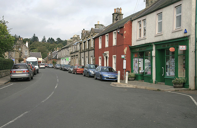
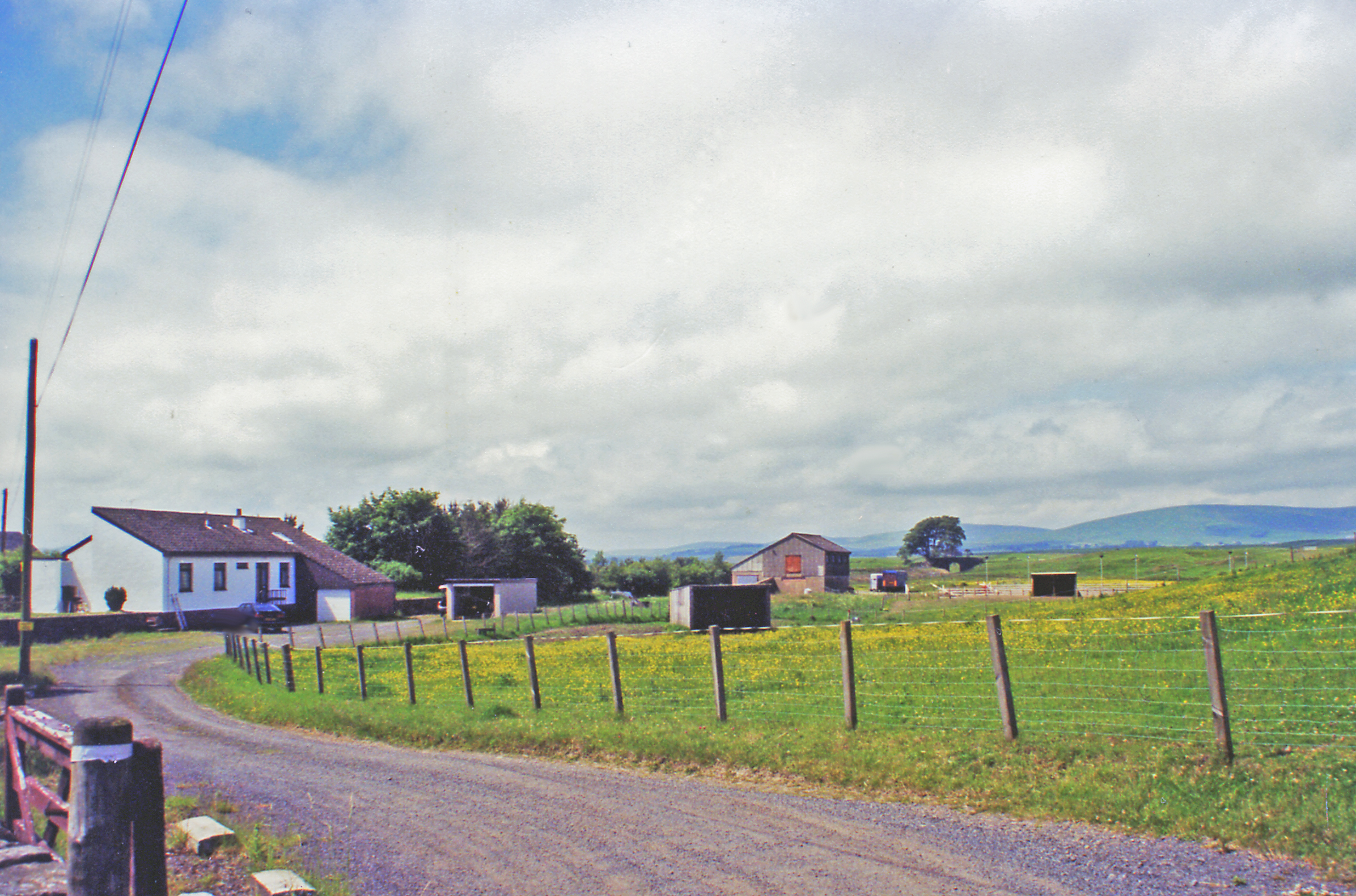
Dod Head Images

Images are sourced within 2km of 55.753112/-3.3107273 or Grid Reference NT1751. Thanks to Geograph Open Source API. All images are credited.

Broomlee Hill Trig Point Flush Bracket S3137
Pyramidal Obelisk near West Linton Well, it probably can't officially be called an obelisk, due to having such sloping sides, but its only description on a map is 'pillar' (this only shows up on very detailed online mapping, which is a bit odd considering the size of the structure) which is probably even less accurate a term.
The real conundrum with this thing regards what it is doing here in the first place! Investigations weren't that straightforward, but OS maps from around 1910 show the route of a pipeline, or 'conduit' as they put it, right at the spot of the obelisk. The pipeline runs underground (apart from occasional aqueducts) so it seems a little odd for it to get plotted on maps. It takes water from the two mile long Talla Reservoir, a good way south of here, to southern Edinburgh, and its overall length is around 35 miles.
Although online information is a bit sketchy there are mentions of similar structures along the pipe's route. Apparently they are surveying towers. As the water gets to its destination solely by gravity accuracy was obviously required, but this still doesn't really explain why it is so grand. My best guess is that because the money required to convert a small water body into a massive reservoir was so huge, the money spent on these was just a drop in the ocean. Plus railway lines had to be constructed from various places to transport materials for the building of the reservoir at the turn of the 20th century. As with everything railway-related, there is a colossal amount of online information regarding them.
Thinking information about the structure would be readily available online I didn't bother measuring it, but I reckon it's around 20 feet high with a four foot square base. There were no obvious markings.
Pyramidal Obelisk near West Linton
Well, it probably can't officially be called an obelisk, due to having such sloping sides, but its only description on a map is 'pillar' (this only shows up on very detailed online mapping, which is a bit odd considering the size of the structure) which is probably even less accurate a term. The real conundrum with this thing regards what it is doing here in the first place! Investigations weren't that straightforward, but OS maps from around 1910 show the route of a pipeline, or 'conduit' as they put it, right at the spot of the obelisk. The pipeline runs underground (apart from occasional aqueducts) so it seems a little odd for it to get plotted on maps. It takes water from the two mile long Talla Reservoir, a good way south of here, to southern Edinburgh, and its overall length is around 35 miles. Although online information is a bit sketchy there are mentions of similar structures along the pipe's route. Apparently they are surveying towers. As the water gets to its destination solely by gravity accuracy was obviously required, but this still doesn't really explain why it is so grand. My best guess is that because the money required to convert a small water body into a massive reservoir was so huge, the money spent on these was just a drop in the ocean. Plus railway lines had to be constructed from various places to transport materials for the building of the reservoir at the turn of the 20th century. As with everything railway-related, there is a colossal amount of online information regarding them. Thinking information about the structure would be readily available online I didn't bother measuring it, but I reckon it's around 20 feet high with a four foot square base. There were no obvious markings.
Broomlee Hill A short detour from the large mobile phone mast, which is passed on the poorly waymarked (along this wiggly bit anyway) Cross Borders Drove Road, brings you to the trig point. This medium-length Long Distance Path runs from the Western side of the Pentland Hills to Hawick. It is based on the route said to have been used long ago by cattle drovers to get their animals to English markets. 'Based' is certainly the operative word round here as it seems highly unlikely that such an odd circuitous route would have been used for any length of time, even if there were access problems with some of the surrounding land.
I was surprised to read that the route has been designed with horse riders in mind. They would certainly be advised to skip this section, and stay on the road until reaching the A701.
Broomlee Hill
A short detour from the large mobile phone mast, which is passed on the poorly waymarked (along this wiggly bit anyway) Cross Borders Drove Road, brings you to the trig point. This medium-length Long Distance Path runs from the Western side of the Pentland Hills to Hawick. It is based on the route said to have been used long ago by cattle drovers to get their animals to English markets. 'Based' is certainly the operative word round here as it seems highly unlikely that such an odd circuitous route would have been used for any length of time, even if there were access problems with some of the surrounding land. I was surprised to read that the route has been designed with horse riders in mind. They would certainly be advised to skip this section, and stay on the road until reaching the A701.
Path near Woodend Quarry The path down from Broomlee Hill has been re-routed through a new tree plantation east of the quarry.
Path near Woodend Quarry
The path down from Broomlee Hill has been re-routed through a new tree plantation east of the quarry.
New deer fence, Woodend A fence with a pedestrian gate enclosing new tree plantation east of Woodend Quarry.
New deer fence, Woodend
A fence with a pedestrian gate enclosing new tree plantation east of Woodend Quarry.
A701 and Macbieknowe
Hillside behind Ironstone Cottages
Cows and bumps The picture was taken from the North wall of the 'Macbiehill' road. The bumps are a scheduled monument. Whilst there are numerous areas in this part of the Scottish Borders altered by early quarrying activity, this one has been singled out. So if you're prepared to mix it up with the cows there are traces of rare old limekilns somewhere out here. According to Historic Environment Scotland, the quarry was once one of the most profitable in Southern Scotland, and 'unusually' was worked by the owner - so there's a timeless business message there for us all.
The quarry was 'Bents Quarry' and the nearest hamlet is/was 'Lamancha'. In the deep distant past I used to deliver parcels round here. After mispronouncing the name several times I was informed that the 'ch' was silent: "like the 'ch' in 'chianti'."
Cows and bumps
The picture was taken from the North wall of the 'Macbiehill' road. The bumps are a scheduled monument. Whilst there are numerous areas in this part of the Scottish Borders altered by early quarrying activity, this one has been singled out. So if you're prepared to mix it up with the cows there are traces of rare old limekilns somewhere out here. According to Historic Environment Scotland, the quarry was once one of the most profitable in Southern Scotland, and 'unusually' was worked by the owner - so there's a timeless business message there for us all. The quarry was 'Bents Quarry' and the nearest hamlet is/was 'Lamancha'. In the deep distant past I used to deliver parcels round here. After mispronouncing the name several times I was informed that the 'ch' was silent: "like the 'ch' in 'chianti'."
Pasture on Broomlee Hill Grassy fields at around 300m with a new conifer plantation to the right.
Pasture on Broomlee Hill
Grassy fields at around 300m with a new conifer plantation to the right.
Sheep and mast, Broomlee Hll Sheep in an upland pasture with a communications mast in view.
Sheep and mast, Broomlee Hll
Sheep in an upland pasture with a communications mast in view.
A field corner, Broomlee Hill In grassy pasture on the almost level ridge running NE from the communications mast. Three hills are on the skyline (L to R): Broomy Law, Tinto and Black Mount.
A field corner, Broomlee Hill
In grassy pasture on the almost level ridge running NE from the communications mast. Three hills are on the skyline (L to R): Broomy Law, Tinto and Black Mount.
Mast on Broomlee Hill A communications mast on the flat grassy ridge with the southern Pentland hills of King Seat and Byrehope Mount on the skyline.
Mast on Broomlee Hill
A communications mast on the flat grassy ridge with the southern Pentland hills of King Seat and Byrehope Mount on the skyline.
Deanfoot Road On the way to West Linton, passing a substation.  The distant hill is the Pentland outlier: Mendick Hill.
Deanfoot Road
On the way to West Linton, passing a substation. The distant hill is the Pentland outlier: Mendick Hill.
Grassland off Deanfoot Road Grassland beneath the Pentland Hills.
Grassland off Deanfoot Road
Grassland beneath the Pentland Hills.
Macbiehill from the air The A701 road can be seen to the right. Viewed from an Edinburgh bound flight from Prague.
Macbiehill from the air
The A701 road can be seen to the right. Viewed from an Edinburgh bound flight from Prague.
Fields at Deanfoot Looking north from Deanfoot Road. For an earlier picture at a different season see <a href="https://www.geograph.org.uk/photo/2668291">NT1652 : Clump of trees off Deanfoot Road</a>.
Fields at Deanfoot
Looking north from Deanfoot Road. For an earlier picture at a different season see NT1652 : Clump of trees off Deanfoot Road.
Whitfield from Deanfoot Road With Deepsyke Forest in the distance.
Whitfield from Deanfoot Road
With Deepsyke Forest in the distance.
Farmland at Whitfield on Deanfoot Road Looking southwest towards Mendick Hill.
Farmland at Whitfield on Deanfoot Road
Looking southwest towards Mendick Hill.
Show me another place!

Dod Head is located at Grid Ref: NT1751 (Lat: 55.753112, Lng: -3.3107273)

Unitary Authority: The Scottish Borders

Police Authority: The Lothians and Scottish Borders

What 3 Words

///grid.chief.helpfully. Near West Linton, Scottish Borders

Nearby Locations

Dod Head

Related Wikis

Macbie Hill railway station

Macbie Hill railway station served the hamlet of Coalyburn, Peeblesshire, Scotland, from 1864 to 1933 on the Leadburn, Linton and Dolphinton Railway....

Broomlee railway station

Broomlee railway station served the village of West Linton, Peeblesshire, Scotland, from 1864 to 1933 on the Leadburn, Linton and Dolphinton Railway....

West Linton

West Linton (Scottish Gaelic: Liontan Ruairidh) is a village and civil parish in southern Scotland, on the A702. It was formerly in the county of Peeblesshire...

Lamancha railway station

Lamancha railway station served the hamlet of Lamancha, Peeblesshire, Scotland, from 1864 to 1933 on the Leadburn, Linton and Dolphinton Railway. ��2...

Nearby Amenities

Located within 500m of 55.753112,-3.3107273
Power: pole
Lat/Long: 55.751158/-3.3162403
Power: pole
Lat/Long: 55.7516683/-3.3174205
Power: pole
Lat/Long: 55.7521754/-3.3185202
Sunnyside
Place: locality
Lat/Long: 55.750847/-3.3076787
Dod Head
Place: locality
Lat/Long: 55.7499201/-3.3134294
Power: pole
Lat/Long: 55.7498319/-3.3077622
Power: pole
Lat/Long: 55.7505808/-3.3092738
Power: pole
Lat/Long: 55.7510967/-3.3102935
Power: pole
Lat/Long: 55.7514682/-3.3110713
Power: pole
Lat/Long: 55.7511902/-3.3122865
Power: pole
Lat/Long: 55.750905/-3.3135101
Power: pole
Lat/Long: 55.7508482/-3.3142817
Power: pole
Lat/Long: 55.7507749/-3.3153476
Power: pole
Lat/Long: 55.7518551/-3.3104301
Power: pole
Lat/Long: 55.7523805/-3.3094315
Power: pole
Lat/Long: 55.752894/-3.3084728
Power: pole
Lat/Long: 55.7534098/-3.307491
Power: pole
Lat/Long: 55.7539434/-3.3064734
Power: pole
Lat/Long: 55.7544912/-3.3054243
Power: pole
Lat/Long: 55.7509678/-3.3082689
Power: pole
Lat/Long: 55.7513227/-3.3077201
Power: pole
Lat/Long: 55.7516942/-3.3071231
Power: pole
Lat/Long: 55.752093/-3.3065134
Power: pole
Lat/Long: 55.7529046/-3.3052477
The data included in this document is from www.openstreetmap.org. The data is made available under ODbL.

Have you been to Dod Head?

Leave your review of Dod Head below (or comments, questions and feedback).