Sròn Saobhaidhe

Hill, Mountain in Angus

Scotland

Sròn Saobhaidhe

Tree-lined path to Tulchan Lodge This is a beautiful, but private driveway that only leads to the lodge. I turned around soon after that point.
Tree-lined path to Tulchan Lodge Credit: Aleks Scholz

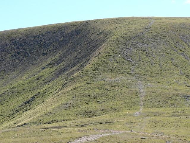
Sròn Saobhaidhe is a prominent hill located in the county of Angus, Scotland. With an elevation of approximately 462 meters (1,516 feet), it is considered one of the notable peaks in the region. The hill is situated near the village of Glen Clova, within the Cairngorms National Park, offering stunning views of the surrounding landscapes.

The ascent to Sròn Saobhaidhe is relatively straightforward, with a well-defined path leading to the summit. The trail begins at the Glen Clova Hotel, taking hikers through picturesque moorlands and gradually ascending towards the peak. Along the way, visitors can enjoy the diverse flora and fauna that thrive in this area, including heather, wildflowers, and various bird species.

Once at the summit, panoramic vistas await, showcasing the beautiful Glen Clova valley, the nearby Munros such as Mayar and Driesh, as well as the vast expanse of the Cairngorms National Park. On a clear day, it is even possible to catch a glimpse of the distant North Sea shimmering on the horizon.

Sròn Saobhaidhe is a popular destination for outdoor enthusiasts, attracting both experienced hikers and beginners looking for a rewarding challenge. Its accessibility, combined with the breathtaking scenery, makes it an ideal location for a day trip or a longer exploration of the surrounding area.

If you have any feedback on the listing, please let us know in the comments section below.

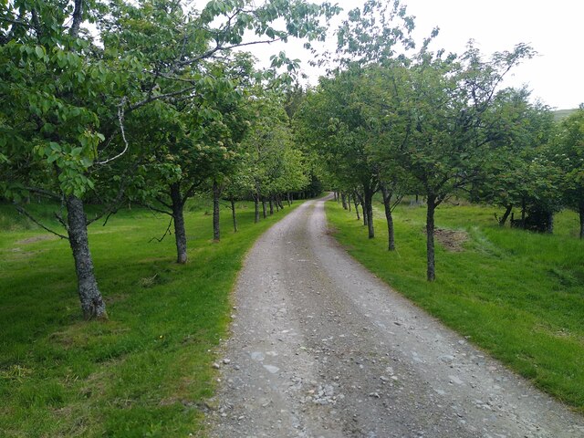
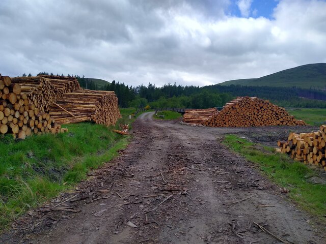
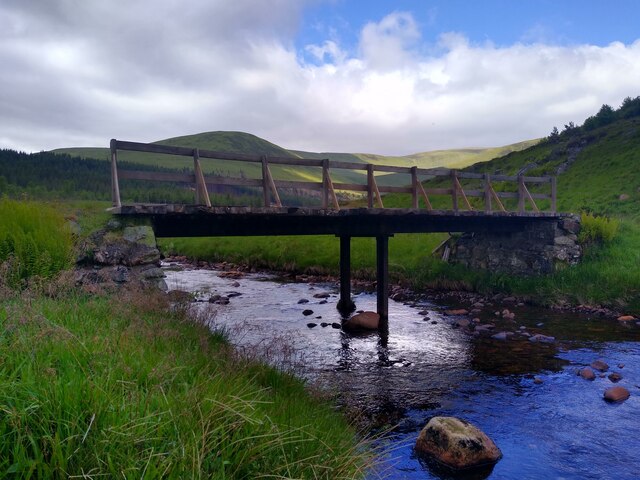
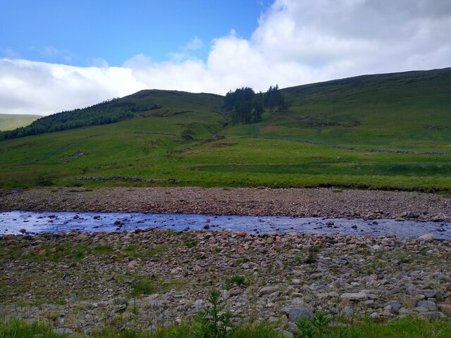
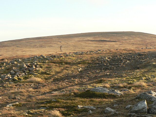
Sròn Saobhaidhe Images

Images are sourced within 2km of 56.846199/-3.3520625 or Grid Reference NO1773. Thanks to Geograph Open Source API. All images are credited.

Tree-lined path to Tulchan Lodge This is a beautiful, but private driveway that only leads to the lodge. I turned around soon after that point.
Tree-lined path to Tulchan Lodge
This is a beautiful, but private driveway that only leads to the lodge. I turned around soon after that point.
Track through timber stacks Entire tree plantations have disappeared compared to previous years in the upper parts of Glen Isla, either the trees were large enough to be harvested, or they have suffered during the storms in winter 2021-22.
Track through timber stacks
Entire tree plantations have disappeared compared to previous years in the upper parts of Glen Isla, either the trees were large enough to be harvested, or they have suffered during the storms in winter 2021-22.
Another bridge across the River Isla In the background parts of the Monega-Glas Maol ridge.
Another bridge across the River Isla
In the background parts of the Monega-Glas Maol ridge.
Across River Isla The Wester Latch burn with some old trees on the other side.
Across River Isla
The Wester Latch burn with some old trees on the other side.
Spring sunshine in Glen Brighty The screes on Creag Leacach drop in from the left. The hump of Glas Maol sunlit beyond.
Spring sunshine in Glen Brighty
The screes on Creag Leacach drop in from the left. The hump of Glas Maol sunlit beyond.
Heading down Monega Hill Heading southwards towards a cairn on the path down Monega Hill, with Glen Isla to the left.
Heading down Monega Hill
Heading southwards towards a cairn on the path down Monega Hill, with Glen Isla to the left.
Upper Glen Isla The track heading north up the upper reach of Glen Isla, with Caenlochan Glen in the distance.
Upper Glen Isla
The track heading north up the upper reach of Glen Isla, with Caenlochan Glen in the distance.
Entrance to Tulchan Lodge Tulchan Lodge entrance in the upper reaches of Glen Isla.
Entrance to Tulchan Lodge
Tulchan Lodge entrance in the upper reaches of Glen Isla.
Looking towards Glen Brighty and Caenlochan Glen Taken from the northern flanks of Monamenach.  The River Isla can be seen flowing down from the high bowls of Caenlochan Glen and Canness Glen, passing between Monega Hill and Finalty Hill.
Looking towards Glen Brighty and Caenlochan Glen
Taken from the northern flanks of Monamenach. The River Isla can be seen flowing down from the high bowls of Caenlochan Glen and Canness Glen, passing between Monega Hill and Finalty Hill.
Bridges by Tulchan Lodge Bridges over the Glenbrighty Burn and River Isla in Glen Isla.
Bridges by Tulchan Lodge
Bridges over the Glenbrighty Burn and River Isla in Glen Isla.
The Monega Road in Glen Isla The Monega Road is an old drove road from Glen Isla to Glen Clunie.
The Monega Road in Glen Isla
The Monega Road is an old drove road from Glen Isla to Glen Clunie.
Approaching Monega Hill The Monega Road leads up into the Caenlochan Glen, but the spur of Monega Hill (in shadow) provides a route up onto Glas Maol.
Approaching Monega Hill
The Monega Road leads up into the Caenlochan Glen, but the spur of Monega Hill (in shadow) provides a route up onto Glas Maol.
Looking up Glen Isla towards Caenlochan Glen Caenlochan Glen is a glacial trench fringed by steep corries, more fertile and verdant than the main Cairngorms massif.
Looking up Glen Isla towards Caenlochan Glen
Caenlochan Glen is a glacial trench fringed by steep corries, more fertile and verdant than the main Cairngorms massif.
Approaching Tulchan Lodge The old hill road known as the Monega Road follows the western bank of the River Isla here, and skirts round the grounds of Tulchan Lodge (in the trees).  Sròn Saobhaidhe ('nose of the foxes' den') is the rounded spur in the centre right, leading eventually up on to Glas Maol.
Approaching Tulchan Lodge
The old hill road known as the Monega Road follows the western bank of the River Isla here, and skirts round the grounds of Tulchan Lodge (in the trees). Sròn Saobhaidhe ('nose of the foxes' den') is the rounded spur in the centre right, leading eventually up on to Glas Maol.
Upper Glen Isla On the Monega Road, looking towards the craggy corries fringing Caenlochan Glen and Canness Glen, home to many unusual lime-loving plants and one of the richest sites in the British Isles for rare arctic-alpine flora.
Upper Glen Isla
On the Monega Road, looking towards the craggy corries fringing Caenlochan Glen and Canness Glen, home to many unusual lime-loving plants and one of the richest sites in the British Isles for rare arctic-alpine flora.
Lizard above Glen Brighty This lizard was very ready to pose for the camera! In an area where the heather had been burned quite recently he shows up very clearly.
Lizard above Glen Brighty
This lizard was very ready to pose for the camera! In an area where the heather had been burned quite recently he shows up very clearly.
Interesting sign Some signs raise more questions than they answer. This path leads over Monega Hill (note the correct spelling!)
Interesting sign
Some signs raise more questions than they answer. This path leads over Monega Hill (note the correct spelling!)
Glas Burn Looking up the Glas Burn where it is crossed by the Monega path.
Glas Burn
Looking up the Glas Burn where it is crossed by the Monega path.
Show me another place!

Sròn Saobhaidhe is located at Grid Ref: NO1773 (Lat: 56.846199, Lng: -3.3520625)

Unitary Authority: Angus

Police Authority: Tayside

What 3 Words

///irritate.slack.guests. Near Inverey, Aberdeenshire

Nearby Locations

Sròn Saobhaidhe

Related Wikis

Glas Maol

Glas Maol (Scottish Gaelic: A' Ghlas-Mheall) is a mountain in the Mounth, in the southeastern part of the Highlands of Scotland. The broad, flat summit...

Caenlochan

Caenlochan (Scottish Gaelic: Cadha an Lochain) is a glen in the Grampian Mountains of Scotland. Under EU Natura 2000 legislation it is a Special Area of...

Loch Beanie

Loch Beanie also known as Loch Shechernich, is a small shallow freshwater loch that is located in Glen Shee in Perth and Kinross, Scotland. == Island... ==

Cairn of Claise

Cairn of Claise is a mountain in the Grampians of Scotland, located about three miles from the Glenshee Ski Center near Braemar. == References ==

Nearby Amenities

Located within 500m of 56.846199,-3.3520625
Sròn Saobhaidhe
Ele: 735
Natural: peak
Lat/Long: 56.8456332/-3.3509765
The data included in this document is from www.openstreetmap.org. The data is made available under ODbL.

Have you been to Sròn Saobhaidhe?

Leave your review of Sròn Saobhaidhe below (or comments, questions and feedback).