Dun Law

Hill, Mountain in Peeblesshire

Scotland

Dun Law

Fence and moorland on Notman Law Grassy moorland on the left of the fence and heather moorland with the Thief's Road on the right.
Fence and moorland on Notman Law Credit: wrobison

Dun Law, located in Peeblesshire, Scotland, is a prominent hill that stands at an elevation of 598 meters (1,962 feet). It is situated within the stunning Scottish Borders region, known for its picturesque landscapes and rich history.

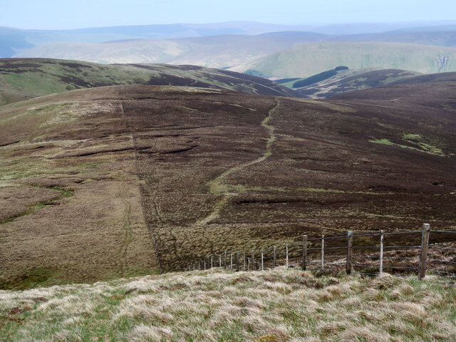
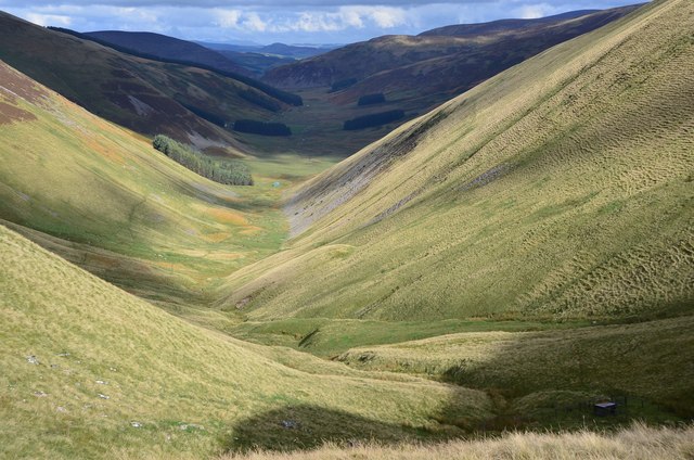
Dun Law is a popular destination for outdoor enthusiasts, hikers, and nature lovers, offering breathtaking views from its summit. The hill is part of the Moorfoot Hills range, which is characterized by rolling hills, heather-covered moorlands, and scattered pockets of woodland.

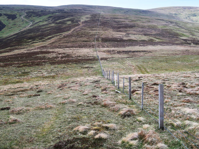
The ascent to Dun Law is relatively straightforward, with well-defined paths leading to the top. The hill is distinguished by its rounded shape and gentle slopes, making it accessible to people of various fitness levels. On a clear day, the summit provides panoramic vistas of the surrounding countryside, including the Tweed Valley and the Pentland Hills.

In addition to its natural beauty, Dun Law also has historical significance. The hill is home to an Iron Age hillfort, believed to have been constructed around 2,000 years ago. The remains of the fort can still be seen, with remnants of the ancient defensive walls and ditches.

Visitors to Dun Law can enjoy a peaceful and tranquil environment, away from the hustle and bustle of urban life. The area is abundant in wildlife, including birds of prey, deer, and various species of flora and fauna. It is a perfect spot for a leisurely stroll, a family picnic, or simply to appreciate the beauty of the Scottish countryside.

If you have any feedback on the listing, please let us know in the comments section below.

Dun Law Images

Images are sourced within 2km of 55.519266/-3.3083736 or Grid Reference NT1725. Thanks to Geograph Open Source API. All images are credited.

Fence and moorland on Notman Law Grassy moorland on the left of the fence and heather moorland with the Thief's Road on the right.
Fence and moorland on Notman Law
Grassy moorland on the left of the fence and heather moorland with the Thief's Road on the right.
Fence and moorland on Notman Law Looking towards Fifescar Knowe.
Fence and moorland on Notman Law
Looking towards Fifescar Knowe.
The Thief's Road on Fifescar Knowe Looking towards Notman Law.
The Thief's Road on Fifescar Knowe
Looking towards Notman Law.
Fence and old dyke on Dollar Law Looking towards Fifescar Knowe with Broad Law on the right.
Fence and old dyke on Dollar Law
Looking towards Fifescar Knowe with Broad Law on the right.
Track near Cramalt Craig summit Heading to the summit cairn.
Track near Cramalt Craig summit
Heading to the summit cairn.
Start of the Glentinning Burn On the north side of Cramalt Craig.
Start of the Glentinning Burn
On the north side of Cramalt Craig.
Col between Cramalt Craig and Dun Law Looking towards Dun Law.
Col between Cramalt Craig and Dun Law
Looking towards Dun Law.
Cotton grass and heather moorland On the east side of Cramalt Craig near the Cramalt Burn.
Cotton grass and heather moorland
On the east side of Cramalt Craig near the Cramalt Burn.
Track beside the Cramalt Burn On the east side of Cramalt Craig.
Track beside the Cramalt Burn
On the east side of Cramalt Craig.
Cramalt Craig This telephoto shot of the east side of the hill was taken from the A708 in late January.
Cramalt Craig
This telephoto shot of the east side of the hill was taken from the A708 in late January.
The head of the Manor Valley The valley ends with a half-ring of 600-800m hilltops - Redsike Head, Greenside Law, Water Head, Notman Law and Fifescar Knowe.
The head of the Manor Valley
The valley ends with a half-ring of 600-800m hilltops - Redsike Head, Greenside Law, Water Head, Notman Law and Fifescar Knowe.
Scree and grass, upper Manor Valley Large blocky scree on the side of Greenside Law.
Scree and grass, upper Manor Valley
Large blocky scree on the side of Greenside Law.
Notman Cleuch A steep-sided erosion feature on the east side of Notman Law.
Notman Cleuch
A steep-sided erosion feature on the east side of Notman Law.
Sheep pen, Manor Head An unexpected artefact high up in the Manor Valley.
Sheep pen, Manor Head
An unexpected artefact high up in the Manor Valley.
View down the Manor Valley The catchment of the upper Manor Valley from the ridge at Shielhope Head. The dark summit in the distance is White Meldon.
View down the Manor Valley
The catchment of the upper Manor Valley from the ridge at Shielhope Head. The dark summit in the distance is White Meldon.
Moorland track below Notman Law The hill track from Megget to Drumelzier is here reverting to bog in its more level stretches. The route swings left to skirt the summit of Notman Law ahead.
Moorland track below Notman Law
The hill track from Megget to Drumelzier is here reverting to bog in its more level stretches. The route swings left to skirt the summit of Notman Law ahead.
Hill track, Cramalt Crook A track up from Cramalt farm by Megget Reservoir, nearing the ridge at Dun Law.
Hill track, Cramalt Crook
A track up from Cramalt farm by Megget Reservoir, nearing the ridge at Dun Law.
Fence to Notman Law summit Looking back to the rounded top from the angle in the fence, where the track from Megget crosses on the way towards Fifescar Knowe.
Fence to Notman Law summit
Looking back to the rounded top from the angle in the fence, where the track from Megget crosses on the way towards Fifescar Knowe.
Show me another place!

Dun Law is located at Grid Ref: NT1725 (Lat: 55.519266, Lng: -3.3083736)

Unitary Authority: The Scottish Borders

Police Authority: The Lothians and Scottish Borders

What 3 Words

///width.backpack.cooks. Near Ettrick, Scottish Borders

Nearby Locations

Dun Law

Related Wikis

Broad Law

Broad Law is a hill in the Manor Hills range, part of the Southern Uplands of Scotland. The second-highest point in the Southern Uplands and the highest...

Craigierig

Craigierig is a village on the Megget Reservoir, in the Scottish Borders area of Scotland, in the former Selkirkshire. Places nearby include the Glengaber...

Megget Reservoir

Megget Reservoir is an impounding reservoir in the Megget valley in Ettrick Forest, in the Scottish Borders. The 259 hectares (640 acres) reservoir is...

Megget

Megget is a former chapelry or parish containing the valley of Megget Water, now forming the westernmost part of the parish of Yarrow, Selkirkshire in...

Have you been to Dun Law?

Leave your review of Dun Law below (or comments, questions and feedback).