Five Cairns Hill

Hill, Mountain in Peeblesshire

Scotland

Five Cairns Hill

Talla Nick On the bealach between Lochcraig Head and Firthybrig Head in the Scottish Borders or rather right on the boundary between the Borders and Dumfries and Galloway. Any moisture falling on the left will end up on the east coast at Berwick on Tweed and any on the right will end up on the west coast at Annan on the Solway Firth.
Talla Nick Credit: Adam Ward

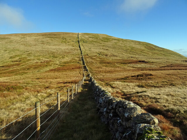
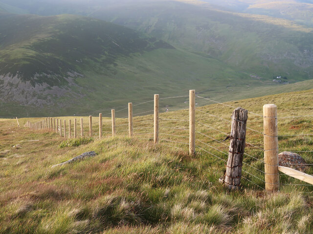
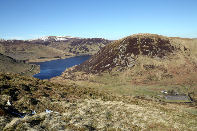
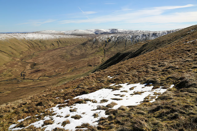
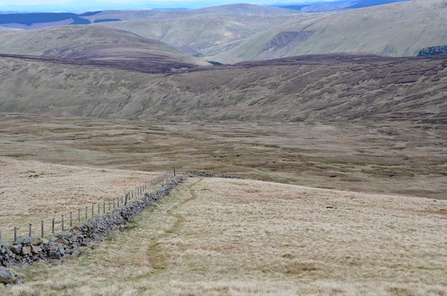
Five Cairns Hill is a prominent hill located in Peeblesshire, a historic county in the Scottish Borders region of Scotland. It is situated about 6 miles southwest of the town of Peebles, near the village of Eddleston. Rising to a height of 448 meters (1,470 feet), the hill is part of the Moorfoot Hills range, which forms an important natural boundary between Peeblesshire and Midlothian.

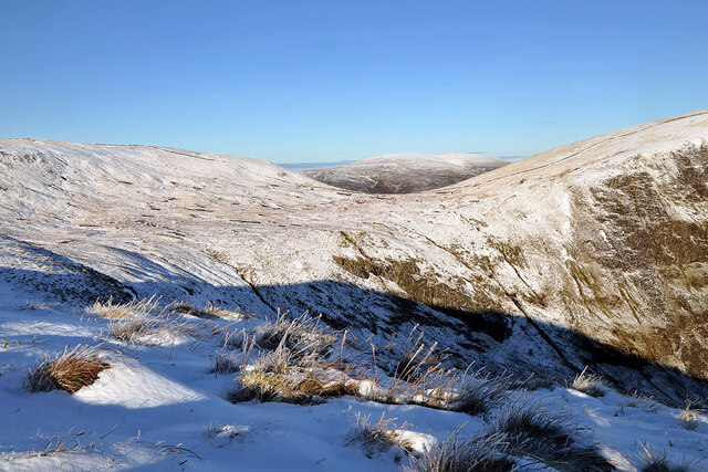
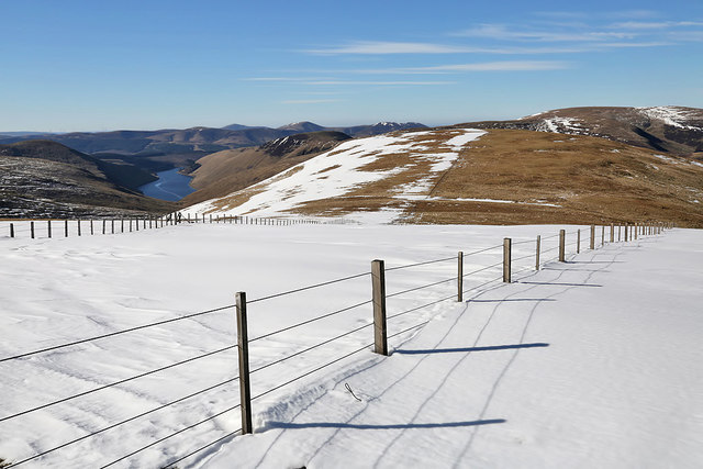
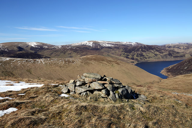
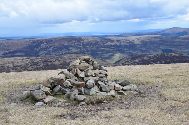
The name "Five Cairns" refers to the presence of five cairns or burial mounds on the hill's summit. These cairns are believed to date back to the Bronze Age, around 4,000 to 2,500 BC, and serve as a testament to the ancient human activity in the area. The hill itself offers breathtaking panoramic views of the surrounding countryside, including the rolling hills and picturesque valleys of Peeblesshire.

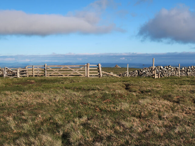
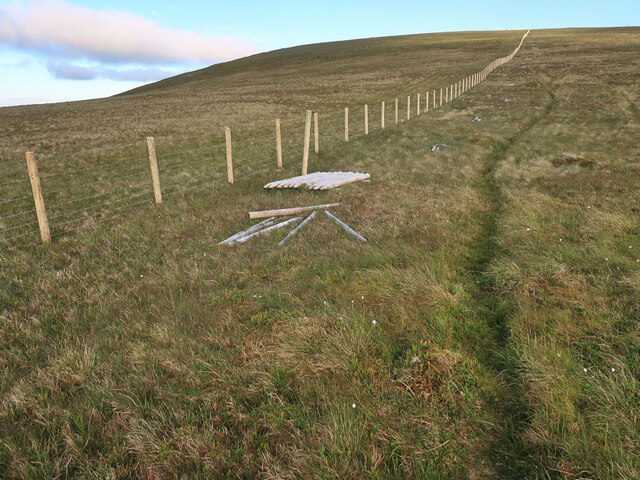
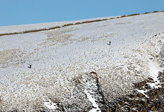
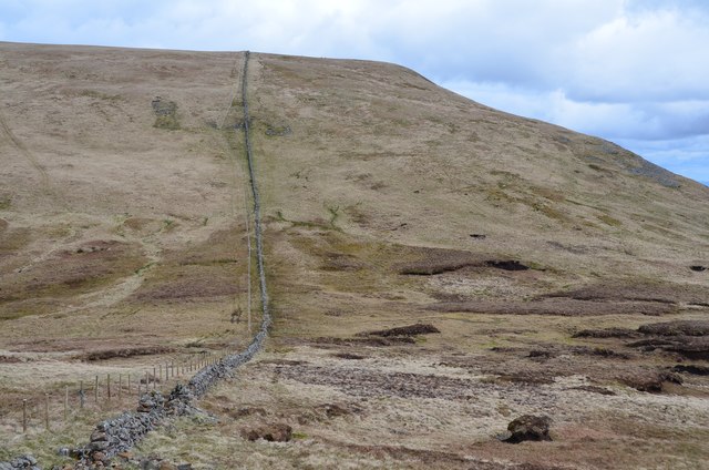
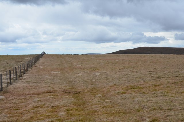
Five Cairns Hill is a popular destination for hikers and outdoor enthusiasts due to its accessibility and stunning natural beauty. Several walking trails lead to the summit, with varying degrees of difficulty, allowing visitors to choose the most suitable route based on their fitness level and preferences. Along the way, walkers can enjoy the diverse flora and fauna of the region, including heather moorland, woodland, and open pasture.

The hill is also known for its historical significance, as it was once part of the ancient Kingdom of Northumbria and witnessed various conflicts and battles during the turbulent medieval period. Today, it stands as a peaceful landmark, offering a serene and tranquil escape for those seeking to explore the rich history and natural wonders of Peeblesshire.

If you have any feedback on the listing, please let us know in the comments section below.

Five Cairns Hill Images

Images are sourced within 2km of 55.456227/-3.3075347 or Grid Reference NT1718. Thanks to Geograph Open Source API. All images are credited.

Talla Nick On the bealach between Lochcraig Head and Firthybrig Head in the Scottish Borders or rather right on the boundary between the Borders and Dumfries and Galloway. Any moisture falling on the left will end up on the east coast at Berwick on Tweed and any on the right will end up on the west coast at Annan on the Solway Firth.
Talla Nick
On the bealach between Lochcraig Head and Firthybrig Head in the Scottish Borders or rather right on the boundary between the Borders and Dumfries and Galloway. Any moisture falling on the left will end up on the east coast at Berwick on Tweed and any on the right will end up on the west coast at Annan on the Solway Firth.
Gate and style near Lochcraig Head summit The cairn beyond the gate is not at the highest point it is at a good viewpoint above Loch Skene.
Gate and style near Lochcraig Head summit
The cairn beyond the gate is not at the highest point it is at a good viewpoint above Loch Skene.
New fence on Talla East Side The boundary of the Talla and Gameshope area managed by the Border Forest Trust, see <a href="https://www.geograph.org.uk/photo/7209729">NT1420 : Border Forest Trust information board at Talla Water</a>.
New fence on Talla East Side
The boundary of the Talla and Gameshope area managed by the Border Forest Trust, see NT1420 : Border Forest Trust information board at Talla Water.
New fence on Nickies Knowe Looking down the steep slopes to the Megget Water and Meggethead the white building on the right. The fence is on the boundary of the Talla and Gameshope area managed by the Border Forest Trust, see <a href="https://www.geograph.org.uk/photo/7209729">NT1420 : Border Forest Trust information board at Talla Water</a>.
New fence on Nickies Knowe
Looking down the steep slopes to the Megget Water and Meggethead the white building on the right. The fence is on the boundary of the Talla and Gameshope area managed by the Border Forest Trust, see NT1420 : Border Forest Trust information board at Talla Water.
Walkers on Loch Craig This telephoto shot was taken from Mid Craig on a beautiful January day.
Walkers on Loch Craig
This telephoto shot was taken from Mid Craig on a beautiful January day.
Winter conditions on Mid Craig This is a view from Mid Craig to the col between Firthybrig Head and Lochcraig Head.
Winter conditions on Mid Craig
This is a view from Mid Craig to the col between Firthybrig Head and Lochcraig Head.
Snow on Talla East Side This is a view towards Nickies Knowe with Talla Reservoir on the far left. There were large patches of snow on the tops on a lovely March day for hill walking.
Snow on Talla East Side
This is a view towards Nickies Knowe with Talla Reservoir on the far left. There were large patches of snow on the tops on a lovely March day for hill walking.
A cairn on Five Cairns Hill Megget Reservoir is in the right background.
A cairn on Five Cairns Hill
Megget Reservoir is in the right background.
Crumley Hill This is near the summit looking towards Megget Reservoir with Craigdilly centre right and Winterhopeburn Farm down on the far right.
Crumley Hill
This is near the summit looking towards Megget Reservoir with Craigdilly centre right and Winterhopeburn Farm down on the far right.
On the lower southeast slopes of Five Cairns Hill The view straight ahead is to Red Scar on Lochcraig Head <a href="https://www.geograph.org.uk/photo/1496701">NT1818 : Red Scar on Lochcraig Rig</a> with the Winterhope Burn down on the left.
On the lower southeast slopes of Five Cairns Hill
The view straight ahead is to Red Scar on Lochcraig Head NT1818 : Red Scar on Lochcraig Rig with the Winterhope Burn down on the left.
West slope of Lochcraig Head Once across the boggy col of Talla Nick, 100m of ascent will deposit you on the summit plateau.
West slope of Lochcraig Head
Once across the boggy col of Talla Nick, 100m of ascent will deposit you on the summit plateau.
Cairn, Lochcraig Head A cairn on the southern edge of the summit plateau. The valley of the Tail Burn is just to the right of the cairn.
Cairn, Lochcraig Head
A cairn on the southern edge of the summit plateau. The valley of the Tail Burn is just to the right of the cairn.
Summit of Lochcraig Head The summit is somewhere in this minuscule rise in the plateau, appearing as two separate 800m contour rings.
Summit of Lochcraig Head
The summit is somewhere in this minuscule rise in the plateau, appearing as two separate 800m contour rings.
Garlie Cleuch Garlie Cleuch is a side valley to Winter Hope, seen here from Lochcraig Head.
Garlie Cleuch
Garlie Cleuch is a side valley to Winter Hope, seen here from Lochcraig Head.
Bend in the wall, Lochcraig Head The wall swings S to descend towards Loch Skene.
Bend in the wall, Lochcraig Head
The wall swings S to descend towards Loch Skene.
Descent from Lochcraig Head Descending by the boundary wall to the bog and peat hags east of the loch. The path keeps by the wall apart from the odd detour to avoid the worst of the bogs.
Descent from Lochcraig Head
Descending by the boundary wall to the bog and peat hags east of the loch. The path keeps by the wall apart from the odd detour to avoid the worst of the bogs.
Loch Skene in a patch of sunlight A gap in the clouds has brought patchy sunlight across the loch to the slopes of Lochcraig Head.
Loch Skene in a patch of sunlight
A gap in the clouds has brought patchy sunlight across the loch to the slopes of Lochcraig Head.
Nickies Knowe Steep scree slopes on the west side of the hill.
Nickies Knowe
Steep scree slopes on the west side of the hill.
Show me another place!

Five Cairns Hill is located at Grid Ref: NT1718 (Lat: 55.456227, Lng: -3.3075347)

Unitary Authority: The Scottish Borders

Police Authority: The Lothians and Scottish Borders

What 3 Words

///rises.alien.propelled. Near Ettrick, Scottish Borders

Related Wikis

Loch Skeen

Loch Skeen or Loch Skene is a loch in Dumfries and Galloway in the south of Scotland. It is located about 10 miles to the north-east of Moffat and feeds...

Megget Reservoir

Megget Reservoir is an impounding reservoir in the Megget valley in Ettrick Forest, in the Scottish Borders. The 259 hectares (640 acres) reservoir is...

Dob's Linn

Dob's Linn is a small steep valley in Dumfries and Galloway, just north of the A708 road between Moffat and Selkirk, in Scotland. It is part of the Grey...

White Coomb

White Coomb is a hill in the Moffat Hills range, part of the Southern Uplands of Scotland. Its broad summit is the highest point in the range and the registration...

Have you been to Five Cairns Hill?

Leave your review of Five Cairns Hill below (or comments, questions and feedback).