Fron Bank

Hill, Mountain in Radnorshire

Wales

Fron Bank

Beacon Hill Climbed from west over Black Mountain on way to summit and Stanky Hill on way back. Cool grey morning with high cloud so reasonable views.
Name: Beacon Hill
Hill number: 2183
Height: 547m / 1795ft
Area: 31B: Welshpool to Hay-on-Wye
Class: Ma,5
Grid ref: SO 17647 76799
Summit feature: trig point
Drop: 174m
Col: 373m  SO082841
Beacon Hill Credit: Rude Health

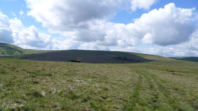
Fron Bank is a prominent hill/mountain located in the county of Radnorshire, Wales. Situated in the central part of the county, it forms part of the beautiful and rugged landscape that characterizes this region. Standing at an elevation of approximately 450 meters (1476 feet), Fron Bank offers stunning panoramic views of the surrounding countryside.

The hill/mountain is known for its distinctive shape and steep slopes, which make it a popular destination for hikers, mountaineers, and nature enthusiasts. Its location within the Radnor Forest makes it an integral part of the local ecosystem, providing a habitat for a variety of plant and animal species.

Fron Bank is surrounded by a diverse range of flora and fauna, including heather, bracken, and various species of wildflowers. The hill is also home to a number of bird species, such as red kites, buzzards, and peregrine falcons, making it a haven for birdwatchers.

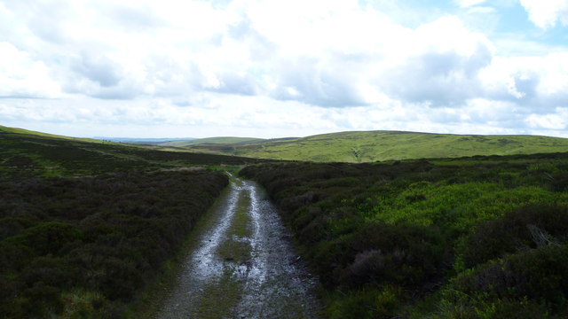
Access to Fron Bank is relatively straightforward, with several walking trails and footpaths leading to its summit. These routes offer different levels of difficulty, catering to both casual walkers and experienced hikers. The hill/mountain can be explored year-round, with each season offering its own unique charm.

In summary, Fron Bank in Radnorshire is a picturesque hill/mountain that provides breathtaking views of the surrounding landscape. Its significance as a natural and recreational resource makes it a must-visit destination for those seeking outdoor adventures in the heart of Wales.

If you have any feedback on the listing, please let us know in the comments section below.
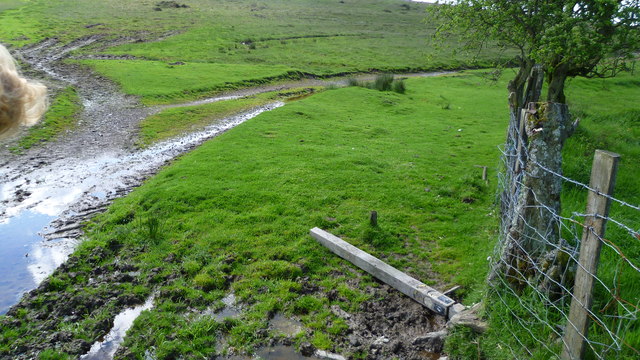
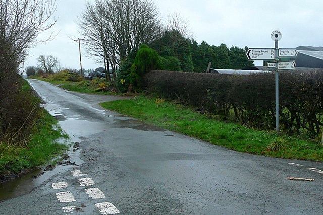
Fron Bank Images

Images are sourced within 2km of 52.396038/-3.2154378 or Grid Reference SO1778. Thanks to Geograph Open Source API. All images are credited.

Beacon Hill Climbed from west over Black Mountain on way to summit and Stanky Hill on way back. Cool grey morning with high cloud so reasonable views.
Name: Beacon Hill
Hill number: 2183
Height: 547m / 1795ft
Area: 31B: Welshpool to Hay-on-Wye
Class: Ma,5
Grid ref: SO 17647 76799
Summit feature: trig point
Drop: 174m
Col: 373m  SO082841
Beacon Hill
Climbed from west over Black Mountain on way to summit and Stanky Hill on way back. Cool grey morning with high cloud so reasonable views. Name: Beacon Hill Hill number: 2183 Height: 547m / 1795ft Area: 31B: Welshpool to Hay-on-Wye Class: Ma,5 Grid ref: SO 17647 76799 Summit feature: trig point Drop: 174m Col: 373m SO082841
On Glyndwr's Way in May Easy upland walking in glorious conditions.

It is May mornings like this that I picture in my mind's eye in the depths of winter when thinking ahead to future walks.
On Glyndwr's Way in May
Easy upland walking in glorious conditions. It is May mornings like this that I picture in my mind's eye in the depths of winter when thinking ahead to future walks.
Cows and calves beside Glyndwr's Way Contentedly chewing the cud here until we approached, they sprung up leaving one lazy calf to rise last. Lovely Welsh Black cattle I think.
Cows and calves beside Glyndwr's Way
Contentedly chewing the cud here until we approached, they sprung up leaving one lazy calf to rise last. Lovely Welsh Black cattle I think.
On an upland section of Glyndwr's Way The stubby new yellow-topped waymarkers prevent cattle, ponies and sheep from rubbing & scratching on them - they are too short, certainly too short for the larger, heavier livestock.
On an upland section of Glyndwr's Way
The stubby new yellow-topped waymarkers prevent cattle, ponies and sheep from rubbing & scratching on them - they are too short, certainly too short for the larger, heavier livestock.
On Glyndwr's Way above Bwlch house A lovely section of GW on a morning like this.
On Glyndwr's Way above Bwlch house
A lovely section of GW on a morning like this.
Waymarker down on Glyndwr's Way near Bwlch House Yet another one down.
Waymarker down on Glyndwr's Way near Bwlch House
Yet another one down.
View from Glyndwr's Way above Bwlch House Lovely hills!
View from Glyndwr's Way above Bwlch House
Lovely hills!
On Glyndwr's Way on Warren Bank in May Lovely upland scene this morning up here.
On Glyndwr's Way on Warren Bank in May
Lovely upland scene this morning up here.
On Glyndwr's Way above Warren Bank in May A fingerpost leans at a tipsy angle.
On Glyndwr's Way above Warren Bank in May
A fingerpost leans at a tipsy angle.
Upland footbridge on Glyndwr's Way Carrying GW across a boggy stream.
Upland footbridge on Glyndwr's Way
Carrying GW across a boggy stream.
On Glyndwr's Way on the slope of the Black Mountain between Knighton and Felindre A steep climb in my direction of travel.
On Glyndwr's Way on the slope of the Black Mountain between Knighton and Felindre
A steep climb in my direction of travel.
On the Black Mountain on Glyndwr's Way Lovely views over serried ranks of hills. Lovely.
On the Black Mountain on Glyndwr's Way
Lovely views over serried ranks of hills. Lovely.
Part of Glyndwr's Way on Black Mountain between Felindre and Knighton Lovely upland with a distant waymarker post on the skyline.
Part of Glyndwr's Way on Black Mountain between Felindre and Knighton
Lovely upland with a distant waymarker post on the skyline.
On Glyndwr's Way between Black Mountain and Stanky Hill between Knighton and Felindre Wonderful upland section of GW - really isolated and unspoilt section, secluded and beautiful on a sunny May morning.
On Glyndwr's Way between Black Mountain and Stanky Hill between Knighton and Felindre
Wonderful upland section of GW - really isolated and unspoilt section, secluded and beautiful on a sunny May morning.
On Glyndwr's Way on Stanky Hill Pleasing upland path through moorland.
On Glyndwr's Way on Stanky Hill
Pleasing upland path through moorland.
View to a valley off Glyndwr's Way Sunlit valley off GW.
View to a valley off Glyndwr's Way
Sunlit valley off GW.
On Glyndwr's Way on Stanky Hill In spring you must walk GW.
On Glyndwr's Way on Stanky Hill
In spring you must walk GW.
Beacon Hill storm clouds Storm clouds over Beacon Hill seen across the Teme Valley from Llanfair Hill above Llanfair Waterdine.
Beacon Hill storm clouds
Storm clouds over Beacon Hill seen across the Teme Valley from Llanfair Hill above Llanfair Waterdine.
Show me another place!

Fron Bank is located at Grid Ref: SO1778 (Lat: 52.396038, Lng: -3.2154378)

Unitary Authority: Powys

Police Authority: Dyfed Powys

What 3 Words

///journey.glassware.pylons. Near Knighton, Powys

Nearby Locations

Fron Bank

Related Wikis

Beacon Hill, Powys

Beacon Hill (Welsh: Mynydd Disglair) is a hill in the county of Radnorshire, Wales. It lies within the Powys unitary council area. It is located north...

East Wales

East Wales (Welsh: Dwyrain Cymru) is either a ITL 3 statistical region of Wales or generally a region encompassing the easternmost parts of the country...

Beguildy

Beguildy (Welsh: Bugeildy) is a village and community in Powys, Wales. It lies in a remote tract of countryside, 8 miles (13 km) northwest of Knighton...

Quabbs

Quabbs is a small, scattered hamlet in the southwest of Shropshire, near the border between England and Wales. The name, which also occurs in Gloucestershire...

Have you been to Fron Bank?

Leave your review of Fron Bank below (or comments, questions and feedback).