Green How

Hill, Mountain in Cumberland Copeland

England

Green How

A fine bridge over the River Esk
A fine bridge over the River Esk Credit: David Medcalf

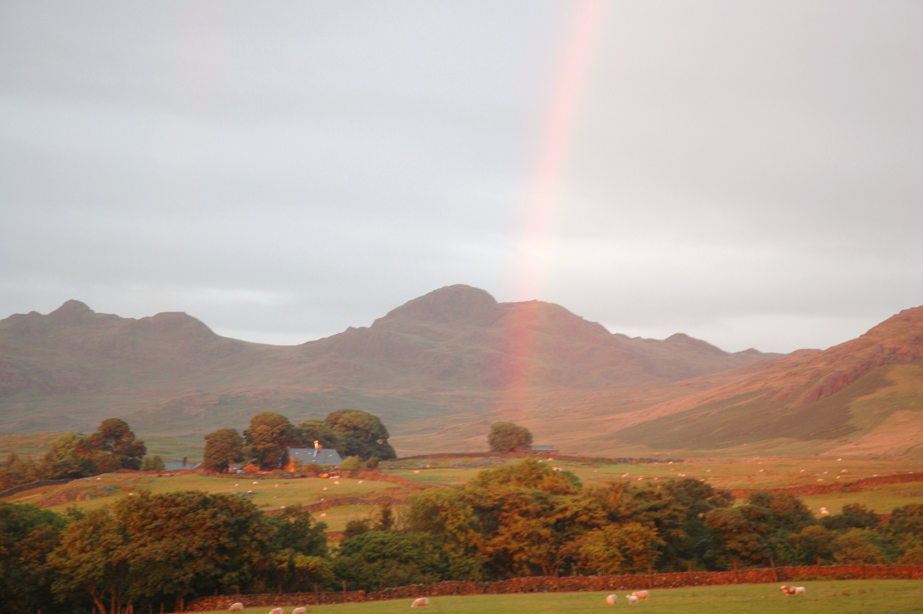
Green How is a prominent hill located in the county of Cumberland, in the northwestern region of England. It is part of the Lake District National Park, a renowned area of natural beauty and a UNESCO World Heritage site. Rising to an elevation of 623 meters (2,044 feet), Green How is considered a significant landmark within the region.

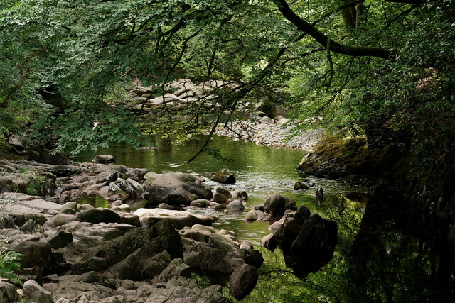
The hill is characterized by its distinctive conical shape, covered in lush green vegetation, hence its name. It offers breathtaking panoramic views of the surrounding countryside, including the picturesque Ennerdale Valley, Crummock Water, and Buttermere, which are renowned for their tranquil beauty. On a clear day, visitors can also enjoy stunning vistas of the nearby mountains, including Great Gable and Haystacks.

Green How is a popular destination for outdoor enthusiasts and hikers, with a variety of marked trails and footpaths that lead to its summit. The ascent can be challenging at times, particularly in adverse weather conditions, but the rewarding views make it a worthwhile experience for many. The hill is also frequented by birdwatchers, as it serves as a habitat for various bird species, including peregrine falcons and golden eagles.

Nearby, there are several quaint villages and hamlets, such as Ennerdale Bridge and Loweswater, that provide convenient bases for visitors looking to explore the area. Green How, with its natural beauty and recreational opportunities, is an essential part of the Lake District experience and continues to captivate locals and tourists alike.

If you have any feedback on the listing, please let us know in the comments section below.
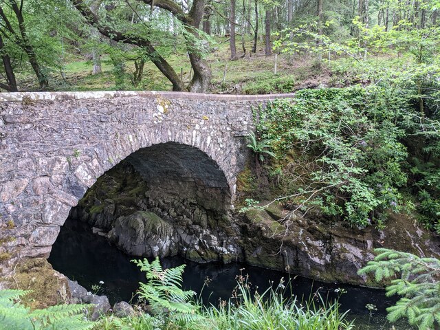
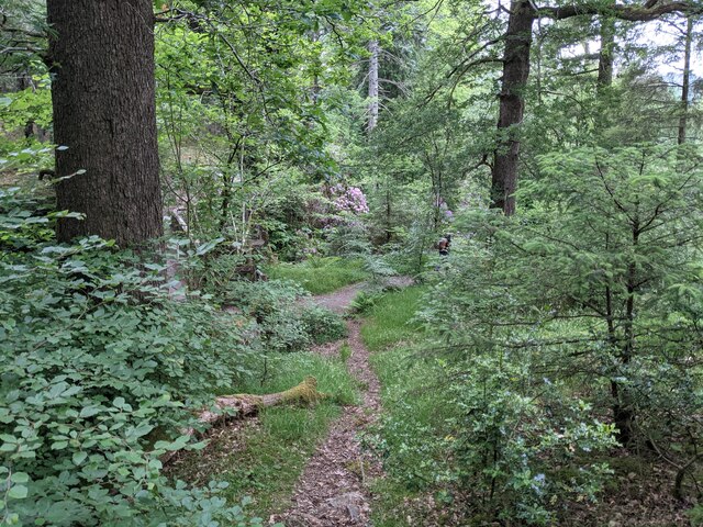
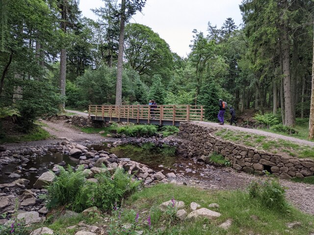
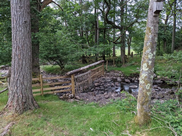
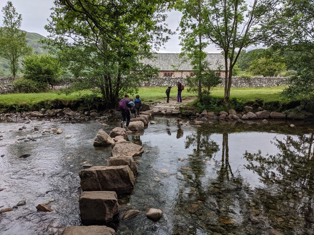
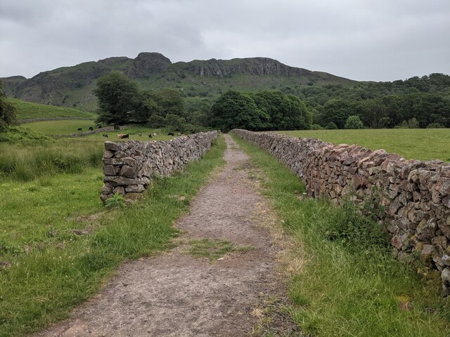
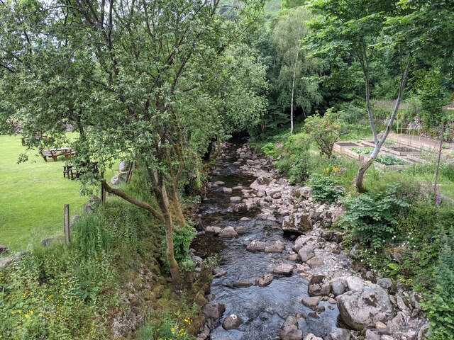
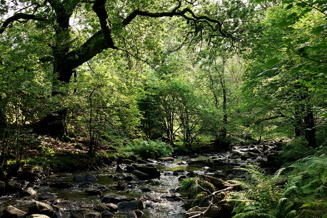
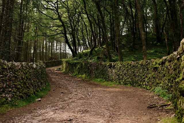
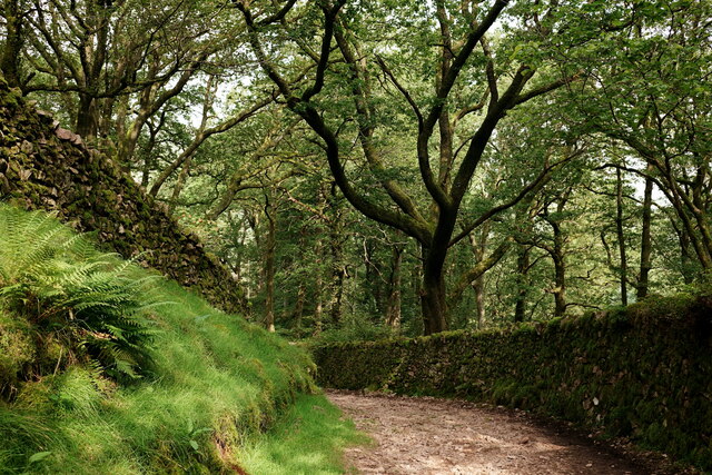
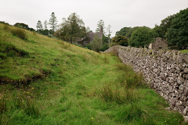
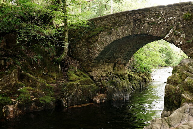
Green How Images

Images are sourced within 2km of 54.381411/-3.276289 or Grid Reference SD1799. Thanks to Geograph Open Source API. All images are credited.

A fine bridge over the River Esk
A path through the woods near Dalegarth
A new bridge over Birker Beck I think the previous bridge (see: <a title="https://www.geograph.org.uk/photo/4455179)" href="https://www.geograph.org.uk/photo/4455179)">Link</a> was probably damaged by floods.
Curiously the beck, referred to in some other geographs as Stanley Ghyll Beck, is named on the OS 1:50k map, but not on the 1:25k map.
A new bridge over Birker Beck
I think the previous bridge (see: Link was probably damaged by floods. Curiously the beck, referred to in some other geographs as Stanley Ghyll Beck, is named on the OS 1:50k map, but not on the 1:25k map.
A hanging fence across Birker Beck To discourage sheep from using the stream bed as an escape to greener pastures.
A hanging fence across Birker Beck
To discourage sheep from using the stream bed as an escape to greener pastures.
The stepping stones - a fun way to cross the Esk
The bridleway to the footbridge across the Esk
Wildflowers and trees Near Esk View Farm.
Wildflowers and trees
Near Esk View Farm.
Whillan Beck from the mill bridge
Stanley Ghyll Beck Seen from the start of the climb up to the waterfall.
Stanley Ghyll Beck
Seen from the start of the climb up to the waterfall.
Eskdale Track up to the new Stanley Force viewing platform. Most walkers take the path in the ravine to reach the viewing platform, returning via this track.
Eskdale
Track up to the new Stanley Force viewing platform. Most walkers take the path in the ravine to reach the viewing platform, returning via this track.
Eskdale Track down to the road, from the new Stanley Force viewing platform.
Eskdale
Track down to the road, from the new Stanley Force viewing platform.
Eskdale View towards Dalegarth Hall, from the track.
Eskdale
View towards Dalegarth Hall, from the track.
Eskdale Trough House bridge and the River Esk.
Eskdale
Trough House bridge and the River Esk.
Eskdale River Esk from Trough House Bridge.
Eskdale
River Esk from Trough House Bridge.
'River Mite' Passing through Beckfoot station, with a train for Ravenglass.
'River Mite'
Passing through Beckfoot station, with a train for Ravenglass.
'Whillan Beck' Arriving at Dalegarth, with a train from Ravenglass.
'Whillan Beck'
Arriving at Dalegarth, with a train from Ravenglass.
'Whillan Beck' Arriving at Dalegarth, with a train from Ravenglass.
'Whillan Beck'
Arriving at Dalegarth, with a train from Ravenglass.
Blea Tarn
Blea Tarn
Show me another place!

Green How is located at Grid Ref: SD1799 (Lat: 54.381411, Lng: -3.276289)

Administrative County: Cumbria

District: Copeland

Police Authority: Cumbria

What 3 Words

///heat.scaffold.fingernails. Near Seascale, Cumbria

Related Wikis

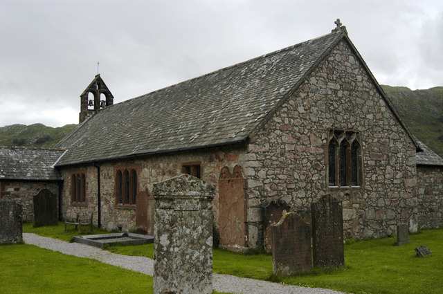
St Catherine's Church, Boot

St Catherine's Church is in the village of Boot, Cumbria, England. It is the Anglican parish church of Eskdale, Cumbria, and is in the deanery of Calder...

Eskdale, Cumbria

Eskdale is a glacial valley and civil parish in the western Lake District National Park in Cumbria, England. It forms part of the Borough of Copeland...

Birkerthwaite

Birkerthwaite is a village on Birker Fell, Eskdale, Cumbria, England. == See also == List of places in Cumbria == External links == Media related to Birkerthwaite...

Beckfoot railway station

Beckfoot railway station is a railway station on the 15" gauge Ravenglass & Eskdale Railway in Cumbria. It is situated within a 1⁄2 mile (0.80 km) walk...

Nearby Amenities

Located within 500m of 54.381411,-3.276289
Waterway: waterfall
Lat/Long: 54.3836649/-3.2726035
Stanley Force
Description: Upper Falls
Height: 30
Waterway: waterfall
Lat/Long: 54.3840221/-3.2729907
Stanley Force
Description: Lower Falls
Waterway: waterfall
Lat/Long: 54.3848635/-3.2730972
Tourism: viewpoint
Lat/Long: 54.38405/-3.2725981
Tonguesdale Moss
Place: locality
Lat/Long: 54.380174/-3.2813504
Whin Rigg
Place: locality
Lat/Long: 54.377987/-3.2775309
Green How
Place: locality
Lat/Long: 54.3817111/-3.276737
Peat Hut
Historic: yes
Lat/Long: 54.3840696/-3.2777559
Peat Hut
Historic: yes
Lat/Long: 54.384819/-3.2784309
Stanley Ghyll
Place: locality
Lat/Long: 54.383776/-3.2722947
Description: Stanley Force Upper falls steel viewing platform completed 2021
Direction: 160
Tourism: viewpoint
Lat/Long: 54.3842751/-3.2731836
Description: Bridge is Stanley force lower falls viewing platform
Direction: 180
Tourism: viewpoint
Lat/Long: 54.3850413/-3.2731029
The data included in this document is from www.openstreetmap.org. The data is made available under ODbL.

Have you been to Green How?

Leave your review of Green How below (or comments, questions and feedback).