Craggan More
Hill, Mountain in Banffshire
Scotland
Craggan More
Craggan More is a prominent hill located in Banffshire, Scotland. It is situated in the eastern part of the country, near the village of Cabrach. Standing at an elevation of approximately 1,564 feet (476 meters), Craggan More is often referred to as a "Corbett" - a designation given to Scottish hills ranging between 2,500 and 3,000 feet (762 to 914 meters) in height.
The hill boasts a distinctive conical shape, with steep slopes covered in heather and grass. Its summit offers breathtaking panoramic views of the surrounding countryside, including the nearby Cabrach Hills and the River Spey which meanders through the valley below.
Craggan More is a popular destination for hikers and outdoor enthusiasts, thanks to its accessible location and relatively moderate difficulty level. There are several well-marked trails and paths leading to the summit, allowing visitors to explore the hill's diverse flora and fauna, which include various species of birds, wildflowers, and mosses.
The area surrounding Craggan More is also steeped in history and folklore. The hill is believed to have once been home to ancient settlements, as evidenced by the presence of stone circles and burial mounds in the vicinity. Additionally, local legends and tales of mythical creatures add an element of mystique to the area, attracting those with an interest in folklore and ancient lore.
Overall, Craggan More offers a rewarding experience for nature lovers, hikers, and history enthusiasts, providing a glimpse into the natural beauty and rich cultural heritage of Banffshire.
If you have any feedback on the listing, please let us know in the comments section below.
Craggan More Images
Images are sourced within 2km of 57.38906/-3.3844365 or Grid Reference NJ1634. Thanks to Geograph Open Source API. All images are credited.


Craggan More is located at Grid Ref: NJ1634 (Lat: 57.38906, Lng: -3.3844365)
Unitary Authority: Moray
Police Authority: North East
What 3 Words
///meaty.cosmic.purifier. Near Charlestown of Aberlour, Moray
Nearby Locations
Related Wikis

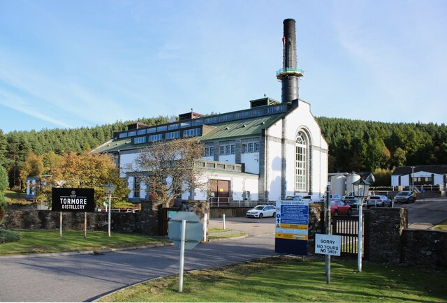
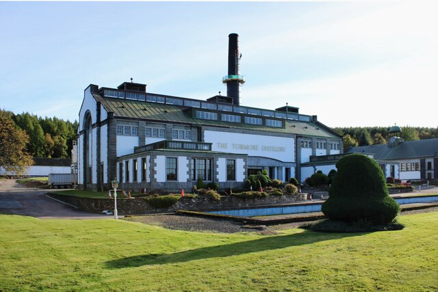
Tormore distillery
Tormore distillery is a Speyside single malt Scotch whisky distillery located approximately 1 km south of the River Spey. Its water source is the Allt...
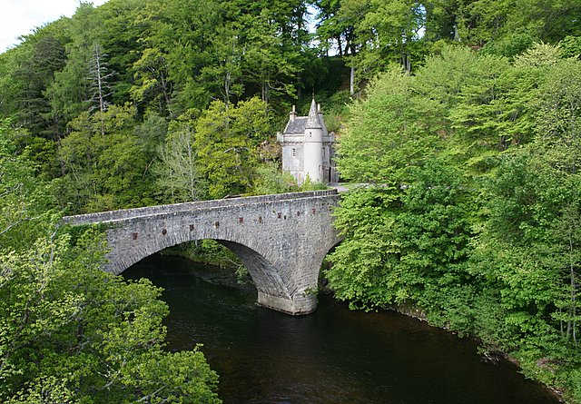
Bridge of Avon
The Bridge of Avon is a bridge over the River Avon at Ballindalloch in Moray, Scotland, built between 1800 and 1801 by George Burn. The bridge is mainly...

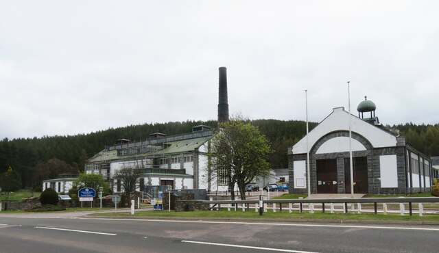
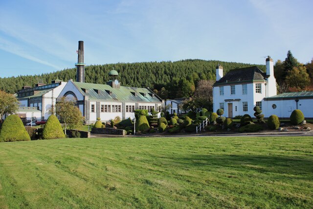
Cragganmore distillery
Cragganmore distillery is a Scotch whisky distillery situated in the village of Ballindalloch in Banffshire, Scotland. == History == The distillery was...

Ballindalloch railway station
Ballindalloch railway station served the village of Ballindalloch, Banffshire, Scotland from 1863 to 1965 on the Strathspey Railway. == History == The...
Nearby Amenities
Located within 500m of 57.38906,-3.3844365Have you been to Craggan More?
Leave your review of Craggan More below (or comments, questions and feedback).