Black Crag

Hill, Mountain in Cumberland Copeland

England

Black Crag

River Liza, Ennerdale
River Liza, Ennerdale Credit: Ian Taylor

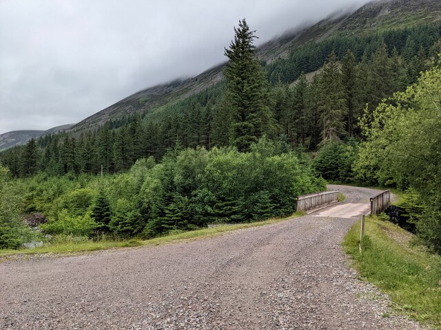
Black Crag is a prominent hill/mountain located in the county of Cumberland, England. It is situated in the Lake District National Park, just southeast of the village of Threlkeld. Rising to an elevation of 1,048 feet (319 meters), Black Crag is a popular destination for hikers and nature enthusiasts.

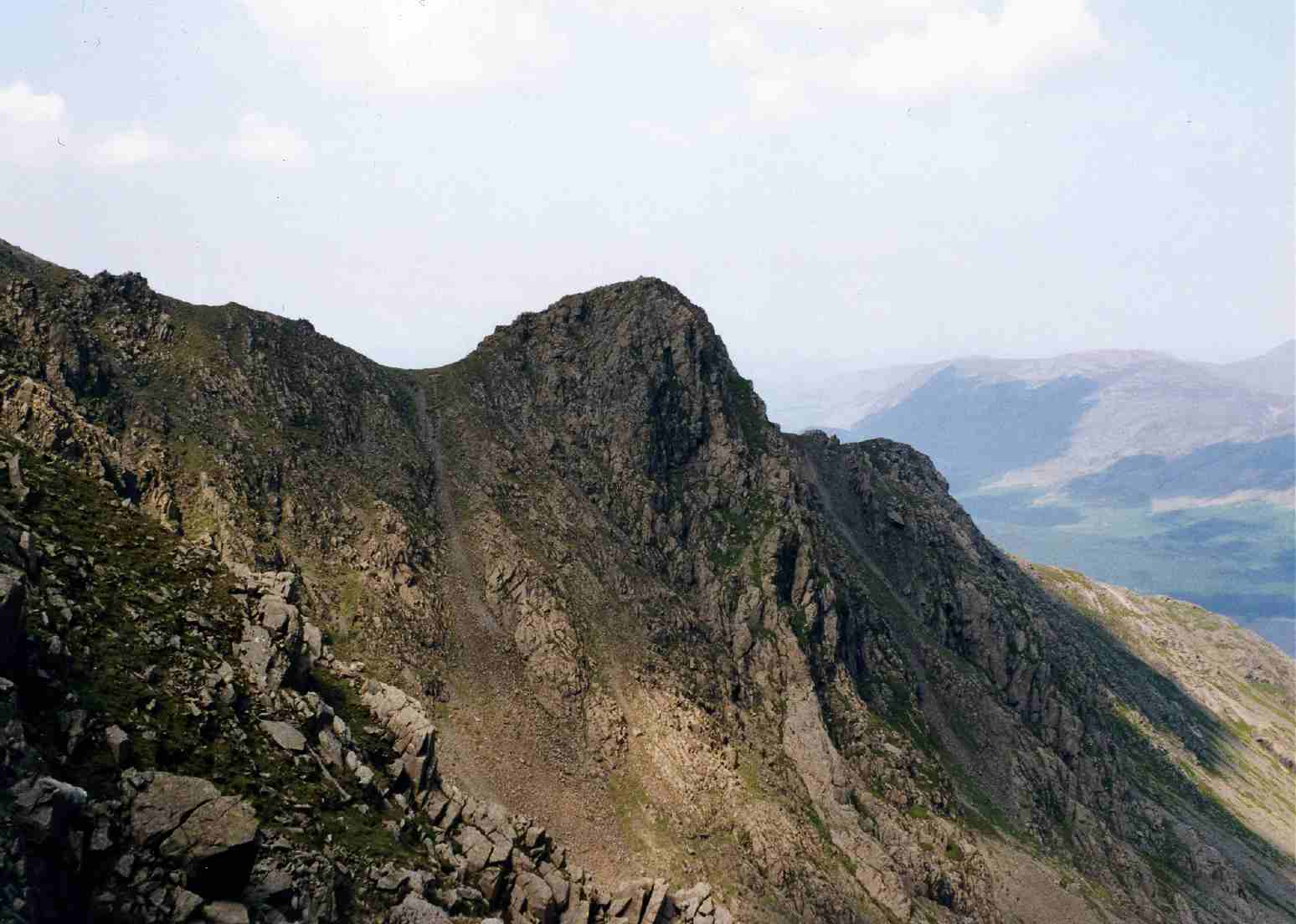
The hill/mountain is composed of volcanic rock and is known for its striking dark appearance, which gives it its name. It offers breathtaking panoramic views of the surrounding landscape, including the nearby Thirlmere reservoir and the surrounding fells.

Black Crag is a relatively accessible hill/mountain, with various footpaths and trails leading to its summit. One of the most popular routes begins from Threlkeld and follows the path along the southeastern slopes, providing stunning vistas along the way. The ascent is moderately challenging, with some steep sections, but is achievable for most walkers.

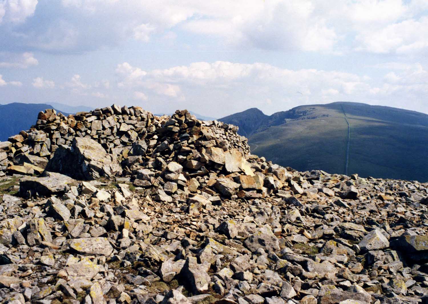
At the summit, visitors are rewarded with outstanding views of the surrounding countryside, including the nearby peaks of Blencathra, Skiddaw, and Helvellyn. On clear days, it is even possible to see as far as the Solway Firth and the Scottish hills in the distance.

Overall, Black Crag in Cumberland is a picturesque and accessible hill/mountain that offers a rewarding experience for nature lovers and outdoor enthusiasts, showcasing the beauty of the Lake District landscape.

If you have any feedback on the listing, please let us know in the comments section below.

Black Crag Images

Images are sourced within 2km of 54.493406/-3.2891021 or Grid Reference NY1611. Thanks to Geograph Open Source API. All images are credited.

River Liza, Ennerdale
A rocky gorge on the River Liza
A bridge over the River Liza The vegetation has grown significantly since 2009. See: <a title="https://www.geograph.org.uk/photo/1438886" href="https://www.geograph.org.uk/photo/1438886">Link</a>
A bridge over the River Liza
The vegetation has grown significantly since 2009. See: Link
The forestry road on the north side of the River Liza
An area of forestry clearance With the forestry road on the south side passing through it.
An area of forestry clearance
With the forestry road on the south side passing through it.
The footbridge over the River Liza  Seen from the south side forestry road.
The footbridge over the River Liza
Seen from the south side forestry road.
Did it fall or was it carried? This out-of-place boulder possibly came from the crags above, but may have been deposited by a glacier at the end of the last Ice Age.
Happily I did not notice the 'memorial plaque' mentioned in: <a title="https://www.geograph.org.uk/photo/2473557" href="https://www.geograph.org.uk/photo/2473557">Link</a>   Such things are inappropriate in the countryside, but unfortunately more and more appear as time passes.
Did it fall or was it carried?
This out-of-place boulder possibly came from the crags above, but may have been deposited by a glacier at the end of the last Ice Age. Happily I did not notice the 'memorial plaque' mentioned in: Link Such things are inappropriate in the countryside, but unfortunately more and more appear as time passes.
Looking down towards the footbridge Which is just visible in centre shot.
Looking down towards the footbridge
Which is just visible in centre shot.
A minor stream causes significant erosion The glacial layer of clay and rocks is easily eroded.
A minor stream causes significant erosion
The glacial layer of clay and rocks is easily eroded.
A series of small 'bridges' Fallen trees may provide passage ways for creatures of the forest?
A series of small 'bridges'
Fallen trees may provide passage ways for creatures of the forest?
Meanderings on the River Liza
Cleared areas by the River Liza
Broad, vegetated section of Pillar's east ridge The green stretch of ridge may well look grassy but many plant species will be present, particularly mosses. Beyond that zone there's a steeper, rocky part of the ridge and there's also one behind the camera position.
Great Gable is the central, dark mountain. The Scafell range is at the right side horizon.
Broad, vegetated section of Pillar's east ridge
The green stretch of ridge may well look grassy but many plant species will be present, particularly mosses. Beyond that zone there's a steeper, rocky part of the ridge and there's also one behind the camera position. Great Gable is the central, dark mountain. The Scafell range is at the right side horizon.
East face of Pillar Crags of the east face of the large dome of Pillar: the crags, and more of them descend to the right into Pillar Cove.
The darkest crag at the right side of the image is Pillar Rock.
East face of Pillar
Crags of the east face of the large dome of Pillar: the crags, and more of them descend to the right into Pillar Cove. The darkest crag at the right side of the image is Pillar Rock.
Fellwalkers on Little Scoat Fell The walkers on the upper slopes of Little Scoat Fell above Black Comb, looking across Mosedale to Great Gable and the Scafell Range.
Fellwalkers on Little Scoat Fell
The walkers on the upper slopes of Little Scoat Fell above Black Comb, looking across Mosedale to Great Gable and the Scafell Range.
Gatherstone Beck Mountain stream above Mosedale with Looking Stead, part of Pillar in the background.
Gatherstone Beck
Mountain stream above Mosedale with Looking Stead, part of Pillar in the background.
Gatherstone Beck Mountain stream, a mountain stream above Mosedale viewed from the bridleway leading to Black Sail Pass.
Gatherstone Beck
Mountain stream, a mountain stream above Mosedale viewed from the bridleway leading to Black Sail Pass.
Bridleway crossing Gatherstone Beck Bridleway crossing Gatherstone Beck in Mosedale.
Bridleway crossing Gatherstone Beck
Bridleway crossing Gatherstone Beck in Mosedale.
Show me another place!

Black Crag is located at Grid Ref: NY1611 (Lat: 54.493406, Lng: -3.2891021)

Administrative County: Cumbria

District: Copeland

Police Authority: Cumbria

What 3 Words

///gives.cuff.dolly. Near Frizington, Cumbria

Related Wikis

Pillar (Lake District)

Pillar is a mountain in the western part of the English Lake District. Situated between the valleys of Ennerdale to the north and Wasdale to the south...

Scoat Fell

Scoat Fell is a fell in the western part of the English Lake District. It stands at the head of the Mosedale Horseshoe with its back to Ennerdale. Paths...

Steeple (Lake District)

Steeple is a fell in the English Lake District. It is situated in the mountainous area between Ennerdale and Wasdale and reaches a height of 819 metres...

Red Pike (Wasdale)

Red Pike is a fell in the English Lake District. It is 826 m or 2,709 ft high and lies due north of Wast Water. It is often climbed as part of the Mosedale...

Haycock (Lake District)

Haycock is a mountain in the western part of the English Lake District. It rises between Scoat Fell and Caw Fell to the south of Ennerdale and the north...

Cumbria

Cumbria ( KUM-bree-ə) is a ceremonial county in North West England. It borders the Scottish council areas of Dumfries and Galloway and Scottish Borders...

Cumbrian dialect

Cumbrian dialect or Cumberland dialect is a local dialect of Northern England in decline, spoken in Cumberland, Westmorland and Lancashire North of the...

Seat (Buttermere)

Seat or Seat (Buttermere) is a minor Fell in the English Lake District. It has a height of 561 m (1840 ft). Seat is over-shadowed by Haystacks and High...

Nearby Amenities

Located within 500m of 54.493406,-3.2891021
Black Crag
Ele: 828
Natural: peak
Source: www.hill-bagging.co.uk
Lat/Long: 54.4933789/-3.289159
Wind Gap
Ele: 761
Natural: saddle
Lat/Long: 54.4944364/-3.2856201
Green Crags
Place: locality
Lat/Long: 54.4909193/-3.2877905
Black Comb
Place: locality
Lat/Long: 54.4895488/-3.2921125
Wind Gap
Place: locality
Lat/Long: 54.4944988/-3.2867984
The data included in this document is from www.openstreetmap.org. The data is made available under ODbL.

Have you been to Black Crag?

Leave your review of Black Crag below (or comments, questions and feedback).