Black Hill

Hill, Mountain in Perthshire

Scotland

Black Hill

Rolling Grampians Watershed boundary fence on Black Hill.
Rolling Grampians Credit: Alan Reid

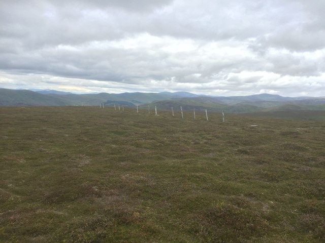
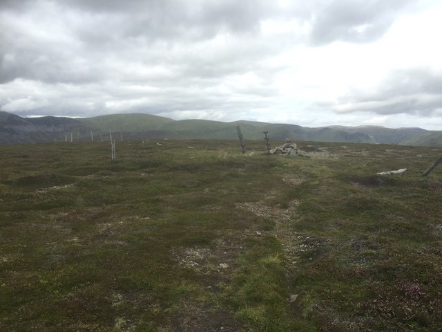
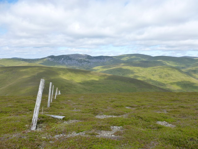
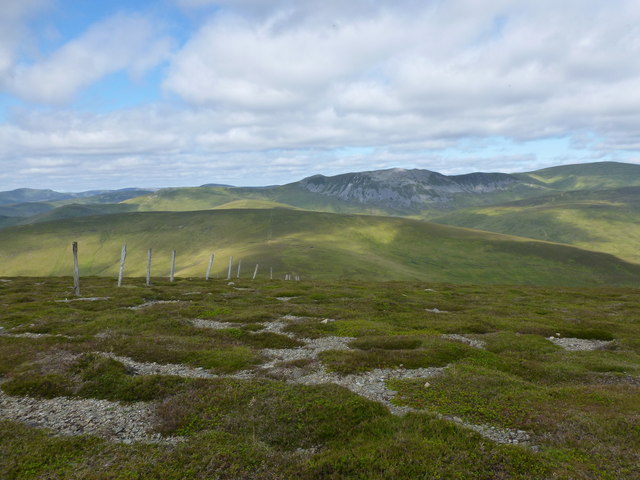
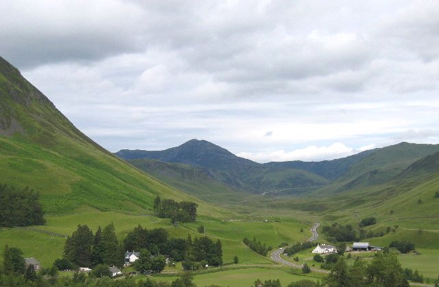
Black Hill is a prominent hill located in the heart of Perthshire, Scotland. Situated within the picturesque countryside, it is part of the Grampian Mountains and offers breathtaking views of the surrounding landscape. Standing at an elevation of 744 meters (2,441 feet), it is a popular destination for hiking and outdoor enthusiasts.

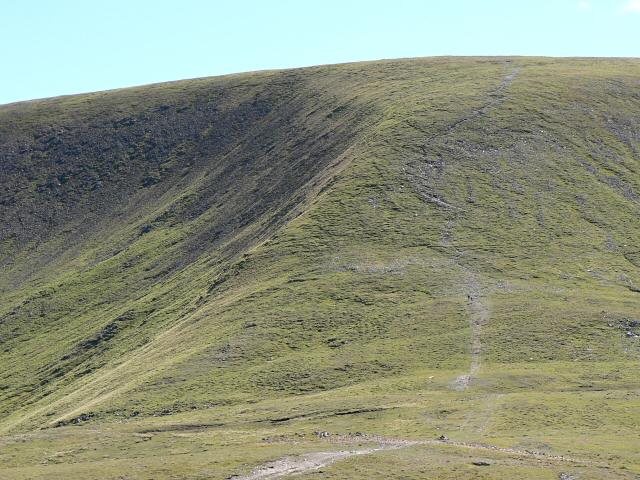
The hill is characterized by its distinctively dark appearance, which is attributed to the presence of heather and peat on its slopes. This unique feature has lent its name to the hill. The terrain is mostly rugged and rocky, with steep slopes that can pose a challenge even to experienced climbers.

Black Hill is home to a diverse range of flora and fauna, making it an ideal spot for nature lovers. The hillside is blanketed with heather, providing a colorful spectacle during the summer months. It is also home to a variety of bird species, including golden eagles, peregrine falcons, and red grouse.

The summit of Black Hill offers panoramic views of the surrounding countryside, including Loch Tay and the nearby Ben Lawers mountain range. On a clear day, it is possible to see as far as the Highlands in the north and the Trossachs National Park in the south.

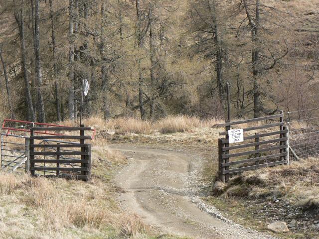
Access to Black Hill is relatively easy, with several trails leading to the summit. However, it is important for visitors to be adequately prepared, as the weather conditions can change rapidly, and the terrain can be challenging.

If you have any feedback on the listing, please let us know in the comments section below.

Black Hill Images

Images are sourced within 2km of 56.830742/-3.3721385 or Grid Reference NO1671. Thanks to Geograph Open Source API. All images are credited.

Rolling Grampians Watershed boundary fence on Black Hill.
Rolling Grampians
Watershed boundary fence on Black Hill.
Spring sunshine in Glen Brighty The screes on Creag Leacach drop in from the left. The hump of Glas Maol sunlit beyond.
Spring sunshine in Glen Brighty
The screes on Creag Leacach drop in from the left. The hump of Glas Maol sunlit beyond.
Boundary between Angus and Perth The pass is Glack of Glengairney. These red deer, streaming left through the fence are part of a herd of around 850.
Boundary between Angus and Perth
The pass is Glack of Glengairney. These red deer, streaming left through the fence are part of a herd of around 850.
Summit slopes of Monamenach Looking into the head of Glen Isla.
Summit slopes of Monamenach
Looking into the head of Glen Isla.
Summit of Monamenach Cairn on the summit of the Corbett. The scree covered slopes of Creag Leacach can be seen in the distance.
Summit of Monamenach
Cairn on the summit of the Corbett. The scree covered slopes of Creag Leacach can be seen in the distance.
Monamenach
Monamenach
Ruined fence, Monamenach
Northern slopes of Monamenach
View up Glen Isla from Monamenach
Summit, Monamenach
Summit, Monamenach
Old fence on the county boundary, Monamenach Perthshire on the left of the posts, Angus on the right.  The grey screes of Creag Leacach are prominent in the distance.
Old fence on the county boundary, Monamenach
Perthshire on the left of the posts, Angus on the right. The grey screes of Creag Leacach are prominent in the distance.
Looking towards Glen Brighty and Caenlochan Glen Taken from the northern flanks of Monamenach.  The River Isla can be seen flowing down from the high bowls of Caenlochan Glen and Canness Glen, passing between Monega Hill and Finalty Hill.
Looking towards Glen Brighty and Caenlochan Glen
Taken from the northern flanks of Monamenach. The River Isla can be seen flowing down from the high bowls of Caenlochan Glen and Canness Glen, passing between Monega Hill and Finalty Hill.
Monamenach view Looking towards Black Hill and the grey screes of Creag Leacach.  The line of fenceposts marks the Perthshire-Angus boundary.
Monamenach view
Looking towards Black Hill and the grey screes of Creag Leacach. The line of fenceposts marks the Perthshire-Angus boundary.
Cairn on Craigenloch Hill This is the small cairn on the top of the hill. Beyond is Creag Leachach.
Cairn on Craigenloch Hill
This is the small cairn on the top of the hill. Beyond is Creag Leachach.
Craigenloch Hill Looking west from the hilltop, with Gleann Carnach and Glen an Daimh opening below.
Craigenloch Hill
Looking west from the hilltop, with Gleann Carnach and Glen an Daimh opening below.
Lizard above Glen Brighty This lizard was very ready to pose for the camera! In an area where the heather had been burned quite recently he shows up very clearly.
Lizard above Glen Brighty
This lizard was very ready to pose for the camera! In an area where the heather had been burned quite recently he shows up very clearly.
Rear entrance to Tolchan Lodge The private grounds to Tolchan Lodge block the path south from Little Glas Maol at this point. However it is just possible to follow the fence north and then east to rejoin the Monega path. Part of the way is awkward because the forest grows close to the fence and the ground is boggy. But this detour does allow a pleasant circular walk up the Monega Path to Monega, west to Little Glas Maol, and then south again.
Rear entrance to Tolchan Lodge
The private grounds to Tolchan Lodge block the path south from Little Glas Maol at this point. However it is just possible to follow the fence north and then east to rejoin the Monega path. Part of the way is awkward because the forest grows close to the fence and the ground is boggy. But this detour does allow a pleasant circular walk up the Monega Path to Monega, west to Little Glas Maol, and then south again.
Mountain track This track descends south and east from Little Glas Maol to Tulchan Lodge. Ahead is the side of Black Hill, with Monamenach beyond.
Mountain track
This track descends south and east from Little Glas Maol to Tulchan Lodge. Ahead is the side of Black Hill, with Monamenach beyond.
Show me another place!

Black Hill is located at Grid Ref: NO1671 (Lat: 56.830742, Lng: -3.3721385)

Unitary Authority: Angus

Police Authority: Tayside

What 3 Words

///pocket.corkscrew.perplexed. Near Inverey, Aberdeenshire

Nearby Locations

Black Hill

Related Wikis

Loch Beanie

Loch Beanie also known as Loch Shechernich, is a small shallow freshwater loch that is located in Glen Shee in Perth and Kinross, Scotland. == Island... ==

Glas Maol

Glas Maol (Scottish Gaelic: A' Ghlas-Mheall) is a mountain in the Mounth, in the southeastern part of the Highlands of Scotland. The broad, flat summit...

Glen Shee

Glen Shee (Scottish Gaelic: Gleann Sith) is a glen in eastern Perthshire, Scotland. Shee Water flows through the glen. The head of the glen, where Gleann...

Spittal of Glenshee

The Spittal of Glenshee (Scottish Gaelic: Spideal Ghlinn Sìdh, pronounced [ˈspitʲəl̪ˠ ʝliːɲ ˈʃiːʝ]) lies at the head of Glenshee in the highlands of eastern...

Nearby Amenities

Located within 500m of 56.830742,-3.3721385
Black Hill
Ele: 754
Natural: peak
Wikidata: Q13126055
Lat/Long: 56.8307374/-3.3719254
The data included in this document is from www.openstreetmap.org. The data is made available under ODbL.

Have you been to Black Hill?

Leave your review of Black Hill below (or comments, questions and feedback).