Gray Stones

Hill, Mountain in Cumberland Copeland

England

Gray Stones

Descending on path below Gray Stones, Black Combe
Descending on path below Gray Stones, Black Combe Credit: Colin Park

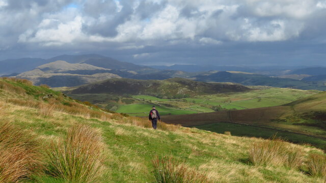
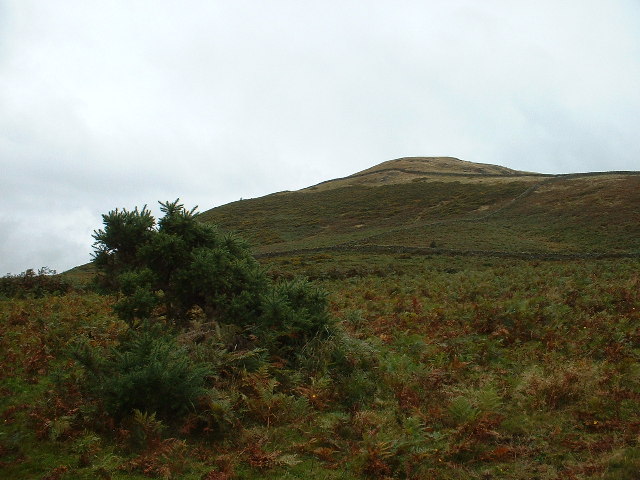
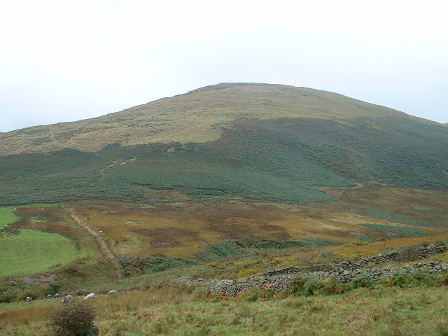
Gray Stones is a prominent hill located in the scenic region of Cumberland, England. Rising to an elevation of approximately 400 meters (1,312 feet), it is often referred to as Gray Mountain due to its significant height in comparison to the surrounding landscape. The hill is situated within the expansive area of the North Pennines, a designated Area of Outstanding Natural Beauty.

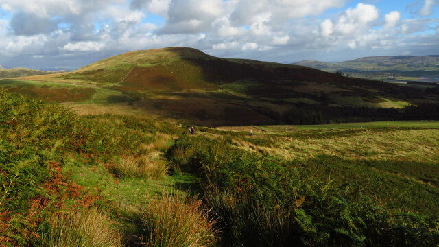
Covered in lush vegetation and heather moorland, Gray Stones offers breathtaking panoramic views of the surrounding countryside. The hill is characterized by its rugged terrain, featuring rocky outcrops and steep slopes. These natural features make it a popular destination for hikers and outdoor enthusiasts seeking a challenging yet rewarding experience.

The summit of Gray Stones provides a vantage point where visitors can marvel at the picturesque landscapes of Cumberland. On clear days, one can spot distant peaks, rolling hills, and meandering rivers, adding to the allure of this natural wonder.

The hill is also home to a diverse range of flora and fauna, with rare species often found within its boundaries. Birdwatchers flock to Gray Stones to catch a glimpse of various avian species, including peregrine falcons and golden plovers that inhabit the region.

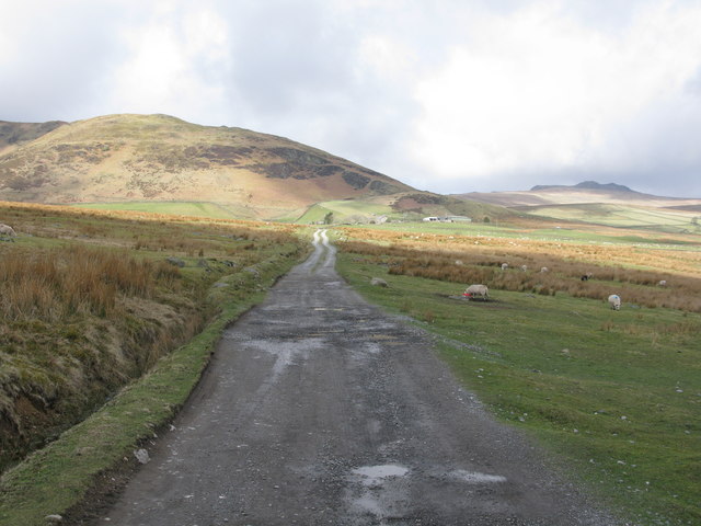
Access to Gray Stones is facilitated by a network of footpaths and trails, ensuring that visitors can explore this natural wonder safely. Whether it's for leisurely walks, wildlife observation, or simply enjoying the tranquility of the countryside, Gray Stones offers a captivating experience for nature enthusiasts and adventurers alike.

If you have any feedback on the listing, please let us know in the comments section below.

Gray Stones Images

Images are sourced within 2km of 54.274622/-3.2902018 or Grid Reference SD1687. Thanks to Geograph Open Source API. All images are credited.
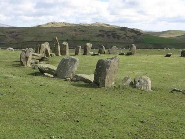
Descending on path below Gray Stones, Black Combe
Descending on path below Grey Stones - view towards Knott Hill
Ordnance Survey Cut Mark This OS cut mark can be found on a large rock to the west of the track.
Ordnance Survey Cut Mark
This OS cut mark can be found on a large rock to the west of the track.
Black Crag From Raven Crag
Black Crag
From Raven Crag
Start of the track to the Swinside Stone Circle The track branching off to the left leads to the Stone Circle and Swinside Farm.
Start of the track to the Swinside Stone Circle
The track branching off to the left leads to the Stone Circle and Swinside Farm.
Track to the Swinside Stone Circle A rough track which also leads to Swinside Farm. Swinside Fell is in the background.
Track to the Swinside Stone Circle
A rough track which also leads to Swinside Farm. Swinside Fell is in the background.
Swinside Stone Circle Also known as Sunkenkirk Stone Circle, Swinside Stone Circle is one of the 'Big 3' stone circles in Cumbria, the other two being <a href="https://www.geograph.org.uk/photo/5383899">NY2923 : Castlerigg Stone Circle</a> and <a href="https://www.geograph.org.uk/photo/5511934">NY5737 : Long Meg and Her Daughters</a>. This little-visited stone circle is one of the finest in Britain and has 55 stones, though there were probably originally 60 stones. Dating from the late Neolithic or early Bronze Age, the stones are of porphyritic slates and form a circle of diameter 28 metres.
Swinside Stone Circle
Also known as Sunkenkirk Stone Circle, Swinside Stone Circle is one of the 'Big 3' stone circles in Cumbria, the other two being NY2923 : Castlerigg Stone Circle and NY5737 : Long Meg and Her Daughters. This little-visited stone circle is one of the finest in Britain and has 55 stones, though there were probably originally 60 stones. Dating from the late Neolithic or early Bronze Age, the stones are of porphyritic slates and form a circle of diameter 28 metres.
Part of the Swinside Stone Circle See <a href="https://www.geograph.org.uk/photo/5728039">SD1788 : Swinside Stone Circle</a> for the full circle, and information about the Swinside Stone Circle.
Part of the Swinside Stone Circle
See SD1788 : Swinside Stone Circle for the full circle, and information about the Swinside Stone Circle.
Ordnance Survey Cut Mark This OS cut mark can be found on the west parapet of Waughfoot Bridge. It marks a point 132.683m above mean sea level.
Ordnance Survey Cut Mark
This OS cut mark can be found on the west parapet of Waughfoot Bridge. It marks a point 132.683m above mean sea level.
Ordnance Survey Rivet This OS rivet can be found on the wall east side of the road. It marks a point 137.962m above mean sea level.
Ordnance Survey Rivet
This OS rivet can be found on the wall east side of the road. It marks a point 137.962m above mean sea level.
The moorland summit at Stoupdale Head Flat moorland at the minor summit at Stoupdale Head, a name which doesn't appear on OS maps but is so-named by Wainwright in the 'Outlying Fells'.
The view is to the north where there are rocky outcrops on Buck Barrow.
The moorland summit at Stoupdale Head
Flat moorland at the minor summit at Stoupdale Head, a name which doesn't appear on OS maps but is so-named by Wainwright in the 'Outlying Fells'. The view is to the north where there are rocky outcrops on Buck Barrow.
Swinside Stone Circle Looking South East
Swinside Stone Circle
Looking South East
Whicham Beck wood The wood does not have a name on the map, but it's on the east bank of Whicham Beck
Whicham Beck wood
The wood does not have a name on the map, but it's on the east bank of Whicham Beck
Knott Hill This little hill stands alone, just east of Whicham Beck, and looking down on Swinside Stone Circle to the north.
Knott Hill
This little hill stands alone, just east of Whicham Beck, and looking down on Swinside Stone Circle to the north.
Gray Stones Viewed across Whicham Beck, looking north west
Gray Stones
Viewed across Whicham Beck, looking north west
Whicham Beck wood & White Combe Looking over the top end of the wood, towards White Combe. The bracken covered shoulder, in the centre of the photo, is the interestingly named Leadmine Breast, though no mines are featured on the map. White Combe is the high point, right of centre.
Whicham Beck wood & White Combe
Looking over the top end of the wood, towards White Combe. The bracken covered shoulder, in the centre of the photo, is the interestingly named Leadmine Breast, though no mines are featured on the map. White Combe is the high point, right of centre.
Swinside Farm & Swinside Fell Looking north west. The farm has Swinside Stone Circle [SD1788] in its fields. The shoulder of Swinside Fell above the farm has the rocky outcrop of Raven Crag.
Swinside Farm & Swinside Fell
Looking north west. The farm has Swinside Stone Circle [SD1788] in its fields. The shoulder of Swinside Fell above the farm has the rocky outcrop of Raven Crag.
Track to Swinside Farm Looking south east, away from the farm, with the Duddon Estuary laid out below.
Track to Swinside Farm
Looking south east, away from the farm, with the Duddon Estuary laid out below.
Show me another place!

Gray Stones is located at Grid Ref: SD1687 (Lat: 54.274622, Lng: -3.2902018)

Administrative County: Cumbria

District: Copeland

Police Authority: Cumbria

What 3 Words

///cabs.earmarked.units. Near Millom, Cumbria

Nearby Locations

Gray Stones

Related Wikis

Swinside

Swinside, which is also known as Sunkenkirk and Swineshead, is a stone circle lying beside Swinside Fell, part of Black Combe in southern Cumbria, North...

St Anne's Church, Thwaites

St Anne's Church is in the village of Thwaites, Cumbria, England. It is an active Anglican parish church in the deanery of Millom, the archdeaconry of...

Thwaites, Cumbria

Thwaites is a small village near Duddon Valley and on the edge of the Duddon Estuary in the Lake District National Park in the Borough of Copeland, Cumbria...

Black Combe

Black Combe is a fell in the south-west corner of the Lake District National Park, England, just 4 miles (6.4 km) from the Irish Sea. It lies near the...

Nearby Amenities

Located within 500m of 54.274622,-3.2902018
Gray Stones
Ele: 396
Natural: peak
Lat/Long: 54.274255/-3.2896262
The data included in this document is from www.openstreetmap.org. The data is made available under ODbL.

Have you been to Gray Stones?

Leave your review of Gray Stones below (or comments, questions and feedback).