Glenstivon Dod

Hill, Mountain in Peeblesshire

Scotland

Glenstivon Dod

View along boundary fence from Long Grain Knowe towards Grey Weather Law These small peat hags were the only sheltered spot to have lunch on this windy day.
View along boundary fence from Long Grain Knowe towards Grey Weather Law Credit: Colin Park

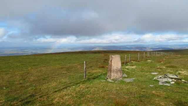
Glenstivon Dod is a prominent hill located in Peeblesshire, a county in the Scottish Borders region of Scotland. Rising to an elevation of approximately 423 meters (1,387 feet), it is a notable landmark in the area and offers breathtaking panoramic views of the surrounding countryside.

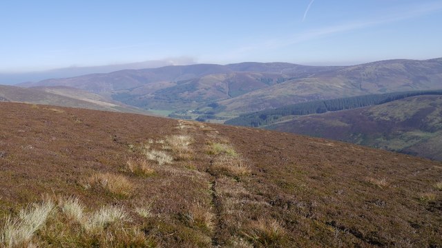
Situated within the expansive Glenstivon Estate, the hill is covered in heather and grass, creating a picturesque landscape. The terrain is relatively gentle, making it accessible to hikers and walkers of varying abilities. A well-marked path leads to the summit, ensuring visitors can navigate the hill easily.

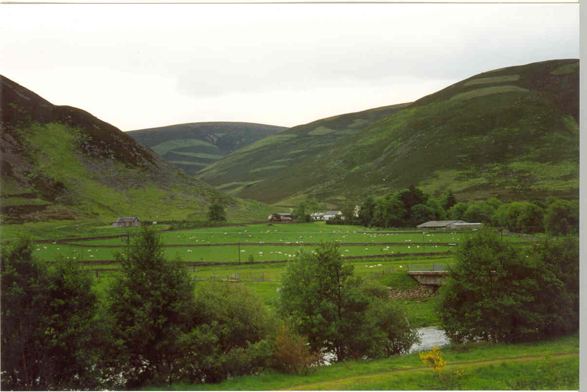
The summit of Glenstivon Dod provides a spectacular vantage point, offering unobstructed views of the rolling hills, valleys, and forests that characterize the region. On clear days, it is possible to see as far as the Southern Uplands and the Tweed Valley. This makes it a popular destination for outdoor enthusiasts, nature lovers, and photographers.

Wildlife is abundant in the area, with the hill providing a habitat for various species of birds, including birds of prey such as buzzards and kestrels. The surrounding estate is also home to deer and other mammals, adding to the natural beauty and tranquility of the landscape.

Overall, Glenstivon Dod is a captivating hill in Peeblesshire, offering visitors the opportunity to immerse themselves in the stunning Scottish countryside and enjoy the wonders of nature.

If you have any feedback on the listing, please let us know in the comments section below.

Glenstivon Dod Images

Images are sourced within 2km of 55.560289/-3.3324736 or Grid Reference NT1630. Thanks to Geograph Open Source API. All images are credited.

View along boundary fence from Long Grain Knowe towards Grey Weather Law These small peat hags were the only sheltered spot to have lunch on this windy day.
View along boundary fence from Long Grain Knowe towards Grey Weather Law
These small peat hags were the only sheltered spot to have lunch on this windy day.
Heading towards Middle Hill from Long Grain Knowe There is a faint ATV track to follow in places along this stretch.
Heading towards Middle Hill from Long Grain Knowe
There is a faint ATV track to follow in places along this stretch.
Summit of Middle Hill near Drumelzier A few old fence posts mark the summit of this rather featureless hill.
Summit of Middle Hill near Drumelzier
A few old fence posts mark the summit of this rather featureless hill.
Trig Point on Pykestone Hill
Approaching Shepherds Cairn on Glenstivon Dod A faint path runs along the broad ridge.
Approaching Shepherds Cairn on Glenstivon Dod
A faint path runs along the broad ridge.
Descending from Glenstivon Dod towards Drumelzier Law A decent path runs along this ridge giving some fine walking.
Descending from Glenstivon Dod towards Drumelzier Law
A decent path runs along this ridge giving some fine walking.
Den Knowes Head High up on the northern slopes of Pykestone Hill with fine views of from left Drumelzier Law, Culter Fell, Chapelgill Hill and Tinto. A grand day out in the Borders with a nice breeze to cool off.
Den Knowes Head
High up on the northern slopes of Pykestone Hill with fine views of from left Drumelzier Law, Culter Fell, Chapelgill Hill and Tinto. A grand day out in the Borders with a nice breeze to cool off.
Drumelzier Law On lovely ground between Glenstivon Dod looking towards Drumelzier Law - fine Borders scenery and walking country. Very different colours to this image here from abut 6 weeks later in the year in 2021.
<a title="https://www.geograph.org.uk/photo/7032846" href="https://www.geograph.org.uk/photo/7032846">Link</a>
Drumelzier Law
On lovely ground between Glenstivon Dod looking towards Drumelzier Law - fine Borders scenery and walking country. Very different colours to this image here from abut 6 weeks later in the year in 2021. Link
Col between Taberon Law and Middle Hill There is a slight descent here to a shallow col.  

An outbreak of northerly air has temporarily brought a cold and crisp interlude and some snow in the otherwise rather soggy month of November 2015.
Col between Taberon Law and Middle Hill
There is a slight descent here to a shallow col. An outbreak of northerly air has temporarily brought a cold and crisp interlude and some snow in the otherwise rather soggy month of November 2015.
Col below Middle Hill A gentle descent from Taberon Law leads to this shallow col.

An outbreak of northerly air has brought a temporary crisp and cold interval with some snow during the otherwise largely soggy month of November 2015.
Col below Middle Hill
A gentle descent from Taberon Law leads to this shallow col. An outbreak of northerly air has brought a temporary crisp and cold interval with some snow during the otherwise largely soggy month of November 2015.
Track towards Middle Hill Frozen ground and light snow cover makes this area less boggy than it might otherwise be.
Track towards Middle Hill
Frozen ground and light snow cover makes this area less boggy than it might otherwise be.
Middle Hill As the name suggests, Middle Hill lies in the middle of a triangle of high moorland summits, the other 'corners' of the triangle being Glenstivon Dod and Long Grain Knowe.

In an otherwise soggy November, an influx of northerly air has temporarily brought crisp, cold walking conditions.
Middle Hill
As the name suggests, Middle Hill lies in the middle of a triangle of high moorland summits, the other 'corners' of the triangle being Glenstivon Dod and Long Grain Knowe. In an otherwise soggy November, an influx of northerly air has temporarily brought crisp, cold walking conditions.
Looking towards Dollar Law On the flat plateau of Middle Hill in crisp, snowy conditions.
Looking towards Dollar Law
On the flat plateau of Middle Hill in crisp, snowy conditions.
Fenceline on Middle Law It's possible to walk long distances on these gentle, plateau-topped hills without having to lose or gain much height.
Fenceline on Middle Law
It's possible to walk long distances on these gentle, plateau-topped hills without having to lose or gain much height.
Middle Hill Bump in the Tweedsmuir Hills.
Middle Hill
Bump in the Tweedsmuir Hills.
Thief's road, Tweedsmuir Hills View towards Dollar Law from Grey Wether Law with the old drove road contouring a slope.
Thief's road, Tweedsmuir Hills
View towards Dollar Law from Grey Wether Law with the old drove road contouring a slope.
Gate, Grey Weather Hill Not as significant to a walker as it would be on most hills, the fences here are plain and low. Barbed wire remains a rarity here where there is only a desire to stop sheep not people.
Gate, Grey Weather Hill
Not as significant to a walker as it would be on most hills, the fences here are plain and low. Barbed wire remains a rarity here where there is only a desire to stop sheep not people.
Path, Kirkhope Rig A very good path uses Kirkhope Rig as a route on to the high ground  west of the Manor Valley.
Path, Kirkhope Rig
A very good path uses Kirkhope Rig as a route on to the high ground west of the Manor Valley.
Show me another place!

Glenstivon Dod is located at Grid Ref: NT1630 (Lat: 55.560289, Lng: -3.3324736)

Unitary Authority: The Scottish Borders

Police Authority: The Lothians and Scottish Borders

What 3 Words

///innovate.childcare.filed. Near Peebles, Scottish Borders

Related Wikis

Stanhope, Peeblesshire

Stanhope is a small settlement in the Scottish Borders region. It is situated in the parish of Drumelzier in Peeblesshire, in the valley of the River...

Mossfennan

Mossfennan is a small settlement in southern Scotland near Drumelzier in the Scottish Borders, in the valley of the River Tweed. Mossfennan is a wooded...

Drumelzier

Drumelzier (), is a village and civil parish on the B712 in the Tweed Valley in the Scottish Borders. The area of the village is extensive and includes...

Dawyck Chapel

Dawyck Chapel, also known as Dalwick Church, is located (NGR NT 16798 34933) within the Parish of Drumelzier in the Scottish Borders area of Scotland....

Nearby Amenities

Located within 500m of 55.560289,-3.3324736
Man Made: cairn
Lat/Long: 55.5610239/-3.3366871
Man Made: cairn
Lat/Long: 55.5589019/-3.3319178
The data included in this document is from www.openstreetmap.org. The data is made available under ODbL.

Have you been to Glenstivon Dod?

Leave your review of Glenstivon Dod below (or comments, questions and feedback).