Cnoca nan Sithean

Hill, Mountain in Banffshire

Scotland

Cnoca nan Sithean

Access to houses at Kinardochy
Access to houses at Kinardochy Credit: Alan Reid

Cnocan nan Sithean is a small hill located in Banffshire, a historic county in the northeast of Scotland. The hill is situated near the village of Aberchirder, also known as Foggieloan, and is a popular spot for outdoor enthusiasts and nature lovers.

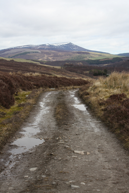
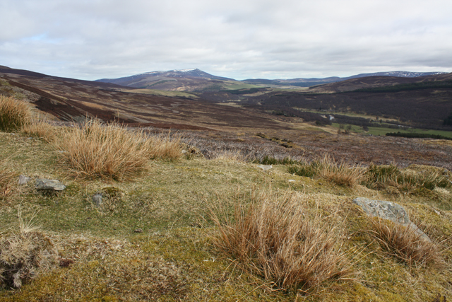
Standing at an elevation of around 243 meters (797 feet), Cnocan nan Sithean offers breathtaking panoramic views of the surrounding countryside. It is a relatively easy climb, making it accessible to hikers of all levels. The hill features a well-maintained path that winds its way up through heather-covered slopes and rocky outcrops.

The summit of Cnocan nan Sithean provides a stunning vantage point from which to admire the picturesque landscape. On clear days, visitors can see the rolling hills of Banffshire stretching out before them, with the North Sea glistening in the distance. The hill is particularly beautiful during the summer months when the heather blooms, covering the slopes in vibrant hues of purple and pink.

In addition to its natural beauty, Cnocan nan Sithean also holds historical significance. The hill is believed to have been used as a lookout point during ancient times, with the remains of a small fort or settlement visible near the summit. This adds an extra layer of intrigue to the hill, attracting history enthusiasts looking to explore the area's past.

Overall, Cnocan nan Sithean is a charming and accessible hill in Banffshire, offering stunning views, a peaceful atmosphere, and a touch of history. It is a must-visit for those seeking a memorable outdoor experience in the Scottish Highlands.

If you have any feedback on the listing, please let us know in the comments section below.

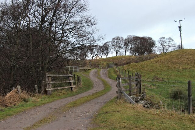
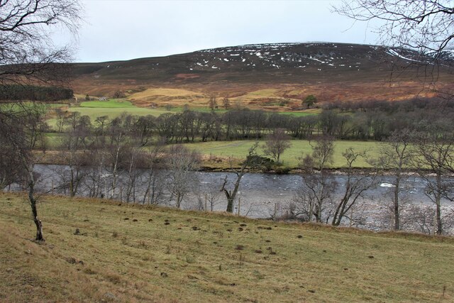
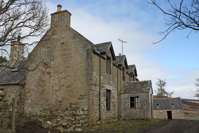
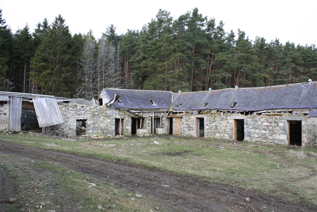
Cnoca nan Sithean Images

Images are sourced within 2km of 57.334196/-3.3990501 or Grid Reference NJ1527. Thanks to Geograph Open Source API. All images are credited.

Access to houses at Kinardochy
Westward across River Avon Avon means river so 'across the Avon' would, strictly speaking, be better.
Westward across River Avon
Avon means river so 'across the Avon' would, strictly speaking, be better.
Farm shed at Dell
Farm shed at Dell
Suspension Footbridge across the Avon It gives access to Altnaha and Lyne on the west side of Strath Avon.
Suspension Footbridge across the Avon
It gives access to Altnaha and Lyne on the west side of Strath Avon.
An ancient birch above Dalrachie Loch
Little Dalrachie A lone cottage in Strath Avon.
Little Dalrachie
A lone cottage in Strath Avon.
Knock Farmhouse Empty house at Knock Farm
Knock Farmhouse
Empty house at Knock Farm
Knock Farm steading Gradually falling down.
Knock Farm steading
Gradually falling down.
Hill track near Knock Farm Looking towards Ben Rinnes.
Hill track near Knock Farm
Looking towards Ben Rinnes.
Moorland west of Knock Farm On the southern slopes of Carn Eachie.
Moorland west of Knock Farm
On the southern slopes of Carn Eachie.
The track up beside Allt na Ha The track doesn't go much further. There are a few grouse shooting butts further up in the moor, but they don't appear to be used. The peak in the far distance is Carn a Ghille Chearr.
The track up beside Allt na Ha
The track doesn't go much further. There are a few grouse shooting butts further up in the moor, but they don't appear to be used. The peak in the far distance is Carn a Ghille Chearr.
Looking down Allt na Ha Over a patch of burnt heather in the moor. In the distance there is a glimpse of Strath Avon. The hillside I am on may be reached by crossing the Avon by a footbridge at Alltnaglander
Looking down Allt na Ha
Over a patch of burnt heather in the moor. In the distance there is a glimpse of Strath Avon. The hillside I am on may be reached by crossing the Avon by a footbridge at Alltnaglander
Deer on the moor This small group crossed Allt na Ha a few yards in front of me.
Deer on the moor
This small group crossed Allt na Ha a few yards in front of me.
Some sort of trap on the moor ? Within the cage there is a tube of netting open at both ends, suspended from the roof, open to the sky, and stopping about a foot from the ground
Some sort of trap on the moor ?
Within the cage there is a tube of netting open at both ends, suspended from the roof, open to the sky, and stopping about a foot from the ground
Moorland in the Cromdale Hills In the distance a shoulder of Carn a' Ghille Chearr, with patches of Winter snow.
Moorland in the Cromdale Hills
In the distance a shoulder of Carn a' Ghille Chearr, with patches of Winter snow.
Cromdale Hills moorland
A  herd of deer feeding on the slopes of Carn Eachie They are quite high up considering the amount of old snow, and the dusting of new snow last night,
A herd of deer feeding on the slopes of Carn Eachie
They are quite high up considering the amount of old snow, and the dusting of new snow last night,
The upper valley of Allt na Ha Looks interesting further up, but according to the contours on the map it would be a stiff climb.
The upper valley of Allt na Ha
Looks interesting further up, but according to the contours on the map it would be a stiff climb.
Show me another place!

Cnoca nan Sithean is located at Grid Ref: NJ1527 (Lat: 57.334196, Lng: -3.3990501)

Unitary Authority: Moray

Police Authority: North East

What 3 Words

///frown.firepower.rejects. Near Grantown-on-Spey, Highland

Nearby Locations

Cnoca nan Sithean

Related Wikis

Tomintoul distillery

Tomintoul distillery is a distillery in Kirkmichael, between Ballindalloch and Tomintoul in the Speyside region of Scotland, producing malt whisky for...

Kirkmichael, Moray

Kirkmichael is a parish and hamlet in Moray, Scotland. Kirkmichael was historically part of Banffshire.The hamlet lies approximately 8 miles south of Ballindalloch...

Drumin Castle

Drumin Castle is a ruined tower house near Glenlivet, Moray, Scotland. The castle is situated on a ridge above the junction of the Livet and Avon Rivers...

The Glenlivet distillery

The Glenlivet distillery is a distillery near Ballindalloch in Moray, Scotland that produces single malt Scotch whisky. It is the oldest legal distillery...

Blairfindy Castle

Blairfindy Castle is an L-plan tower house, dating from the 16th century, around 6.5 miles (10.5 km) north of Tomintoul, and west of the River Livet....

Glenlivet

Glenlivet (Scottish Gaelic: Gleann Lìobhait) is the glen in the Scottish Highlands through which the River Livet flows. The river rises high in the Ladder...

Deskie Castle

Deskie Castle was a medieval tower house that is thought to have been near Bridgend of Livet, Moray, Scotland. == History == Little is known of the castle...

Auchbreck

Auchbreck (Scottish Gaelic: An t-Achadh Breac, meaning the speckled field) is a village in Moray, Scotland.

Related Videos

DRUMIN CASTLE in Video (DRONE FOOTAGE)

DRUMIN CASTLE in Video (DRONE FOOTAGE) Diary: 6th August 2020 I headed off alone, heading for Cloddymoss. However on ...

DRUMIN CASTLE in Glenlivet

DRUMIN CASTLE in Glenlivet A visit to Drumin castle in Glenlivet and our photo diary of the trip. Please subscribe for more ...

Nearby Amenities

Located within 500m of 57.334196,-3.3990501
Communication Mobile Phone: yes
Height: 20
Man Made: mast
Tower Construction: lattice
Tower Type: communication
Lat/Long: 57.3371535/-3.400322
Height: 5
Material: wood
Power: pole
Lat/Long: 57.3319374/-3.3936279
Height: 5
Material: wood
Power: pole
Lat/Long: 57.3313583/-3.3943709
Height: 5
Material: wood
Power: pole
Lat/Long: 57.3307451/-3.3952145
Height: 5
Material: wood
Power: pole
Lat/Long: 57.3302203/-3.3958837
Height: 5
Material: wood
Power: pole
Lat/Long: 57.3331261/-3.3920541
Height: 5
Material: wood
Power: pole
Lat/Long: 57.3338687/-3.3919226
Height: 5
Material: wood
Power: pole
Lat/Long: 57.3345217/-3.3917884
Height: 5
Material: wood
Power: pole
Lat/Long: 57.3353346/-3.3916436
Height: 5
Material: wood
Power: pole
Lat/Long: 57.3357912/-3.3913231
Height: 5
Material: wood
Power: pole
Lat/Long: 57.3325212/-3.392863
Height: 0.5
Waterway: waterfall
Lat/Long: 57.3346754/-3.3946574
Athan Dàidh
Ford: yes
Lat/Long: 57.3327369/-3.3959515
Ford: yes
Lat/Long: 57.3308246/-3.4005669
Ford: yes
Lat/Long: 57.3377357/-3.3954513
Ford: yes
Lat/Long: 57.3313326/-3.4005958
Airmen's Monument
Description: Believed to be associated with the wartime crash, on 31/1/1943, of a RAF Whitley bomber, on Carn a’ Ghille Chearr, killing 4 of the crew. http://www.yorkshire-aircraft.co.uk/aircraft/scotland/la837.html
Historic: memorial
Inscription: [uninscribed]
Material: stone
Memorial: war_memorial
Lat/Long: 57.3331727/-3.3990683
MacGarvin's Delight
Direction: 0-90
Tourism: viewpoint
Lat/Long: 57.3351546/-3.3959234
Cnoca nan Sithean
Direction: 0-360
Tourism: viewpoint
Lat/Long: 57.3341137/-3.3989301
Power: pole
Lat/Long: 57.33254/-3.4034785
Power: pole
Lat/Long: 57.3322386/-3.4029207
Power: pole
Lat/Long: 57.3318948/-3.4022705
Power: pole
Lat/Long: 57.3315779/-3.4016585
Power: pole
Lat/Long: 57.3311516/-3.4008732
Power: pole
Lat/Long: 57.3308395/-3.4002876
Power: pole
Lat/Long: 57.3303808/-3.3994319
Power: pole
Lat/Long: 57.3299355/-3.3985953
Power: pole
Lat/Long: 57.329823/-3.3979157
Power: pole
Lat/Long: 57.3377204/-3.3944695
Power: pole
Lat/Long: 57.3379034/-3.3951021
The data included in this document is from www.openstreetmap.org. The data is made available under ODbL.

Have you been to Cnoca nan Sithean?

Leave your review of Cnoca nan Sithean below (or comments, questions and feedback).