Tod Hill

Hill, Mountain in Dumfriesshire

Scotland

Tod Hill

Fingland Fell Trig Point Flush Bracket S7703
Fingland Fell Trig Point Flush Bracket S7703 Credit: thejackrustles

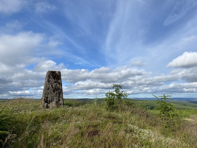
Tod Hill, located in Dumfriesshire, Scotland, is a prominent hill that stands at an elevation of 515 meters (1,690 feet). It is situated within the Southern Uplands, a range of hills and valleys known for their scenic beauty. Tod Hill is part of the Moffat Hills, which are renowned for their rugged and picturesque landscapes.

The hill offers panoramic views of the surrounding countryside, with its summit providing an excellent vantage point to admire the rolling hills, valleys, and lochs that characterize the region. On a clear day, visitors can even catch a glimpse of the Southern Uplands' highest peak, Merrick, standing at 843 meters (2,766 feet).

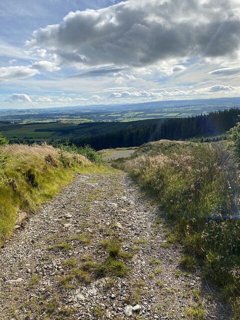
Tod Hill is a popular destination for hikers and outdoor enthusiasts, as it offers various walking routes that cater to different levels of difficulty and fitness. The ascent to the summit is relatively challenging, with steep sections and uneven terrain, but the reward of reaching the top makes it all worthwhile.

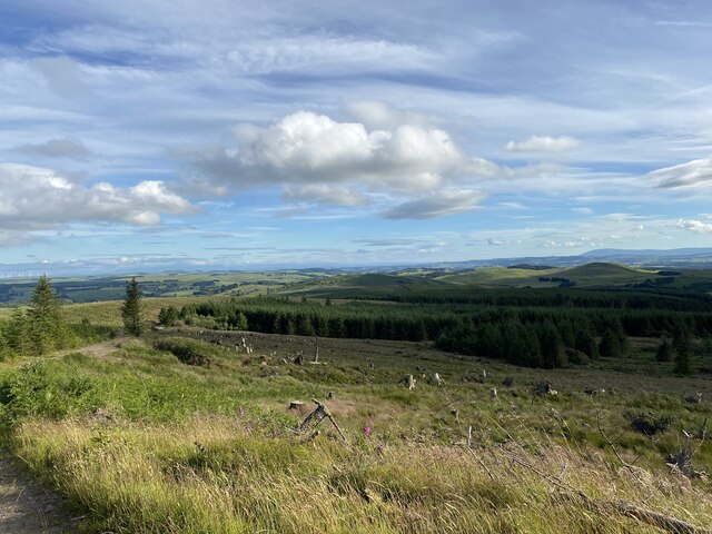
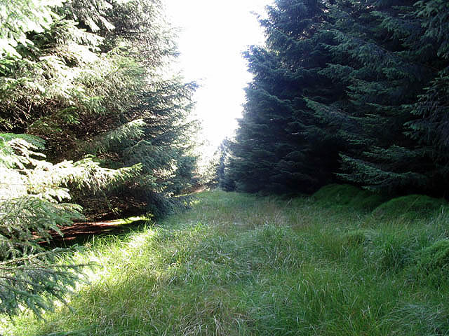
The hill is also home to an abundance of wildlife, including red deer, grouse, and various bird species, making it an ideal spot for nature lovers and birdwatchers. The surrounding area is rich in flora and fauna, with heather-covered slopes, scattered birch trees, and vibrant wildflowers adding to the beauty of the landscape.

Overall, Tod Hill in Dumfriesshire is a captivating destination for those seeking natural beauty, breathtaking views, and a chance to immerse themselves in the tranquility of the Scottish countryside.

If you have any feedback on the listing, please let us know in the comments section below.
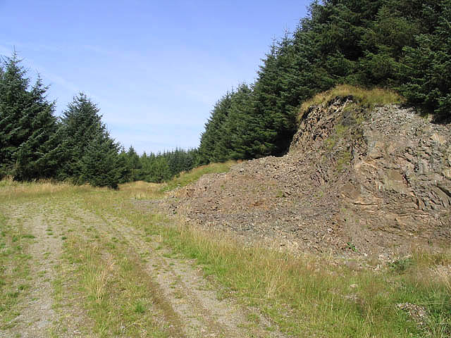
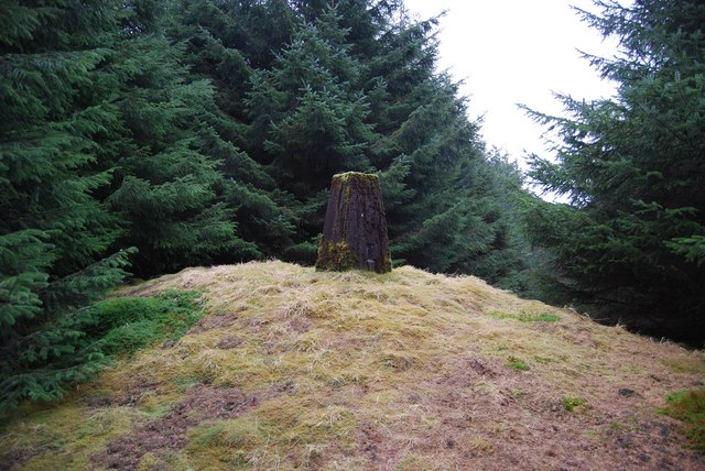
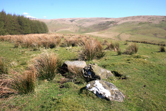
Tod Hill Images

Images are sourced within 2km of 55.251225/-3.3253365 or Grid Reference NY1596. Thanks to Geograph Open Source API. All images are credited.

Fingland Fell Trig Point Flush Bracket S7703
Short section of steep track on descent from Fingland Fell
Views near Fingland Fell
Log pile on descent from Fingland Fell
Forestry at Watchy Hass
Fire-break on Fingland Fell
A small quarry on Fingland Fell By a forestry track and probably used for bottoming materials in forestry roads.
A small quarry on Fingland Fell
By a forestry track and probably used for bottoming materials in forestry roads.
Fingland Fell trig point inside forest
View across to Ravens Nest from Gudewifes Hill A very dull scene to a naturalist but the place names show a rich historical background.
View across to Ravens Nest from Gudewifes Hill
A very dull scene to a naturalist but the place names show a rich historical background.
Gillesbie Hill
Gillesbie Hill
View across Wamphray Glen to upper Annandale
Stone Circle on Kirk Hill Remains of a stone circle on the hillside behind Wamphray Kirk. The Royal Commission on the Ancient and Historical Monuments of Scotland notes in the most recent survey in 1990 'The remains of this possible stone circle are situated in rough pasture and lie on the edge of a low terrace to the E of an unnamed tributary of the Staffenbiggen Burn. Only one stone (A on plan) is in its original position, and it has been reduced to a stump with what may be the upper part of the stone lying to the ESE (B); the remaining six stones have all fallen and others may have been removed in the past.' See <span class="nowrap"><a title="http://canmore.rcahms.gov.uk/en/site/66901/details/kirkhill/" rel="nofollow ugc noopener" href="http://canmore.rcahms.gov.uk/en/site/66901/details/kirkhill/">Link</a><img style="margin-left:2px;" alt="External link" title="External link - shift click to open in new window" src="https://s1.geograph.org.uk/img/external.png" width="10" height="10"/></span>
Stone Circle on Kirk Hill
Remains of a stone circle on the hillside behind Wamphray Kirk. The Royal Commission on the Ancient and Historical Monuments of Scotland notes in the most recent survey in 1990 'The remains of this possible stone circle are situated in rough pasture and lie on the edge of a low terrace to the E of an unnamed tributary of the Staffenbiggen Burn. Only one stone (A on plan) is in its original position, and it has been reduced to a stump with what may be the upper part of the stone lying to the ESE (B); the remaining six stones have all fallen and others may have been removed in the past.' See LinkExternal link
The Pinnacle Here's a spot of colour in the rough grazing on the south slope of The Pinnacle, a small hill east of Kirkhill Farm.
The Pinnacle
Here's a spot of colour in the rough grazing on the south slope of The Pinnacle, a small hill east of Kirkhill Farm.
The Pinnacle Top of The Pinnacle, a small hill east of Kirkhill farm, here looking north towards the fells above Laverhay.
The Pinnacle
Top of The Pinnacle, a small hill east of Kirkhill farm, here looking north towards the fells above Laverhay.
From Howgill Fell From the western slope of Howgill Fell, looking over Howgill Linn, to Dundoran Plantation in the distance.
From Howgill Fell
From the western slope of Howgill Fell, looking over Howgill Linn, to Dundoran Plantation in the distance.
Howgill Fell Looking north from the top of Howgill Fell, towards Craig Fell (479m) in the far distance.
Howgill Fell
Looking north from the top of Howgill Fell, towards Craig Fell (479m) in the far distance.
Towards Howgill Fell Looking east from the top of The Pinnacle towards Howgill Fell, the next goal of a splendid April day's walk in Annandale.
Towards Howgill Fell
Looking east from the top of The Pinnacle towards Howgill Fell, the next goal of a splendid April day's walk in Annandale.
Milne Height This old dry stane dyke and fence run across the top of Milne Height (422m). This is looking north towards Heatherybrae Head.
Milne Height
This old dry stane dyke and fence run across the top of Milne Height (422m). This is looking north towards Heatherybrae Head.
Show me another place!

Tod Hill is located at Grid Ref: NY1596 (Lat: 55.251225, Lng: -3.3253365)

Unitary Authority: Dumfries and Galloway

Police Authority: Dumfries and Galloway

What 3 Words

///shed.lawful.waking. Near Johnstonebridge, Dumfries & Galloway

Nearby Locations

White Moss Tod Hill

Related Wikis

Wamphray railway station

Wamphray railway station served Newton Wamphray, near Beattock, in the Scottish county of Dumfries and Galloway. It was served by local trains on what...

Newton Wamphray

Newton Wamphray is a village in Dumfries and Galloway. Wamphray is the name of the surrounding parish and of the Wamphray Water, which flows south-west...

Boreland

Boreland is a village in Dumfries and Galloway, Scotland, which is located in Dryfesdale about 7 miles (11 kilometres) north of Lockerbie on the B723 road...

Annandale Water services

Annandale Water services is a motorway service station in the village of Johnstonebridge, Scotland. The service station is located next to the A74(M) motorway...

Have you been to Tod Hill?

Leave your review of Tod Hill below (or comments, questions and feedback).