Bankfoot

Settlement in Perthshire

Scotland

Bankfoot

A9 embankment at Bankfoot Tree planting for stabilisation of the new slopes.
A9 embankment at Bankfoot Credit: Alan Reid

Bankfoot is a small village located in the Perth and Kinross council area of Scotland, specifically in the county of Perthshire. Situated on the banks of the River Tay, it lies approximately 8 miles north of Perth, the administrative center of the region.

The village of Bankfoot is home to a population of around 1,200 residents. It is primarily a residential area, with a mix of traditional stone-built houses and more modern developments. The stunning natural surroundings of the village, including the nearby hills and the river, provide a picturesque backdrop for the community.

Despite its small size, Bankfoot offers a range of amenities to its residents. These include a primary school, a medical center, a post office, and a few local shops. There are also several pubs and restaurants serving both traditional Scottish fare and international cuisine, catering to both locals and visitors.

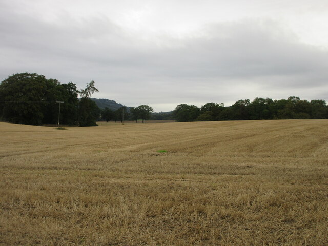
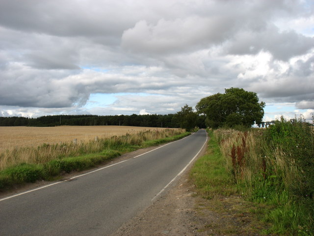
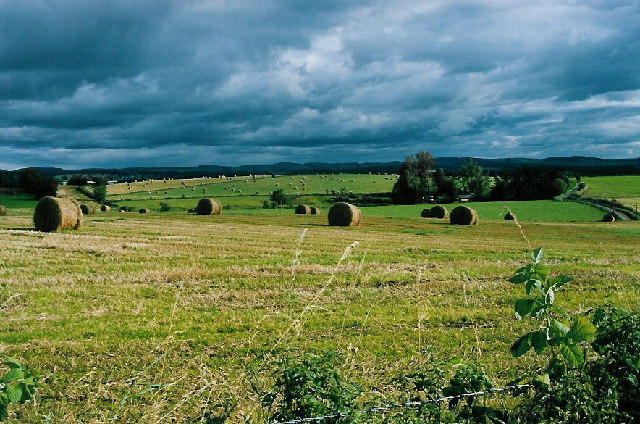
Outdoor enthusiasts will find plenty to enjoy in Bankfoot and the surrounding area. The village is located near the southern edge of the Scottish Highlands, offering numerous opportunities for hiking, cycling, and fishing. The nearby River Tay is particularly renowned for its salmon fishing.

Bankfoot's location also provides easy access to other attractions in the region. The historic city of Perth is a short drive away, offering a wider range of amenities, cultural events, and shopping opportunities. Overall, Bankfoot is a charming village that combines a peaceful rural setting with convenient access to larger towns and natural wonders, making it an attractive place to live or visit.

If you have any feedback on the listing, please let us know in the comments section below.
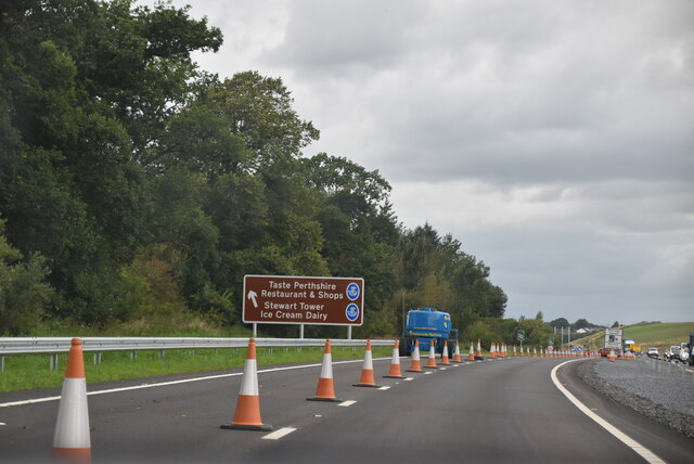
Bankfoot Images

Images are sourced within 2km of 56.500212/-3.5150804 or Grid Reference NO0635. Thanks to Geograph Open Source API. All images are credited.

A9 embankment at Bankfoot Tree planting for stabilisation of the new slopes.
A9 embankment at Bankfoot
Tree planting for stabilisation of the new slopes.
Improved A9 junction at Bankfoot
A wooded strip at the edge of Cairnleith Moss Shelter from easterly weather for the A9.
A wooded strip at the edge of Cairnleith Moss
Shelter from easterly weather for the A9.
Telecom mast on Muir of Thorn beside the A9
A9, northbound The A9 is a strategic link between the Highlands of Scotland and the Central Belt. It runs 279 miles from junction 5 of the M9 at Polmont to Scrabster. Originally it ran from Edinburgh.
<span class="nowrap"><a title="https://www.sabre-roads.org.uk/wiki/index.php?title=A9" rel="nofollow ugc noopener" href="https://www.sabre-roads.org.uk/wiki/index.php?title=A9">Link</a><img style="margin-left:2px;" alt="External link" title="External link - shift click to open in new window" src="https://s1.geograph.org.uk/img/external.png" width="10" height="10"/></span>
A9, northbound
The A9 is a strategic link between the Highlands of Scotland and the Central Belt. It runs 279 miles from junction 5 of the M9 at Polmont to Scrabster. Originally it ran from Edinburgh. LinkExternal link
Signage - A9 northbound
Road bridge - A9 northbound
Play Equipment at Taste Perthshire Roadside visitor centre.
Play Equipment at Taste Perthshire
Roadside visitor centre.
Stubble field west of Bankfoot Looking northwards from the roadside over a stubble field west of Bankfoot.
Stubble field west of Bankfoot
Looking northwards from the roadside over a stubble field west of Bankfoot.
Road to Bankfoot Minor road heading to Bankfoot from the south-west.
Road to Bankfoot
Minor road heading to Bankfoot from the south-west.
Over Blelock New builds at Over Blelock viewed over farmland from the south-east.
Over Blelock
New builds at Over Blelock viewed over farmland from the south-east.
Southbound A9, Layby 36S As you travel along the A9 between Perth and Cromarty Bridge, there is a series of laybys at fairly regular intervals on both sides of the road. These laybys are numbered consecutively from south to north. The layby furthest north is number 200.
Southbound A9, Layby 36S
As you travel along the A9 between Perth and Cromarty Bridge, there is a series of laybys at fairly regular intervals on both sides of the road. These laybys are numbered consecutively from south to north. The layby furthest north is number 200.
Muir of Thorn View from an A9 layby.
Muir of Thorn
View from an A9 layby.
Minor road to Murthly, leaving Bankfoot The bridge ahead carries the A9 past the village.

Oh! how the Scottish Government must wish that the A9 had been dualled all the way from Perth to Inverness when it was first improved. The extensive two-lane stretches are usually long, sweeping bends with inadequate visibility to overtake when oncoming traffic is also doing at least 60mph (to say nothing of the fact that the road is now so busy that there are rarely any gaps). It is gradually being upgraded but this must be an expensive process - also painfully slow, a bit like driving along it often is.
Minor road to Murthly, leaving Bankfoot
The bridge ahead carries the A9 past the village. Oh! how the Scottish Government must wish that the A9 had been dualled all the way from Perth to Inverness when it was first improved. The extensive two-lane stretches are usually long, sweeping bends with inadequate visibility to overtake when oncoming traffic is also doing at least 60mph (to say nothing of the fact that the road is now so busy that there are rarely any gaps). It is gradually being upgraded but this must be an expensive process - also painfully slow, a bit like driving along it often is.
The road from Bankfoot to Murthly
Path to North Barns and Kingswood Signed as a path to Kingswood "(crossing A9)", actually a warning. See <a href="https://www.geograph.org.uk/photo/4698542">NO0735 : Path signs at South Barns</a> for more details.
Path to North Barns and Kingswood
Signed as a path to Kingswood "(crossing A9)", actually a warning. See NO0735 : Path signs at South Barns for more details.
Show me another place!

Bankfoot is located at Grid Ref: NO0635 (Lat: 56.500212, Lng: -3.5150804)

Unitary Authority: Perth and Kinross

Police Authority: Tayside

What 3 Words

///voltages.bandwagon.bulb. Near Bankfoot, Perth & Kinross

Nearby Locations

Bankfoot

Related Wikis

Bankfoot

Bankfoot is a village in Perth and Kinross, Scotland, approximately 8 miles (13 km) north of Perth and 7 miles (11 km) south of Dunkeld. Bankfoot had a...

Bankfoot railway station

Bankfoot railway station served the village of Bankfoot, Perth and Kinross, Scotland, from 1906 to 1964 on the Bankfoot Light Railway. In 1911, the registered...

Waterloo, Perth and Kinross

Waterloo is a small hamlet in Perth and Kinross, Scotland approximately 1⁄2 mile (800 metres) north of Bankfoot on the old A9. == Etymology == Local opinion...

Airntully

Airntully () is a village in the Scottish council area of Perth and Kinross, which is to the west of the River Tay, 8 miles (11 km) north of Perth. In...

Rohallion railway station

Rohallion railway station was a private station from 1860 to 1864 on the Perth and Dunkeld Railway. == History == The station opened in February 1860 by...

Tullybelton

Tullybelton is a hamlet located in the Scottish county of Perth and Kinross about 8 miles (13 km) north-northeast of Perth. Ian Fraser, Baron Fraser of...
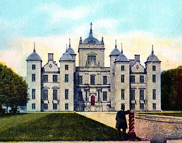
Murthly House

Murthly House, also known as New Murthly Castle, was a substantial mansion in Perth and Kinross, Scotland, designed by James Gillespie Graham and demolished...

Murthly railway station

Murthly railway station served the village of Murthly, Perth and Kinross, Scotland from 1856 to 1965 on the Perth and Dunkeld Railway. The railway line...

Nearby Amenities

Located within 500m of 56.500212,-3.5150804
Post Box
Collection Times: Mo-Fr 09:00; Sa 07:00
Manufacturer: Abbot Engineering
Operator: Royal Mail
Operator Wikidata: Q638098
Post Box Mounting: pier
Post Box Type: lamp
Ref: PH1 104D
Royal Cypher: scottish_crown
Source: survey;local knowledge
Lat/Long: 56.4993234/-3.512849
Booth: K6
Removed Amenity: telephone
Source: survey
Lat/Long: 56.5019269/-3.5168031
Pub
Bankfoot Inn
Addr City: Bankfoot
Addr Postcode: PH1 4AB
Addr Street: Main Street
Fhrs Id: 1099679
Lat/Long: 56.5006124/-3.5147233
Bankfoot
Name Gd: Uachdar Ghamhair
Old Name: Auchtergaven
Place: village
Population: 1280
Source: OS_OpenData_StreetView
Wikidata: Q1013600
Wikipedia: en:Bankfoot
Lat/Long: 56.5002597/-3.5145898
Post Box
Collection Times: Mo-Fr 09:00; Sa 07:00
Manufacturer: Lion Foundry Co Ltd Kirkintilloch
Operator: Royal Mail
Operator Wikidata: Q638098
Post Box Mounting: pier
Post Box Type: lamp
Ref: PH1 32D
Royal Cypher: scottish_crown
Source: survey;local knowledge
Lat/Long: 56.5002033/-3.5227259
Kayrene B&B
Tourism: guest_house
Lat/Long: 56.5003356/-3.51381
Turning Circle
Lat/Long: 56.4971014/-3.5111059
Noexit: yes
Lat/Long: 56.4968638/-3.5109965
Post Box
Collection Times: Mo-Fr 11:45; Sa 11:45
Manufacturer: Lion Foundry Co Ltd Kirkintilloch
Operator: Royal Mail
Post Box Mounting: pier
Post Box Type: lamp
Ref: PH1 174
Royal Cypher: scottish_crown
Source: survey;local knowledge
Lat/Long: 56.5023066/-3.5149421
Nisa
Addr City: Bankfoot
Addr Postcode: PH1 4AB
Addr Street: Main Street
Brand: Nisa
Brand Wikidata: Q16999069
Brand Wikipedia: en:Nisa (retailer)
Fhrs Id: 938014
Shop: convenience
Lat/Long: 56.500879/-3.5151445
Atm
Lat/Long: 56.5009426/-3.5150104
Bankfoot Inn
Addr City: Bankfoot
Addr Postcode: PH1 4AB
Addr Street: Main Street
Fhrs Id: 1099679
Tourism: guest_house
Lat/Long: 56.5006791/-3.5148253
Pub
The Atholl
Addr Postcode: PH1 4AA
Addr Street: Main Street
Contact Facebook: https://www.facebook.com/athollbankfoot
Email: mail@theathollbankfoot.co.uk
Fhrs Id: 934275
Phone: +44 1738 787 366
Website: https://www.theathollbankfoot.co.uk/
Lat/Long: 56.5028182/-3.5177811
Bankfoot War Memorial
Historic: memorial
Material: stone
Memorial Type: war_memorial
Lat/Long: 56.4995626/-3.5126175
Entrance: main
Lat/Long: 56.4999909/-3.5204909
Mcintosh Tours
Addr City: Bankfoot
Addr Housename: Westhill Cottage
Addr Postcode: PH1 4AB
Addr Street: Main Street
Description: Exclusive tours of the Scottish Highlands
Website: https://mcintoshtours.co.uk/
Lat/Long: 56.5005206/-3.5146776
Bankfoot
Historic Railway: station
Railway: site
Wikidata: Q54869677
Wikipedia: en:Bankfoot railway station
Lat/Long: 56.4991108/-3.5124894
Motorway Junction
Lat/Long: 56.5012932/-3.5099779
Ford: yes
Lat/Long: 56.4977158/-3.5115161
Material: wood
Power: pole
Lat/Long: 56.5032117/-3.509523
Power: pole
Lat/Long: 56.5030891/-3.5109946
Power: pole
Lat/Long: 56.5029844/-3.5120515
Power: pole
Lat/Long: 56.5029328/-3.5137778
Power: pole
Lat/Long: 56.5035901/-3.5143415
Power: pole
Lat/Long: 56.5042946/-3.5149702
Power: pole
Lat/Long: 56.5008113/-3.5116665
Power: pole
Lat/Long: 56.5011147/-3.5108425
Material: wood
Power: pole
Lat/Long: 56.5012104/-3.5105998
Material: wood
Power: pole
Lat/Long: 56.5008738/-3.5105162
Material: wood
Power: pole
Lat/Long: 56.5002681/-3.5103367
Power: pole
Lat/Long: 56.4999022/-3.5103163
Power: pole
Lat/Long: 56.4993742/-3.5103999
Power: pole
Lat/Long: 56.4987505/-3.5104203
Ford: yes
Lat/Long: 56.4983538/-3.5133084
Ford: yes
Lat/Long: 56.4999489/-3.5221039
Material: wood
Power: pole
Lat/Long: 56.5028245/-3.5098436
Power: pole
Lat/Long: 56.4974327/-3.5125139
Power: pole
Lat/Long: 56.4977416/-3.5138588
Power: pole
Lat/Long: 56.4980449/-3.5151881
Power: pole
Lat/Long: 56.4983509/-3.5165693
Power: pole
Lat/Long: 56.4986656/-3.5179531
Post Box
Brand: Royal Mail
Brand Wikidata: Q638098
Collection Times: Mo-Fr 17:15; Sa 11:45
Manufacturer: Machan Scotland
Operator: Royal Mail
Operator Wikidata: Q638098
Post Box Mounting: pier
Post Box Type: lamp
Ref: PH1 84
Royal Cypher: scottish_crown
Source: survey;local knowledge
Lat/Long: 56.5008347/-3.5152355
Information: guidepost
Tourism: information
Lat/Long: 56.5037157/-3.5157134
The data included in this document is from www.openstreetmap.org. The data is made available under ODbL.

Have you been to Bankfoot?

Leave your review of Bankfoot below (or comments, questions and feedback).