Burn Moor

Hill, Mountain in Cumberland Copeland

England

Burn Moor

Summit of Whitfell Ancient cairn and trig pillar (572m) just squeezing into the corner of the square. Less frequented Lakeland fells.
Summit of Whitfell Credit: Richard Webb

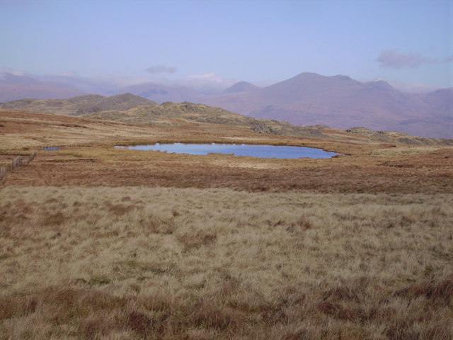
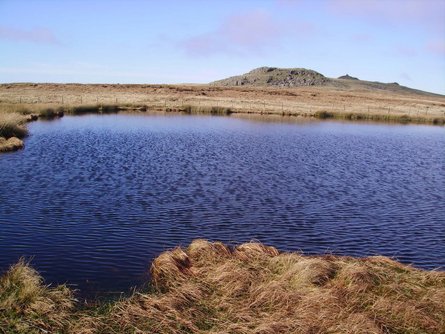
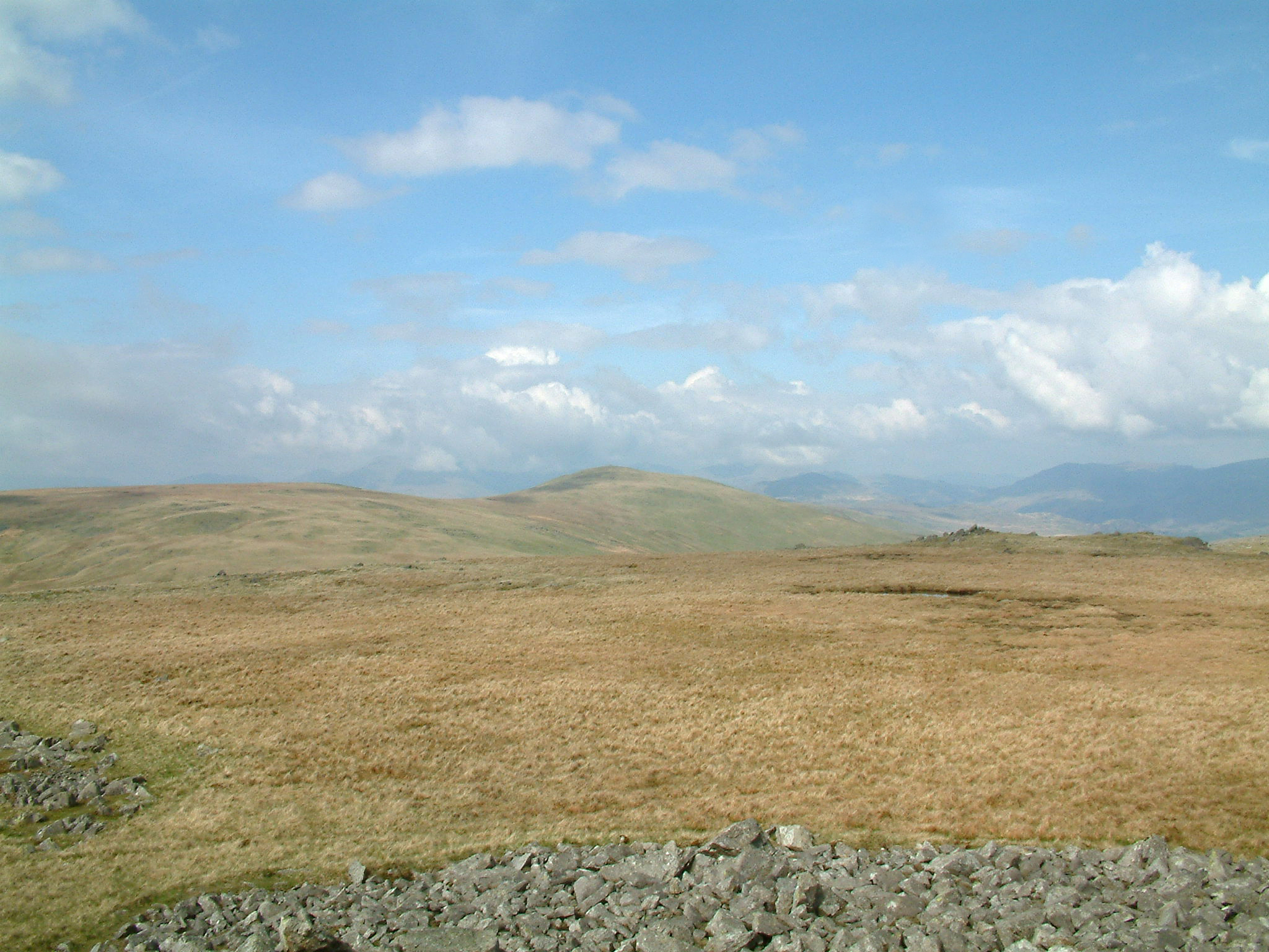
Burn Moor is a prominent hill located in the county of Cumberland, in the northwest of England. It is part of the Lake District National Park and sits within the boundaries of the town of Keswick. With an elevation of approximately 1,341 feet (409 meters), Burn Moor offers breathtaking panoramic views of the surrounding picturesque landscape.

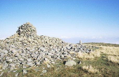
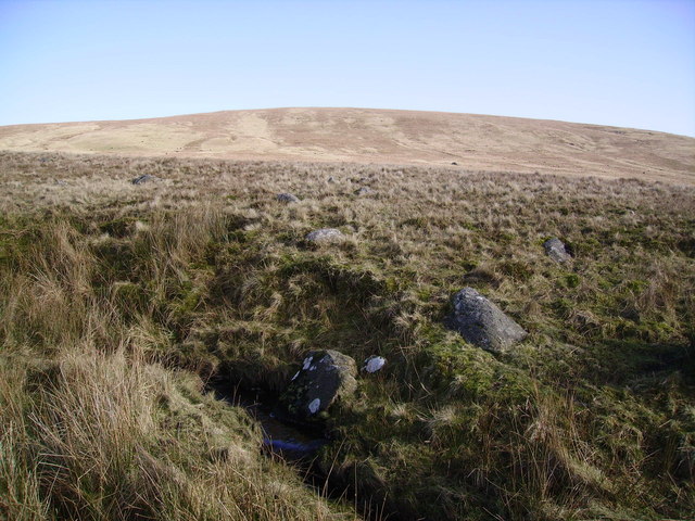
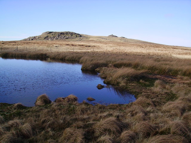
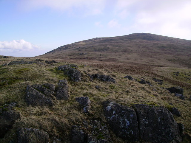
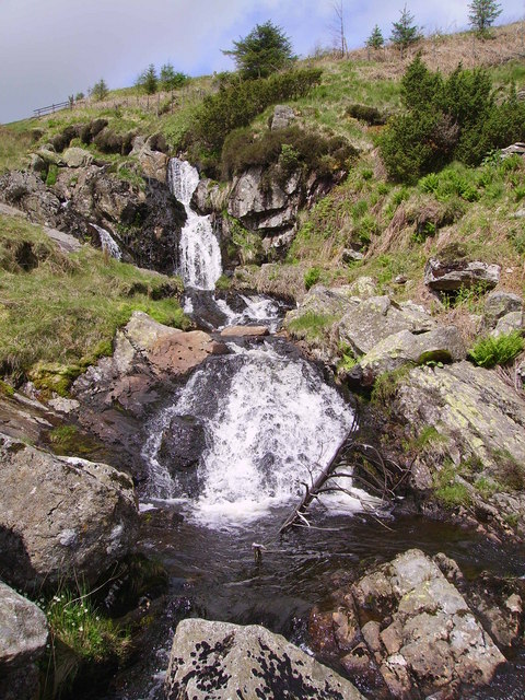
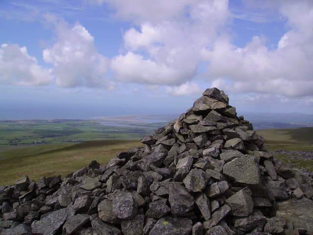
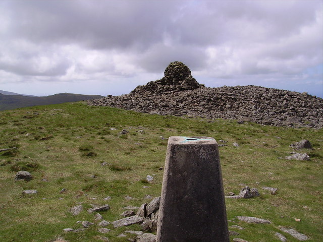
The hill is characterized by its rugged terrain, covered in heather and grasses, which provide a natural habitat for a variety of wildlife including birds, small mammals, and reptiles. The summit of Burn Moor is marked by a cairn, a man-made pile of stones, which serves as a navigational aid for hikers and mountaineers.

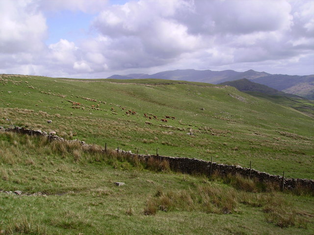
The hill is a popular destination for outdoor enthusiasts, offering a range of activities such as hiking, hill walking, and birdwatching. Several well-marked trails lead to the summit, providing visitors with the opportunity to explore the diverse flora and fauna of the area.

Burn Moor is also steeped in history, with evidence of past human habitation dating back thousands of years. Archaeological remains, including Bronze Age burial mounds and stone circles, can be found scattered across the hillside, providing a glimpse into the region's rich cultural heritage.

Overall, Burn Moor is a captivating natural landmark that offers visitors a chance to immerse themselves in the stunning beauty of the Lake District, while also providing a fascinating glimpse into the area's past.

If you have any feedback on the listing, please let us know in the comments section below.

Burn Moor Images

Images are sourced within 2km of 54.320486/-3.3062122 or Grid Reference SD1592. Thanks to Geograph Open Source API. All images are credited.

Summit of Whitfell Ancient cairn and trig pillar (572m) just squeezing into the corner of the square. Less frequented Lakeland fells.
Summit of Whitfell
Ancient cairn and trig pillar (572m) just squeezing into the corner of the square. Less frequented Lakeland fells.
On Thwaites Fell Walking south from Buckbarrow, a rocky summit in SD1591. The square is almost entirely grassy moorland.
On Thwaites Fell
Walking south from Buckbarrow, a rocky summit in SD1591. The square is almost entirely grassy moorland.
Corney Fell An example of southwest lakeland Silurian Slate.
Corney Fell
An example of southwest lakeland Silurian Slate.
Storthes A boggy dip between Hesk Fell and Whitfell. Several small becks and Storthes Gill eventually meet together in the square to become Holehouse Gill a tributary of the Duddon.Looking up at Hesk Fell.
Storthes
A boggy dip between Hesk Fell and Whitfell. Several small becks and Storthes Gill eventually meet together in the square to become Holehouse Gill a tributary of the Duddon.Looking up at Hesk Fell.
Holehouse Tarn On the ridge between Whitfell and Stainton Pike.
Holehouse Tarn
On the ridge between Whitfell and Stainton Pike.
Summit Cairn, Stainton Pike On the approach from Holehouse Tarn. Stainton Pike is an 'Outlying Wainwright' on the ridge leading from Whitfell to Devoke Water. This side of the ridge becomes craggy compared with the grassy Ulpa and Hesk fells and is littered with ancient cairns and interesting nooks and crannies.
Summit Cairn, Stainton Pike
On the approach from Holehouse Tarn. Stainton Pike is an 'Outlying Wainwright' on the ridge leading from Whitfell to Devoke Water. This side of the ridge becomes craggy compared with the grassy Ulpa and Hesk fells and is littered with ancient cairns and interesting nooks and crannies.
Holehouse Tarn and Stainton Pike The gridline between the two squares SD1593 and SD1594 runs right through the middle of the Tarn. The cairn on Stainton Pike on the skyline.
Holehouse Tarn and Stainton Pike
The gridline between the two squares SD1593 and SD1594 runs right through the middle of the Tarn. The cairn on Stainton Pike on the skyline.
Summit Cairn, Stainton Pike Where the fells meet the sea. Extensive views to the west from Stainton Pike
Summit Cairn, Stainton Pike
Where the fells meet the sea. Extensive views to the west from Stainton Pike
Holehouse Tarn On the grassy ridge which runs down from Whitfell.
Holehouse Tarn
On the grassy ridge which runs down from Whitfell.
Holehouse Tarn The southern half of the Tarn is just in the square
Holehouse Tarn
The southern half of the Tarn is just in the square
Whitfell From Fox Crags on the ridge to Stainton Pike
Whitfell
From Fox Crags on the ridge to Stainton Pike
Waterfall, Logan Beck Running down from Sele Bottom by the plantation. Logan Beck has some lovely falls.
Waterfall, Logan Beck
Running down from Sele Bottom by the plantation. Logan Beck has some lovely falls.
On Whitfell On the east slope above the wall. Brown Cows grazing in the distance.
On Whitfell
On the east slope above the wall. Brown Cows grazing in the distance.
Waberthwaite Fell Looking towards Stainton Pike over most of the square.
Waberthwaite Fell
Looking towards Stainton Pike over most of the square.
Cairn, Burn Moor On the west edge of the domed Moor. Looking towards the Estuary of the Esk.
Cairn, Burn Moor
On the west edge of the domed Moor. Looking towards the Estuary of the Esk.
Cairn, Kinmont Buckbarrow Looking towards the coast.
Cairn, Kinmont Buckbarrow
Looking towards the coast.
Cairn, Buckbarrow Craggy little Outlying Wainwright. Looking into the Southern Fells
Cairn, Buckbarrow
Craggy little Outlying Wainwright. Looking into the Southern Fells
Whitfell Trig Pillar and Cairn Large windshelter cairn and Trig Pillar on Whitfell. On a busy Sunday in the Lakes no other walkers were seen for 4 hours in these quiet outliers.
Whitfell Trig Pillar and Cairn
Large windshelter cairn and Trig Pillar on Whitfell. On a busy Sunday in the Lakes no other walkers were seen for 4 hours in these quiet outliers.
Show me another place!

Burn Moor is located at Grid Ref: SD1592 (Lat: 54.320486, Lng: -3.3062122)

Administrative County: Cumbria

District: Copeland

Police Authority: Cumbria

What 3 Words

///recur.alternate.irrigate. Near Millom, Cumbria

Related Wikis

Whitfell

Whitfell (or sometimes Whit Fell) is a hill of 573 metres (1,880 ft) in the southwestern part of the Lake District. It is the highest point between Black...

Stainton Pike

Stainton Pike is a hill in the English Lake District, near Waberthwaite, Cumbria. It is the subject of a chapter of Wainwright's book The Outlying Fells...

Hesk Fell

Hesk Fell is a hill in the south-west of the English Lake District, between the Duddon Valley and Eskdale near Ulpha, Cumbria. It is the subject of a chapter...

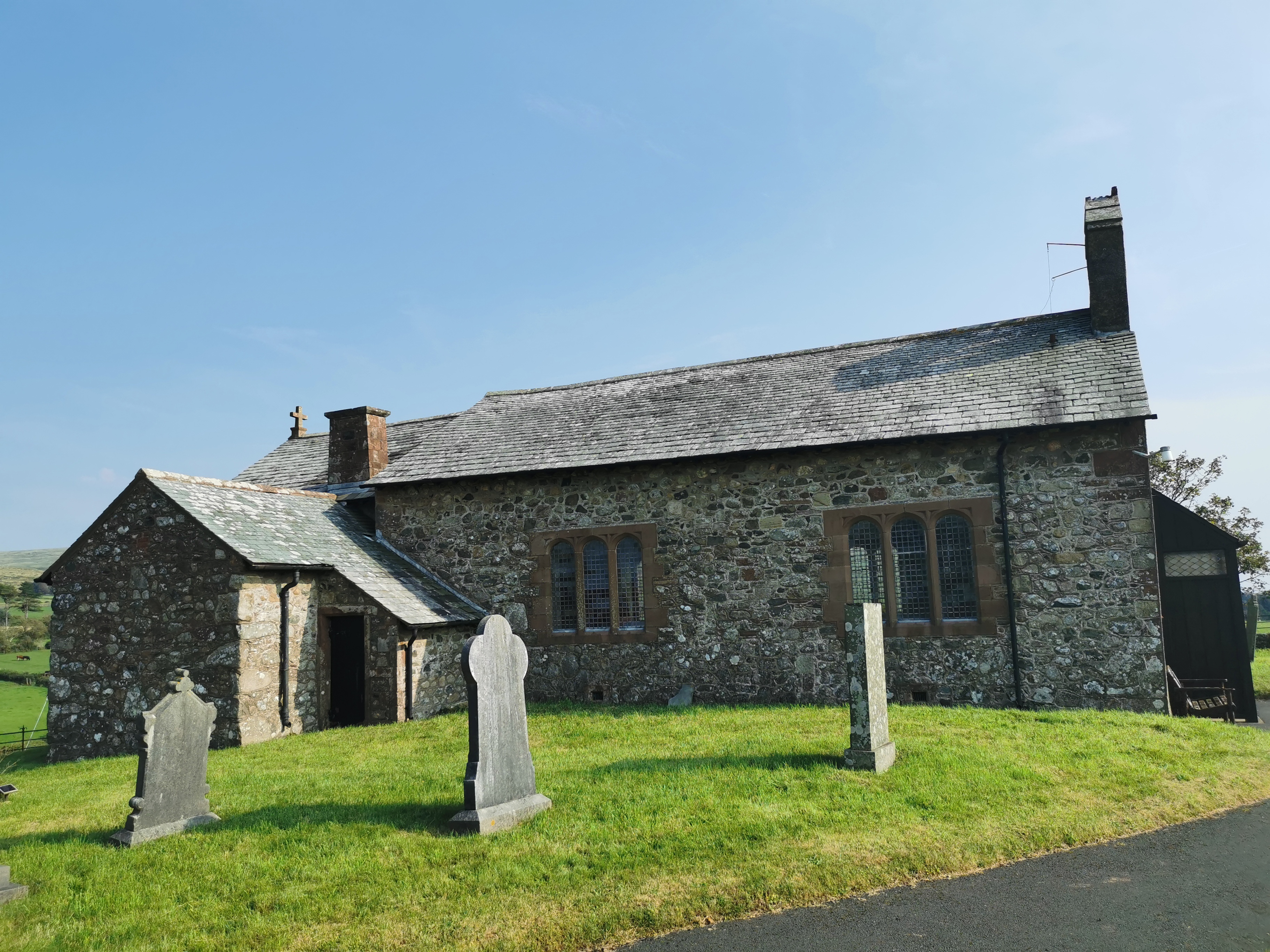
St John the Baptist, Corney

St John the Baptist, is in Corney, Cumbria, England. It is an Anglican parish church in the deanery of Calder, and the diocese of Carlisle. Its benefice...

Nearby Amenities

Located within 500m of 54.320486,-3.3062122
Burn Moor
Ele: 543
Natural: peak
Lat/Long: 54.3204869/-3.3069992
Burnmoor Stake
Place: locality
Lat/Long: 54.3215249/-3.3085988
The data included in this document is from www.openstreetmap.org. The data is made available under ODbL.

Have you been to Burn Moor?

Leave your review of Burn Moor below (or comments, questions and feedback).