Big Garvoun

Hill, Mountain in Banffshire

Scotland

Big Garvoun

Burn of Loin From Cnap Chaochan Aitinn. The tributary is Caochan Garvoun.
Burn of Loin Credit: Alan Reid

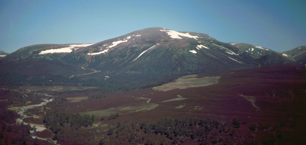
Big Garvoun is a prominent hill located in the region of Banffshire, Scotland. Situated approximately 15 kilometers south of the town of Banff, it is part of the larger Grampian Mountains range. With an elevation of 671 meters (2,201 feet), Big Garvoun offers breathtaking panoramic views of the surrounding landscape, making it a popular destination for hikers and nature enthusiasts.

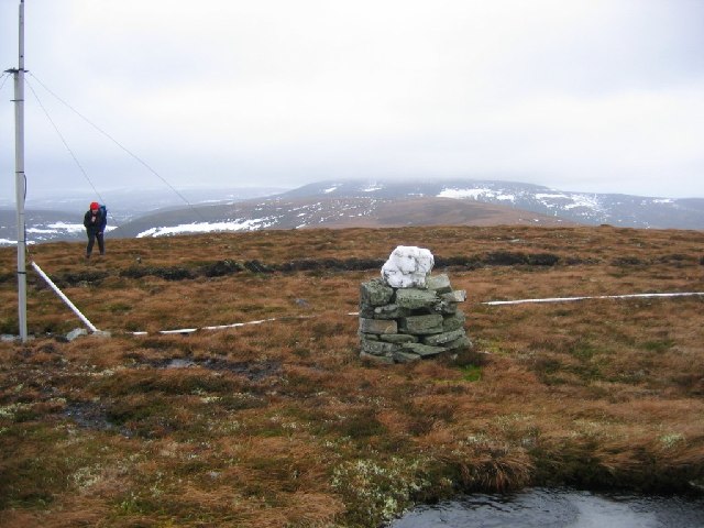
The hill is characterized by its distinctive conical shape and is covered in a mixture of heather, grasses, and scattered patches of woodland. Its slopes are moderately steep, providing an enjoyable challenge for climbers of varying abilities. The summit of Big Garvoun is marked by a cairn, a man-made pile of stones traditionally used to mark significant points on hills and mountains.

Wildlife is abundant on Big Garvoun, with various bird species such as golden eagles and peregrine falcons often spotted soaring overhead. The hill is also home to a diverse range of flora, including heather, bilberries, and mosses, adding to its natural beauty.

Access to Big Garvoun is relatively straightforward, with several well-marked trails leading to the summit. The hill is easily accessible from the nearby village of Gardenstown, which offers parking facilities and amenities for visitors. It is advisable to wear appropriate hiking gear and bring supplies, as the ascent can be challenging at times due to uneven terrain and changing weather conditions.

Overall, Big Garvoun is a picturesque and rewarding destination for outdoor enthusiasts seeking to explore the stunning landscapes of Banffshire and experience the majestic beauty of the Scottish Highlands.

If you have any feedback on the listing, please let us know in the comments section below.

Big Garvoun Images

Images are sourced within 2km of 57.158568/-3.4102993 or Grid Reference NJ1408. Thanks to Geograph Open Source API. All images are credited.

Burn of Loin From Cnap Chaochan Aitinn. The tributary is Caochan Garvoun.
Burn of Loin
From Cnap Chaochan Aitinn. The tributary is Caochan Garvoun.
On Drum Loin Looking towards Meall Gaineimh, the northeast top of Ben Avon.
On Drum Loin
Looking towards Meall Gaineimh, the northeast top of Ben Avon.
On a heathery ridge above Glen Loin Ben Avon forms the background.
On a heathery ridge above Glen Loin
Ben Avon forms the background.
Summit of Big Garvoun An old, overgrown cairn marks the spot.
Ben Avon and Beinn a' Bhuird in the distance.
Summit of Big Garvoun
An old, overgrown cairn marks the spot. Ben Avon and Beinn a' Bhuird in the distance.
A hill track dropping towards Inverloin
Island on the Avon
Island on the Avon
Looking west up Glen Avon
Looking up Coire Grealach
Looking down Glen Avon
Bailey bridge in Glen Avon Taking an estate track over the River Avon near Inverloin.
Bailey bridge in Glen Avon
Taking an estate track over the River Avon near Inverloin.
Bridge and tracks in Glen Avon Estate tracks and a Bailey bridge over the River Avon.
Bridge and tracks in Glen Avon
Estate tracks and a Bailey bridge over the River Avon.
Summit of Cnap Chaochan Aitin. A 715m high hill in the eastern Monadh Ruadh was a tough proposition on a very windy day. The estate maintains a radio relay up here; it's quite a cluttered summit.
Summit of Cnap Chaochan Aitin.
A 715m high hill in the eastern Monadh Ruadh was a tough proposition on a very windy day. The estate maintains a radio relay up here; it's quite a cluttered summit.
Tracks in Glen Avon
Tracks in Glen Avon
Track, Glen Loin Hill track going down from Cnap Chaochan Aitinn to meet the main Glen Loin track.
Track, Glen Loin
Hill track going down from Cnap Chaochan Aitinn to meet the main Glen Loin track.
Burn of Loin Flowing through Glen Loin below scree slopes of Cnap Eas Chaorach.
Burn of Loin
Flowing through Glen Loin below scree slopes of Cnap Eas Chaorach.
Glen Loin Track passing below Cnap Chaochan Aitinn with the southwestern slopes of Cnap Eas Chaorach ahead.
Glen Loin
Track passing below Cnap Chaochan Aitinn with the southwestern slopes of Cnap Eas Chaorach ahead.
Track in Glen Loin A track which runs the length of this remote and peaceful glen.
Track in Glen Loin
A track which runs the length of this remote and peaceful glen.
Big Garvoun from Glen Loin North eastern slopes seen across Burn of Loin
Big Garvoun from Glen Loin
North eastern slopes seen across Burn of Loin
Show me another place!

Big Garvoun is located at Grid Ref: NJ1408 (Lat: 57.158568, Lng: -3.4102993)

Unitary Authority: Moray

Police Authority: North East

What 3 Words

///reminder.surprised.infringe. Near Inverey, Aberdeenshire

Nearby Locations

Big Garvoun

Related Wikis

Ben Avon

Ben Avon (Scottish Gaelic: Beinn Athfhinn, 'mountain of the Avon') is a mountain in the Cairngorms of Scotland. It is a sprawling mountain with a broad...

Delnadamph Lodge

Delnadamph Lodge was located on the Balmoral Estate about 8 miles (13 km) north of the castle. The lodge and its estate lands were bought by Queen Elizabeth...

Beinn a' Bhùird

Beinn a' Bhùird is a Munro in the Cairngorm mountain range of Scotland. In Watson (1975) the author suggests the mountain should be named Beinn Bòrd -...

Nearby Amenities

Located within 500m of 57.158568,-3.4102993
Big Garvoun
Ele: 740
Natural: peak
Lat/Long: 57.1587311/-3.4107325
The data included in this document is from www.openstreetmap.org. The data is made available under ODbL.

Have you been to Big Garvoun?

Leave your review of Big Garvoun below (or comments, questions and feedback).