Haycock

Hill, Mountain in Cumberland Copeland

England

Haycock

Fellwalkers on Little Scoat Fell The walkers on the upper slopes of Little Scoat Fell above Black Comb, looking across Mosedale to Great Gable and the Scafell Range.
Fellwalkers on Little Scoat Fell Credit: Adrian Taylor

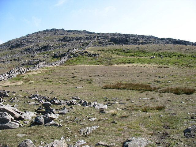
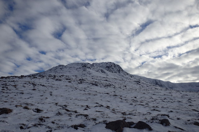
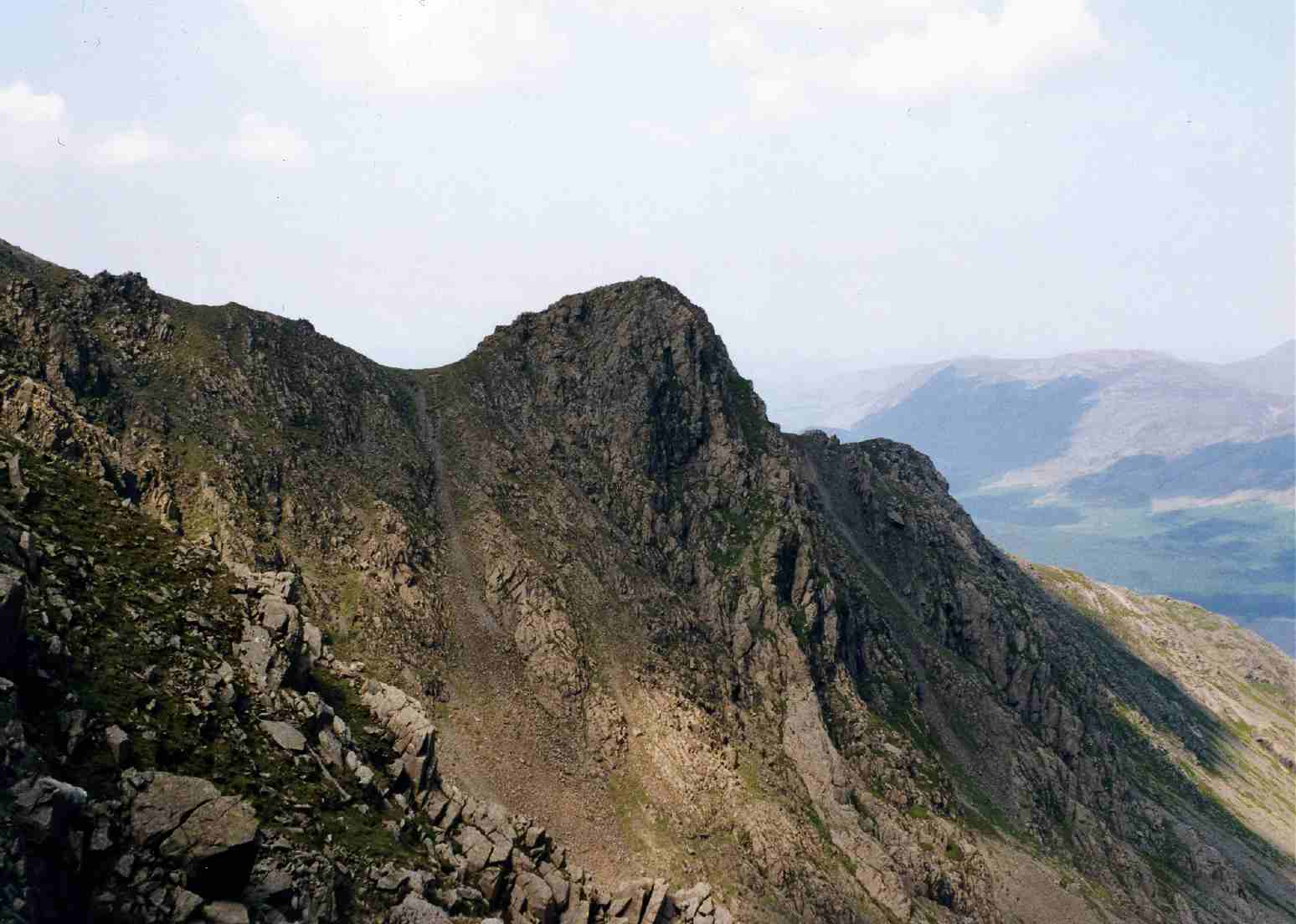
Haycock is a prominent hill located in the county of Cumberland in Northwest England. It stands at an elevation of 1,195 feet (364 meters) above sea level, making it one of the notable peaks in the region. Situated near the village of Dalston, Haycock is part of the larger Lake District National Park, renowned for its stunning landscapes and picturesque views.

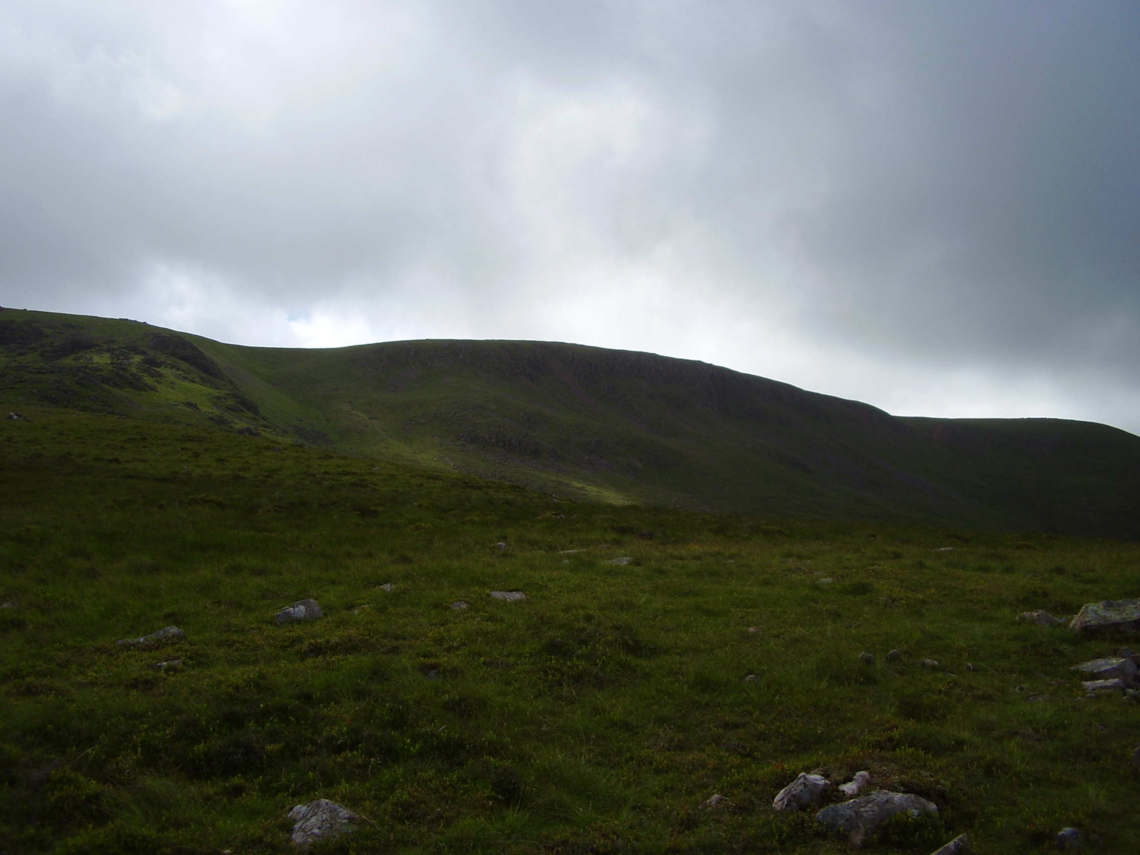
The hill is characterized by its distinctive shape and rugged terrain, with steep slopes and rocky outcrops. Its location offers hikers and outdoor enthusiasts a challenging yet rewarding experience, as the ascent provides panoramic vistas of the surrounding countryside, including nearby fells and valleys.

Haycock is predominantly composed of volcanic rock, which gives it a unique geological identity compared to other hills in the area. This also contributes to the hill's stability and resilience against erosion.

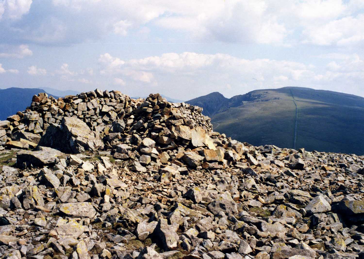
The summit of Haycock offers breathtaking views in all directions, with the Irish Sea visible to the west and the expansive Cumbrian countryside stretching out to the east. On clear days, it is even possible to see the distant peaks of the Scottish Highlands.

Haycock is a popular destination for walkers and climbers, attracting nature enthusiasts and adventurers alike. Its remote location and untouched natural beauty make it a haven for wildlife, with a variety of flora and fauna inhabiting its slopes.

In summary, Haycock is a striking hill in Cumberland, offering stunning views, challenging terrain, and a wealth of natural beauty. It is a must-visit destination for those seeking an adventure in the Lake District.

If you have any feedback on the listing, please let us know in the comments section below.

Haycock Images

Images are sourced within 2km of 54.484266/-3.3215392 or Grid Reference NY1410. Thanks to Geograph Open Source API. All images are credited.

Fellwalkers on Little Scoat Fell The walkers on the upper slopes of Little Scoat Fell above Black Comb, looking across Mosedale to Great Gable and the Scafell Range.
Fellwalkers on Little Scoat Fell
The walkers on the upper slopes of Little Scoat Fell above Black Comb, looking across Mosedale to Great Gable and the Scafell Range.
Bridleway heading down by Nether Beck Bridleway heading down by Nether Beck with Middle Fell in the distance
Bridleway heading down by Nether Beck
Bridleway heading down by Nether Beck with Middle Fell in the distance
Bridleway heading down by Nether Beck Bridleway heading down by Nether Beck with Middle Fell in the distance
Bridleway heading down by Nether Beck
Bridleway heading down by Nether Beck with Middle Fell in the distance
Repairing the Ennerdale Wall Looking towards the cairn (left of centre) at the west end of Caw Fell, a very minor top.
Repairing the Ennerdale Wall
Looking towards the cairn (left of centre) at the west end of Caw Fell, a very minor top.
Approaching the summit of Caw Fell Traditionally the cairn, away to the left, is assumed to mark the highest point of Caw Fell. But I wonder whether the spot at the foot of the wall ahead is actually higher.
Approaching the summit of Caw Fell
Traditionally the cairn, away to the left, is assumed to mark the highest point of Caw Fell. But I wonder whether the spot at the foot of the wall ahead is actually higher.
The Ennerdale Wall heading for Haycock This stretch of the wall has not yet been restored.
The Ennerdale Wall heading for Haycock
This stretch of the wall has not yet been restored.
North-west ridge of Haycock The route to the summit follows the dilapidated wall, with a few minor variations.
North-west ridge of Haycock
The route to the summit follows the dilapidated wall, with a few minor variations.
Low Beck Easy to cross today
Low Beck
Easy to cross today
Under Steeple Zoom shot from Low Beck
Under Steeple
Zoom shot from Low Beck
Ascending Steeple
Ascending Steeple
Under Long Crag Deep crusty snow made the ascent hard work
Under Long Crag
Deep crusty snow made the ascent hard work
Ascending Steeple Exhausted after struggling for two hours in deep snow this is as far as I got.
Ascending Steeple
Exhausted after struggling for two hours in deep snow this is as far as I got.
Under Long Crag On the Steeple ridge
Under Long Crag
On the Steeple ridge
Descending Steeple High above Ennerdale
Descending Steeple
High above Ennerdale
Steeple summit Ennerdale Water seen from the summit cairn.
Steeple summit
Ennerdale Water seen from the summit cairn.
Descending from Scoat Fell On the ridge from Scoat Fell to Red Pike with its edge falling steeply down to Mosedale. Great Gable's characteristic shape is on the skyline above Kirk Fell with the Scafell group R of centre.
Descending from Scoat Fell
On the ridge from Scoat Fell to Red Pike with its edge falling steeply down to Mosedale. Great Gable's characteristic shape is on the skyline above Kirk Fell with the Scafell group R of centre.
Nether Beck and Seatallan Nether Beck flows out of Scoat Tarn, a typical glacial corrie lake, and descends into the valley over many waterfalls and cascades. Beyond, is the rounded fell of Seatallan.
Nether Beck and Seatallan
Nether Beck flows out of Scoat Tarn, a typical glacial corrie lake, and descends into the valley over many waterfalls and cascades. Beyond, is the rounded fell of Seatallan.
On top of Steeple As the mists came and went about the summit of Scoat Fell, a lone walker appeared on top of Steeple, the northern spur of the larger fell.
On top of Steeple
As the mists came and went about the summit of Scoat Fell, a lone walker appeared on top of Steeple, the northern spur of the larger fell.
Show me another place!

Haycock is located at Grid Ref: NY1410 (Lat: 54.484266, Lng: -3.3215392)

Administrative County: Cumbria

District: Copeland

Police Authority: Cumbria

What 3 Words

///styled.freely.soggy. Near Frizington, Cumbria

Nearby Locations

Haycock Little Gowder Crag

Related Wikis

Haycock (Lake District)

Haycock is a mountain in the western part of the English Lake District. It rises between Scoat Fell and Caw Fell to the south of Ennerdale and the north...

Caw Fell

Caw Fell is a fell in the English Lake District, standing between Haycock the Lank Rigg group. It occupies a wide upland area with Ennerdale to the north...

Scoat Fell

Scoat Fell is a fell in the western part of the English Lake District. It stands at the head of the Mosedale Horseshoe with its back to Ennerdale. Paths...

Steeple (Lake District)

Steeple is a fell in the English Lake District. It is situated in the mountainous area between Ennerdale and Wasdale and reaches a height of 819 metres...

Nearby Amenities

Located within 500m of 54.484266,-3.3215392
Haycock
Ele: 797
Natural: peak
Source: npe
Wikidata: Q5686220
Wikipedia: en:Haycock (Lake District)
Lat/Long: 54.4844998/-3.3216904
Barrier: stile
Lat/Long: 54.4863029/-3.327625
The data included in this document is from www.openstreetmap.org. The data is made available under ODbL.

Have you been to Haycock?

Leave your review of Haycock below (or comments, questions and feedback).