Carn Stwpa

Hill, Mountain in Monmouthshire

Wales

Carn Stwpa

Grid Gwartheg ar y B4256 / Cattle grid on the B4246 Grid gwartheg ar y B4256 ger Cefn Golau.

A cattle grid on the B4256 near Cefn Golau (trans. light ridge).
Grid Gwartheg ar y B4256 / Cattle grid on the B4246 Credit: Alan Richards

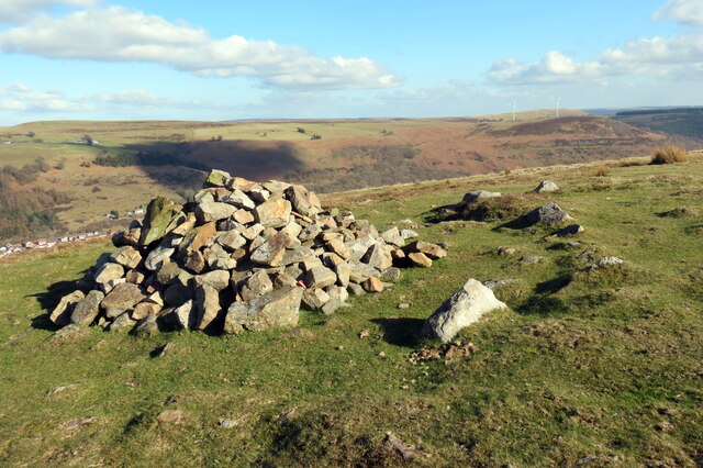
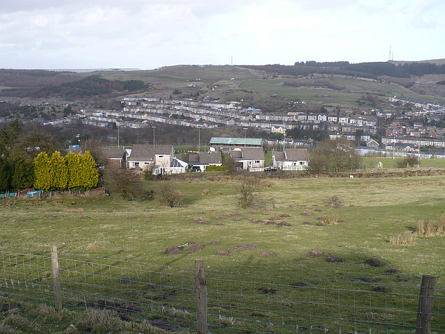
Carn Stwpa is a prominent hill located in Monmouthshire, Wales. It is situated near the village of Llanvihangel Crucorney and stands at an elevation of 486 meters (1,594 feet) above sea level. The hill is part of the Black Mountains range and offers stunning panoramic views of the surrounding countryside.

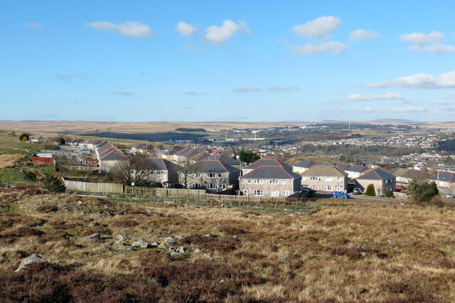
Carn Stwpa is a popular destination for hikers and outdoor enthusiasts, with several well-marked trails leading to the summit. The climb to the top is relatively challenging but rewarding, as visitors are treated to breathtaking vistas of the Brecon Beacons National Park, the Usk Valley, and the Herefordshire countryside.

The hill is known for its diverse flora and fauna, with a variety of wildflowers, birds, and other wildlife calling it home. The area is also rich in history, with ancient ruins and archaeological sites scattered throughout the landscape.

Overall, Carn Stwpa is a beautiful and tranquil spot for nature lovers to explore and enjoy the natural beauty of Monmouthshire.

If you have any feedback on the listing, please let us know in the comments section below.

Carn Stwpa Images

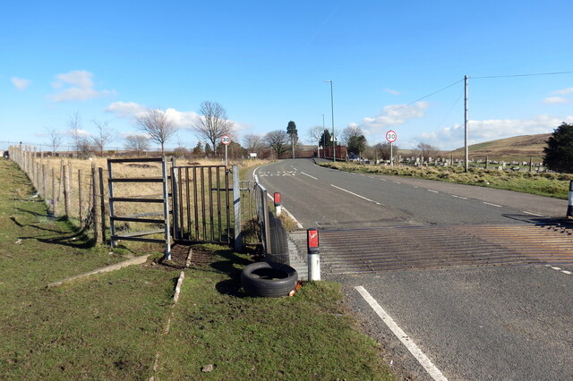
Images are sourced within 2km of 51.753398/-3.2406684 or Grid Reference SO1406. Thanks to Geograph Open Source API. All images are credited.

Grid Gwartheg ar y B4256 / Cattle grid on the B4246 Grid gwartheg ar y B4256 ger Cefn Golau.

A cattle grid on the B4256 near Cefn Golau (trans. light ridge).
Grid Gwartheg ar y B4256 / Cattle grid on the B4246
Grid gwartheg ar y B4256 ger Cefn Golau. A cattle grid on the B4256 near Cefn Golau (trans. light ridge).
Colfen arswydus / Spooky tree Colfen arswydus ei golwg yng Nghladdfa Cefn Golau.

A spooky looking tree at Cefn Golau cemetery (trans. light ridge).
Colfen arswydus / Spooky tree
Colfen arswydus ei golwg yng Nghladdfa Cefn Golau. A spooky looking tree at Cefn Golau cemetery (trans. light ridge).
Pownd Cefn Golau / Cefn Golau Pond Gorlifiad Pownd Cefn Golau.

The overflow of Cefn Golau Pond (trans. light ridge).
Pownd Cefn Golau / Cefn Golau Pond
Gorlifiad Pownd Cefn Golau. The overflow of Cefn Golau Pond (trans. light ridge).
Ar lethrau Mynydd Bedwellte / On the slopes of Mynydd Bedwellte Wal gerrig sych ar lethrau Mynydd Bedwellte.

A dry stone wall on the slopes of Mynydd Bedwellte (trans. mountain of Mellte's abode).
Ar lethrau Mynydd Bedwellte / On the slopes of Mynydd Bedwellte
Wal gerrig sych ar lethrau Mynydd Bedwellte. A dry stone wall on the slopes of Mynydd Bedwellte (trans. mountain of Mellte's abode).
Llwybr i lawr i Dredegar / Path down to Tredegar Llwybr cyhoeddus yn mynd i lawr y waered i gyfeiriad Tredegar.

A public footpath descending towards Tredegar.
Llwybr i lawr i Dredegar / Path down to Tredegar
Llwybr cyhoeddus yn mynd i lawr y waered i gyfeiriad Tredegar. A public footpath descending towards Tredegar.
Carn Stwpa Gweddillion Carn Stwpa, heneb o'r Oes Efydd. Sylwer ar y dde ymylfeini o'r garn wreiddiol.

The remains of Carn Stwpa, a Bronze Age monument. Note on the right surviving kerbstones of the original cairn.
Carn Stwpa
Gweddillion Carn Stwpa, heneb o'r Oes Efydd. Sylwer ar y dde ymylfeini o'r garn wreiddiol. The remains of Carn Stwpa, a Bronze Age monument. Note on the right surviving kerbstones of the original cairn.
Carn Stwpa Gweddillion Carn Stwpa, heneb o'r Oes Efydd. Yn y pellter mae Tredegar.

The remains of Carn Stwpa, a Bronze Age monument. Tredegar can be seen in the distance.
Carn Stwpa
Gweddillion Carn Stwpa, heneb o'r Oes Efydd. Yn y pellter mae Tredegar. The remains of Carn Stwpa, a Bronze Age monument. Tredegar can be seen in the distance.
Mynydd Bedwellte Edrych lan at gopa Mynydd Betwellte.

Looking upwards towards the summit of Mynydd Bedwellte (trans. mountain of Mellte's abode).
Mynydd Bedwellte
Edrych lan at gopa Mynydd Betwellte. Looking upwards towards the summit of Mynydd Bedwellte (trans. mountain of Mellte's abode).
Ystad Cefn Golau / Cefn Golau Estate Ystad Cefn Golau yn ffinio â'r mynydd.

Cefn Golau Estate borders the mountain.
Ystad Cefn Golau / Cefn Golau Estate
Ystad Cefn Golau yn ffinio â'r mynydd. Cefn Golau Estate borders the mountain.
Mynydd Bedwellte Trac ar gefnen Mynydd Bedwellte.

A track on the ridge of Mynydd Bedwellte (trans. mountain of Mellte's abode).
Mynydd Bedwellte
Trac ar gefnen Mynydd Bedwellte. A track on the ridge of Mynydd Bedwellte (trans. mountain of Mellte's abode).
Llwybr ger Cwarau Bedwellte / Path near Bedwellty Quarries Llwybr yn agosau at Gwarau Bedwellte.

A path approaches Bedwellty Quarries.
Llwybr ger Cwarau Bedwellte / Path near Bedwellty Quarries
Llwybr yn agosau at Gwarau Bedwellte. A path approaches Bedwellty Quarries.
Colfen farw / Dead tree Colfen farw yng Nghwarau Bedwellte.

A dead tree at Bedwellty Quarries.
Colfen farw / Dead tree
Colfen farw yng Nghwarau Bedwellte. A dead tree at Bedwellty Quarries.
Agosau at offer weindio / Approaching winding gear Llwybr yn agosau at offer weindio offer sy'n dyddio o oddeutu 1850. Cludai gerrig a glo i lawr yr inclein i'r rheilffordd ym Mhyllau Bedwellte.

A path approaches winding gear which dates c1850. It transported stone and coal down the incline to the railway at Bedwellty Pits.
Agosau at offer weindio / Approaching winding gear
Llwybr yn agosau at offer weindio offer sy'n dyddio o oddeutu 1850. Cludai gerrig a glo i lawr yr inclein i'r rheilffordd ym Mhyllau Bedwellte. A path approaches winding gear which dates c1850. It transported stone and coal down the incline to the railway at Bedwellty Pits.
Offer weindio / Winding gear Offer weindio sy'n dyddio o oddeutu 1850. Cludai gerrig a glo i lawr yr inclein i'r rheilffordd ym Mhyllau Bedwellte.

Winding gear which dates c1850. It transported stone and coal down the incline to the railway at Bedwellty Pits.
Offer weindio / Winding gear
Offer weindio sy'n dyddio o oddeutu 1850. Cludai gerrig a glo i lawr yr inclein i'r rheilffordd ym Mhyllau Bedwellte. Winding gear which dates c1850. It transported stone and coal down the incline to the railway at Bedwellty Pits.
Sticil uwchben yr A4048 / A stile above the A4048 Sticil uwchben yr A4048 ger Pyllau Bedwellte.

A stile above the A4048 near Bedwellty Pits.
Sticil uwchben yr A4048 / A stile above the A4048
Sticil uwchben yr A4048 ger Pyllau Bedwellte. A stile above the A4048 near Bedwellty Pits.
Llwybr i Deras Mafeking / Path to Mafeking Terrace Llwybr cyhoeddus yn mynd i gyfeiriad Teras Mafeking.

A public footpath heading towards Mafeking Terrace.
Llwybr i Deras Mafeking / Path to Mafeking Terrace
Llwybr cyhoeddus yn mynd i gyfeiriad Teras Mafeking. A public footpath heading towards Mafeking Terrace.
Ffordd i gerddwyr / Way for pedestrians Rhan o'r heol wedi ei neilltuo i gerddwyr oherwydd prinder pafin. 

Part of the road designated for pedestrians due to the lack of a pavement.
Ffordd i gerddwyr / Way for pedestrians
Rhan o'r heol wedi ei neilltuo i gerddwyr oherwydd prinder pafin. Part of the road designated for pedestrians due to the lack of a pavement.
Llwybr i Deras Fictoria / Path to Victoria  Terrace Stepiau yn arwain lawr at Deras Fictoria.

Steps leading down to Victoria Terrace.
Llwybr i Deras Fictoria / Path to Victoria Terrace
Stepiau yn arwain lawr at Deras Fictoria. Steps leading down to Victoria Terrace.
Show me another place!

Carn Stwpa is located at Grid Ref: SO1406 (Lat: 51.753398, Lng: -3.2406684)

Unitary Authority: Blaenau Gwent

Police Authority: Gwent

What 3 Words

///prosper.myths.breakaway. Near Tredegar, Blaenau Gwent

Related Wikis

Mynydd Bedwellte

Mynydd Bedwellte is the name given to the broad ridge of high ground between the Rhymney Valley (Welsh: Cwm Rhymni) and the Sirhowy Valley in the Valleys...

Tredegar Town F.C.

Tredegar Town Football Club are a football club based in Tredegar, in Wales. The club plays in the Ardal Leagues South East, the third tier of the Welsh...

Bedwellty Union Workhouse

The Bedwellty Union Workhouse was situated in Georgetown, Tredegar. It is 2.9 miles (4.7 km) from the Nanybwtch Junction A465. The building was in existence...

Georgetown, Blaenau Gwent

Georgetown is a village in the Sirhowy Valley in Blaenau Gwent. It belongs in the ward of Georgetown.It is located 0.59 miles (0.95 km) south of Tredegar...

Nearby Amenities

Located within 500m of 51.753398,-3.2406684
Carn Stwpa
Ele: 457
Name Cy: carn Stwpa
Natural: peak
Lat/Long: 51.753903/-3.2402455
Tourism: viewpoint
Lat/Long: 51.7539204/-3.2402498
The data included in this document is from www.openstreetmap.org. The data is made available under ODbL.

Have you been to Carn Stwpa?

Leave your review of Carn Stwpa below (or comments, questions and feedback).