Bryn Golau

Hill, Mountain in Flintshire

Wales

Bryn Golau

Truck on the A541 DG Roberts' Volvo FM (SA13 DAY) passing a layby on the A541 near to Ysceifiog.
Truck on the A541 Credit: David Dixon

The requested URL returned error: 429 Too Many Requests

If you have any feedback on the listing, please let us know in the comments section below.
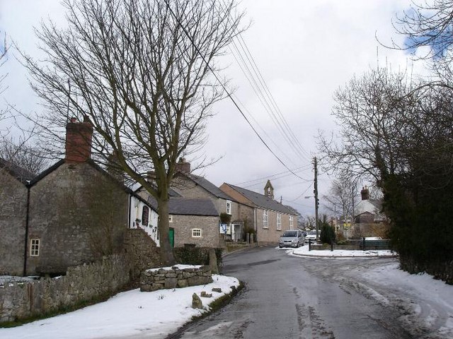
Bryn Golau Images

Images are sourced within 2km of 53.215447/-3.2859267 or Grid Reference SJ1469. Thanks to Geograph Open Source API. All images are credited.

Truck on the A541 DG Roberts' Volvo FM (SA13 DAY) passing a layby on the A541 near to Ysceifiog.
Truck on the A541
DG Roberts' Volvo FM (SA13 DAY) passing a layby on the A541 near to Ysceifiog.
Afonwen, Denbigh Road (A541) The A541 runs for 26 miles, linking St Asaph with Wrexham. Its northern end starts at the crossroads in the middle of the village of Trefnant (just south of St Asaph). It ends at Wrexham, where it joins the B5101 road. On the way, it passes the town of Mold and also passes through many villages.
Afonwen, Denbigh Road (A541)
The A541 runs for 26 miles, linking St Asaph with Wrexham. Its northern end starts at the crossroads in the middle of the village of Trefnant (just south of St Asaph). It ends at Wrexham, where it joins the B5101 road. On the way, it passes the town of Mold and also passes through many villages.
A541 near Swan Wood The A541 runs for 26 miles, linking St Asaph with Wrexham. Its northern end starts at the crossroads in the middle of the village of Trefnant (just south of St Asaph). It ends at Wrexham, where it joins the B5101 road. On the way, it passes the town of Mold and also passes through many villages.
A541 near Swan Wood
The A541 runs for 26 miles, linking St Asaph with Wrexham. Its northern end starts at the crossroads in the middle of the village of Trefnant (just south of St Asaph). It ends at Wrexham, where it joins the B5101 road. On the way, it passes the town of Mold and also passes through many villages.
A541, Melin y Wern The A541 runs for 26 miles, linking St Asaph with Wrexham. Its northern end starts at the crossroads in the middle of the village of Trefnant (just south of St Asaph). It ends at Wrexham, where it joins the B5101 road. On the way, it passes the town of Mold and also passes through many villages.
A541, Melin y Wern
The A541 runs for 26 miles, linking St Asaph with Wrexham. Its northern end starts at the crossroads in the middle of the village of Trefnant (just south of St Asaph). It ends at Wrexham, where it joins the B5101 road. On the way, it passes the town of Mold and also passes through many villages.
Looking down on the Afon Disgynfa Descending northeast below the impressive ramparts of the iron-age hill fort Penycloddiau, one is soon away from the network of paths, though there is a track shown on the OS map some way to the east, dropping down to a public footpath which crosses the valley a considerable distance below. From this point (just inside the square) it is almost a hundred metres vertical back up to the fort, perhaps explaining why it seems to have been so little visited by geograph aficionados!
Looking down on the Afon Disgynfa
Descending northeast below the impressive ramparts of the iron-age hill fort Penycloddiau, one is soon away from the network of paths, though there is a track shown on the OS map some way to the east, dropping down to a public footpath which crosses the valley a considerable distance below. From this point (just inside the square) it is almost a hundred metres vertical back up to the fort, perhaps explaining why it seems to have been so little visited by geograph aficionados!
Windbreak NE of Penycloddiau With a southwesterly wind, this side of Penycloddiau, well below the ramparts of the iron-age hill fort, is fairly sheltered already, but this cruciform windbreak will provide additional protection in virtually any wind direction. Being well off the beaten paths along the tops and round the fort, it's likely to be far more used by livestock than by walkers having lunch, so I'm sure sheep find themselves grateful for having a farmer with enough benevolence to provide such a well-built and maintained structure.
Windbreak NE of Penycloddiau
With a southwesterly wind, this side of Penycloddiau, well below the ramparts of the iron-age hill fort, is fairly sheltered already, but this cruciform windbreak will provide additional protection in virtually any wind direction. Being well off the beaten paths along the tops and round the fort, it's likely to be far more used by livestock than by walkers having lunch, so I'm sure sheep find themselves grateful for having a farmer with enough benevolence to provide such a well-built and maintained structure.
Descending northwards from Penycloddiau On the Offa's Dyke Path. Moel y Parc in the distance.
Descending northwards from Penycloddiau
On the Offa's Dyke Path. Moel y Parc in the distance.
A541 looking east
A541 looking east
A541 near Sarn Farm
A541 near Sarn Farm
Offa's Dyke Path near Nant Coed-y-mynydd Offa's Dyke Path as it heads north, Nant Coed-y-mynydd can be seen just ahead.
Offa's Dyke Path near Nant Coed-y-mynydd
Offa's Dyke Path as it heads north, Nant Coed-y-mynydd can be seen just ahead.
Windswept hawthorns on Bryn Golau The footpath across Bryn Golau provides excellent views of the Clwyd range, including Moel Arthur.
Windswept hawthorns on Bryn Golau
The footpath across Bryn Golau provides excellent views of the Clwyd range, including Moel Arthur.
Llwybr Clawdd Offa / Offa Dykes Path Llwybr hirbell Clawdd Offa yn mynd i gyfeiriad Bodfari. Y bryn yn y pellter yw Moel y Parc.

The long distance Offa's Dyke Path heading in the direction of Bodfari. The hill in the distance is known as Moel y Parc (trans. bare hill of the park/field)
Llwybr Clawdd Offa / Offa Dykes Path
Llwybr hirbell Clawdd Offa yn mynd i gyfeiriad Bodfari. Y bryn yn y pellter yw Moel y Parc. The long distance Offa's Dyke Path heading in the direction of Bodfari. The hill in the distance is known as Moel y Parc (trans. bare hill of the park/field)
Llwybr Clawdd Offa / Offa's Dyke Path Ar lethrau Penycloddiau / On the slopes of Penycloddiau.
Llwybr Clawdd Offa / Offa's Dyke Path
Ar lethrau Penycloddiau / On the slopes of Penycloddiau.
Coed D'Arcis Car sales business near Coed D'Arcis.
Coed D'Arcis
Car sales business near Coed D'Arcis.
Sarn Farm House alongside the A541 near Sarn Farm.
Sarn Farm
House alongside the A541 near Sarn Farm.
Ddol Cottage alongside the A541 at Ddol.
Ddol
Cottage alongside the A541 at Ddol.
Moel-y-parc Track leading up to the transmitter mast at Moel-y-parc <a href="https://www.geograph.org.uk/photo/4675518">SJ1270 : Moel-y-Parc Television Transmitter</a>.
Moel-y-parc
Track leading up to the transmitter mast at Moel-y-parc SJ1270 : Moel-y-Parc Television Transmitter.
Moel-y-Parc transmitter: aerial 2015
Show me another place!

Bryn Golau is located at Grid Ref: SJ1469 (Lat: 53.215447, Lng: -3.2859267)

Unitary Authority: Flintshire

Police Authority: North Wales

What 3 Words

///barbarian.suspended.explores. Near Halkyn, Flintshire

Nearby Locations

Bryn Golau

Related Wikis

Ddol Uchaf

Ddol Uchaf (also known as Y Ddol Uchaf) is a Site of Special Scientific Interest located near Ysceifiog, Flintshire, Wales. It has been selected as an...

Moel-y-Parc transmitting station

The Moel-y-Parc transmitting station is situated on Moel y Parc, a hill in north-east Wales at the northern end of the Clwydian range, close to the town...

Penbedw

Penbedw is a country estate near Nannerch, Flintshire, Wales. Penbedw Hall was demolished by developers some time after 1969.Its parks and gardens are...

Ysceifiog

Ysceifiog, also spelled as Ysgeifiog, is a village, community and parish in Flintshire, Wales. It lies on a back road just north of the A541 highway between...

Nearby Amenities

Located within 500m of 53.215447,-3.2859267
Bryn Golau
Ele: 302
Natural: peak
Wikidata: Q106710042
Lat/Long: 53.2150164/-3.2858818
The data included in this document is from www.openstreetmap.org. The data is made available under ODbL.

Have you been to Bryn Golau?

Leave your review of Bryn Golau below (or comments, questions and feedback).