Brown Knowe

Hill, Mountain in Peeblesshire

Scotland

Brown Knowe

Hunt Law Summit This appears to be the summit of Hunt Law - there's no cairn just this old post and it does appear to be on the highest point. Unusual cloud formation above Fifescar Knowe, with Dollar Law to the left. A lovely day with a bitter NW wind.
Hunt Law Summit Credit: Adam Ward

Brown Knowe is a prominent hill located in Peeblesshire, Scotland. Standing at an elevation of approximately 470 meters (1542 feet), it is part of the picturesque Scottish Borders region. The hill is situated near the village of Eddleston, about 5 kilometers (3 miles) south of the town of Peebles.

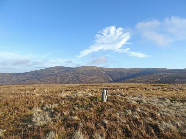
Known for its scenic beauty and commanding views, Brown Knowe is a popular destination for outdoor enthusiasts and hikers. Its accessible location and well-maintained trails make it an ideal spot for both experienced walkers and those new to hillwalking. The hill offers a relatively easy ascent, with a gradual incline leading to the summit, making it suitable for a range of fitness levels.

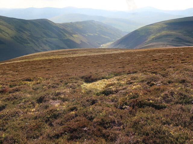
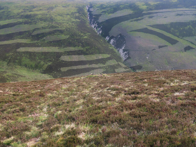
From the top of Brown Knowe, visitors are rewarded with breathtaking panoramic views of the surrounding countryside. On clear days, the vista stretches across rolling hills and lush valleys, with the River Tweed snaking its way through the landscape. The hill also offers a glimpse of the nearby Moorfoot Hills and the iconic Southern Uplands.

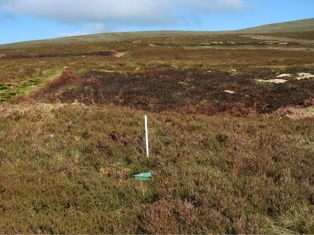
Nature lovers will appreciate the diverse flora and fauna found on Brown Knowe. The hill is home to a variety of plant species, including heather, gorse, and wildflowers, which add vibrant colors to the landscape. It is also a haven for birdwatchers, with sightings of birds of prey such as buzzards and kestrels being common.

Overall, Brown Knowe is a captivating hill in Peeblesshire, offering visitors a chance to immerse themselves in the natural beauty of the Scottish Borders while enjoying a rewarding outdoor experience.

If you have any feedback on the listing, please let us know in the comments section below.

Brown Knowe Images

Images are sourced within 2km of 55.510528/-3.3605623 or Grid Reference NT1424. Thanks to Geograph Open Source API. All images are credited.

Hunt Law Summit This appears to be the summit of Hunt Law - there's no cairn just this old post and it does appear to be on the highest point. Unusual cloud formation above Fifescar Knowe, with Dollar Law to the left. A lovely day with a bitter NW wind.
Hunt Law Summit
This appears to be the summit of Hunt Law - there's no cairn just this old post and it does appear to be on the highest point. Unusual cloud formation above Fifescar Knowe, with Dollar Law to the left. A lovely day with a bitter NW wind.
Frozen Track, Broad Law Nearing the summit of Broad Law on a bitter January day. The track is frozen and unlikely to thaw out any time soon. In the distance you can just see the Donald of Cramalt Crag.
Frozen Track, Broad Law
Nearing the summit of Broad Law on a bitter January day. The track is frozen and unlikely to thaw out any time soon. In the distance you can just see the Donald of Cramalt Crag.
Grouse moorland on Sherraside Rig Between Cramalt Craig and Hunt Law.
Grouse moorland on Sherraside Rig
Between Cramalt Craig and Hunt Law.
Moorland near Hunt Law summit Looking towards the Polmood Burn.
Moorland near Hunt Law summit
Looking towards the Polmood Burn.
Grouse moorland above the Polmood Burn The top of a grouse butt is just visible in the centre of the photo.
Grouse moorland above the Polmood Burn
The top of a grouse butt is just visible in the centre of the photo.
Broad Law from Dollar Law The bulky round top of Broad Law (840m) seen from the trig point on Dollar Law (817m), about 5km away.
Broad Law from Dollar Law
The bulky round top of Broad Law (840m) seen from the trig point on Dollar Law (817m), about 5km away.
Peaty col between Hunt Law and Birkside Law In 2015 the Original Mountain Marathon was held in the Manor Hills.  Great care was taken with the routes to avoid damage to the undissected peat deposits.
Peaty col between Hunt Law and Birkside Law
In 2015 the Original Mountain Marathon was held in the Manor Hills. Great care was taken with the routes to avoid damage to the undissected peat deposits.
Boggy ridge between Hunt Law and Birkside Law The fence has now gone and there is a badly churned up Argo track along the ridge.
Boggy ridge between Hunt Law and Birkside Law
The fence has now gone and there is a badly churned up Argo track along the ridge.
Grouse butts, Hunt Law
Hunt Law summit No fence now.
Hunt Law summit
No fence now.
Road, Hunt Law A road connecting the Polmood Glen with Stanhope Hope.  Cramalt Craig is in the background.
Road, Hunt Law
A road connecting the Polmood Glen with Stanhope Hope. Cramalt Craig is in the background.
All terrain vehicle tracks, Hunt Law
Road, Hunt Law One of the many roads which have recently appeared in the Tweeddale hills.  View towards Dollar Law.
Road, Hunt Law
One of the many roads which have recently appeared in the Tweeddale hills. View towards Dollar Law.
The very boggy col between Cramalt Craig and Hunt Law Fortunately not yet cut up by vehicles. If appears  that the kinder quadbike is the vehicle of choice over Cramalt Craig which unlike Hunt Law is reasonably unscathed.   View towards Cramalt Craig, it is worth noting that the fence shown on many maps has now been taken down.
The very boggy col between Cramalt Craig and Hunt Law
Fortunately not yet cut up by vehicles. If appears that the kinder quadbike is the vehicle of choice over Cramalt Craig which unlike Hunt Law is reasonably unscathed. View towards Cramalt Craig, it is worth noting that the fence shown on many maps has now been taken down.
Foot of Sherraside Rig Looking over peat covered moorland towards Hunt Law. The fence shown here <a href="https://www.geograph.org.uk/photo/16243">NT1525 : Sherraside Rig</a> in 2004 has been demolished. Some of the stobs are lying in the bogs.
Foot of Sherraside Rig
Looking over peat covered moorland towards Hunt Law. The fence shown here NT1525 : Sherraside Rig in 2004 has been demolished. Some of the stobs are lying in the bogs.
Sherraside Rig The west side of Cramalt Craig. No fence now.
Sherraside Rig
The west side of Cramalt Craig. No fence now.
Broad Law View from the Cramalt Craig col at the head of the Polmood Glen. There is a nascent corrie here, a rare excursion into mountain scenery for the area.
Broad Law
View from the Cramalt Craig col at the head of the Polmood Glen. There is a nascent corrie here, a rare excursion into mountain scenery for the area.
Boggy col between Broad Law and Cramalt Craig Rather wet but easier going than it looks.
Boggy col between Broad Law and Cramalt Craig
Rather wet but easier going than it looks.
Show me another place!

Brown Knowe is located at Grid Ref: NT1424 (Lat: 55.510528, Lng: -3.3605623)

Unitary Authority: The Scottish Borders

Police Authority: The Lothians and Scottish Borders

What 3 Words

///steady.visions.shelf. Near Biggar, South Lanarkshire

Nearby Locations

Brown Knowe

Related Wikis

Broad Law

Broad Law is a hill in the Manor Hills range, part of the Southern Uplands of Scotland. The second-highest point in the Southern Uplands and the highest...

Crook Inn

The Crook Inn is an inn in the Scottish Borders, near the village of Tweedsmuir on the A701 road between Broughton and Moffat. It is one of many claimants...

Polmood

Polmood is a small settlement in southern Scotland near Tweedsmuir in the Scottish Borders, in the valley of the River Tweed. Polmood was for many centuries...

Talla Reservoir

Talla Reservoir, located a mile from Tweedsmuir, Scottish Borders, Scotland, is an earth-work dam fed by Talla Water. The reservoir is supplemented by...

Have you been to Brown Knowe?

Leave your review of Brown Knowe below (or comments, questions and feedback).