Flint Hill

Hill, Mountain in Peeblesshire

Scotland

Flint Hill

View from Ladyurd Hill Ladyurd Hill belongs to an obscure category of hills called Donald Deweys. The Deweys were originally drawn up by a Mr Dewey for England and Wales only, then subsequently adopted in Scotland by various hill-list compilers in the early 2000s. The Donald Deweys  are Lowland hills lower than Donalds (which are Lowland hills starting at 610 metres, or 2000 feet, and follow no other real criteria other than being deemed important enough to be on his list by Percy Donald back in 1935) but at least 500 metres high, with a minimum prominence of 30 metres. There are 247 in total - I have yet to hear of anybody having done a 'round' of them.
Where the actual summit is,  is a matter of some debate. The OS map at the 1:25k scale puts it at the Southern end of the fairly long summit plateau, but confuse matters by showing it as being towards the Northern edge of the plateau on their 1:50k scale map.  Near to the Southern 'summit' are two shallow depressions; an 1850s OS map shows these as being at the site of an old whinstone quarry.
Whether the hill takes its name from the old farm below, or vice-versa is unclear. As is the meaning of 'urd', which also appears in other nearby placenames: Netherurd, Kirkurd and Lochurd. Wikipedia references an 1840s book which suggests it might mean quarter, which presumably would be as in 'living quarters', but other than that there is nothing to go on.
View from Ladyurd Hill Credit: Ian Dodds

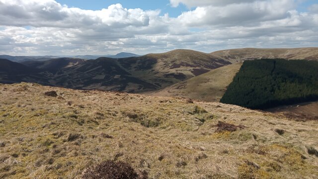
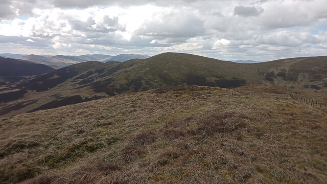
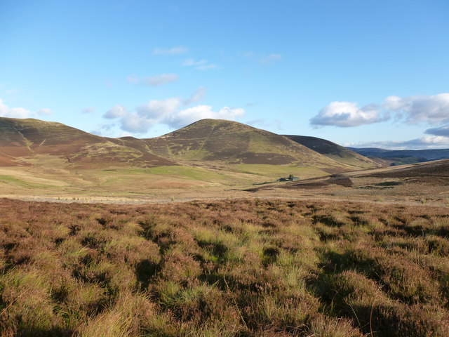
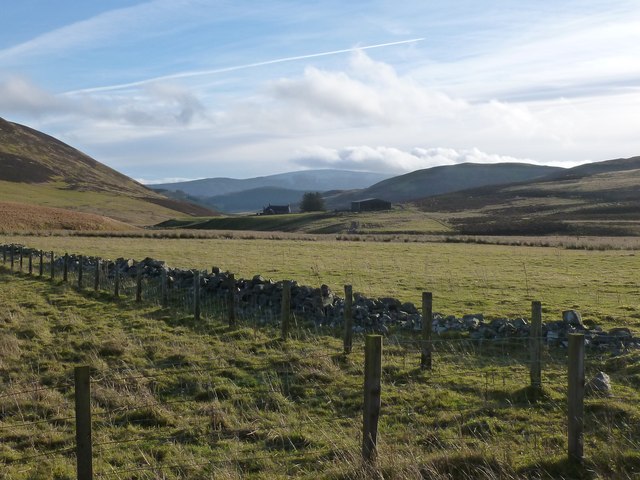
Flint Hill is a prominent hill located in Peeblesshire, Scotland. Situated approximately 3 miles southwest of the town of Innerleithen, it forms part of the stunning landscape of the Scottish Borders region. Rising to an elevation of 383 meters (1256 feet), Flint Hill offers captivating panoramic views of the surrounding countryside.

The hill is known for its distinctive geological features, particularly the presence of flint, which gives it its name. Flint is a hard, sedimentary rock composed of microcrystalline quartz, and its occurrence on the hill has been of great interest to geologists and rock enthusiasts. The flint deposits can be observed in various forms, from small nodules to larger outcrops, providing a fascinating insight into the area's geological history.

Flint Hill is a popular destination for outdoor enthusiasts, hikers, and nature lovers. It boasts a network of well-maintained trails, making it accessible to visitors of all abilities. The paths meander through picturesque woodlands, across open moorland, and up to the summit, rewarding climbers with breathtaking vistas across the rolling hills and valleys below.

In addition to its natural beauty, Flint Hill also holds historical significance. Nearby archaeological sites and ancient ruins indicate human activity in the area dating back thousands of years. These remnants of the past add an intriguing layer of intrigue to the hill, capturing the imagination of those interested in Scotland's rich heritage.

Overall, Flint Hill is a captivating destination offering a blend of natural beauty, geological intrigue, and historical significance. Whether one seeks a challenging hike, a peaceful retreat in nature, or an opportunity to explore Scotland's past, Flint Hill provides a memorable experience for all who visit.

If you have any feedback on the listing, please let us know in the comments section below.

Flint Hill Images

Images are sourced within 2km of 55.653191/-3.371276 or Grid Reference NT1340. Thanks to Geograph Open Source API. All images are credited.

View from Ladyurd Hill Ladyurd Hill belongs to an obscure category of hills called Donald Deweys. The Deweys were originally drawn up by a Mr Dewey for England and Wales only, then subsequently adopted in Scotland by various hill-list compilers in the early 2000s. The Donald Deweys  are Lowland hills lower than Donalds (which are Lowland hills starting at 610 metres, or 2000 feet, and follow no other real criteria other than being deemed important enough to be on his list by Percy Donald back in 1935) but at least 500 metres high, with a minimum prominence of 30 metres. There are 247 in total - I have yet to hear of anybody having done a 'round' of them.
Where the actual summit is,  is a matter of some debate. The OS map at the 1:25k scale puts it at the Southern end of the fairly long summit plateau, but confuse matters by showing it as being towards the Northern edge of the plateau on their 1:50k scale map.  Near to the Southern 'summit' are two shallow depressions; an 1850s OS map shows these as being at the site of an old whinstone quarry.
Whether the hill takes its name from the old farm below, or vice-versa is unclear. As is the meaning of 'urd', which also appears in other nearby placenames: Netherurd, Kirkurd and Lochurd. Wikipedia references an 1840s book which suggests it might mean quarter, which presumably would be as in 'living quarters', but other than that there is nothing to go on.
View from Ladyurd Hill
Ladyurd Hill belongs to an obscure category of hills called Donald Deweys. The Deweys were originally drawn up by a Mr Dewey for England and Wales only, then subsequently adopted in Scotland by various hill-list compilers in the early 2000s. The Donald Deweys are Lowland hills lower than Donalds (which are Lowland hills starting at 610 metres, or 2000 feet, and follow no other real criteria other than being deemed important enough to be on his list by Percy Donald back in 1935) but at least 500 metres high, with a minimum prominence of 30 metres. There are 247 in total - I have yet to hear of anybody having done a 'round' of them. Where the actual summit is, is a matter of some debate. The OS map at the 1:25k scale puts it at the Southern end of the fairly long summit plateau, but confuse matters by showing it as being towards the Northern edge of the plateau on their 1:50k scale map. Near to the Southern 'summit' are two shallow depressions; an 1850s OS map shows these as being at the site of an old whinstone quarry. Whether the hill takes its name from the old farm below, or vice-versa is unclear. As is the meaning of 'urd', which also appears in other nearby placenames: Netherurd, Kirkurd and Lochurd. Wikipedia references an 1840s book which suggests it might mean quarter, which presumably would be as in 'living quarters', but other than that there is nothing to go on.
View from Brown Dod A quirk of the classification of Britain's lesser hills - fun for those who, like me, like these kind of things, but bewildering for most -  is that there is a category of hills referred to as Dodds, which actually get their name due to a fairly boring acronym, and refers to British hills with a height of 500-599 metres with a 30 metre drop, and has absolutely nothing to to do with the words 'Dod' or  'Dodd' which occasionally appear in hill names.
Since my name is Ian Dodds I should probably step up my research into these things. It is generally accepted that'Dodd' and 'Dod' refer to smallish round hills.  Thankfully the internet has become slightly more forgiving about my surname etymology over the last few years. It used to be commonplace to find my family name described online as having derived from the hill name to mean 'small round man', or simply a 'stupid fellow'!
All family tree records on the male side lead to and stay in and around Durham, which is reported as being historically the place where most variations of the Dodds surname came from. I have not done much walking round there, so am not sure how many Dodd/Dod hill-names there are in the Durham area; I just know them from Southern Scotland and the Lake District. Irrespective of this, I think it is fair to say that my surname is based on ancestors having lived close to hilly areas, and has nothing whatsoever with us being dim-witted people!
View from Brown Dod
A quirk of the classification of Britain's lesser hills - fun for those who, like me, like these kind of things, but bewildering for most - is that there is a category of hills referred to as Dodds, which actually get their name due to a fairly boring acronym, and refers to British hills with a height of 500-599 metres with a 30 metre drop, and has absolutely nothing to to do with the words 'Dod' or 'Dodd' which occasionally appear in hill names. Since my name is Ian Dodds I should probably step up my research into these things. It is generally accepted that'Dodd' and 'Dod' refer to smallish round hills. Thankfully the internet has become slightly more forgiving about my surname etymology over the last few years. It used to be commonplace to find my family name described online as having derived from the hill name to mean 'small round man', or simply a 'stupid fellow'! All family tree records on the male side lead to and stay in and around Durham, which is reported as being historically the place where most variations of the Dodds surname came from. I have not done much walking round there, so am not sure how many Dodd/Dod hill-names there are in the Durham area; I just know them from Southern Scotland and the Lake District. Irrespective of this, I think it is fair to say that my surname is based on ancestors having lived close to hilly areas, and has nothing whatsoever with us being dim-witted people!
South ridge of Green Law A fence runs along the ridge, once it was electric, but now is a plain one.
South ridge of Green Law
A fence runs along the ridge, once it was electric, but now is a plain one.
Summit, Pyked Stane Hill A somewhat battered triangulation pillar at the highest point of the Broughton Heights. There is a suggestion that a lot of triangulation pillars in the Lanark area were built with inferior concrete and many of them are badly damaged or worse. Perhaps they used similar materials to the roads?
Summit, Pyked Stane Hill
A somewhat battered triangulation pillar at the highest point of the Broughton Heights. There is a suggestion that a lot of triangulation pillars in the Lanark area were built with inferior concrete and many of them are badly damaged or worse. Perhaps they used similar materials to the roads?
Broughton Heights triangulation pillar Crumbling concrete, many pillars near Lanark suffer from damage and it is believed that poor quality concrete was used.
Broughton Heights triangulation pillar
Crumbling concrete, many pillars near Lanark suffer from damage and it is believed that poor quality concrete was used.
Broughton Heights
Broughton Heights
North Ridge, Green Law
Broughton Heights: Broomy Side from Green Law
Green Law The quad bike track makes for easy walking here.
Green Law
The quad bike track makes for easy walking here.
Col between Green Law and Pyked Stane Hill Fence line and quad bike track running (almost) in parallel.
Col between Green Law and Pyked Stane Hill
Fence line and quad bike track running (almost) in parallel.
Approaching the summit of Pyked Stane Hill A fairly gentle gradient in the rolling Broughton Heights.
Approaching the summit of Pyked Stane Hill
A fairly gentle gradient in the rolling Broughton Heights.
Rough grazing on Pyked Stane Hill A few slight traces of snow could be found amongst the grassy tussocks on a colder than average October day.
Rough grazing on Pyked Stane Hill
A few slight traces of snow could be found amongst the grassy tussocks on a colder than average October day.
Sheep grazing near the top of Pyked Stane Hill A bit boggy here with some traces of snow amongst the grass but they seemed happy enough!
Sheep grazing near the top of Pyked Stane Hill
A bit boggy here with some traces of snow amongst the grass but they seemed happy enough!
Frozen Pool near summit of Pyked Stane Hill Pyked Stane Hill apparently takes its name from the cairn shown on the map (with 'pyked stane' referring to a peaked stone or pile of stones).
Frozen Pool near summit of Pyked Stane Hill
Pyked Stane Hill apparently takes its name from the cairn shown on the map (with 'pyked stane' referring to a peaked stone or pile of stones).
Penvalla and the farm of Stobo Hopehead A remote sheep farm high on the moor between Broughton and Stobo.
Penvalla and the farm of Stobo Hopehead
A remote sheep farm high on the moor between Broughton and Stobo.
Pyked Stane Hill Looking towards Green Law and Hammer Head.
Pyked Stane Hill
Looking towards Green Law and Hammer Head.
Wether Law The valley of Black Grain lies in shadow, with a slight dusting of snow on Pyked Stane Hill and Wether Law.
Wether Law
The valley of Black Grain lies in shadow, with a slight dusting of snow on Pyked Stane Hill and Wether Law.
Enclosure near Stobo Hopehead Looking towards a distant Pykestone Hill.
Enclosure near Stobo Hopehead
Looking towards a distant Pykestone Hill.
Show me another place!

Flint Hill is located at Grid Ref: NT1340 (Lat: 55.653191, Lng: -3.371276)

Unitary Authority: The Scottish Borders

Police Authority: The Lothians and Scottish Borders

What 3 Words

///impresses.scowls.hops. Near Biggar, South Lanarkshire

Nearby Locations

Flint Hill

Related Wikis

Tarth Water

The Tarth Water is a river in Peebleshire, in the Scottish Borders. It forms part of the River Tweed system. The river with a total length of 7.1 miles...

Castle Craig Hospital

Castle Craig Hospital is a private residential drug and alcohol rehabilitation clinic. It is located in Peeblesshire, Scotland. Castle Craig is an 18th...

Drochil Castle

Drochil Castle is a ruined castle in the Scottish Borders. It is located above the Lyne Water, 10 kilometres (6.2 mi) north-west of Peebles, and 8 kilometres...

Kirkurd

Kirkurd is a parish in Peeblesshire in the Scottish Borders situated 3 miles south-east of Dolphinton and 6 miles north-east of Broughton. Tarth Water...

Nearby Amenities

Located within 500m of 55.653191,-3.371276
Flint Hill
Corbett: no
Donald: no
Ele: 532
Graham: no
Munro: no
Natural: peak
Lat/Long: 55.6538342/-3.3713132
Bench
Lat/Long: 55.6545746/-3.372438
The data included in this document is from www.openstreetmap.org. The data is made available under ODbL.

Have you been to Flint Hill?

Leave your review of Flint Hill below (or comments, questions and feedback).