Dreva Hill

Hill, Mountain in Peeblesshire

Scotland

Dreva Hill

Fence junction on Trahenna Hill Modern fencing cutting across an old drystane dyke in the Broughton Heights.
Fence junction on Trahenna Hill Credit: Alan O'Dowd

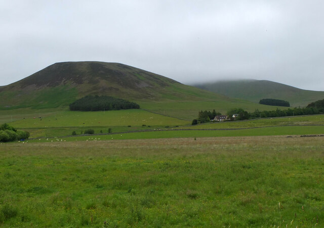
Dreva Hill is a prominent landmark located in Peeblesshire, a historic county in the southern region of Scotland. Rising to an elevation of approximately 486 meters (1594 feet), it is classified as a hill rather than a mountain. Despite its relatively modest height, Dreva Hill offers commanding views of the surrounding countryside and is a popular destination for hikers and outdoor enthusiasts.

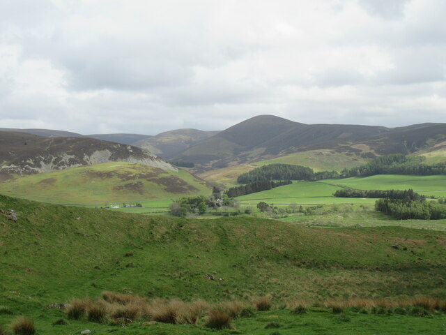
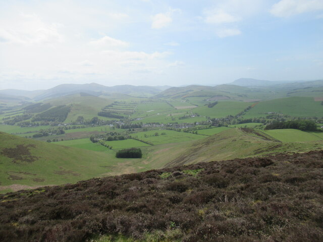
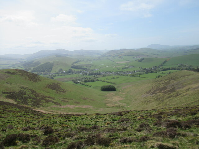
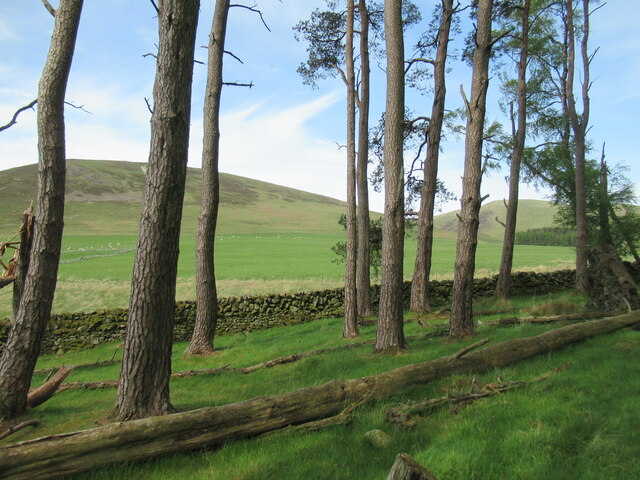
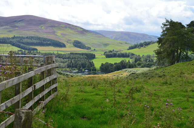
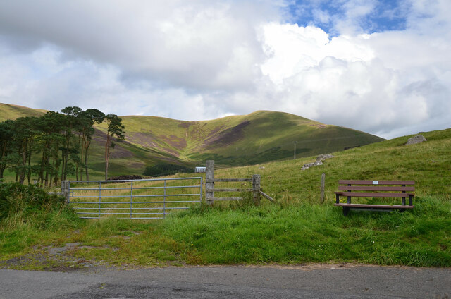
Situated within the scenic Tweed Valley, Dreva Hill is characterized by its gently sloping sides and grassy terrain. The hill is primarily composed of sedimentary rocks, with layers of sandstone and shale visible along its slopes. The summit is adorned with a trig point, providing a reference point for surveying and mapping purposes.

The hill is covered in patches of heather, bracken, and grasses, creating a rich habitat for various flora and fauna. Visitors to Dreva Hill may encounter a variety of bird species, including skylarks, wheatears, and peregrine falcons. The surrounding area is also home to mammals such as red squirrels and roe deer.

Access to Dreva Hill is facilitated by a network of footpaths and trails, making it easily accessible to walkers of different abilities. The most popular route starts from the village of Broughton, which lies to the northeast of the hill. From there, a well-marked path leads up the hillside, offering stunning views of the surrounding rolling hills and the distant Southern Uplands.

In conclusion, Dreva Hill is a picturesque and accessible hill in Peeblesshire, Scotland. Its modest height, scenic beauty, and varied wildlife make it a favored destination for nature lovers and outdoor enthusiasts alike.

If you have any feedback on the listing, please let us know in the comments section below.
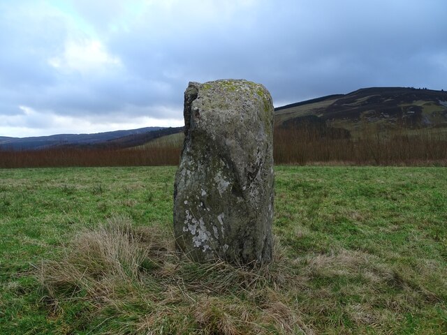
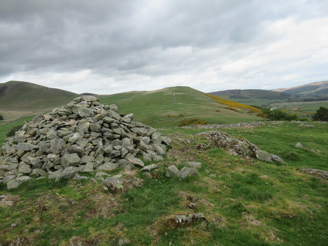
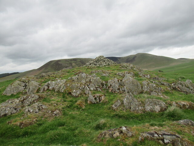
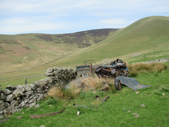
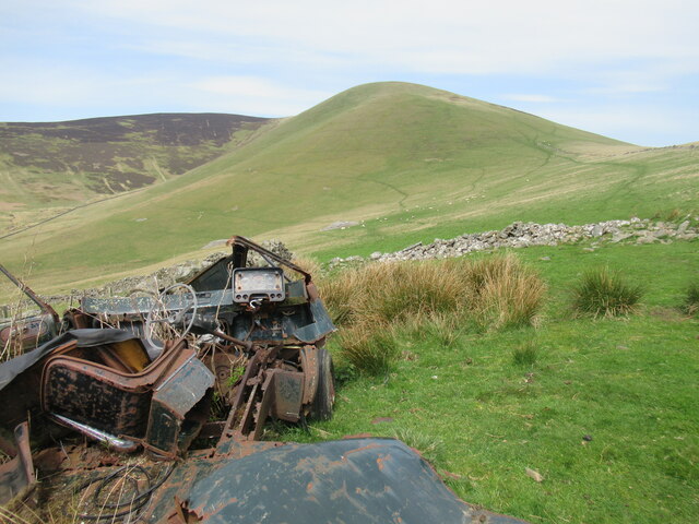
Dreva Hill Images

Images are sourced within 2km of 55.609316/-3.3740464 or Grid Reference NT1335. Thanks to Geograph Open Source API. All images are credited.

Fence junction on Trahenna Hill Modern fencing cutting across an old drystane dyke in the Broughton Heights.
Fence junction on Trahenna Hill
Modern fencing cutting across an old drystane dyke in the Broughton Heights.
Undulating moorland on Trahenna Hill Low winter sunlight on the Broughton Heights, in the north-western corner of the Scottish Borders.
Undulating moorland on Trahenna Hill
Low winter sunlight on the Broughton Heights, in the north-western corner of the Scottish Borders.
Drumelzier Standing Stone The standing stone near Drumelzier.
Photo taken on the 2nd January 2022.
Drumelzier Standing Stone
The standing stone near Drumelzier. Photo taken on the 2nd January 2022.
View towards Drumelzier Law from Dreva Craig Drumelzier Law rises above low-lying farmland by the River Tweed.
View towards Drumelzier Law from Dreva Craig
Drumelzier Law rises above low-lying farmland by the River Tweed.
Cairn at Dreva Craig Dreva Craig has the extensive remnants of a prehistoric fort, settlement and protective structures.  For more information see <span class="nowrap"><a title="https://canmore.org.uk/site/49881/dreva-craig" rel="nofollow ugc noopener" href="https://canmore.org.uk/site/49881/dreva-craig">Link</a><img style="margin-left:2px;" alt="External link" title="External link - shift click to open in new window" src="https://s1.geograph.org.uk/img/external.png" width="10" height="10"/></span>
Cairn at Dreva Craig
Dreva Craig has the extensive remnants of a prehistoric fort, settlement and protective structures. For more information see LinkExternal link
Dreva Craig Dreva Craig is the site of a prehistoric fort, settlement and defences. For more information, see <span class="nowrap"><a title="https://canmore.org.uk/site/49881/dreva-craig" rel="nofollow ugc noopener" href="https://canmore.org.uk/site/49881/dreva-craig">Link</a><img style="margin-left:2px;" alt="External link" title="External link - shift click to open in new window" src="https://s1.geograph.org.uk/img/external.png" width="10" height="10"/></span>
Dreva Craig
Dreva Craig is the site of a prehistoric fort, settlement and defences. For more information, see LinkExternal link
Trahenna Hill viewed from hillside above Dreva Hope Part of the Broughton Heights group of hills, Trahenna Hill rises to 549 metres above sea level.
Trahenna Hill viewed from hillside above Dreva Hope
Part of the Broughton Heights group of hills, Trahenna Hill rises to 549 metres above sea level.
Remains of a van below Trahenna Hill The old Bedford van/shed photographed by Richard Webb in 2005 (<a href="https://www.geograph.org.uk/photo/44843">NT1336 : Old van, Dreva</a>) has now completely fallen apart, leaving something of an eyesore.
Remains of a van below Trahenna Hill
The old Bedford van/shed photographed by Richard Webb in 2005 (NT1336 : Old van, Dreva) has now completely fallen apart, leaving something of an eyesore.
Remains of a van below Trahenna Hill The old Bedford van/shed photographed by Richard Webb in 2005 (<a href="https://www.geograph.org.uk/photo/44843">NT1336 : Old van, Dreva</a>) has now completely fallen apart, leaving something of an eyesore.

And all with only 80,000-odd miles on the clock – although it may have gone round the clock more than once.
Remains of a van below Trahenna Hill
The old Bedford van/shed photographed by Richard Webb in 2005 (NT1336 : Old van, Dreva) has now completely fallen apart, leaving something of an eyesore. And all with only 80,000-odd miles on the clock – although it may have gone round the clock more than once.
Near the summit of Trahenna Hill Looking across towards Hammer Head in the Broughton Heights.
Near the summit of Trahenna Hill
Looking across towards Hammer Head in the Broughton Heights.
Hazy view from Cat Cleuch Head A view towards Broughton on a bright but hazy mid-May afternoon.
Hazy view from Cat Cleuch Head
A view towards Broughton on a bright but hazy mid-May afternoon.
Looking into Cat Cleuch The upper part of the Ratchill Burn, which flows through this wide bowl between Ratchill Hill, on the left, and Cat Cleuch Head, on the right.

Photographed on bright but hazy afternoon in mid May.
Looking into Cat Cleuch
The upper part of the Ratchill Burn, which flows through this wide bowl between Ratchill Hill, on the left, and Cat Cleuch Head, on the right. Photographed on bright but hazy afternoon in mid May.
Small woodland of Scots pines, Dreva Muirburn Ratchill Hill and the Mere Cleuch are visible beyond the trees.
Small woodland of Scots pines, Dreva Muirburn
Ratchill Hill and the Mere Cleuch are visible beyond the trees.
Ratchill Hill with cloud beyond Ratchill Hill (about 420m) is clear but cloud base is below the higher ground of Cat Cleuch Head and Trahenna Hill.
Ratchill Hill with cloud beyond
Ratchill Hill (about 420m) is clear but cloud base is below the higher ground of Cat Cleuch Head and Trahenna Hill.
Course of the Muir Burn The burn is out of sight, surrounded by the creamy flowers of meadowsweet.
Course of the Muir Burn
The burn is out of sight, surrounded by the creamy flowers of meadowsweet.
Farmland south of Broughton Looking from the Dreva road towards Glen Holm. The cottages at Nether Whitslade on the A701 are R of centre.
Farmland south of Broughton
Looking from the Dreva road towards Glen Holm. The cottages at Nether Whitslade on the A701 are R of centre.
From the summit of the Dreva road Looking over Rachan Home Farm to the heathery upper slopes of Logan Head.
From the summit of the Dreva road
Looking over Rachan Home Farm to the heathery upper slopes of Logan Head.
Summit of the Dreva road The road reaches 260m as it crosses the ridge of Dreva Hill. Trahenna Hill is in the background.
Summit of the Dreva road
The road reaches 260m as it crosses the ridge of Dreva Hill. Trahenna Hill is in the background.
Show me another place!

Dreva Hill is located at Grid Ref: NT1335 (Lat: 55.609316, Lng: -3.3740464)

Unitary Authority: The Scottish Borders

Police Authority: The Lothians and Scottish Borders

What 3 Words

///denim.completed.begin. Near Biggar, South Lanarkshire

Related Wikis

Dreva on Tweed

Dreva on Tweed (or simply Dreva) is a hamlet in the Scottish Borders. It was historically in Peebles-shire. It is noted for the historical presence of...

Biggar Water

Biggar Water is a river in Lanarkshire and Peeblesshire, in the Southern Uplands of Scotland. It forms part of the River Tweed system. It rises, as Biggar...

Drumelzier

Drumelzier (), is a village and civil parish on the B712 in the Tweed Valley in the Scottish Borders. The area of the village is extensive and includes...

Holms Water

The Holms Water is a river and a tributary of the Biggar Water, which is a tributary of the River Tweed, in the parish of Broughton, Glenholm and Kilbucho...

Nearby Amenities

Located within 500m of 55.609316,-3.3740464
Passing Place
Lat/Long: 55.6066838/-3.3713161
Passing Place
Lat/Long: 55.6081694/-3.3682551
Give Way
Lat/Long: 55.6057361/-3.3737207
Power: pole
Lat/Long: 55.6059617/-3.3700614
Power: pole
Lat/Long: 55.606595/-3.3709604
Power: pole
Lat/Long: 55.6072079/-3.3718827
Power: pole
Lat/Long: 55.6089417/-3.367542
Power: pole
Lat/Long: 55.6084864/-3.3680941
Power: pole
Lat/Long: 55.6080312/-3.3686272
Power: pole
Lat/Long: 55.6077074/-3.3699218
Power: pole
Lat/Long: 55.6073657/-3.3713009
Power: pole
Lat/Long: 55.6069044/-3.373154
Power: pole
Lat/Long: 55.6066141/-3.3743237
Power: pole
Lat/Long: 55.606301/-3.3755781
Power: pole
Lat/Long: 55.6059987/-3.3767944
Power: pole
Lat/Long: 55.6059868/-3.3782371
Power: pole
Lat/Long: 55.6054216/-3.3766612
Passing Place
Lat/Long: 55.6054202/-3.3754126
The data included in this document is from www.openstreetmap.org. The data is made available under ODbL.

Have you been to Dreva Hill?

Leave your review of Dreva Hill below (or comments, questions and feedback).