Caw Fell
Hill, Mountain in Cumberland Copeland
England
Caw Fell

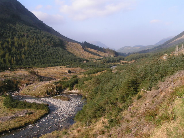
Caw Fell is a prominent hill located in the county of Cumberland in northwest England. Sitting within the scenic Lake District National Park, it forms part of the larger range of fells known as the Western Fells. Caw Fell stands at an elevation of 697 meters (2,287 feet) above sea level, making it a popular destination for hikers and outdoor enthusiasts seeking breathtaking views of the surrounding landscape.
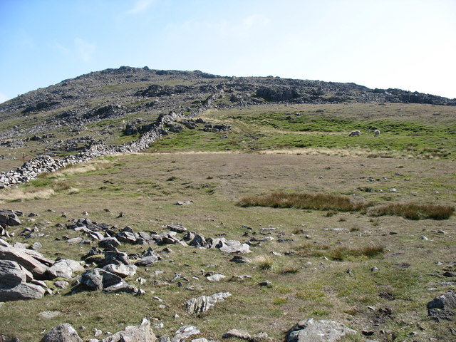
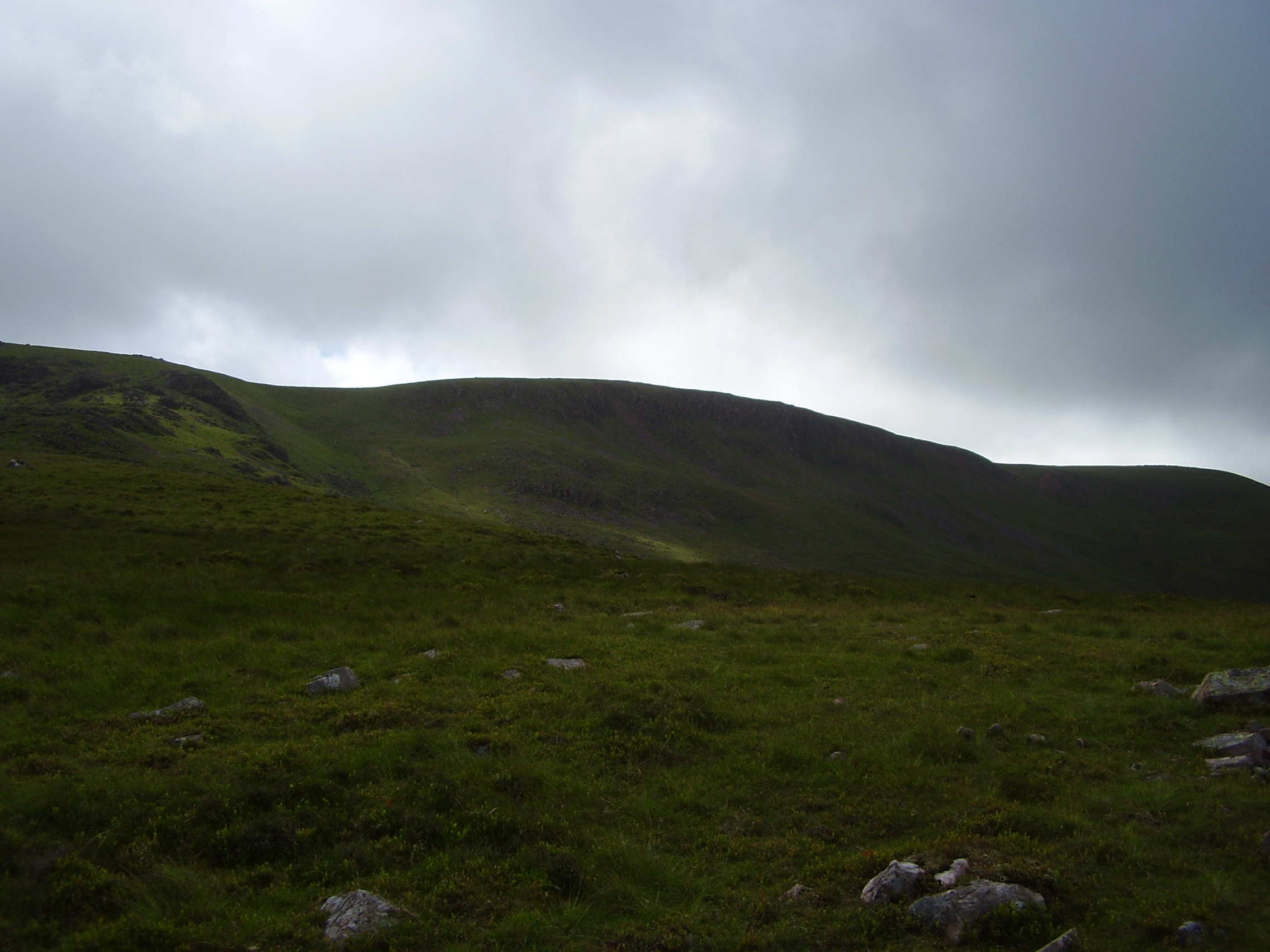
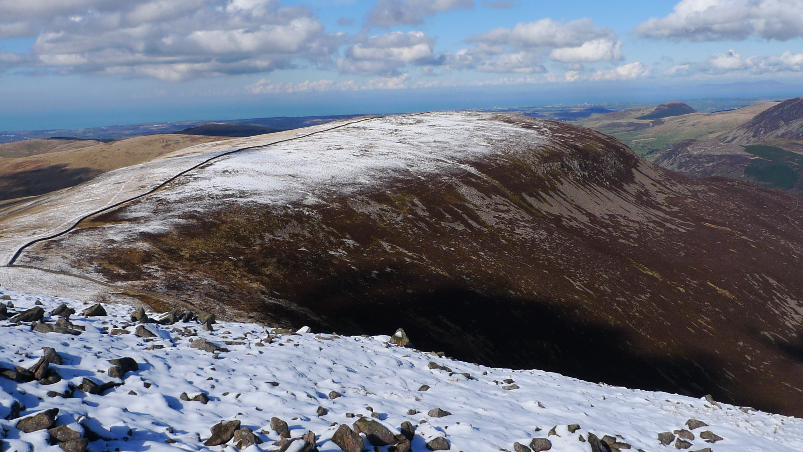
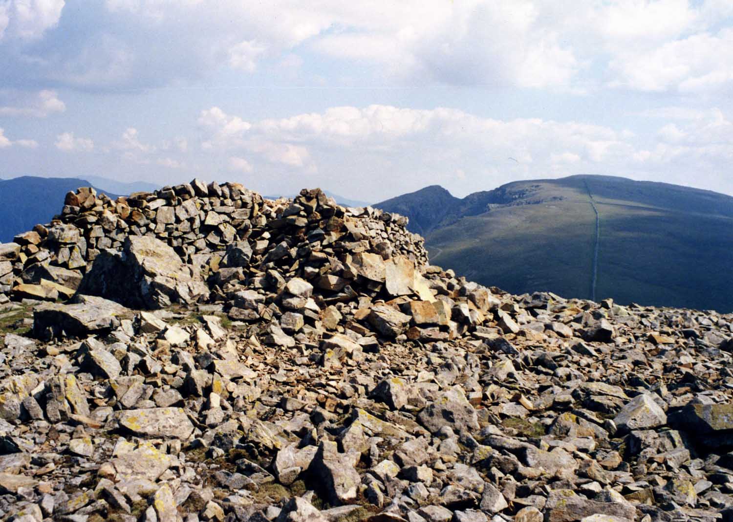
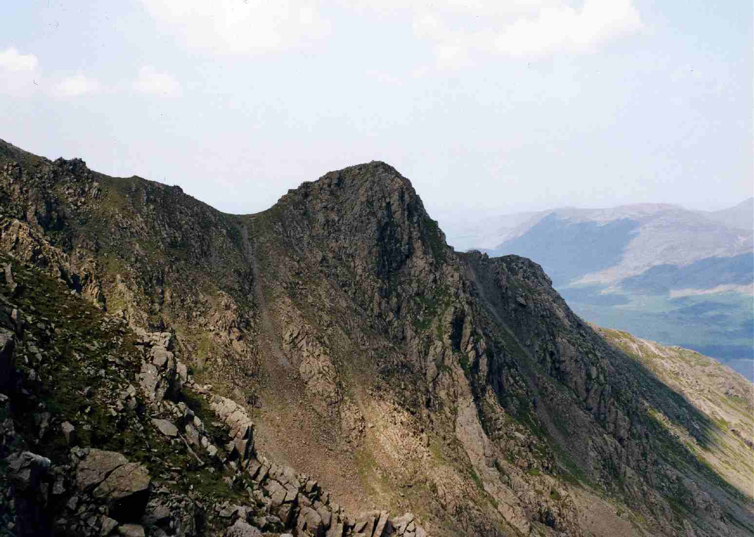
The hill is characterized by its rugged and rocky terrain, with steep slopes and craggy outcrops. Its summit is marked by a cairn, providing a notable landmark for those reaching the top. From this vantage point, visitors are treated to panoramic views of the nearby Ennerdale Valley, the Sellafield nuclear power station, and the Irish Sea to the west. On clear days, it is even possible to see the Isle of Man on the horizon.
Access to Caw Fell is primarily via the neighboring fells of Haycock and Iron Crag, with various walking routes available to suit different skill levels. As part of the Lake District National Park, the area surrounding Caw Fell is rich in biodiversity, offering opportunities for wildlife spotting and nature photography.
Whether taking on the challenge of its steep ascent or simply enjoying a leisurely stroll through the picturesque countryside, Caw Fell offers visitors a chance to immerse themselves in the natural beauty of the Lake District.
If you have any feedback on the listing, please let us know in the comments section below.
Caw Fell Images
Images are sourced within 2km of 54.486246/-3.342443 or Grid Reference NY1310. Thanks to Geograph Open Source API. All images are credited.


Caw Fell is located at Grid Ref: NY1310 (Lat: 54.486246, Lng: -3.342443)
Administrative County: Cumbria
District: Copeland
Police Authority: Cumbria
What 3 Words
///oval.boater.worldwide. Near Frizington, Cumbria
Nearby Locations
Related Wikis
Caw Fell
Caw Fell is a fell in the English Lake District, standing between Haycock the Lank Rigg group. It occupies a wide upland area with Ennerdale to the north...

Pillar and Ennerdale Fells
Pillar and Ennerdale Fells is a Site of Special Scientific Interest (SSSI) in Ennerdale, Cumbria, England. Protected for its biological interest, the site...
Iron Crag
Iron Crag is a mountain in the English Lake District, standing between Crag Fell and Caw Fell. The name of the fell is the source of some confusion, as...
Haycock (Lake District)
Haycock is a mountain in the western part of the English Lake District. It rises between Scoat Fell and Caw Fell to the south of Ennerdale and the north...
River Liza
The River Liza flows through Ennerdale, a glacial valley in Cumbria, England. The river is allowed to flow freely as part of a rewilding project. The...

Seatallan
Seatallan is a mountain in the western part of the English Lake District. It is rounded, grassy and fairly unassuming, occupying a large amount of land...
Steeple (Lake District)
Steeple is a fell in the English Lake District. It is situated in the mountainous area between Ennerdale and Wasdale and reaches a height of 819 metres...

Scoat Fell
Scoat Fell is a fell in the western part of the English Lake District. It stands at the head of the Mosedale Horseshoe with its back to Ennerdale. Paths...
Nearby Amenities
Located within 500m of 54.486246,-3.342443Have you been to Caw Fell?
Leave your review of Caw Fell below (or comments, questions and feedback).