Rhos Fawr Hill
Hill, Mountain in Montgomeryshire
Wales
Rhos Fawr Hill

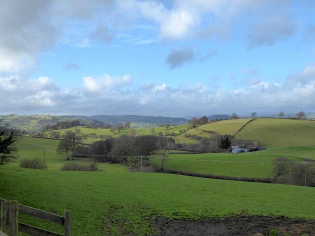
Rhos Fawr Hill is a prominent hill located in Montgomeryshire, Wales. It is part of the Cambrian Mountains range and sits at an elevation of approximately 495 meters (1,624 feet) above sea level. The hill is situated near the village of Llanbrynmair and offers stunning panoramic views of the surrounding countryside.
Rhos Fawr Hill is characterized by its gentle slopes and verdant landscapes. The hill is covered in rich grasslands, which provide excellent grazing opportunities for livestock. It is also home to a diverse range of flora and fauna, making it an attractive spot for nature enthusiasts and hikers.
The hill is easily accessible by foot, and there are several footpaths and trails that wind their way up to its summit. As one ascends, the views become increasingly breathtaking, with sweeping vistas of the Montgomeryshire countryside and nearby mountains.
Rhos Fawr Hill holds historical significance as well. The remains of ancient settlements and stone structures can be found scattered across the hill, indicating human habitation in the area dating back centuries. These remnants offer a glimpse into the region's past and add an intriguing aspect to the hill's appeal.
Overall, Rhos Fawr Hill is a picturesque and tranquil location that showcases the natural beauty of Montgomeryshire. Whether it is for a leisurely stroll, a challenging hike, or a moment of serene contemplation, this hill provides an ideal setting for anyone looking to connect with nature and immerse themselves in the stunning Welsh countryside.
If you have any feedback on the listing, please let us know in the comments section below.
Rhos Fawr Hill Images
Images are sourced within 2km of 52.633394/-3.2918849 or Grid Reference SJ1204. Thanks to Geograph Open Source API. All images are credited.


Rhos Fawr Hill is located at Grid Ref: SJ1204 (Lat: 52.633394, Lng: -3.2918849)
Unitary Authority: Powys
Police Authority: Dyfed Powys
What 3 Words
///belief.hacksaw.january. Near Llanfair Caereinion, Powys
Nearby Locations
Related Wikis

Hen Llys
Hen Llys (or Henllys Hall) is a house in Manafon, Powys, Wales. It is a Grade II listed building. In his biography of John Douglas, Edward Hubbard attributes...
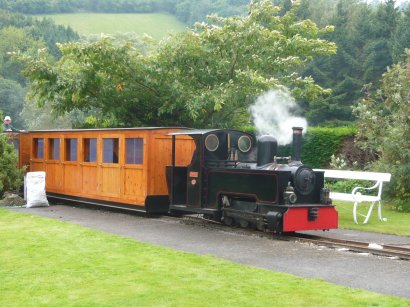
Rhiw Valley Light Railway
The Rhiw Valley Light Railway was a 15 in (381 mm) gauge railway located near to the village of Berriew in Powys, Wales. It closed on 2 October 2022....
St Michael's Church, Manafon
St Michael's Church is in the small village of Manafon, Powys, Wales. It is an active Anglican church in the parish of Llanfair Caereinion, Llanllugan...
Llanfair United F.C.
Llanfair United are an amateur football team who are from Llanfair Caereinion, Powys, Wales. They play in the Ardal Leagues North East whilst their reserve...
Nearby Amenities
Located within 500m of 52.633394,-3.2918849Have you been to Rhos Fawr Hill?
Leave your review of Rhos Fawr Hill below (or comments, questions and feedback).