Bald Hill

Hill, Mountain in Devon East Devon

England

Bald Hill

Boundary Stone, Holloway Head Cross Marking the boundaries of Sidmouth to the South, Sidbury (East) and Ottery St Mary (West). It also has a rivet benchmark on top, representing 219.0 m ASL. See also <a title="https://www.geograph.org.uk/photo/6434734" href="https://www.geograph.org.uk/photo/6434734">Link</a>.

Inscription: S / D // U / O // ?

Milestone Society National ID: DV_SDUC01pb
Boundary Stone, Holloway Head Cross Credit: Tamar Lesley

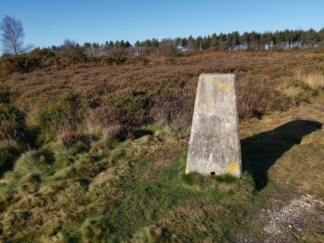
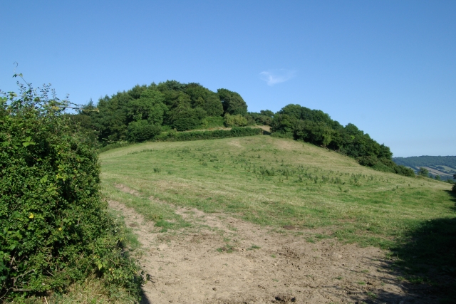
Bald Hill is a prominent landmark located in the county of Devon, England. Situated in the southwestern part of the county, it is classified as a hill rather than a mountain due to its elevation, reaching a peak height of approximately 387 meters (1,270 feet) above sea level. This makes it one of the highest points in the region.

The name "Bald Hill" is derived from the bare and exposed appearance of the hilltop, lacking significant vegetation or tree cover. As a result, the summit offers panoramic views of the surrounding countryside, making it a popular destination for hikers, nature enthusiasts, and photographers.

The terrain of Bald Hill is primarily comprised of grassy slopes, with some rocky outcrops scattered across the landscape. It is situated within an area of outstanding natural beauty, with rolling green hills, picturesque valleys, and charming rural villages in close proximity.

The hill is easily accessible by foot, with several marked trails leading to the summit. Visitors can enjoy a pleasant walk through the countryside, taking in the natural beauty and enjoying the peaceful atmosphere. On a clear day, the view from the top offers glimpses of the nearby coastline, adding to the visual appeal and sense of awe.

Bald Hill is not only a recreational destination but also holds historical significance. It has been used as a vantage point for centuries, providing strategic viewpoints during conflicts and serving as a lookout during various periods of history.

Overall, Bald Hill in Devon offers a unique blend of natural beauty, historical significance, and recreational opportunities, making it an exceptional destination for those seeking to explore the region's diverse landscape.

If you have any feedback on the listing, please let us know in the comments section below.

Bald Hill Images

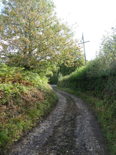
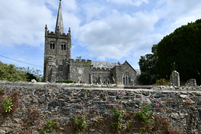
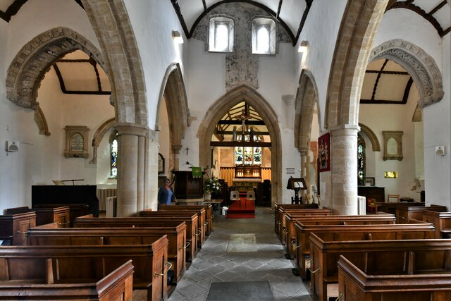
Images are sourced within 2km of 50.722685/-3.2401582 or Grid Reference SY1292. Thanks to Geograph Open Source API. All images are credited.

Boundary Stone, Holloway Head Cross Marking the boundaries of Sidmouth to the South, Sidbury (East) and Ottery St Mary (West). It also has a rivet benchmark on top, representing 219.0 m ASL. See also <a title="https://www.geograph.org.uk/photo/6434734" href="https://www.geograph.org.uk/photo/6434734">Link</a>.

Inscription: S / D // U / O // ?

Milestone Society National ID: DV_SDUC01pb
Boundary Stone, Holloway Head Cross
Marking the boundaries of Sidmouth to the South, Sidbury (East) and Ottery St Mary (West). It also has a rivet benchmark on top, representing 219.0 m ASL. See also Link. Inscription: S / D // U / O // ? Milestone Society National ID: DV_SDUC01pb
Footpath (sunken lane) on west side of Fire Beacon
Lane east of Coombe
Lane east of Coombe
Heathland Ride A view of a wide heathland ride on Harpford Common at the top of Beacon Hill in Devon.
Heathland Ride
A view of a wide heathland ride on Harpford Common at the top of Beacon Hill in Devon.
Trig Point on Harpford Common The trig point on Harpford Common on the top of Beacon Hill in Devon.
Trig Point on Harpford Common
The trig point on Harpford Common on the top of Beacon Hill in Devon.
Heathland Track lknlk
Heathland Track
lknlk
Sidbury, St. Giles' Church: Vaulted south porch with large boss
Sidbury, St. Giles' Church: Southern aspect
Sidbury, St. Giles' Church: Two enbattled stair turrets and basically Norman tower The top of the tower and spire were rebuilt in 1884.
Sidbury, St. Giles' Church: Two enbattled stair turrets and basically Norman tower
The top of the tower and spire were rebuilt in 1884.
Sidbury, St. Giles' Church: Norman nave with Early English chancel arch and transepts
Sidbury, St. Giles' Church: West gallery (1620) extended for the organ (1754)
Sidbury, St. Giles' Church: Norman chancel with Victorian east window rebuild
Sidbury, St. Giles' Church: Norman nave
Sidbury, St. Giles' Church: Kempe window, St. Thaddeus and St. Simon
Sidbury, St. Giles' Church: Kempe window, St. Jacob and St. Simon
Sidbury, St. Giles' Church: East window, 'The Transfiguration' designed by Cave 1913
Sidbury, St. Giles' Church: The Frances Fellowes memorial on the chancel east wall
Sidbury, St. Giles' Church: The Alice Cheek memorial on the chancel east wall
Show me another place!

Bald Hill is located at Grid Ref: SY1292 (Lat: 50.722685, Lng: -3.2401582)

Administrative County: Devon

District: East Devon

Police Authority: Devon and Cornwall

What 3 Words

///poppy.influence.forwarded. Near Sidmouth, Devon

Nearby Locations

Bald Hill

Related Wikis

Sidbury Manor

Sidbury Manor is a privately owned 19th-century country mansion situated at Sidbury, Sidmouth, East Devon. It is a Grade II listed building. Built in 1879...

Sidbury Castle

Sidbury Castle is a substantial Iron Age hill fort near Sidbury in Devon, England. It occupies a large hilltop overlooking the town and the River Sid at...

Sidbury

Sidbury is a large village and former civil parish north of Sidmouth, now in the parish of Sidmouth, in the East Devon district, in the county of Devon...

Sidford

Sidford is a small village in the civil parish of and on the outskirts of the town of Sidmouth in the English county of Devon. It has a population of just...

Nearby Amenities

Located within 500m of 50.722685,-3.2401582
Bald Hill
Natural: peak
Lat/Long: 50.7226112/-3.240085
Power: pole
Source: bing
Lat/Long: 50.7224509/-3.2333413
Power: pole
Source: bing
Lat/Long: 50.7222318/-3.2336819
Power: pole
Source: bing
Lat/Long: 50.7214754/-3.234551
Power: pole
Source: bing
Lat/Long: 50.7207825/-3.2353663
Power: pole
Source: bing
Transformer: distribution
Lat/Long: 50.7194359/-3.2369086
Power: pole
Source: bing
Lat/Long: 50.7202052/-3.2360342
The data included in this document is from www.openstreetmap.org. The data is made available under ODbL.

Have you been to Bald Hill?

Leave your review of Bald Hill below (or comments, questions and feedback).