Dover Heights

Hill, Mountain in Fife

Scotland

Dover Heights

Pitbauchlie House Hotel
Pitbauchlie House Hotel Credit: Tim Glover

Dover Heights, located in Fife, Scotland, is a prominent hill situated in the northern part of the region. Rising to an elevation of approximately 210 meters (690 feet), it is often referred to as a hill rather than a mountain due to its relatively modest height. Despite this, Dover Heights offers stunning panoramic views of the surrounding countryside and is a popular attraction for locals and tourists alike.

The hill is characterized by its gentle slopes and grassy terrain, making it easily accessible for hikers and walkers of all abilities. The summit of Dover Heights provides a commanding view of the picturesque Fife coastline, with the North Sea stretching out before it. On clear days, it is possible to see as far as the Isle of May and the East Lothian coast.

Dover Heights is also home to an abundance of wildlife and is a haven for birdwatchers. The hill's coastal location attracts various seabirds, including gulls, auks, and cormorants, while the surrounding farmland is frequented by species such as skylarks and lapwings. The area is also rich in flora, with heather, gorse, and wildflowers adding bursts of color to the landscape.

Access to Dover Heights is facilitated by a network of well-maintained footpaths, ensuring visitors can explore the area safely. The hill is conveniently located close to the town of St Andrews, renowned for its historic university and world-class golf courses, making it an ideal destination for those seeking a combination of outdoor activities and cultural attractions.

If you have any feedback on the listing, please let us know in the comments section below.

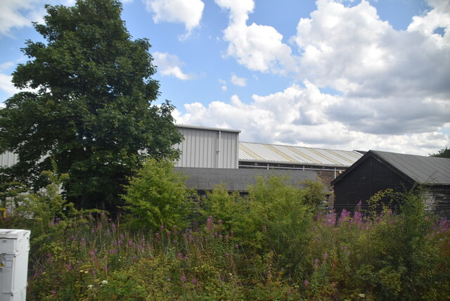
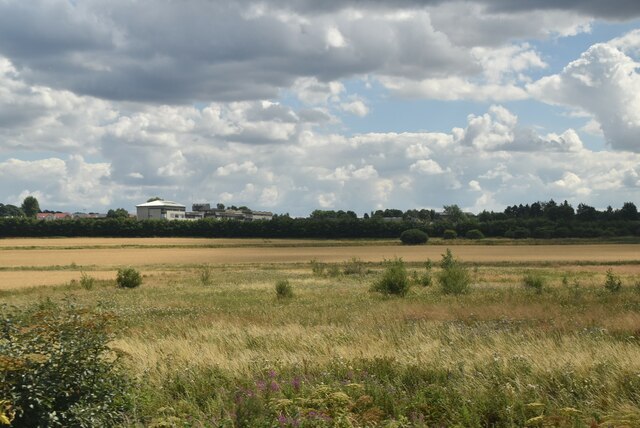
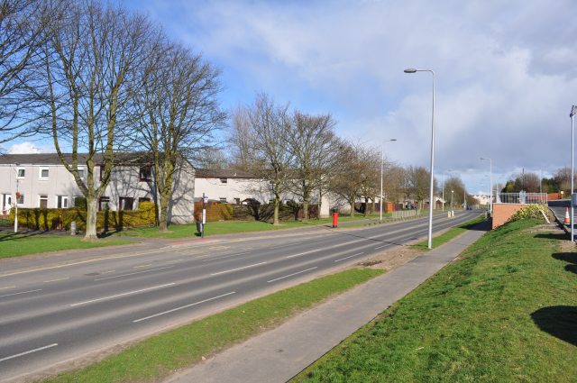
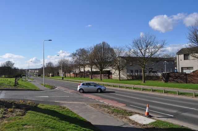
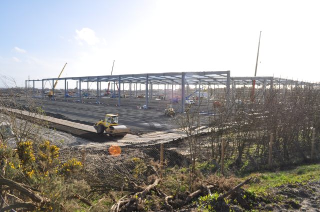
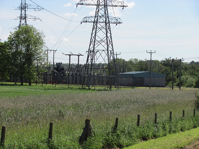
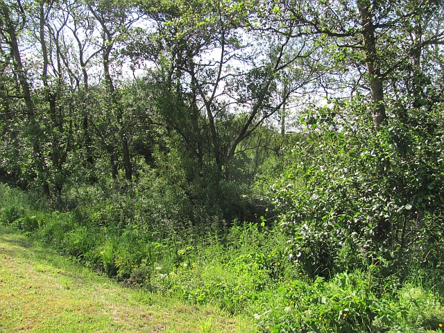
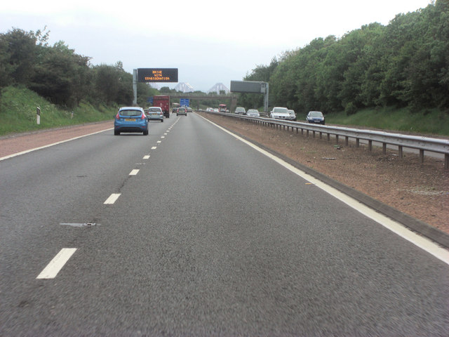
Dover Heights Images

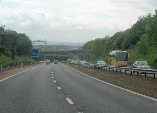
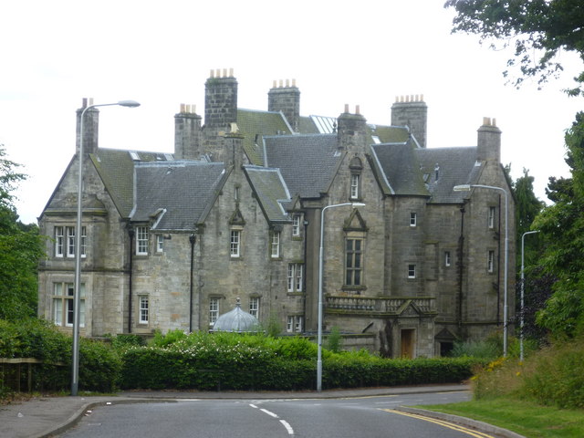
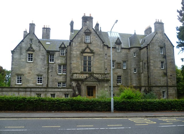
Images are sourced within 2km of 56.054567/-3.4098643 or Grid Reference NT1285. Thanks to Geograph Open Source API. All images are credited.

Pitbauchlie House Hotel
Railway, Rosyth
Railway, Rosyth
Queensferry Road A hoarding for the Alhambra Theatre.
Queensferry Road
A hoarding for the Alhambra Theatre.
Rosyth: Norval Place 'Garden City' housing Terraced houses on Norval Place.  The layout followed the new principles of town planning with broken frontage lines giving variety, areas of green space with trees lining the roads and private gardens front and back. 
The Scottish National Housing Company was set up to provide houses for employees at Rosyth naval dockyard along Garden City lines.  Dunfermline Town Council approved the Rosyth town planning scheme in July 1915 and the first houses were occupied in 1916. 
Raymond Unwin was expert advisor to the Admiralty in connection with the Rosyth scheme.  Alfred Hugh Mottram, as architect for the Scottish National Housing Company, worked on the layout and designed many of the houses.
<span class="nowrap"><a title="https://thepastandotherplaces.wordpress.com/2022/10/24/rosyth-garden-town/" rel="nofollow ugc noopener" href="https://thepastandotherplaces.wordpress.com/2022/10/24/rosyth-garden-town/">Link</a><img style="margin-left:2px;" alt="External link" title="External link - shift click to open in new window" src="https://s1.geograph.org.uk/img/external.png" width="10" height="10"/></span>
Rosyth: Norval Place 'Garden City' housing
Terraced houses on Norval Place. The layout followed the new principles of town planning with broken frontage lines giving variety, areas of green space with trees lining the roads and private gardens front and back. The Scottish National Housing Company was set up to provide houses for employees at Rosyth naval dockyard along Garden City lines. Dunfermline Town Council approved the Rosyth town planning scheme in July 1915 and the first houses were occupied in 1916. Raymond Unwin was expert advisor to the Admiralty in connection with the Rosyth scheme. Alfred Hugh Mottram, as architect for the Scottish National Housing Company, worked on the layout and designed many of the houses. LinkExternal link
Rosyth parish church, Backmarch Road Rosyth Church of Scotland parish church is B listed and designed in 1930 by Alfred Hugh Mottram. 
<span class="nowrap"><a title="https://rosythparishchurch.org/about/" rel="nofollow ugc noopener" href="https://rosythparishchurch.org/about/">Link</a><img style="margin-left:2px;" alt="External link" title="External link - shift click to open in new window" src="https://s1.geograph.org.uk/img/external.png" width="10" height="10"/></span>

The Scottish National Housing Company was set up to provide houses for employees at Rosyth naval dockyard along Garden City lines.  Dunfermline Town Council approved the Rosyth town planning scheme in July 1915 and the first houses were occupied in 1916. 
Raymond Unwin was expert advisor to the Admiralty in connection with the Rosyth scheme.
Rosyth parish church, Backmarch Road
Rosyth Church of Scotland parish church is B listed and designed in 1930 by Alfred Hugh Mottram. LinkExternal link The Scottish National Housing Company was set up to provide houses for employees at Rosyth naval dockyard along Garden City lines. Dunfermline Town Council approved the Rosyth town planning scheme in July 1915 and the first houses were occupied in 1916. Raymond Unwin was expert advisor to the Admiralty in connection with the Rosyth scheme.
Lamond & Murray
Lamond & Murray
Rough grassland by Inverkeithing East Junction
Aberdour Road Looking east along Aberdour Road.
Aberdour Road
Looking east along Aberdour Road.
Aberdour Road Looking west along Aberdour Road
Aberdour Road
Looking west along Aberdour Road
Under Construction Building a new distribution centre on the outskirts of the Dunfermline East expansion area. All this steelwork went up in the last four days.
Under Construction
Building a new distribution centre on the outskirts of the Dunfermline East expansion area. All this steelwork went up in the last four days.
The Sportsman, Burnside Road The Sportsman is located on Burnside Road near the edge of Rosyth.
The Sportsman, Burnside Road
The Sportsman is located on Burnside Road near the edge of Rosyth.
Rain on Burnside Crescent A rainy day at the junction of Burnside Crescent & Burnside Street.
Rain on Burnside Crescent
A rainy day at the junction of Burnside Crescent & Burnside Street.
Substation, Inverkeithing It's beside the (non electrified) railway.
Substation, Inverkeithing
It's beside the (non electrified) railway.
Damp woodland A small damp woodland beside the Keithing Burn. It was busy with whitethroats today.
Damp woodland
A small damp woodland beside the Keithing Burn. It was busy with whitethroats today.
M90 near Duloch In the distance, on this alignment of the southbound carriageway, are the towers of the Forth bridge.
M90 near Duloch
In the distance, on this alignment of the southbound carriageway, are the towers of the Forth bridge.
M90 approaching Inverkeithing North Junction
Pitreavie Castle Late-Victorian edifice on the site of Pitreavie Castle where the last fighting took place in the Battle of Inverkeithing in 1651. <span class="nowrap"><a title="http://en.wikipedia.org/wiki/Pitreavie_Castle" rel="nofollow ugc noopener" href="http://en.wikipedia.org/wiki/Pitreavie_Castle">Link</a><img style="margin-left:2px;" alt="External link" title="External link - shift click to open in new window" src="https://s1.geograph.org.uk/img/external.png" width="10" height="10"/></span>
Pitreavie Castle
Late-Victorian edifice on the site of Pitreavie Castle where the last fighting took place in the Battle of Inverkeithing in 1651. LinkExternal link
Pitreavie Castle The site featured prominently in the Battle of Inverkeithing. For more information, see the relevant entry in the Annals of Dunfermline (1879) via the following <span class="nowrap"><a title="http://www.tulbol.demon.co.uk/dunfermline/annals11.htm" rel="nofollow ugc noopener" href="http://www.tulbol.demon.co.uk/dunfermline/annals11.htm">Link</a><img style="margin-left:2px;" alt="External link" title="External link - shift click to open in new window" src="https://s1.geograph.org.uk/img/external.png" width="10" height="10"/></span>  where it is referred to as the Battle of Pitreavie.

"17th July, 1651, being a thursday, cromwell's armie landit heir, who, on the sabbath yreftir, being the 20 day of the sd month, battell being beside pitreavie, killed an cutt manie of or men, robbed and plunderit all."
-- Kirk Session Records of Dunfermline
Pitreavie Castle
The site featured prominently in the Battle of Inverkeithing. For more information, see the relevant entry in the Annals of Dunfermline (1879) via the following LinkExternal link where it is referred to as the Battle of Pitreavie. "17th July, 1651, being a thursday, cromwell's armie landit heir, who, on the sabbath yreftir, being the 20 day of the sd month, battell being beside pitreavie, killed an cutt manie of or men, robbed and plunderit all." -- Kirk Session Records of Dunfermline
Show me another place!

Dover Heights is located at Grid Ref: NT1285 (Lat: 56.054567, Lng: -3.4098643)

Unitary Authority: Fife

Police Authority: Fife

What 3 Words

///hiring.protrude.culminate. Near Rosyth, Fife

Nearby Locations

Dover Heights

Related Wikis

RAF Pitreavie Castle

Royal Air Force Pitreavie Castle or RAF Pitreavie Castle was a station of the Royal Air Force located at Pitreavie Castle in Dunfermline and near Rosyth...
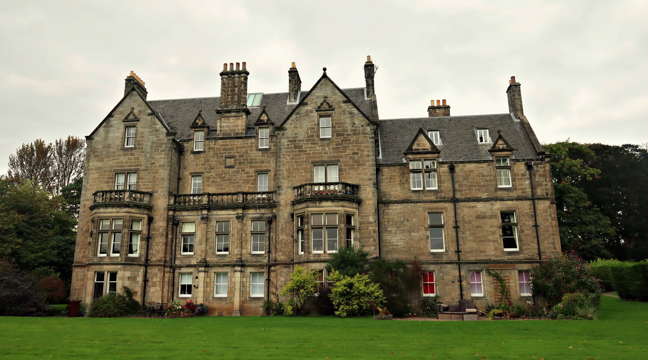
Pitreavie Castle

Pitreavie Castle is a country house, located between Rosyth and Dunfermline in Fife, Scotland. It was built in the early 17th century, and was extensively...

Battle of Inverkeithing

The Battle of Inverkeithing was fought on 20 July 1651 between an English army under John Lambert and a Scottish army led by James Holborne as part of...

Wellwood, Fife

Wellwood is a small village to the north of Dunfermline, Fife, Scotland. It was named after the Wellwoods who used to own coalmines in the area. It has...

Nearby Amenities

Located within 500m of 56.054567,-3.4098643
ROSYTH1
Disused Man Made: petroleum_well
Ref GB Decc: LF/28-1
Source: DECC
Lat/Long: 56.0560833/-3.4128333
Turning Circle
Lat/Long: 56.0539697/-3.411054
Turning Circle
Lat/Long: 56.0539799/-3.411857
Turning Circle
Lat/Long: 56.0529448/-3.4121494
Noexit: yes
Lat/Long: 56.0523729/-3.4121904
Noexit: yes
Lat/Long: 56.0540703/-3.4133299
Noexit: yes
Lat/Long: 56.0539881/-3.4094738
Turning Circle
Lat/Long: 56.0570725/-3.4164641
Turning Circle
Lat/Long: 56.0566026/-3.416408
Mini Roundabout
Direction: clockwise
Source: survey
Lat/Long: 56.0560047/-3.4150041
Crossing
Crossing: traffic_signals
Crossing Island: no
Tactile Paving: yes
Lat/Long: 56.0579683/-3.4046291
Crossing
Crossing: traffic_signals
Crossing Island: no
Crossing Ref: pelican
Kerb: flush
Tactile Paving: yes
Lat/Long: 56.0585399/-3.4080703
Crossing: informal
Lat/Long: 56.0585447/-3.4091646
Crossing
Bicycle: yes
Crossing: traffic_signals
Crossing Island: no
Crossing Ref: toucan
Kerb: flush
Tactile Paving: yes
Lat/Long: 56.0518524/-3.4119019
Crossing
Crossing: unmarked
Crossing Island: yes
Tactile Paving: yes
Lat/Long: 56.0507337/-3.4114079
Masterton
Place: suburb
Wikidata: Q64947596
Lat/Long: 56.055193/-3.4071402
Post Box
Collection Times: Mo-Fr 17:00; Sa 11:45
Operator: Royal Mail
Post Box Type: lamp
Ref: KY11 209
Royal Cypher: scottish_crown
Lat/Long: 56.0561507/-3.4144977
Crossing
Crossing: yes
Lat/Long: 56.051489/-3.4113348
Crossing
Crossing: yes
Lat/Long: 56.0513887/-3.4113004
Noexit: yes
Lat/Long: 56.0517589/-3.4102955
Post Box
Collection Times: Mo-Fr 09:00; Sa 07:00
Operator: Royal Mail
Post Box Type: lamp
Ref: KY11 106D
Royal Cypher: scottish_crown
Lat/Long: 56.0526082/-3.4146365
Crossing
Crossing: traffic_signals
Lat/Long: 56.0513664/-3.4129217
Power: pole
Lat/Long: 56.0516654/-3.4083983
Bus Stop
David Crescent
Bus: yes
Naptan AtcoCode: 6500D1129
Naptan Bearing: W
Naptan CommonName: David Crescent
Naptan Indicator: adj
Naptan Landmark: David Crescent
Naptan NaptanCode: 34345656
Naptan Street: Aberdour Road
Public Transport: platform
Shelter: no
Lat/Long: 56.0583785/-3.4074627
Bus Stop
David Crescent
Bus: yes
Naptan AtcoCode: 6500D1128
Naptan Bearing: E
Naptan CommonName: David Crescent
Naptan Indicator: opp
Naptan Landmark: David Crescent
Naptan NaptanCode: 34345652
Naptan Street: Aberdour Road
Public Transport: platform
Shelter: no
Lat/Long: 56.0583758/-3.4070956
Bus Stop
Dover Park
Bench: no
Bin: yes
Bus: yes
Check Date Shelter: 2024-03-29
Departures Board: timetable
Lit: no
Operator: Stagecoach
Public Transport: platform
Shelter: no
Surface: tactile_paving
Tactile Paving: no
Lat/Long: 56.0571114/-3.4153636
Bus Stop
Dover Drive
Bench: no
Bin: yes
Bus: yes
Check Date Shelter: 2023-11-12
Departures Board: timetable
Lit: yes
Operator: Stagecoach
Public Transport: platform
Shelter: no
Surface: tactile_paving
Tactile Paving: no
Lat/Long: 56.056395/-3.4153283
Bus Stop
Crematorium
Bus: yes
Departures Board: timetable
Operator: Stagecoach
Public Transport: platform
Shelter: no
Surface: tactile_paving
Lat/Long: 56.0549381/-3.414421
Bus Stop
Crematorium
Bus: yes
Departures Board: timetable
Naptan AtcoCode: 6500D1118
Naptan NaptanCode: 34345634
Operator: Stagecoach
Public Transport: platform
Shelter: no
Surface: tactile_paving
Lat/Long: 56.054625/-3.41409
Bus Stop
The Heathery
Bus: yes
Departures Board: timetable
Naptan AtcoCode: 6500D1060
Naptan NaptanCode: 34323797
Operator: Stagecoach
Public Transport: platform
Shelter: no
Surface: tactile_paving
Lat/Long: 56.0534353/-3.4132526
Bus Stop
The Heathery
Bench: no
Bus: yes
Check Date Shelter: 2023-11-12
Departures Board: timetable
Operator: Stagecoach
Public Transport: platform
Shelter: no
Surface: tactile_paving
Lat/Long: 56.053249/-3.4132526
Bus Stop
Peploe Rise
Bus: yes
Departures Board: timetable
Naptan AtcoCode: 6500D1155
Naptan Bearing: E
Naptan CommonName: Peploe Rise
Naptan Indicator: adj
Naptan Landmark: Peploe Rise
Naptan NaptanCode: 34346423
Naptan Street: Lapwing Drive
Operator: Stagecoach
Public Transport: platform
Shelter: no
Surface: tactile_paving
Lat/Long: 56.0517661/-3.409384
Bus Stop
Peploe Rise
Bus: yes
Departures Board: timetable
Naptan AtcoCode: 6500D1154
Naptan Bearing: W
Naptan CommonName: Peploe Rise
Naptan Indicator: Opp
Naptan Landmark: Peploe Rise
Naptan NaptanCode: 34346396
Naptan Street: Lapwing Drive
Operator: Stagecoach
Public Transport: platform
Shelter: no
Surface: tactile_paving
Lat/Long: 56.0515113/-3.4103723
Bus Stop
Eardley Crescent
Bus: yes
Departures Board: timetable
Naptan AtcoCode: 6500D1157
Naptan Bearing: NE
Naptan CommonName: Eardley Crescent
Naptan Indicator: Adj
Naptan Landmark: Eardley Crescent
Naptan NaptanCode: 34346429
Naptan Street: Lapwing Drive
Operator: Stagecoach
Public Transport: platform
Shelter: no
Surface: tactile_paving
Lat/Long: 56.0524216/-3.4060254
Bus Stop
Eardley Crescent
Bus: yes
Departures Board: timetable
Naptan AtcoCode: 6500D1156
Naptan Bearing: SW
Naptan CommonName: Eardley Crescent
Naptan Indicator: Opp
Naptan Landmark: Eardley Crescent
Naptan NaptanCode: 34346425
Naptan Street: Lapwing Drive
Operator: Stagecoach
Public Transport: platform
Shelter: no
Surface: tactile_paving
Lat/Long: 56.0520779/-3.4069711
Bus Stop
Lapwing Drive
Bus: yes
Departures Board: timetable
Naptan AtcoCode: 6500D1159
Naptan NaptanCode: 34346456
Operator: Stagecoach
Public Transport: platform
Shelter: no
Surface: tactile_paving
Lat/Long: 56.0542172/-3.4026243
Bus Stop
Lapwing Drive
Bus: yes
Departures Board: timetable
Naptan AtcoCode: 6500D1158
Naptan NaptanCode: 34346454
Operator: Stagecoach
Public Transport: platform
Shelter: no
Surface: tactile_paving
Lat/Long: 56.0537659/-3.4030197
Noexit: yes
Lat/Long: 56.0507285/-3.4093091
Noexit: yes
Lat/Long: 56.0507363/-3.4091737
Generator Method: photovoltaic
Generator Output Electricity: yes
Generator Source: solar
Generator Type: solar_photovoltaic_panel
Power: generator
Lat/Long: 56.0554178/-3.4099195
Generator Method: photovoltaic
Generator Output Electricity: yes
Generator Source: solar
Generator Type: solar_photovoltaic_panel
Power: generator
Lat/Long: 56.0552419/-3.4120104
Generator Method: photovoltaic
Generator Output Electricity: yes
Generator Source: solar
Generator Type: solar_photovoltaic_panel
Power: generator
Lat/Long: 56.0558998/-3.412055
Generator Method: photovoltaic
Generator Output Electricity: yes
Generator Source: solar
Generator Type: solar_photovoltaic_panel
Power: generator
Lat/Long: 56.0560092/-3.4114226
Generator Method: photovoltaic
Generator Output Electricity: yes
Generator Source: solar
Generator Type: solar_photovoltaic_panel
Power: generator
Lat/Long: 56.0561532/-3.4103387
Generator Method: photovoltaic
Generator Output Electricity: yes
Generator Source: solar
Generator Type: solar_photovoltaic_panel
Power: generator
Lat/Long: 56.0557918/-3.4073723
Crossing
Crossing: yes
Lat/Long: 56.0511224/-3.4116848
Crossing
Crossing: yes
Lat/Long: 56.0511496/-3.4115414
Crossing
Crossing: yes
Lat/Long: 56.0516284/-3.4098735
Generator Method: photovoltaic
Generator Output Electricity: yes
Generator Source: solar
Generator Type: solar_photovoltaic_panel
Power: generator
Lat/Long: 56.053457/-3.4154054
Generator Method: photovoltaic
Generator Output Electricity: yes
Generator Source: solar
Generator Type: solar_photovoltaic_panel
Power: generator
Lat/Long: 56.0523584/-3.4157735
Generator Method: photovoltaic
Generator Output Electricity: yes
Generator Source: solar
Generator Type: solar_photovoltaic_panel
Power: generator
Lat/Long: 56.0516624/-3.4155144
Generator Method: photovoltaic
Generator Output Electricity: yes
Generator Source: solar
Generator Type: solar_photovoltaic_panel
Power: generator
Lat/Long: 56.0517042/-3.4131894
Noexit: yes
Lat/Long: 56.0516309/-3.4087893
Noexit: yes
Lat/Long: 56.0526895/-3.4125296
Noexit: yes
Lat/Long: 56.0522623/-3.4071967
The data included in this document is from www.openstreetmap.org. The data is made available under ODbL.

Have you been to Dover Heights?

Leave your review of Dover Heights below (or comments, questions and feedback).