Bad an Lòin

Hill, Mountain in Perthshire

Scotland

Bad an Lòin

Ruins, Spittal of Glenshee Hotel The partially demolished fire damaged hotel at Spittal of Glenshee.
Ruins, Spittal of Glenshee Hotel Credit: Richard Webb

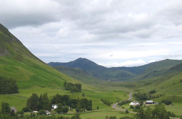
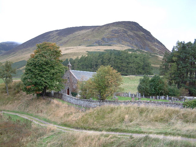
Bad an Lòin is a prominent hill located in the region of Perthshire, Scotland. Situated near the picturesque village of Aberfeldy, it stands at an elevation of approximately 579 meters (1,900 feet) above sea level. This mountain is a popular destination for outdoor enthusiasts, offering breathtaking views and a variety of recreational activities.

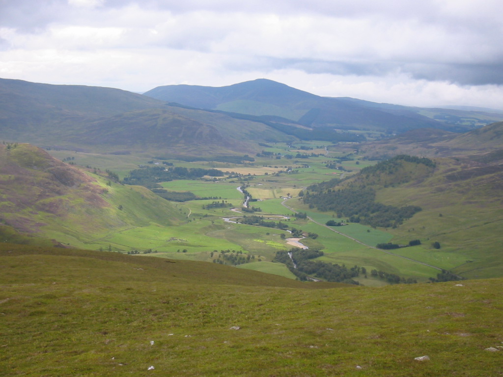
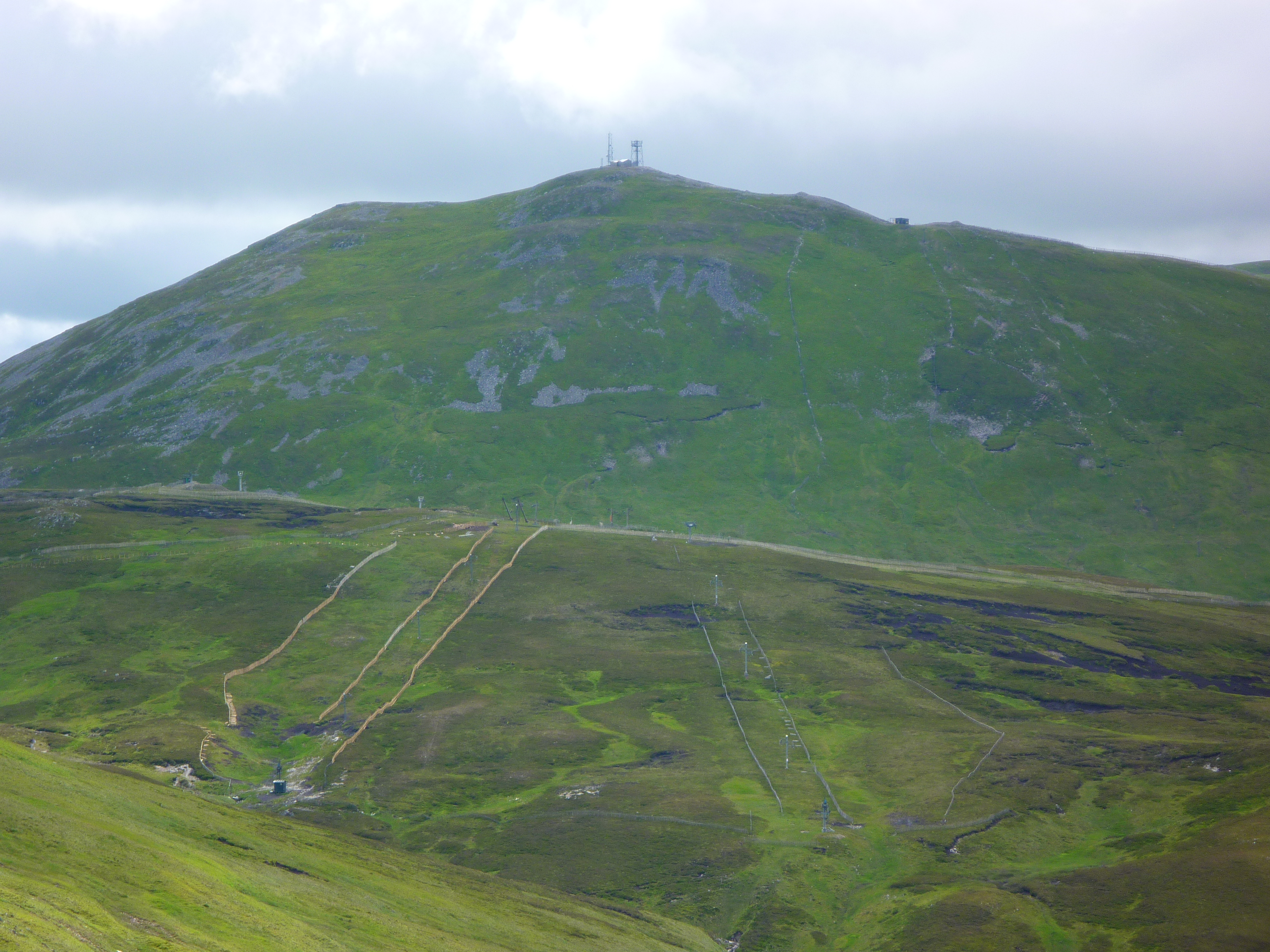
The hill is characterized by its rugged terrain, with steep slopes covered in heather and scattered rocky outcrops. Its location within the Cairngorms National Park makes it an ideal spot for hikers and hillwalkers, providing a challenging yet rewarding experience. Numerous trails and footpaths traverse the area, catering to different levels of difficulty and offering opportunities for exploration.

At the summit of Bad an Lòin, visitors are treated to panoramic vistas of the surrounding landscape, including the rolling hills, verdant valleys, and sparkling lochs that dot the region. On clear days, one can even catch a glimpse of the distant peaks of the Grampian Mountains.

Wildlife enthusiasts will also find Bad an Lòin to be a haven for various species. Red deer, mountain hares, and golden eagles are among the creatures that call this area home, adding to the natural charm of the place.

Overall, Bad an Lòin is a must-visit destination for those seeking a taste of Scotland's rugged beauty. Its challenging trails, stunning vistas, and diverse flora and fauna make it an unforgettable experience for outdoor enthusiasts and nature lovers alike.

If you have any feedback on the listing, please let us know in the comments section below.

Bad an Lòin Images

Images are sourced within 2km of 56.820471/-3.4431651 or Grid Reference NO1270. Thanks to Geograph Open Source API. All images are credited.

Ruins, Spittal of Glenshee Hotel The partially demolished fire damaged hotel at Spittal of Glenshee.
Ruins, Spittal of Glenshee Hotel
The partially demolished fire damaged hotel at Spittal of Glenshee.
Ruined Spittal of Glenshee Hotel
Spittal of Glenshee
Spittal of Glenshee
Allt Coire Lairige, Spittal of Glenshee
The A93 in Gleann Beag The A93 Gleann Beag north of Spittal of Glenshee
The A93 in Gleann Beag
The A93 Gleann Beag north of Spittal of Glenshee
The old A93, Spittal of Glenshee I can just about remember the main road crossing this bridge, now bypassed.
The old A93, Spittal of Glenshee
I can just about remember the main road crossing this bridge, now bypassed.
Old A93 road, Spittal of Glenshee The A93 now has a new alignment missing out a narrow bridge and the houses at Spittal. The road leaves Glenshee here for the climb to the pass at Cairnwell.
Old A93 road, Spittal of Glenshee
The A93 now has a new alignment missing out a narrow bridge and the houses at Spittal. The road leaves Glenshee here for the climb to the pass at Cairnwell.
Shee Water View upstream from the humpbacked bridge in Spittal of Glenshee.
Shee Water
View upstream from the humpbacked bridge in Spittal of Glenshee.
Car park, Glen Shee Parking area on the road to Dalmunzie. It is also possible to park at the hotel for a small charge.
Car park, Glen Shee
Parking area on the road to Dalmunzie. It is also possible to park at the hotel for a small charge.
Shee Water Beside the road to Dalmunzie.
Shee Water
Beside the road to Dalmunzie.
Glen Shee A view down Glen Shee from Creag Bhreac between Glen Taitneach and Glen Lochsie
Glen Shee
A view down Glen Shee from Creag Bhreac between Glen Taitneach and Glen Lochsie
Logs laid alongside estate road The area to the right of the logs has been used in the past for car parking - the aerial view available from 'OS Maps' shows vehicles there. It appears still to be possible to park cars alongside the logs without obstructing the road but the overall amount of parking there has been restricted. One wonders for what purpose!
Logs laid alongside estate road
The area to the right of the logs has been used in the past for car parking - the aerial view available from 'OS Maps' shows vehicles there. It appears still to be possible to park cars alongside the logs without obstructing the road but the overall amount of parking there has been restricted. One wonders for what purpose!
The A93 in Gleann Beag This is a well-photographed view up the glen towards the Devil's Elbow just visible in the distance because there is a lay-by just out of the picture to the left.   The A93 extends some 174 km from Perth to Aberdeen through spectacular Highland scenery: <span class="nowrap"><a title="https://www.sabre-roads.org.uk/wiki/index.php?title=A93" rel="nofollow ugc noopener" href="https://www.sabre-roads.org.uk/wiki/index.php?title=A93">Link</a><img style="margin-left:2px;" alt="External link" title="External link - shift click to open in new window" src="https://s1.geograph.org.uk/img/external.png" width="10" height="10"/></span> .
The A93 in Gleann Beag
This is a well-photographed view up the glen towards the Devil's Elbow just visible in the distance because there is a lay-by just out of the picture to the left. The A93 extends some 174 km from Perth to Aberdeen through spectacular Highland scenery: LinkExternal link .
View eastwards from the A93
Sheep in Gleann Beag
Glacial flats at Easter Binzean
Approaching Spittal of Glenshee along the A93 The prominent mountain to the right is the corbett Ben Gulabin.
Approaching Spittal of Glenshee along the A93
The prominent mountain to the right is the corbett Ben Gulabin.
A93 at Wester Binzean
Show me another place!

Bad an Lòin is located at Grid Ref: NO1270 (Lat: 56.820471, Lng: -3.4431651)

Unitary Authority: Perth and Kinross

Police Authority: Tayside

What 3 Words

///buckets.verse.utter. Near Inverey, Aberdeenshire

Related Wikis

Spittal of Glenshee

The Spittal of Glenshee (Scottish Gaelic: Spideal Ghlinn Sìdh, pronounced [ˈspitʲəl̪ˠ ʝliːɲ ˈʃiːʝ]) lies at the head of Glenshee in the highlands of eastern...

Shee Water

The Shee Water (Scottish Gaelic: Sìdh / Uisge Sìdh) is a river in the highland portion of eastern Perth and Kinross, Scotland. The Allt a' Ghlinne Bhig...

Glen Shee

Glen Shee (Scottish Gaelic: Gleann Sith) is a glen in eastern Perthshire, Scotland. Shee Water flows through the glen. The head of the glen, where Gleann...

Ben Gulabin

Ben Gulabin (806 m) is a mountain in the Mounth area of the Grampian Mountains in Scotland. It is located on the eastern side of the main A93 road between...

Loch Beanie

Loch Beanie also known as Loch Shechernich, is a small shallow freshwater loch that is located in Glen Shee in Perth and Kinross, Scotland. == Island... ==

Finegand

Finegand is a farming hamlet located in eastern Perth and Kinross, Scotland and also refers historically to the portion of lands surrounding the hamlet...

Càrn a' Gheòidh

Càrn a' Gheòidh or Càrn Gheòidh is a mountain in the Mounth region of the Scottish Highlands. It lies 15 km south of the town of Braemar. Its summit stands...

The Cairnwell

The Cairnwell (Scottish Gaelic: An Càrn Bhailg) is a mountain in the Eastern Highlands of Scotland, south of Braemar. It is often considered to be one...

Nearby Amenities

Located within 500m of 56.820471,-3.4431651
Bad an Lòin
Place: locality
Lat/Long: 56.8220186/-3.4413799
Ford: yes
Lat/Long: 56.8165712/-3.4400361
The data included in this document is from www.openstreetmap.org. The data is made available under ODbL.

Have you been to Bad an Lòin?

Leave your review of Bad an Lòin below (or comments, questions and feedback).