Gallows Hill

Hill, Mountain in Dumfriesshire

Scotland

Gallows Hill

OS Cut Mark - Dalton, Murraythwaite Mill Cottage
OS Cut Mark - Dalton, Murraythwaite Mill Cottage Credit: thejackrustles

Gallows Hill is a prominent hill located in Dumfriesshire, Scotland. Situated approximately 3 miles southeast of the town of Moffat, it stands at an elevation of 464 meters (1,522 feet) above sea level. The hill is part of the Southern Uplands range, which runs along the border between Scotland and England.

Gallows Hill derives its name from its historical association with public executions that took place on its slopes during the 17th and 18th centuries. The hill was chosen as the site for these grim events due to its high visibility and commanding position, ensuring that the executions were witnessed by a large audience.

Today, Gallows Hill is a popular destination for hikers and nature enthusiasts. It offers stunning panoramic views of the surrounding countryside, including the rolling hills and valleys of Dumfriesshire. The hill is covered in heather and grasses, providing a rich habitat for various species of wildlife, such as red grouse and mountain hares.

Access to Gallows Hill is relatively straightforward, with several footpaths leading to its summit. The most common route starts from the nearby village of Beattock and ascends gradually through open moorland. It is advisable for visitors to wear appropriate footwear and clothing, as the terrain can be uneven and exposed to changing weather conditions.

In conclusion, Gallows Hill is a historically significant and picturesque hill in Dumfriesshire, offering visitors a chance to explore its natural beauty while reflecting on its dark past.

If you have any feedback on the listing, please let us know in the comments section below.
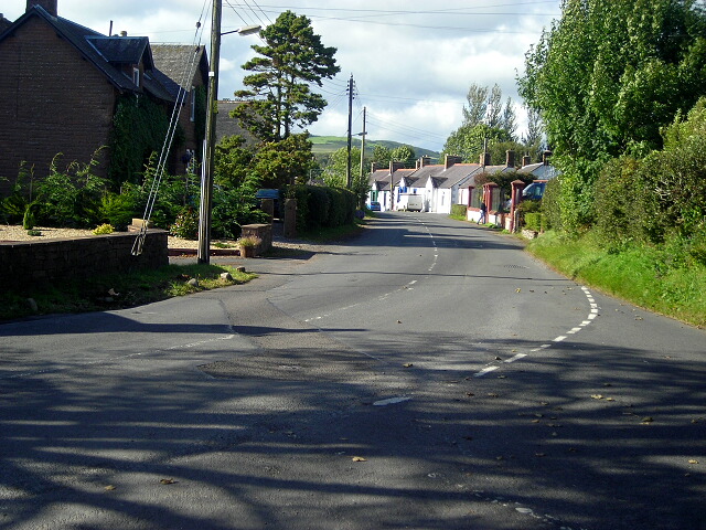
Gallows Hill Images

Images are sourced within 2km of 55.04644/-3.3790108 or Grid Reference NY1173. Thanks to Geograph Open Source API. All images are credited.

OS Cut Mark - Dalton, Murraythwaite Mill Cottage
Close up of OS Cut Mark - Dalton, Murraythwaite Mill Cottage
Dalton Parish Church
OS Cut Mark - Dalton, Parish Church <span class="nowrap"><a title="https://www.bench-marks.org.uk/bm70196" rel="nofollow ugc noopener" href="https://www.bench-marks.org.uk/bm70196">Link</a><img style="margin-left:2px;" alt="External link" title="External link - shift click to open in new window" src="https://s1.geograph.org.uk/img/external.png" width="10" height="10"/></span>
OS Cut Mark - Dalton, Parish Church
Position of OS Cut Mark - Dalton, Parish Church <span class="nowrap"><a title="https://www.bench-marks.org.uk/bm70196" rel="nofollow ugc noopener" href="https://www.bench-marks.org.uk/bm70196">Link</a><img style="margin-left:2px;" alt="External link" title="External link - shift click to open in new window" src="https://s1.geograph.org.uk/img/external.png" width="10" height="10"/></span>
Position of OS Cut Mark - Dalton, Parish Church
Dalton Parish Church This 19th century building was sited next to the older church which was located in a very old religious place.
Dalton Parish Church
This 19th century building was sited next to the older church which was located in a very old religious place.
Dalton UF Church This church in Dalton village was "non-conformist", constructed during the 19th century for the breakaway United Free Kirk.
Dalton UF Church
This church in Dalton village was "non-conformist", constructed during the 19th century for the breakaway United Free Kirk.
This way to Little Dalton Kirk I had hoped to visit Little Dalton Kirk but the road was closed after storm Arwen had brought trees down during the previous evening. There's always another day to visit.
This way to Little Dalton Kirk
I had hoped to visit Little Dalton Kirk but the road was closed after storm Arwen had brought trees down during the previous evening. There's always another day to visit.
Field near Manse Bridge The road is the B7020 from Annan to Lochmaben and it is the route of the Annandale Way.
Field near Manse Bridge
The road is the B7020 from Annan to Lochmaben and it is the route of the Annandale Way.
B7020 road near Dormont The road is the B7020 from Annan to Lochmaben and it is the route of the Annandale Way.
B7020 road near Dormont
The road is the B7020 from Annan to Lochmaben and it is the route of the Annandale Way.
Minor road at Dormont This road leads from Williamwath Bridge to the B7020 road near Dalton; it is the route of the Annandale Way.
Minor road at Dormont
This road leads from Williamwath Bridge to the B7020 road near Dalton; it is the route of the Annandale Way.
Minor road at Greenswangs
Road near Manse Bridge The minor road from Dalton to Almagill near Manse Bridge.
This is the route of the Annandale Way long distance path.
Road near Manse Bridge
The minor road from Dalton to Almagill near Manse Bridge. This is the route of the Annandale Way long distance path.
Minor road at Hindgillbrae This minor road from Dalton to Almagill is the route of the Annandale Way.
Minor road at Hindgillbrae
This minor road from Dalton to Almagill is the route of the Annandale Way.
Near Dalton The B 725 near Dalton. The building is the Dalton Pottery & Art Cafe.
Near Dalton
The B 725 near Dalton. The building is the Dalton Pottery & Art Cafe.
Dalton Church The present building is close to the remains of a previous church. The small village of Dalton boasts, somewhat incongruously, a Thai restaurant.
Dalton Church
The present building is close to the remains of a previous church. The small village of Dalton boasts, somewhat incongruously, a Thai restaurant.
Stream by Dalton church Unnamed watercourse near Dalton church, the graveyard of which can be seen on the left of the picture.
Stream by Dalton church
Unnamed watercourse near Dalton church, the graveyard of which can be seen on the left of the picture.
Bull blocking the road A farm track to nowhere
Bull blocking the road
A farm track to nowhere
Show me another place!

Gallows Hill is located at Grid Ref: NY1173 (Lat: 55.04644, Lng: -3.3790108)

Unitary Authority: Dumfries and Galloway

Police Authority: Dumfries and Galloway

What 3 Words

///chips.yachting.ringers. Near Lockerbie, Dumfries & Galloway

Nearby Locations

Gallows Hill

Related Wikis

Dalton, Dumfries and Galloway

The village of Dalton is a small settlement about 10 miles (16 km) southeast of Dumfries and 4 miles (6.4 km) south of Lockerbie, in Dumfries and Galloway...

Carrutherstown

Carrutherstown is a village in the civil parish of Dalton, in Dumfries and Galloway, Scotland. It is about 9 miles (14 km) east of Dumfries. == Demographics... ==
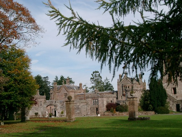
Hoddom Castle

Hoddom Castle is a large tower house in Dumfries and Galloway, south Scotland. It is located by the River Annan, 4 kilometres (2.5 mi) south-west of Ecclefechan...

Hoddom

Hoddom is a small settlement and civil parish in Dumfries and Galloway, Scotland, dating back to the 8th century. == Location == Hoddom is 13 miles by...

Nearby Amenities

Located within 500m of 55.04644,-3.3790108
Power: pole
Lat/Long: 55.04624/-3.3841356
Power: pole
Lat/Long: 55.0468377/-3.3833628
Power: pole
Lat/Long: 55.0472996/-3.3827395
Power: pole
Lat/Long: 55.047614/-3.3823118
Power: pole
Lat/Long: 55.0478855/-3.3812892
Power: pole
Lat/Long: 55.048157/-3.3803232
Power: pole
Lat/Long: 55.0484197/-3.3793134
Power: pole
Lat/Long: 55.0487399/-3.3781027
Power: pole
Lat/Long: 55.0490439/-3.3769384
Power: pole
Lat/Long: 55.0493656/-3.3757251
Power: pole
Lat/Long: 55.0500754/-3.3756375
Power: pole
Lat/Long: 55.0479371/-3.3825308
Power: pole
Lat/Long: 55.0482972/-3.3827678
The data included in this document is from www.openstreetmap.org. The data is made available under ODbL.

Have you been to Gallows Hill?

Leave your review of Gallows Hill below (or comments, questions and feedback).