Bennet Hill
Hill, Mountain in Morayshire
Scotland
Bennet Hill

Bennet Hill is a prominent hill located in Morayshire, Scotland. Rising to an elevation of approximately 355 meters (1,165 feet), it is recognized as one of the notable hills in the region. Situated near the village of Craigellachie, Bennet Hill offers stunning panoramic views of the surrounding countryside.
Covered in lush greenery and heather, the hill is a haven for nature enthusiasts and hikers. Its gentle slopes make it accessible to both experienced climbers and beginners, making it a popular destination for outdoor activities. The summit of Bennet Hill provides an excellent vantage point to appreciate the natural beauty of Morayshire, as well as the nearby River Spey and the picturesque Speyside region.
Bennet Hill is also steeped in history. At its base, the hill features the remnants of an ancient fort, which adds an element of intrigue and fascination to the site. The fort is believed to have been constructed during the Iron Age, serving as a defensive structure for the local inhabitants. Exploring these archaeological remains offers visitors a glimpse into the region's rich cultural heritage.
Due to its accessibility and scenic surroundings, Bennet Hill attracts a steady stream of visitors throughout the year. Whether it be for a leisurely stroll, a challenging hike, or a historical exploration, Bennet Hill provides a memorable experience for nature lovers, adventurers, and history enthusiasts alike.
If you have any feedback on the listing, please let us know in the comments section below.
Bennet Hill Images
Images are sourced within 2km of 57.688889/-3.4901437 or Grid Reference NJ1167. Thanks to Geograph Open Source API. All images are credited.


Bennet Hill is located at Grid Ref: NJ1167 (Lat: 57.688889, Lng: -3.4901437)
Unitary Authority: Moray
Police Authority: North East
What 3 Words
///cookies.loafing.royally. Near Burghead, Moray
Nearby Locations
Related Wikis

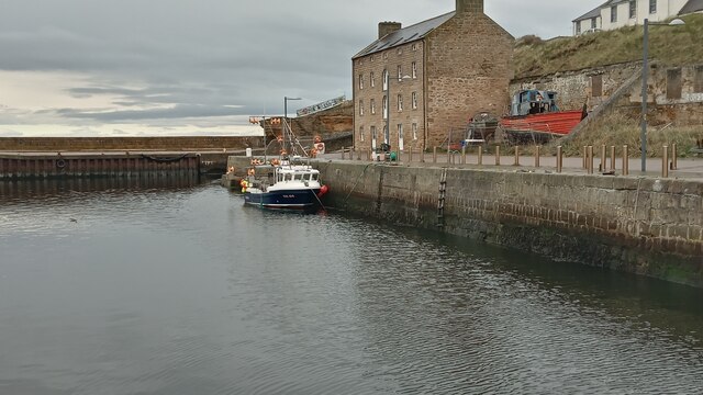
Burghead
Burghead (Scots: Burgheid or The Broch, Scottish Gaelic: Am Broch) is a small town in Moray, Scotland, about 8 miles (13 km) north-west of Elgin. The town...
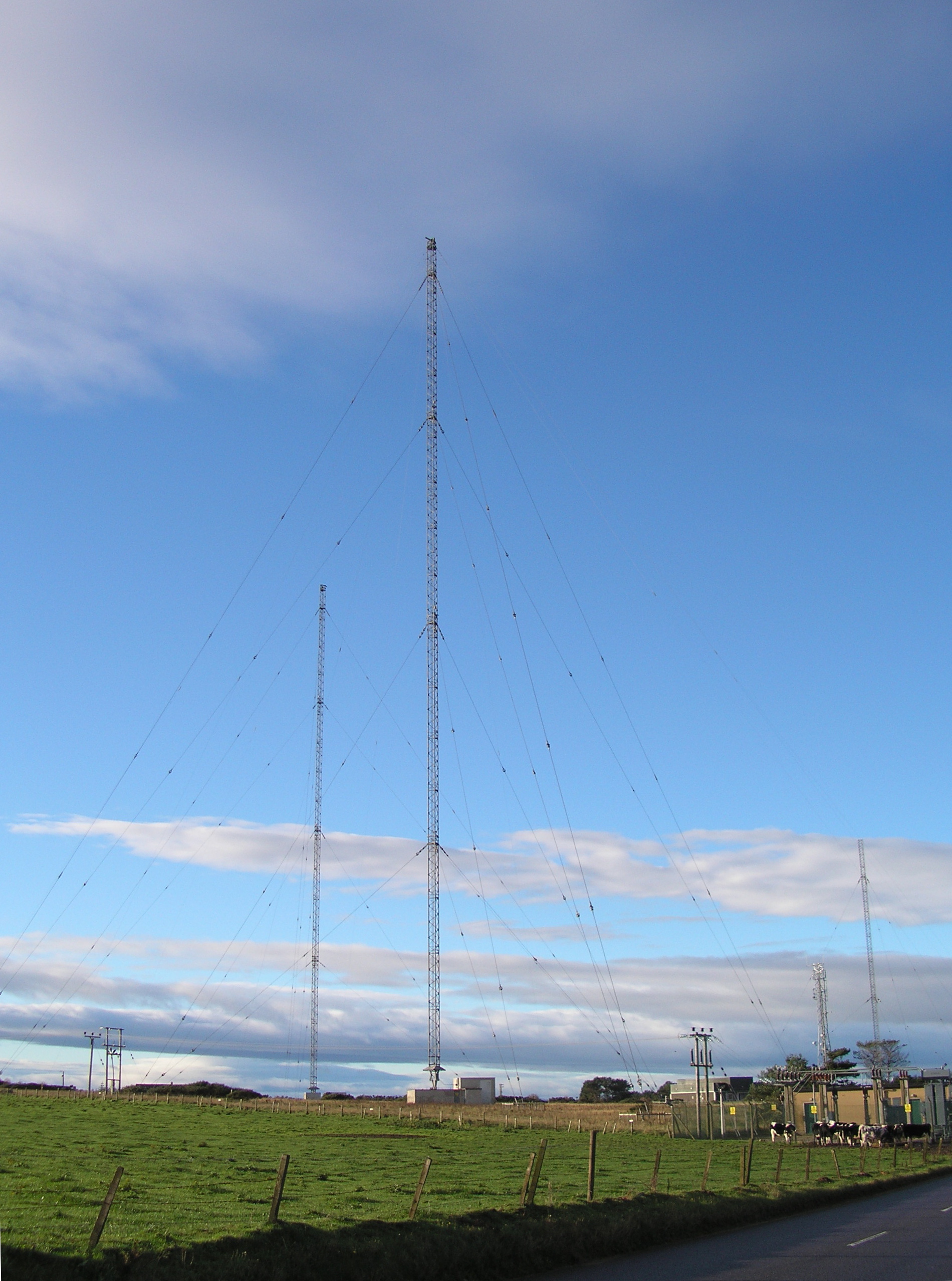
Burghead Transmitting Station
The Burghead transmitting station is a broadcasting facility near Burghead (grid reference NJ125685) in Scotland for long wave and medium wave radio transmission...
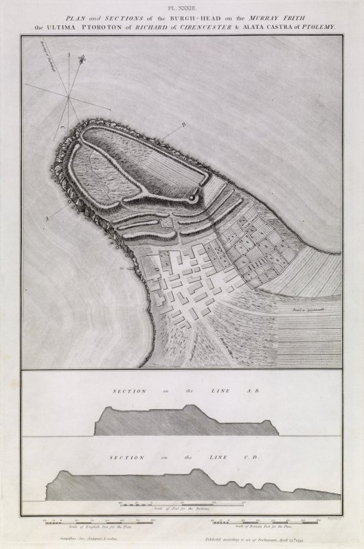
Burghead Fort
Burghead Fort was a Pictish promontory fort on the site now occupied by the small town of Burghead in Moray, Scotland. It was one of the earliest power...

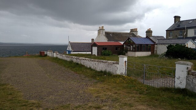
Cummingston
Cummingston is located on the north-east coast of Scotland in Moray. It lies on the B9012, sandwiched between the two fishing villages of Hopeman and Burghead...
Related Videos

Our Moray Coastal Walk Adventure: Day 2 Burghead to Lossiemouth!
Day Two up! We braved the ebbing and flowing tides, the rain and saw some whales out at sea! Please like, subscribe, share and ...
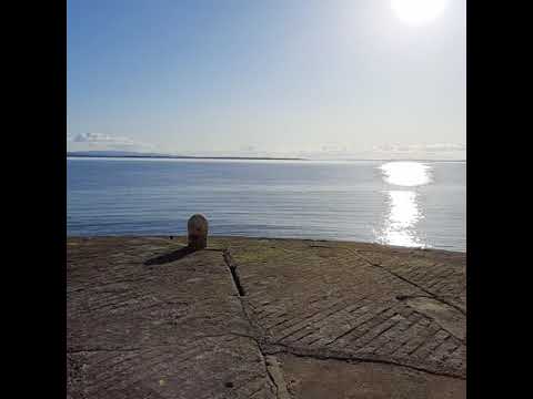
Beautiful. Calm. Peaceful. We love Burghead!
One of the most beautiful places to be. Burghead has something for everyone.
Scottish Tour: A walkabout in Burghead the Harbour and the Pictish Fort. Well worth a visit! 👍🤗
Lovely little Harbour town not far from Lossiemouth and Elgin on the Moray coast with a beautiful harbour, sandy beaches.
Family walks - what Sundays are made for. Well that and a roast dinner!
travel #nature #photography #travelphotography #love #photooftheday #instagood #travelgram #picoftheday #photo #beautiful ...
Nearby Amenities
Located within 500m of 57.688889,-3.4901437Have you been to Bennet Hill?
Leave your review of Bennet Hill below (or comments, questions and feedback).