Noutwath Hill

Hill, Mountain in Dumfriesshire

Scotland

Noutwath Hill

Woodland beside the B7076
Woodland beside the B7076 Credit: JThomas

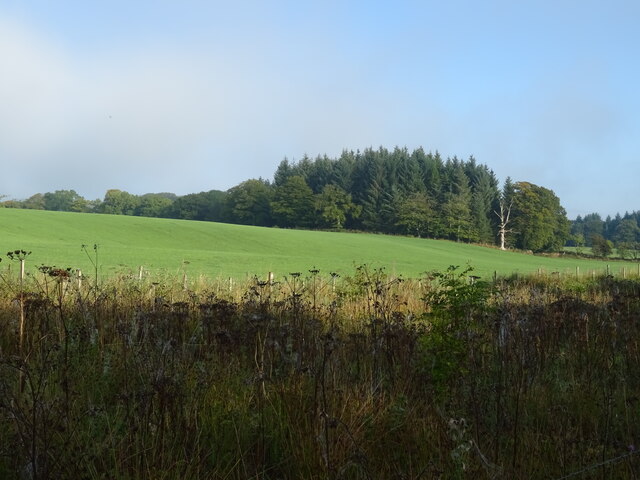
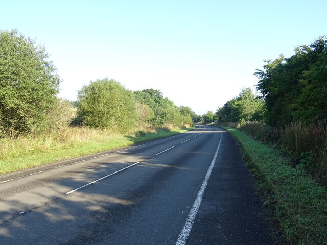
Noutwath Hill is a prominent hill located in Dumfriesshire, Scotland. Situated near the village of Penpont, it is part of the Southern Uplands range, known for its picturesque landscapes and rolling hills. Noutwath Hill stands at an elevation of approximately 365 meters (1,198 feet) above sea level, making it a notable landmark in the area.

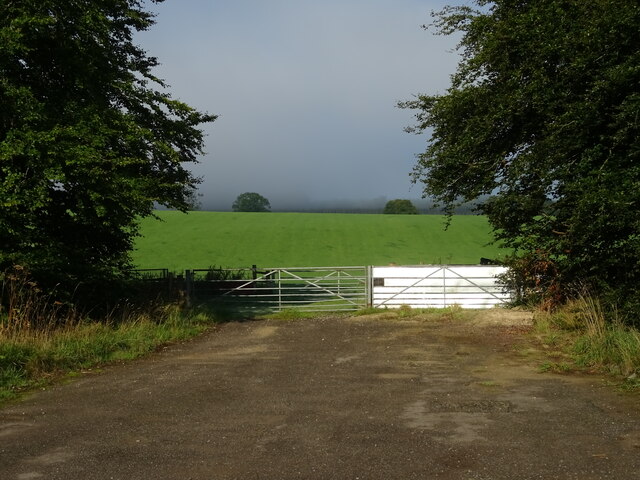
The hill is characterized by its distinct conical shape, covered in lush green vegetation and scattered with rocks and boulders. Its slopes are predominantly grassy, providing grazing grounds for local livestock. From the summit of Noutwath Hill, visitors are rewarded with breathtaking panoramic views of the surrounding countryside, including the Nith Valley and the neighboring hills.

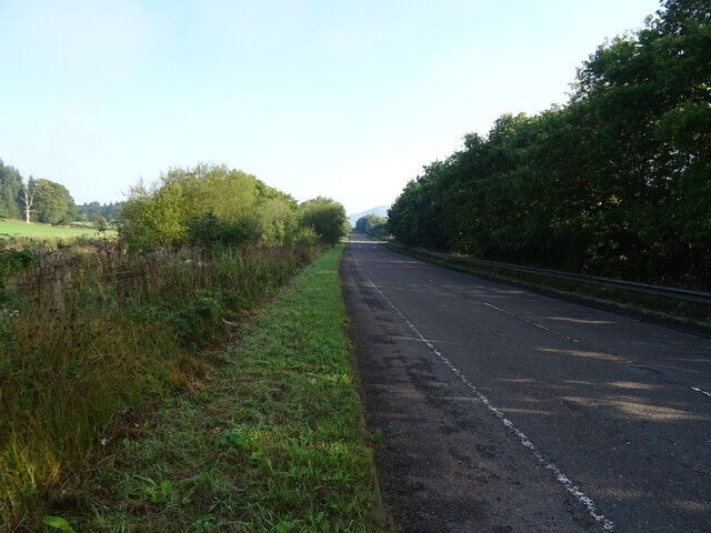
Noutwath Hill is easily accessible by foot, with several walking trails leading to its summit. The most popular route starts from Penpont, offering a moderate hike that takes around two to three hours to complete. Along the way, walkers can enjoy the diverse flora and fauna of the region, including heather, wildflowers, and various bird species.

The hill holds historical significance as well, with ancient burial mounds found on its slopes, indicating human presence in the area dating back thousands of years. These archaeological remnants add to the hill's allure and provide a glimpse into the rich history of Dumfriesshire.

Overall, Noutwath Hill in Dumfriesshire offers nature enthusiasts and hikers an opportunity to explore the beauty of the Southern Uplands, with its stunning views, diverse wildlife, and historical landmarks.

If you have any feedback on the listing, please let us know in the comments section below.

Noutwath Hill Images

Images are sourced within 2km of 55.241595/-3.4013933 or Grid Reference NY1095. Thanks to Geograph Open Source API. All images are credited.

Woodland beside the B7076
B7076 towards Beattock Heading north parallel to the A74(M).
B7076 towards Beattock
Heading north parallel to the A74(M).
Hillside farmland and woodland near Green Rigg
B7076 towards Beattock Heading north parallel to the A74(M).
B7076 towards Beattock
Heading north parallel to the A74(M).
A74(M) northbound near Green Rigg Towards Glasgow.
A74(M) northbound near Green Rigg
Towards Glasgow.
Field entrance off the B7076
Woodland beside the B7076
National Cycle Route 74 towards Beattock B7076 heading north beside the A74(M).
National Cycle Route 74 towards Beattock
B7076 heading north beside the A74(M).
Field entrance off the B7076
B7076 towards Beattock Heading north parallel to the A74(M).
B7076 towards Beattock
Heading north parallel to the A74(M).
View towards Oakrig Plantation Looking from the West Coast Main Line.
View towards Oakrig Plantation
Looking from the West Coast Main Line.
Start of the path, Wamphray Glen An information board near the road junction at Wamphray Bridge. There is room to park a few cars nearby.
Start of the path, Wamphray Glen
An information board near the road junction at Wamphray Bridge. There is room to park a few cars nearby.
The Wamphray Water Spring growth appearing in the woodland on the banks with Wamphray Bridge in the background.
The Wamphray Water
Spring growth appearing in the woodland on the banks with Wamphray Bridge in the background.
Footbridge over the Wamphray Water The path up the glen crosses here to follow the north bank of the Wamphray Water.
Footbridge over the Wamphray Water
The path up the glen crosses here to follow the north bank of the Wamphray Water.
The Wamphray Water from the footbridge Looking upstream from the bridge on the Wamphray Glen path.
The Wamphray Water from the footbridge
Looking upstream from the bridge on the Wamphray Glen path.
Field path by the Wamphray Water The Wamphray Glen path climbs to the top of the northern bank to follow the woodland edge towards Wamphray Mill.
Field path by the Wamphray Water
The Wamphray Glen path climbs to the top of the northern bank to follow the woodland edge towards Wamphray Mill.
Track to Hillhouse A track on the Wamphray Glen circular walk which can be started either at Wamphray Bridge or by Wamphray Parish Church.
Track to Hillhouse
A track on the Wamphray Glen circular walk which can be started either at Wamphray Bridge or by Wamphray Parish Church.
Hillhouse farm Farmland south of the Wamphray Water. The Wamphray Glen circular walk goes left past the farm to meet the minor road near the bridge.
Hillhouse farm
Farmland south of the Wamphray Water. The Wamphray Glen circular walk goes left past the farm to meet the minor road near the bridge.
Show me another place!

Noutwath Hill is located at Grid Ref: NY1095 (Lat: 55.241595, Lng: -3.4013933)

Unitary Authority: Dumfries and Galloway

Police Authority: Dumfries and Galloway

What 3 Words

///jogged.cheer.microchip. Near Johnstonebridge, Dumfries & Galloway

Related Wikis

Wamphray railway station

Wamphray railway station served Newton Wamphray, near Beattock, in the Scottish county of Dumfries and Galloway. It was served by local trains on what...

Newton Wamphray

Newton Wamphray is a village in Dumfries and Galloway. Wamphray is the name of the surrounding parish and of the Wamphray Water, which flows south-west...

Annandale Water services

Annandale Water services is a motorway service station in the village of Johnstonebridge, Scotland. The service station is located next to the A74(M) motorway...

Annandale Water

Annandale Water is a loch in Annandale, Dumfries and Galloway, in the south west of Scotland. It is part of Annandale Water service station at Junction...

Lochwood Tower

Lochwood Tower, also known as Lochwood Castle, is a ruined 16th-century L-plan tower house situated in Annandale (Valley of the River Annan) about 6 miles...

Johnstonebridge

Johnstonebridge is a village in Dumfries and Galloway, Scotland.It is roughly halfway between Moffat and Lockerbie, and lies on the A74(M) motorway. The...

Dinwoodie railway station

Dinwoodie railway station was a station which served the rural area around the settlement of Dinwoodie, 6 miles north of Lockerbie in Applegarth parish...

Kirkpatrick-Juxta

Kirkpatrick-Juxta is a parish in Dumfries and Galloway on the A701, between Biggar, Moffat and Lockerbie. The parish straddles the main road A74 (M). It...

Nearby Amenities

Located within 500m of 55.241595,-3.4013933
Bus Stop
Village
Bench: yes
Naptan AtcoCode: 680000234222
Naptan Bearing: S
Naptan CommonName: Village
Naptan Indicator: Station
Naptan Landmark: Station Road
Naptan NaptanCode: 34232968
Naptan Notes: none
Naptan Street: Main Road
Naptan Verified: no
Shelter: yes
Source: naptan_import
Lat/Long: 55.2401961/-3.3990064
Newton
Is In: Dumfries & Galloway, Scotland, UK
Place: hamlet
Lat/Long: 55.2399476/-3.3998847
Post Box
Ref: DG10 76
Source: survey
Lat/Long: 55.2409981/-3.3988781
Power: pole
Lat/Long: 55.2379024/-3.3983079
Power: pole
Lat/Long: 55.2387469/-3.3981791
Power: pole
Lat/Long: 55.2395782/-3.3980632
Power: pole
Lat/Long: 55.2400584/-3.3983414
Power: pole
Lat/Long: 55.2409352/-3.3985165
Power: pole
Lat/Long: 55.241157/-3.3989004
Power: pole
Lat/Long: 55.2386999/-3.3993331
Power: pole
Lat/Long: 55.2388482/-3.4004176
Power: pole
Lat/Long: 55.2389863/-3.4015484
Power: pole
Lat/Long: 55.2391434/-3.4026793
Power: pole
Lat/Long: 55.2399768/-3.4032012
Power: pole
Lat/Long: 55.2407311/-3.4036736
Power: pole
Lat/Long: 55.2415645/-3.4041733
Power: pole
Lat/Long: 55.2423781/-3.4047014
Power: pole
Lat/Long: 55.2432519/-3.4052462
Power: pole
Lat/Long: 55.2436212/-3.4045237
Power: pole
Lat/Long: 55.2440765/-3.4051393
Power: pole
Lat/Long: 55.2444891/-3.4056906
Power: pole
Lat/Long: 55.2446051/-3.4070056
Material: wood
Power: pole
Lat/Long: 55.24363/-3.4081171
Power: pole
Lat/Long: 55.2398087/-3.4044515
Power: pole
Lat/Long: 55.2396017/-3.4059971
Power: pole
Lat/Long: 55.239471/-3.4071305
Material: wood
Power: pole
Lat/Long: 55.2405739/-3.4087096
Material: wood
Power: pole
Lat/Long: 55.2414169/-3.4085705
Material: wood
Power: pole
Lat/Long: 55.2422863/-3.4083953
Material: wood
Power: pole
Lat/Long: 55.2431616/-3.4082588
Wamphray
Historic Railway: station
Railway: site
Wikidata: Q7966951
Wikipedia: en:Wamphray railway station
Lat/Long: 55.2413708/-3.3958982
The data included in this document is from www.openstreetmap.org. The data is made available under ODbL.

Have you been to Noutwath Hill?

Leave your review of Noutwath Hill below (or comments, questions and feedback).