Nancy's Hill

Hill, Mountain in Dumfriesshire

Scotland

Nancy's Hill

Minor road, Castle Knowe Heads west towards the B7020.
Minor road, Castle Knowe Credit: JThomas

Nancy's Hill is a prominent geographical feature located in Dumfriesshire, a county in the southern part of Scotland. Rising to an elevation of approximately 700 meters, it is classified as a hill rather than a mountain. This picturesque landmark is situated within the stunning landscape of the Southern Uplands, providing breathtaking views of the surrounding countryside.

Nancy's Hill is renowned for its distinctive shape, with a gentle slope on one side and a steeper incline on the other. The hill is predominantly covered in heather and grasses, creating a vibrant and colorful scenery, especially during the summer months. The summit offers a panoramic vista, showcasing the rolling hills, valleys, and nearby lochs that characterize the region.

Accessing Nancy's Hill is relatively straightforward, with several well-defined footpaths leading to the top. Hiking enthusiasts and nature lovers often flock to this site, as it offers a rewarding and relatively easy climb suitable for all skill levels. Additionally, the hill is a popular spot for outdoor activities such as picnicking, birdwatching, and photography due to its unspoiled beauty and peaceful ambiance.

Nancy's Hill also holds historical significance, as it is believed to have been named after Nancy, a local shepherdess who lived in the area during the 19th century. Her story, although shrouded in mystery, has become a local legend, further adding to the charm and allure of this remarkable landmark.

Overall, Nancy's Hill in Dumfriesshire is a captivating natural feature, offering visitors a chance to immerse themselves in Scotland's rugged beauty and explore its rich history.

If you have any feedback on the listing, please let us know in the comments section below.
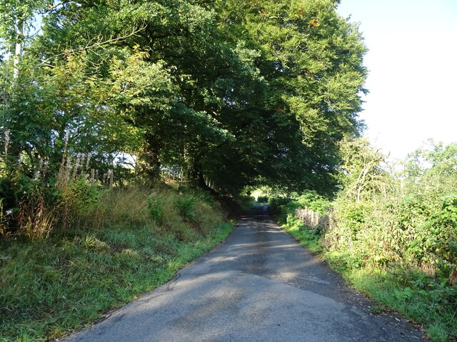
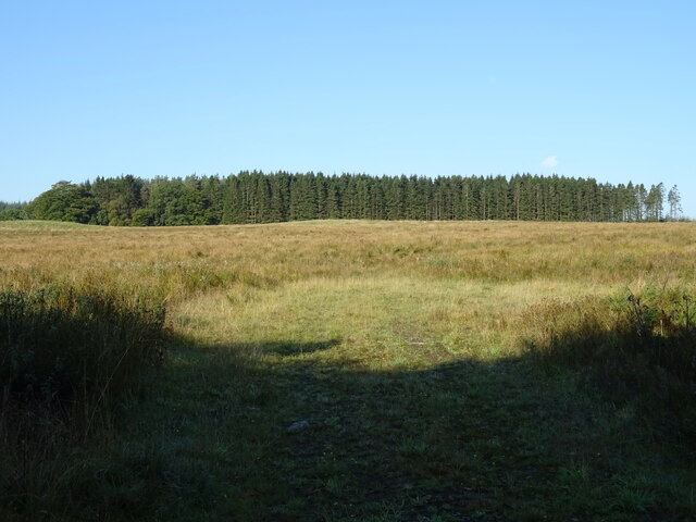
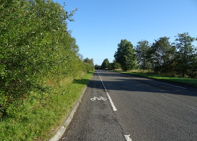
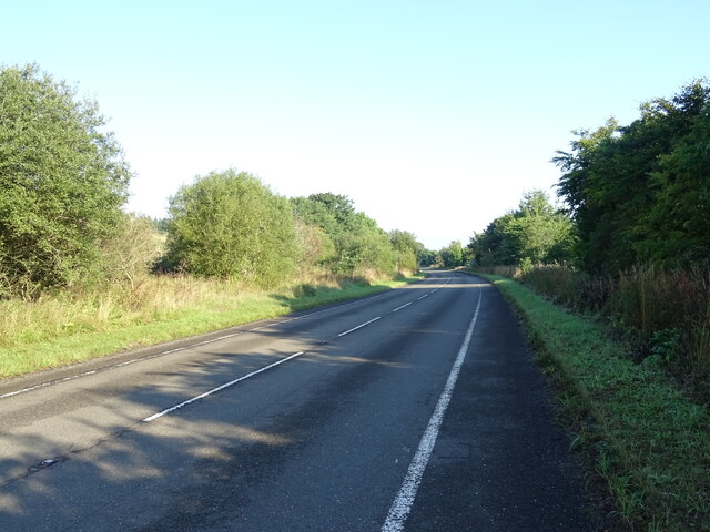
Nancy's Hill Images

Images are sourced within 2km of 55.256582/-3.403982 or Grid Reference NY1096. Thanks to Geograph Open Source API. All images are credited.

Minor road, Castle Knowe Heads west towards the B7020.
Minor road, Castle Knowe
Heads west towards the B7020.
Cogrie Moor Grassland towards woodland - west of the B7076.
Cogrie Moor
Grassland towards woodland - west of the B7076.
B7076 towards Beattock Heading north on National Cycle Route 74.
B7076 towards Beattock
Heading north on National Cycle Route 74.
Dumfries And Galloway : The A74(M) Looking along the A74(M) motorway.
Dumfries And Galloway : The A74(M)
Looking along the A74(M) motorway.
Woodland beside the B7076
National Cycle Route 74 towards Beattock B7076 heading north beside the A74(M).
National Cycle Route 74 towards Beattock
B7076 heading north beside the A74(M).
Field entrance off the B7076
B7076 towards Beattock Heading north parallel to the A74(M).
B7076 towards Beattock
Heading north parallel to the A74(M).
Trees beside the B7076
National Cycle Route 74 towards Beattock On the B7076.
National Cycle Route 74 towards Beattock
On the B7076.
View towards Oakrig Plantation Looking from the West Coast Main Line.
View towards Oakrig Plantation
Looking from the West Coast Main Line.
Start of the path, Wamphray Glen An information board near the road junction at Wamphray Bridge. There is room to park a few cars nearby.
Start of the path, Wamphray Glen
An information board near the road junction at Wamphray Bridge. There is room to park a few cars nearby.
The Wamphray Water Spring growth appearing in the woodland on the banks with Wamphray Bridge in the background.
The Wamphray Water
Spring growth appearing in the woodland on the banks with Wamphray Bridge in the background.
Footbridge over the Wamphray Water The path up the glen crosses here to follow the north bank of the Wamphray Water.
Footbridge over the Wamphray Water
The path up the glen crosses here to follow the north bank of the Wamphray Water.
The Wamphray Water from the footbridge Looking upstream from the bridge on the Wamphray Glen path.
The Wamphray Water from the footbridge
Looking upstream from the bridge on the Wamphray Glen path.
Field path by the Wamphray Water The Wamphray Glen path climbs to the top of the northern bank to follow the woodland edge towards Wamphray Mill.
Field path by the Wamphray Water
The Wamphray Glen path climbs to the top of the northern bank to follow the woodland edge towards Wamphray Mill.
Cascades on the Wamphray Water The path up the glen follows the steep edge of the bank with the river rushing past below.
Cascades on the Wamphray Water
The path up the glen follows the steep edge of the bank with the river rushing past below.
Hillhouse farm Farmland south of the Wamphray Water. The Wamphray Glen circular walk goes left past the farm to meet the minor road near the bridge.
Hillhouse farm
Farmland south of the Wamphray Water. The Wamphray Glen circular walk goes left past the farm to meet the minor road near the bridge.
Show me another place!

Nancy's Hill is located at Grid Ref: NY1096 (Lat: 55.256582, Lng: -3.403982)

Unitary Authority: Dumfries and Galloway

Police Authority: Dumfries and Galloway

What 3 Words

///distilled.works.sprain. Near Johnstonebridge, Dumfries & Galloway

Nearby Locations

Nancy's Hill

Related Wikis

Wamphray railway station

Wamphray railway station served Newton Wamphray, near Beattock, in the Scottish county of Dumfries and Galloway. It was served by local trains on what...

Newton Wamphray

Newton Wamphray is a village in Dumfries and Galloway. Wamphray is the name of the surrounding parish and of the Wamphray Water, which flows south-west...

Lochwood Tower

Lochwood Tower, also known as Lochwood Castle, is a ruined 16th-century L-plan tower house situated in Annandale (Valley of the River Annan) about 6 miles...

Annandale Water services

Annandale Water services is a motorway service station in the village of Johnstonebridge, Scotland. The service station is located next to the A74(M) motorway...

Annandale Water

Annandale Water is a loch in Annandale, Dumfries and Galloway, in the south west of Scotland. It is part of Annandale Water service station at Junction...

Johnstonebridge

Johnstonebridge is a village in Dumfries and Galloway, Scotland.It is roughly halfway between Moffat and Lockerbie, and lies on the A74(M) motorway. The...

Kirkpatrick-Juxta

Kirkpatrick-Juxta is a parish in Dumfries and Galloway on the A701, between Biggar, Moffat and Lockerbie. The parish straddles the main road A74 (M). It...

Dinwoodie railway station

Dinwoodie railway station was a station which served the rural area around the settlement of Dinwoodie, 6 miles north of Lockerbie in Applegarth parish...

Nearby Amenities

Located within 500m of 55.256582,-3.403982
Power: pole
Lat/Long: 55.2586568/-3.3988202
Power: pole
Lat/Long: 55.2588387/-3.3976883
Power: pole
Lat/Long: 55.2605888/-3.4023929
Power: pole
Lat/Long: 55.2602112/-3.4018967
Power: pole
Lat/Long: 55.2595693/-3.4011188
Power: pole
Lat/Long: 55.2591245/-3.4005851
Power: pole
Lat/Long: 55.2584733/-3.399775
Power: pole
Lat/Long: 55.2578314/-3.3989838
Power: pole
Lat/Long: 55.2571527/-3.3981443
Power: pole
Lat/Long: 55.2565382/-3.3973396
Power: pole
Lat/Long: 55.2558809/-3.3965188
Material: wood
Power: pole
Lat/Long: 55.2549023/-3.4108811
Material: wood
Power: pole
Lat/Long: 55.2557464/-3.4112315
Material: wood
Power: pole
Lat/Long: 55.2566258/-3.4115947
Material: wood
Power: pole
Lat/Long: 55.2579103/-3.4115071
Material: wood
Power: pole
Lat/Long: 55.25726/-3.4112624
Material: wood
Power: pole
Lat/Long: 55.2565377/-3.4109842
Material: wood
Power: pole
Lat/Long: 55.2558272/-3.4106905
Material: wood
Power: pole
Lat/Long: 55.2550285/-3.410384
Material: wood
Power: pole
Lat/Long: 55.2541976/-3.4100826
The data included in this document is from www.openstreetmap.org. The data is made available under ODbL.

Have you been to Nancy's Hill?

Leave your review of Nancy's Hill below (or comments, questions and feedback).