North Muir Hill

Hill, Mountain in Peeblesshire

Scotland

North Muir Hill

Summit cairn, Catstone A nice display of cumulus clouds from the summit in this unfrequented part of the Pentlands. The double-humped hill L of centre is Bleak Law.
Summit cairn, Catstone Credit: Jim Barton

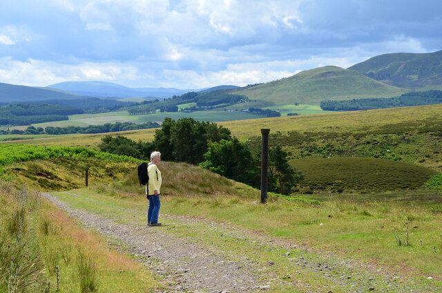
North Muir Hill is a prominent hill located in Peeblesshire, a historic county in the Scottish Borders region of Scotland. Rising to an elevation of approximately 460 meters (1,509 feet), it is classified as a hill rather than a mountain. Despite its relatively modest height, North Muir Hill offers breathtaking panoramic views of the surrounding countryside.

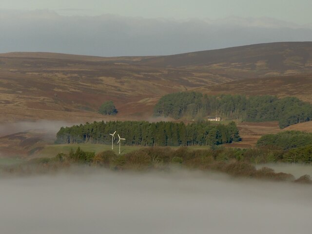
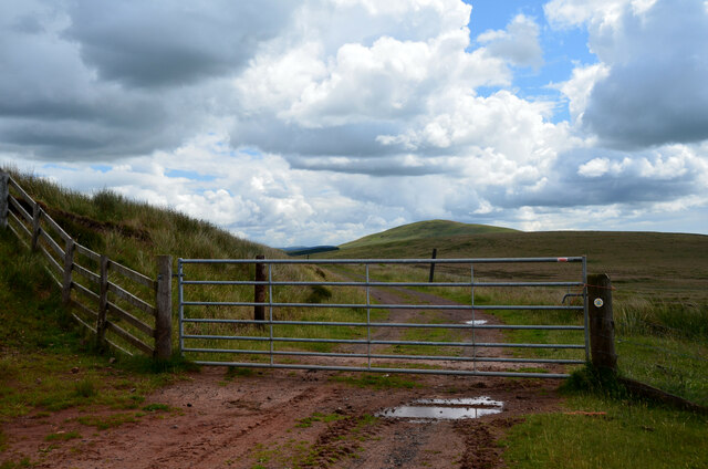
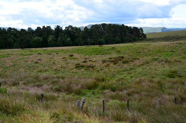
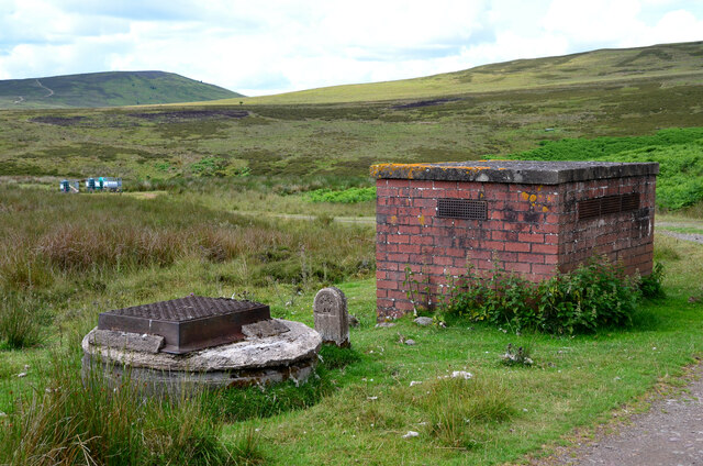
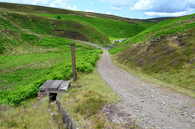
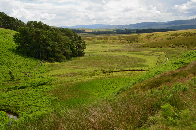
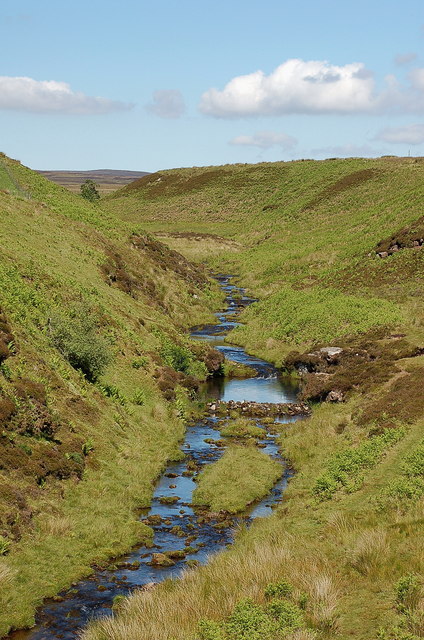
Situated just north of the village of Eddleston, North Muir Hill is easily accessible from various points in the area. The hill is predominantly covered in heather and grass, with scattered trees dotting its slopes. Walking trails and paths crisscross the hill, providing opportunities for outdoor enthusiasts to explore and enjoy the natural beauty of the area.

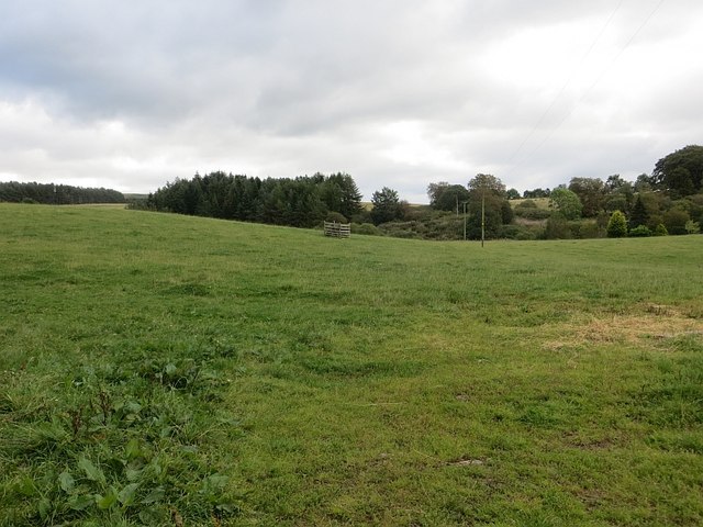
The summit of North Muir Hill rewards hikers with stunning vistas, offering sweeping views of the rolling hills, verdant valleys, and picturesque farmland that make up the Peeblesshire landscape. On clear days, it is even possible to catch a glimpse of the distant Southern Uplands and the majestic Pentland Hills.

North Muir Hill is home to a diverse range of flora and fauna, making it an attractive destination for nature lovers. Birdwatchers can spot a variety of species, including raptors and songbirds, while lucky visitors may come across deer, rabbits, and other wildlife that inhabit the hill.

With its captivating scenery and tranquil surroundings, North Muir Hill is a popular destination for hikers, nature enthusiasts, and those seeking a peaceful escape in the heart of Peeblesshire.

If you have any feedback on the listing, please let us know in the comments section below.

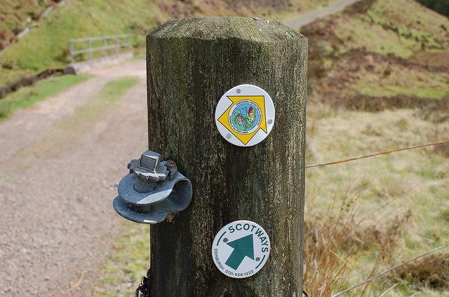
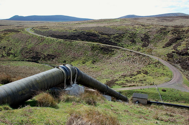
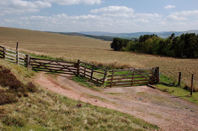
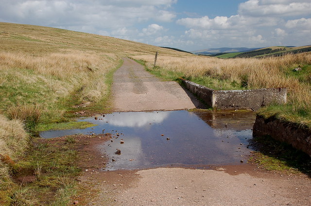
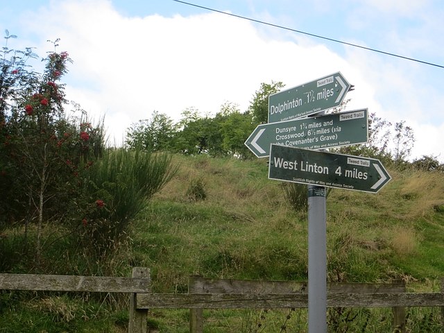
North Muir Hill Images

Images are sourced within 2km of 55.745119/-3.4272611 or Grid Reference NT1051. Thanks to Geograph Open Source API. All images are credited.

Summit cairn, Catstone A nice display of cumulus clouds from the summit in this unfrequented part of the Pentlands. The double-humped hill L of centre is Bleak Law.
Summit cairn, Catstone
A nice display of cumulus clouds from the summit in this unfrequented part of the Pentlands. The double-humped hill L of centre is Bleak Law.
Waymarks on a gatepost, Medwynhead Waymarks from Friends of the Pentlands and Scotways on the track to Slipperfield and West Linton.
Waymarks on a gatepost, Medwynhead
Waymarks from Friends of the Pentlands and Scotways on the track to Slipperfield and West Linton.
Track and pipeline, Medwynhead At this point the pipeline goes underground after rising up the bank from the Medwin Water. The track is access to a dam NE of Bleak Law.
Track and pipeline, Medwynhead
At this point the pipeline goes underground after rising up the bank from the Medwin Water. The track is access to a dam NE of Bleak Law.
Gates and cattle grid, Medwynhead On the track to Slipperfield and West Linton.
Gates and cattle grid, Medwynhead
On the track to Slipperfield and West Linton.
Ford near Medwynhead A ford on the waterworks track between Medwynhead and West Linton.
Ford near Medwynhead
A ford on the waterworks track between Medwynhead and West Linton.
Medwynhead and inversion conditions View from Shaw Hill into the Pentland Hills. Garvald is still under the fog.
Medwynhead and inversion conditions
View from Shaw Hill into the Pentland Hills. Garvald is still under the fog.
Road near Medwynhead The waterworks road from Slipperfield with Mendick Hill ahead.
Road near Medwynhead
The waterworks road from Slipperfield with Mendick Hill ahead.
Trees at Medwynhead On the moorland, seen from the waterworks road.
Trees at Medwynhead
On the moorland, seen from the waterworks road.
Brick structure for water pipeline Possibly a ventilator and a manhole on the route of the pipeline to West Water Reservoir.
Brick structure for water pipeline
Possibly a ventilator and a manhole on the route of the pipeline to West Water Reservoir.
Descending to the Medwin Water The waterworks road makes a hairpin descent to cross the Medwin Water, where two pipelines meet. The grassy hill R of centre is White Hill with Black Mount beyond. The vertical posts are old iron pipes used to mark the course of the road from Slipperfield.
Descending to the Medwin Water
The waterworks road makes a hairpin descent to cross the Medwin Water, where two pipelines meet. The grassy hill R of centre is White Hill with Black Mount beyond. The vertical posts are old iron pipes used to mark the course of the road from Slipperfield.
Waterworks road at the Medwin Water The road crosses the Medwin Water, where a pipeline captures water from a dam upstream to connect with the West Water Reservoir. Note the concrete-lined gutter to protect the road edges - see also <a href="https://www.geograph.org.uk/photo/1011753">NT1051 : Catch drains by the water board track</a> by Gordon Brown.
Waterworks road at the Medwin Water
The road crosses the Medwin Water, where a pipeline captures water from a dam upstream to connect with the West Water Reservoir. Note the concrete-lined gutter to protect the road edges - see also NT1051 : Catch drains by the water board track by Gordon Brown.
Pipelines at the Medwin Water The pipeline collects water from the dam upstream (shown in <a href="https://www.geograph.org.uk/photo/174099">NT0853 : Dam</a> by Callum Black), is joined in the small building by another pipe from the west, to rise up the hillside and continue towards West Water Reservoir.
Pipelines at the Medwin Water
The pipeline collects water from the dam upstream (shown in NT0853 : Dam by Callum Black), is joined in the small building by another pipe from the west, to rise up the hillside and continue towards West Water Reservoir.
Pipelines at the Medwin Water (2) The left-hand pipeline brings water from a dam upstream and is joined in the small building by another pipe from the west, to rise up the hillside and continue towards West Water Reservoir.
Pipelines at the Medwin Water (2)
The left-hand pipeline brings water from a dam upstream and is joined in the small building by another pipe from the west, to rise up the hillside and continue towards West Water Reservoir.
Valley of the Medwin Water A level area on the valley floor of the Medwin Water as it heads south, eventually to join the River Clyde.
Valley of the Medwin Water
A level area on the valley floor of the Medwin Water as it heads south, eventually to join the River Clyde.
West Water near Garvald Not to be confused with the other West Water about 3 km to the east. This burn drains southwards from the slopes of Mid Hill round to Black Law.
West Water near Garvald
Not to be confused with the other West Water about 3 km to the east. This burn drains southwards from the slopes of Mid Hill round to Black Law.
Garvald Mains farm Attractive old sandstone buildings around the yard at Garvald.
Garvald Mains farm
Attractive old sandstone buildings around the yard at Garvald.
Field, Garvald
Field, Garvald
Signpost, Garvald The route across the Pentland Hills via the Covenanter's Grave meets the old road from West Linton.
Signpost, Garvald
The route across the Pentland Hills via the Covenanter's Grave meets the old road from West Linton.
Show me another place!

North Muir Hill is located at Grid Ref: NT1051 (Lat: 55.745119, Lng: -3.4272611)

Unitary Authority: The Scottish Borders

Police Authority: The Lothians and Scottish Borders

What 3 Words

///epidemics.opened.slowness. Near West Linton, Scottish Borders

Nearby Locations

North Muir North Muir Hill

Related Wikis

West Water Reservoir

West Water Reservoir (sometimes Westwater Reservoir) is an artificial reservoir in the Pentland Hills, Scottish Borders, 3 kilometres (1.9 mi) west of...

Garvald, South Lanarkshire

Garvald is a small settlement on the boundary between the Scottish Borders and South Lanarkshire, Scotland. == References == The geographic coordinates...

Dolphinton (CR) railway station

Dolphinton railway station served the village of Dolphinton, Lanarkshire, Scotland, from 1867 to 1945 on the Dolphinton branch. == History == The station...

Dolphinton railway station

Dolphinton (North British Railway) railway station served the village of Dolphinton, Lanarkshire, Scotland from 1864 to 1933 on the Leadburn, Linton and...

Dunsyre railway station

Dunsyre railway station served the village of Dunsyre, South Lanarkshire, Scotland from 1867 to 1945 on the Dolphinton branch. == History == The station...

Dunsyre

Dunsyre (Scottish Gaelic: Dùn Saghair) is a village in South Lanarkshire, Scotland. It is 10 kilometres (6 mi) from Carnwath. Dunsyre is associated with...

Dolphinton

Dolphinton is a village and parish in Lanarkshire, Scotland. It is located 7 miles (11 km) northeast of Biggar, 11 miles (18 km) northeast of Carstairs...

Baddinsgill

Baddinsgill is a hamlet in the Scottish Borders area of Scotland. The Baddinsgill Reservoir is a few hundred metres north of the hamlet. == See also... ==

Nearby Amenities

Located within 500m of 55.745119,-3.4272611
North Muir Hill
Natural: peak
Wikidata: Q24661178
Lat/Long: 55.7446318/-3.4291935
The data included in this document is from www.openstreetmap.org. The data is made available under ODbL.

Have you been to North Muir Hill?

Leave your review of North Muir Hill below (or comments, questions and feedback).