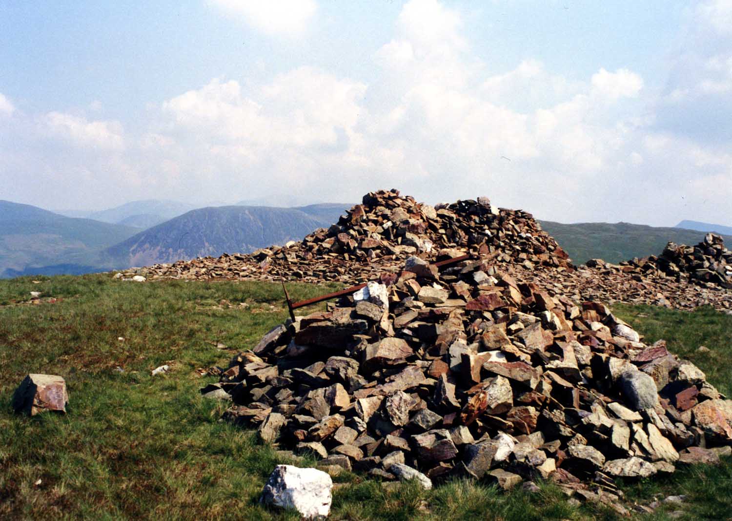
Crag Fell

Hill, Mountain in Cumberland Copeland

England

Crag Fell

Weir at outflow of Ennerdale Water
Weir at outflow of Ennerdale Water Credit: Graeme Yuill

Crag Fell is a prominent hill located in the western part of the Lake District National Park, in the county of Cumberland, England. Standing at an elevation of 523 meters (1,716 feet), it is categorized as a Wainwright Fell, named after the famous fell walker and author Alfred Wainwright.

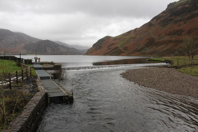
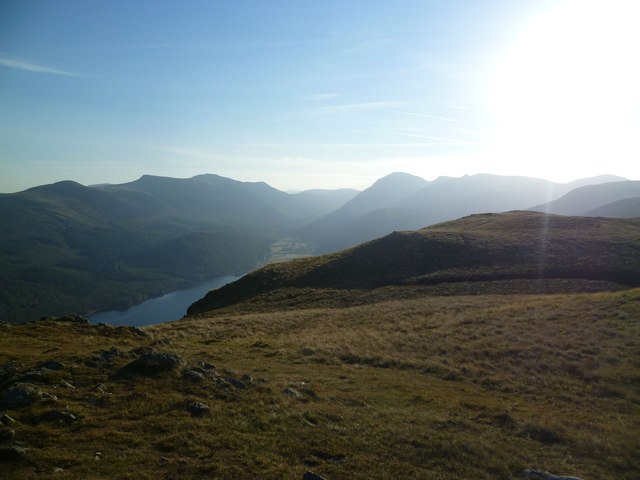
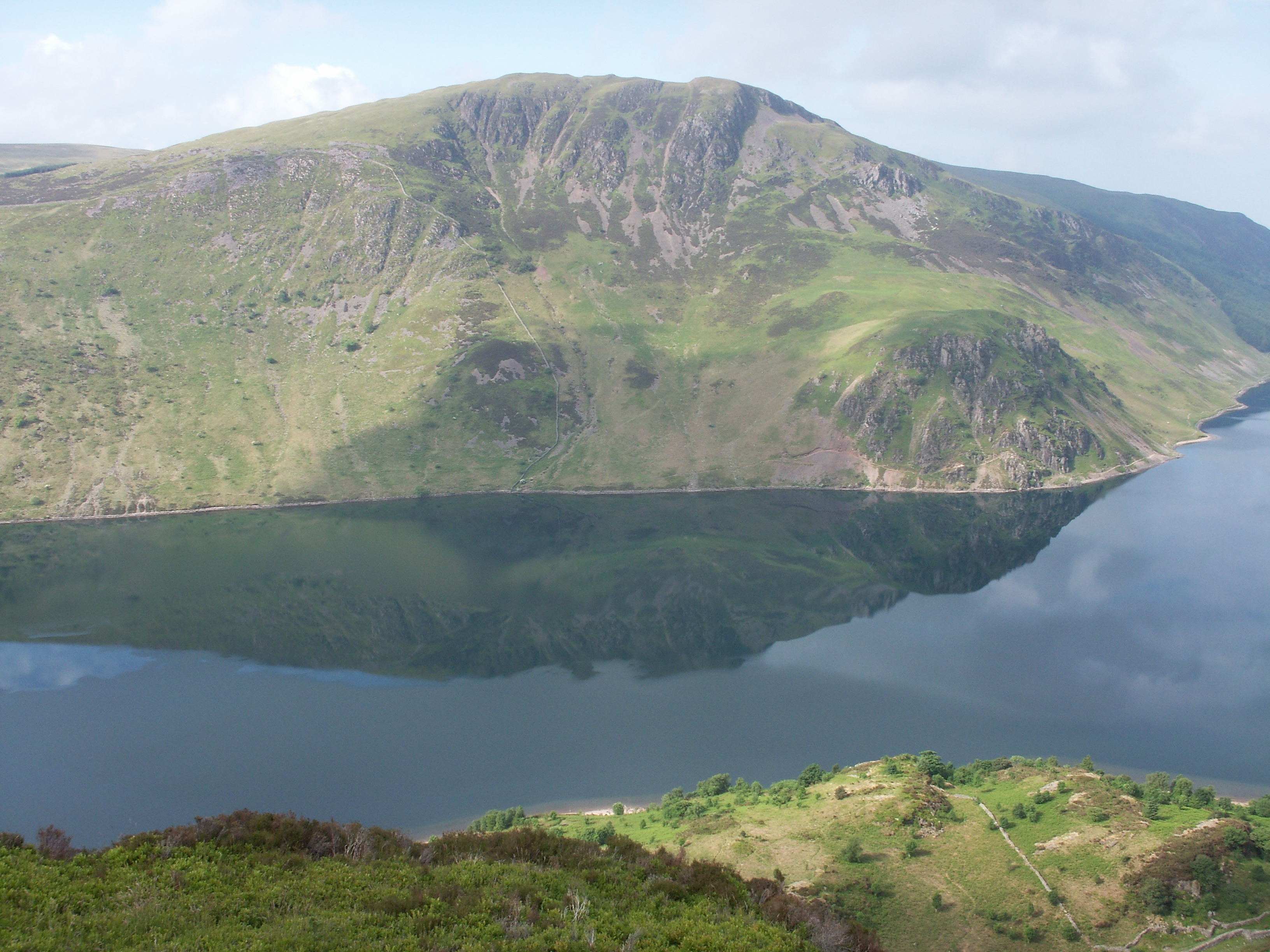
Situated near the village of Ennerdale Bridge, Crag Fell offers fantastic panoramic views of the surrounding landscape. To the north, the vista includes the picturesque Ennerdale Water, one of the most unspoiled lakes in the region. The western aspect reveals the rugged peaks of the nearby fells, such as Grike and Lank Rigg. On a clear day, it is even possible to catch a glimpse of the Irish Sea to the west.

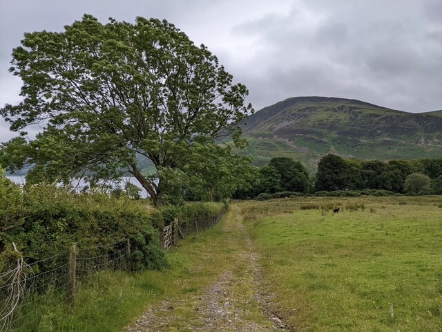
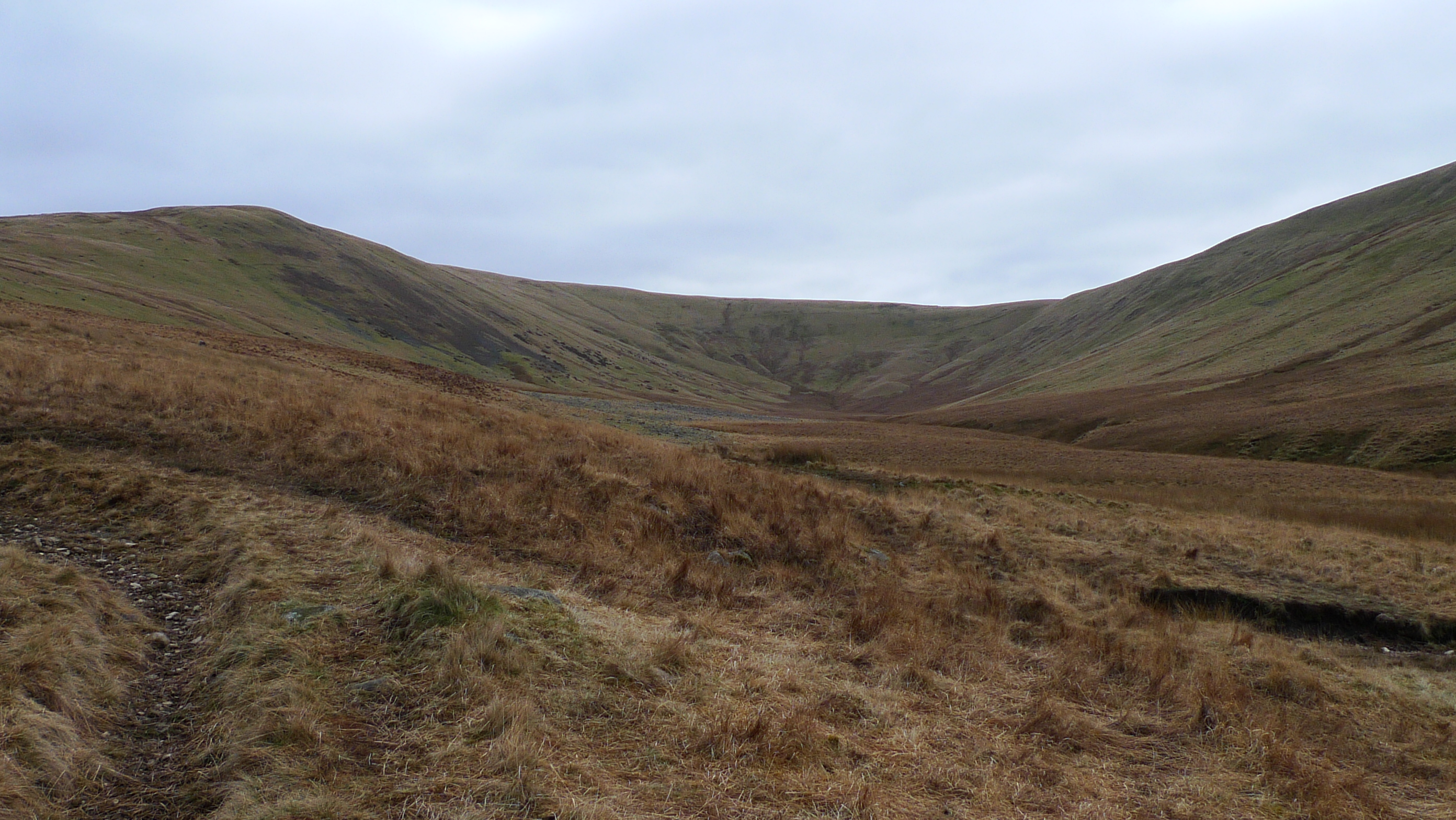
The ascent of Crag Fell is relatively straightforward, with various paths leading to the summit. The most popular route starts from the car park at Bleach Green and follows a well-defined path that gradually climbs through open moorland. As hikers ascend, they are rewarded with breathtaking views and the chance to spot local wildlife, including red deer and buzzards.

Crag Fell is a popular destination for walkers and outdoor enthusiasts, offering a peaceful and tranquil environment away from the more crowded areas of the Lake District. Its accessibility and stunning vistas make it an ideal choice for those seeking a moderately challenging hike with rewarding scenery.

If you have any feedback on the listing, please let us know in the comments section below.

Crag Fell Images

Images are sourced within 2km of 54.516648/-3.3959805 or Grid Reference NY0914. Thanks to Geograph Open Source API. All images are credited.

Weir at outflow of Ennerdale Water
A bridleway leading to Ennerdale Water
Ennerdale Pano
Ennerdale Pano
Start of the River Ehan, Ennerdale Waters The river's source is at the west end of Ennerdale Water: it runs west through Ennerdale Bridge

<span class="nowrap"><a title="https://en.wikipedia.org/wiki/River_Ehen" rel="nofollow ugc noopener" href="https://en.wikipedia.org/wiki/River_Ehen">Link</a><img style="margin-left:2px;" alt="External link" title="External link - shift click to open in new window" src="https://s1.geograph.org.uk/img/external.png" width="10" height="10"/></span>
Start of the River Ehan, Ennerdale Waters
The river's source is at the west end of Ennerdale Water: it runs west through Ennerdale Bridge LinkExternal link
On Whoap Summit On the unmarked top looking towards Crag Fell. Few are fortunate enough to have climbed modest Whoap ten times as I have done over the years.
On Whoap Summit
On the unmarked top looking towards Crag Fell. Few are fortunate enough to have climbed modest Whoap ten times as I have done over the years.
Violet Ground Beetle By the Ennerdale fence under Whoap. The beetle though a common sight on the fells startled as it scurried over the grass  flashing violet.
Violet Ground Beetle
By the Ennerdale fence under Whoap. The beetle though a common sight on the fells startled as it scurried over the grass flashing violet.
Ascending Crag Fell Looking towards Boat How from the flanks of Crag Fell
Ascending Crag Fell
Looking towards Boat How from the flanks of Crag Fell
Above Revelin Crag The fellside falls away steeply 1300' above Ennerdale Lake
Above Revelin Crag
The fellside falls away steeply 1300' above Ennerdale Lake
Weir at Enerdale Water
Angler's Crag Bowness Knott in the distance across Ennerdale Water
Angler's Crag
Bowness Knott in the distance across Ennerdale Water
On Grike Looking towards the Loweswater hills
On Grike
Looking towards the Loweswater hills
On Crag Fell Looking up Ennerdale
On Crag Fell
Looking up Ennerdale
Small Fall and Pool On the beck which runs out of Buck Hole
Small Fall and Pool
On the beck which runs out of Buck Hole
It's a Baby Girl! Message on another balloon which has come to rest in Stinking Gill
It's a Baby Girl!
Message on another balloon which has come to rest in Stinking Gill
Weir at Ennerdale Water The track over Anglers Crag clearly visible
Weir at Ennerdale Water
The track over Anglers Crag clearly visible
Lakeside footpath Ennerdale Water Part of the Coast to Coast long distance walk
Lakeside footpath Ennerdale Water
Part of the Coast to Coast long distance walk
Crag Fell Summit Cairn Crag Fell summit cairn looking over to the Great Bourne to Red Pike ridge. 

Name: Crag Fell
Hill number: 2476
Height: 523m / 1716ft
Area: Lake District - Western Fells
Class: Hu,5,W,B
Grid ref: NY 09725 14385
Summit feature: cairn
Drop: 114m
Col: 409m  NY101136
Crag Fell Summit Cairn
Crag Fell summit cairn looking over to the Great Bourne to Red Pike ridge. Name: Crag Fell Hill number: 2476 Height: 523m / 1716ft Area: Lake District - Western Fells Class: Hu,5,W,B Grid ref: NY 09725 14385 Summit feature: cairn Drop: 114m Col: 409m NY101136
Grike Summit Cairns Seventh Birkett of nine on this frosty morning's circuit.
Name: Grike
Hill number: 2482
Height: 488m / 1601ft
Area: Lake District - Western Fells
Class: W,B
Grid ref: NY 08502 14080
Summit feature: windshelter
Drop: 37m
Col: 451m  NY092140
Grike Summit Cairns
Seventh Birkett of nine on this frosty morning's circuit. Name: Grike Hill number: 2482 Height: 488m / 1601ft Area: Lake District - Western Fells Class: W,B Grid ref: NY 08502 14080 Summit feature: windshelter Drop: 37m Col: 451m NY092140
Show me another place!

Crag Fell is located at Grid Ref: NY0914 (Lat: 54.516648, Lng: -3.3959805)

Administrative County: Cumbria

District: Copeland

Police Authority: Cumbria

What 3 Words

///thread.paddlers.broker. Near Frizington, Cumbria

Nearby Locations

Crag Fell

Related Wikis

Crag Fell

Crag Fell is a hill in the English Lake District. It is part of the Lank Rigg group, standing above Ennerdale Water in the Western Fells. The craggy northern...

Grike (Lake District)

Grike is a hill in the west of the English Lake District, near Ennerdale Water. It is part of the Lank Rigg group, the most westerly Wainwright as the...
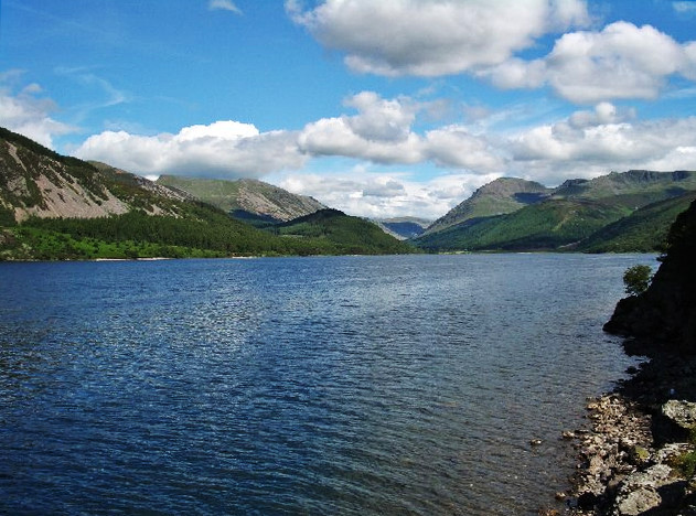
Ennerdale Water

Ennerdale Water is the most westerly lake in the Lake District National Park in Cumbria, England. It is a glacial lake, with a maximum depth of 150 feet...

Whoap

Whoap is a hill located near the western edge of the English Lake District, standing at 511 m. It is part of the Lank Rigg group and is separated from...

Nearby Amenities

Located within 500m of 54.516648,-3.3959805
Crag Fell
Ele: 523
Natural: peak
Source: npe
Wikidata: Q5180590
Wikipedia: en:Crag Fell
Lat/Long: 54.5167056/-3.3960575
Abandoned: yes
Man Made: adit
Lat/Long: 54.5170507/-3.3920731
Abandoned: yes
Direction: 110
Man Made: adit
Mineral: iron
Lat/Long: 54.5148276/-3.3897286
The data included in this document is from www.openstreetmap.org. The data is made available under ODbL.

Have you been to Crag Fell?

Leave your review of Crag Fell below (or comments, questions and feedback).