Fadden

Hill, Mountain in Peeblesshire

Scotland

Fadden

Summit cairn, Catstone A nice display of cumulus clouds from the summit in this unfrequented part of the Pentlands. The double-humped hill L of centre is Bleak Law.
Summit cairn, Catstone Credit: Jim Barton

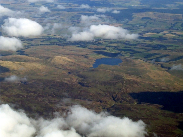
Fadden is a hill located in Peeblesshire, a historic county in the Scottish Borders region of Scotland. It is situated within the beautiful Tweed Valley, known for its picturesque landscapes and rolling hills. Fadden stands at an elevation of approximately 415 meters (1,362 feet) above sea level.

This hill offers stunning panoramic views of the surrounding countryside, with the Tweed Valley stretching out before it. The hill is covered in lush green vegetation and is home to a variety of plant and animal species, making it a popular spot for nature enthusiasts and hikers.

Fadden is easily accessible by foot, with several well-marked trails leading to its summit. The journey to the top is moderately challenging, presenting a rewarding hike for outdoor enthusiasts of all levels. Along the way, hikers can enjoy the tranquil atmosphere and the chance to spot various wildlife species, including birds, rabbits, and maybe even deer.

From the summit of Fadden, visitors can take in breathtaking vistas of the rolling hills, meandering rivers, and charming villages that make up the Peeblesshire region. On a clear day, it is possible to see as far as the distant hills of the Southern Uplands.

Overall, Fadden is a delightful hill in Peeblesshire, offering a serene escape into nature and the chance to appreciate the stunning beauty of the Scottish countryside.

If you have any feedback on the listing, please let us know in the comments section below.
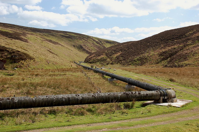
Fadden Images

Images are sourced within 2km of 55.770088/-3.4406233 or Grid Reference NT0953. Thanks to Geograph Open Source API. All images are credited.

Summit cairn, Catstone A nice display of cumulus clouds from the summit in this unfrequented part of the Pentlands. The double-humped hill L of centre is Bleak Law.
Summit cairn, Catstone
A nice display of cumulus clouds from the summit in this unfrequented part of the Pentlands. The double-humped hill L of centre is Bleak Law.
Shooting hut below Fadden The hut and a nearby shed are at the end of the gravel track that comes up from the Slipperfield track. White Craig is in the background.
Shooting hut below Fadden
The hut and a nearby shed are at the end of the gravel track that comes up from the Slipperfield track. White Craig is in the background.
Summit of Fadden West Water Reservoir and Mendick Hill seen from this rounded heathery summit.
Summit of Fadden
West Water Reservoir and Mendick Hill seen from this rounded heathery summit.
Unnamed cleuch near Fadden A small valley in the heather that runs east from the col between Fadden and Craigengar. Byrehope Mount is in the background.
Unnamed cleuch near Fadden
A small valley in the heather that runs east from the col between Fadden and Craigengar. Byrehope Mount is in the background.
Moorland drain below Craigengar The ground here around the head of Raven's Cleuch is rough peat moorland covered in places by deep heather.
Moorland drain below Craigengar
The ground here around the head of Raven's Cleuch is rough peat moorland covered in places by deep heather.
Raven's Cleuch (eastern), Craigengar There is Raven's Cleuch shown here meeting the Medwin Water at the dam, and a Ravens Cleugh (no apostrophe according to the 1:25,000 map!) only 1 km to the west. Millstone Rig is in between.
Raven's Cleuch (eastern), Craigengar
There is Raven's Cleuch shown here meeting the Medwin Water at the dam, and a Ravens Cleugh (no apostrophe according to the 1:25,000 map!) only 1 km to the west. Millstone Rig is in between.
Dam and pipeline, Medwin Water Water from the Medwin and Raven's Cleuch in the foreground is diverted into a pipeline that runs down the valley to go underground to West Water Reservoir.
Dam and pipeline, Medwin Water
Water from the Medwin and Raven's Cleuch in the foreground is diverted into a pipeline that runs down the valley to go underground to West Water Reservoir.
Medwin Water The burn upstream of the dam; see <a href="https://www.geograph.org.uk/photo/2119506">NT0853 : Medwin Burn</a> for the same view in October last year.
Medwin Water
The burn upstream of the dam; see NT0853 : Medwin Burn for the same view in October last year.
Pipeline intake and weir, Medwin Water Water is diverted into a pipeline near the building, with surplus running down the bed of the burn.
Pipeline intake and weir, Medwin Water
Water is diverted into a pipeline near the building, with surplus running down the bed of the burn.
Pipeline, Medwin Water The pipeline runs for about 2 km above ground to Medwynhead, where it swings E towards West Water Reservoir.
Pipeline, Medwin Water
The pipeline runs for about 2 km above ground to Medwynhead, where it swings E towards West Water Reservoir.
Nature meets pipeline engineering A small sapling has somehow managed to root on the pedestal carrying the pipe joint, and lichen is growing on the pipe surface. Note the roller mounting to allow small pipe movements due to expansion.
Nature meets pipeline engineering
A small sapling has somehow managed to root on the pedestal carrying the pipe joint, and lichen is growing on the pipe surface. Note the roller mounting to allow small pipe movements due to expansion.
Bridges and pipeline, Medwin Water The access road to the dam and water intake crosses the burn several times in this narrow glen.
Bridges and pipeline, Medwin Water
The access road to the dam and water intake crosses the burn several times in this narrow glen.
Bend in the pipeline, Medwin Water The water pipe connects with West Water Reservoir about 3 km to the east and here makes a bend to follow the glen.
Bend in the pipeline, Medwin Water
The water pipe connects with West Water Reservoir about 3 km to the east and here makes a bend to follow the glen.
West Water Reservoir from the air A few minutes after take-off from Edinburgh towards the southwest.
West Water Reservoir from the air
A few minutes after take-off from Edinburgh towards the southwest.
Huts between Catstone and Fadden Near the top of an un-named burn draining into the West Water Reservoir.
Huts between Catstone and Fadden
Near the top of an un-named burn draining into the West Water Reservoir.
Un-named burn draining into the West Water Reservoir Taken just after a heavy shower of rain and hail, on an unusually cool and unsettled July day.
Un-named burn draining into the West Water Reservoir
Taken just after a heavy shower of rain and hail, on an unusually cool and unsettled July day.
View towards the main Pentland Hills from Craigengar Craigengar is much less visited than the distant hills closer to Edinburgh. One of several cairns on its summit plateau is visible here.
View towards the main Pentland Hills from Craigengar
Craigengar is much less visited than the distant hills closer to Edinburgh. One of several cairns on its summit plateau is visible here.
View from Craigengar summit shelter down fenceline Another shower is sweeping in on a changeable day of weather.
View from Craigengar summit shelter down fenceline
Another shower is sweeping in on a changeable day of weather.
Show me another place!

Fadden is located at Grid Ref: NT0953 (Lat: 55.770088, Lng: -3.4406233)

Unitary Authority: The Scottish Borders

Police Authority: The Lothians and Scottish Borders

What 3 Words

///gullible.cloth.static. Near West Linton, Scottish Borders

Nearby Locations

Fadden

Related Wikis

West Water Reservoir

West Water Reservoir (sometimes Westwater Reservoir) is an artificial reservoir in the Pentland Hills, Scottish Borders, 3 kilometres (1.9 mi) west of...

Baddinsgill

Baddinsgill is a hamlet in the Scottish Borders area of Scotland. The Baddinsgill Reservoir is a few hundred metres north of the hamlet. == See also... ==

Baddinsgill Reservoir

Baddinsgill Reservoir is a small reservoir in the Scottish Borders area of Scotland close to Carlops, West Linton, and the boundary with Midlothian. It...

West Cairn Hill

West Cairn Hill is a hill in the Pentland Hills range of Scotland. With a height of 562 m (1,844 ft), it is the fifth highest elevation and lies on the...

Garvald, South Lanarkshire

Garvald is a small settlement on the boundary between the Scottish Borders and South Lanarkshire, Scotland. == References == The geographic coordinates...

Cauldstane Slap

Cauldstane Slap is a pass located in the Pentland Hills of Scotland. It marks the border between the neighboring council areas of West Lothian and Scottish...
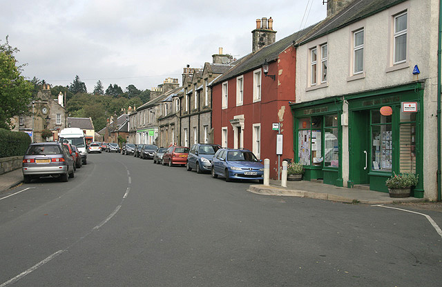
West Linton

West Linton (Scottish Gaelic: Liontan Ruairidh) is a village and civil parish in southern Scotland, on the A702. It was formerly in the county of Peeblesshire...

Pentland Hills

The Pentland Hills are a range of hills southwest of Edinburgh, Scotland. The range is around twenty miles (thirty kilometres) in length, and runs southwest...

Have you been to Fadden?

Leave your review of Fadden below (or comments, questions and feedback).