Carn Cruinn

Hill, Mountain in Aberdeenshire

Scotland

Carn Cruinn

Southern slopes of An Socach A view of Loch Vrotachan in the background.
Southern slopes of An Socach Credit: Richard Webb

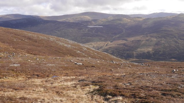
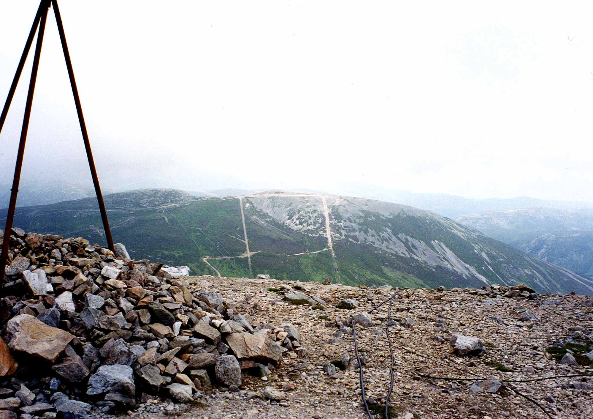
Carn Cruinn is a prominent hill located in Aberdeenshire, Scotland. Standing at an elevation of approximately 653 meters (2,142 feet), it is a notable landmark in the region, offering breathtaking views of the surrounding landscape. The hill is situated in the Cairngorms National Park, known for its stunning natural beauty and diverse wildlife.

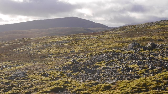
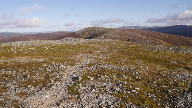
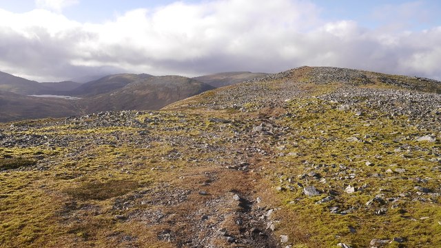
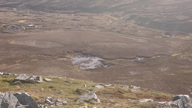
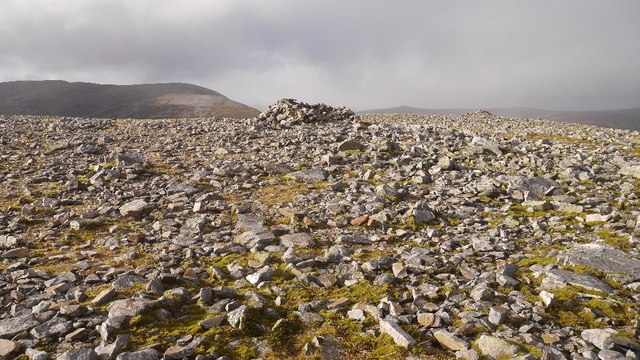
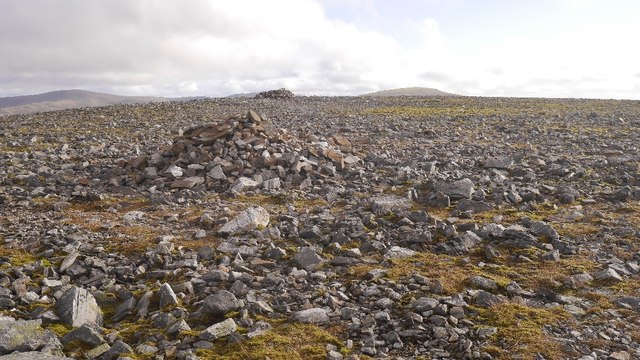
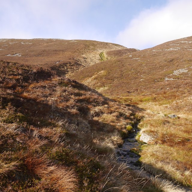
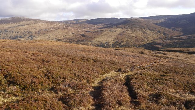
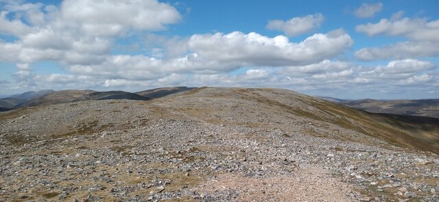
Carn Cruinn is characterized by its gently sloping sides and rocky summit. Its distinctive shape and prominent position make it a popular destination for hikers and nature enthusiasts. The hill is accessible by several well-marked trails, providing a range of difficulty levels for walkers of all abilities.

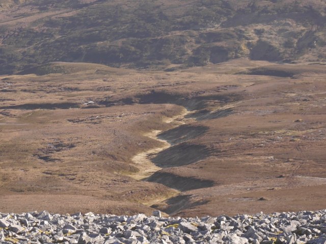
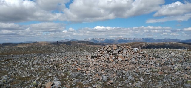
At the top of Carn Cruinn, visitors are rewarded with panoramic vistas of the surrounding countryside. On clear days, it is possible to see the Cairngorms mountain range to the south, as well as the fertile farmland and rolling hills of Aberdeenshire. The summit also offers a peaceful and serene atmosphere, providing a perfect spot for relaxation and contemplation.

The area surrounding Carn Cruinn is rich in biodiversity, with a variety of plant and animal species inhabiting its slopes. Walkers may encounter indigenous wildlife such as red deer, mountain hares, and a wide array of bird species.

Overall, Carn Cruinn is a remarkable hill that showcases the natural beauty of Aberdeenshire. Its accessibility, stunning views, and diverse wildlife make it a popular destination for outdoor enthusiasts, offering a memorable experience for all who venture to its summit.

If you have any feedback on the listing, please let us know in the comments section below.

Carn Cruinn Images

Images are sourced within 2km of 56.911901/-3.4925816 or Grid Reference NO0981. Thanks to Geograph Open Source API. All images are credited.

Southern slopes of An Socach A view of Loch Vrotachan in the background.
Southern slopes of An Socach
A view of Loch Vrotachan in the background.
Quartzite strewn across An Socach An Socach is covered in frost shattered quartzite, often moss covered.
Quartzite strewn across An Socach
An Socach is covered in frost shattered quartzite, often moss covered.
Summit ridge, An Socach 2km of wide, flat ridge between the two tops.  Looking towards the eastern top.
Summit ridge, An Socach
2km of wide, flat ridge between the two tops. Looking towards the eastern top.
An Socach (Mar) There are a few An Socachs in the Highlands, three of them in Munro's Tables. (One is also called Meall a' Chraisg which could reduce confusion).  This one is in the rolling hill country at the head of Glen Ey, south of Braemar and like its neighbours has a quartzite cap. The rock is frost shattered giving angular boulder fields, but the walking is easy, this is no Schiehallion or Sgùrr Bàn.  The highest point is at the western end, switching the original Munro's tables which had the eastern top as the highest. 
The hill is often done from the Baddoch Glen, but can also be visited from Glen Ey.  Apart from it not being exactly a roadside hill, this is one of the easier munros.

This is the ridge to the east of the main top with Loch an Eun in the background.
An Socach (Mar)
There are a few An Socachs in the Highlands, three of them in Munro's Tables. (One is also called Meall a' Chraisg which could reduce confusion). This one is in the rolling hill country at the head of Glen Ey, south of Braemar and like its neighbours has a quartzite cap. The rock is frost shattered giving angular boulder fields, but the walking is easy, this is no Schiehallion or Sgùrr Bàn. The highest point is at the western end, switching the original Munro's tables which had the eastern top as the highest. The hill is often done from the Baddoch Glen, but can also be visited from Glen Ey. Apart from it not being exactly a roadside hill, this is one of the easier munros. This is the ridge to the east of the main top with Loch an Eun in the background.
Peat pool, Baddoch Glen Bogs beneath An Socach.
Peat pool, Baddoch Glen
Bogs beneath An Socach.
An Socach The summit ridge, not far east of the higher west top.

There are a few An Socachs in the Highlands, three of them in Munro's Tables. (One is also called Meall a' Chraisg which could reduce confusion).  This one is in the rolling hill country at the head of Glen Ey, south of Braemar and like its neighbours has a quartzite cap. The rock is frost shattered giving angular boulder fields, but the walking is easy, this is no Schiehallion or Sgùrr Bàn.  The highest point is at the western end, switching the original Munro's tables which had the eastern top as the highest. 
The hill is often done from the Baddoch Glen, but can also be visited from Glen Ey.  Apart from it not being exactly a roadside hill, this is one of the easier munros.
An Socach
The summit ridge, not far east of the higher west top. There are a few An Socachs in the Highlands, three of them in Munro's Tables. (One is also called Meall a' Chraisg which could reduce confusion). This one is in the rolling hill country at the head of Glen Ey, south of Braemar and like its neighbours has a quartzite cap. The rock is frost shattered giving angular boulder fields, but the walking is easy, this is no Schiehallion or Sgùrr Bàn. The highest point is at the western end, switching the original Munro's tables which had the eastern top as the highest. The hill is often done from the Baddoch Glen, but can also be visited from Glen Ey. Apart from it not being exactly a roadside hill, this is one of the easier munros.
An Socach summit cairn A very flat moss and quartzite summit, but the view is very fine.

There are a few An Socachs in the Highlands, three of them in Munro's Tables. (One is also called Meall a' Chraisg which could reduce confusion).  This one is in the rolling hill country at the head of Glen Ey, south of Braemar and like its neighbours has a quartzite cap. The rock is frost shattered giving angular boulder fields, but the walking is easy, this is no Schiehallion or Sgùrr Bàn.  The highest point is at the western end, switching the original Munro's tables which had the eastern top as the highest. 
The hill is often done from the Baddoch Glen, but can also be visited from Glen Ey.  Apart from it not being exactly a roadside hill, this is one of the easier munros.
An Socach summit cairn
A very flat moss and quartzite summit, but the view is very fine. There are a few An Socachs in the Highlands, three of them in Munro's Tables. (One is also called Meall a' Chraisg which could reduce confusion). This one is in the rolling hill country at the head of Glen Ey, south of Braemar and like its neighbours has a quartzite cap. The rock is frost shattered giving angular boulder fields, but the walking is easy, this is no Schiehallion or Sgùrr Bàn. The highest point is at the western end, switching the original Munro's tables which had the eastern top as the highest. The hill is often done from the Baddoch Glen, but can also be visited from Glen Ey. Apart from it not being exactly a roadside hill, this is one of the easier munros.
Cairns, An Socach A pair of cairns on the west top of the Mar An Socach. The distant cairn is the summit.
Cairns, An Socach
A pair of cairns on the west top of the Mar An Socach. The distant cairn is the summit.
Allt Boruiche A burn cuts down below peat covered glacial deposits.  A view from An Socach.
Allt Boruiche
A burn cuts down below peat covered glacial deposits. A view from An Socach.
Allt Boruiche A burn flowing south off An Socach.  This is one of the usual routes on or off the hill.
Allt Boruiche
A burn flowing south off An Socach. This is one of the usual routes on or off the hill.
All terrain vehicle track, An Socach Descent into the Baddoch Glen. Things get very boggy further down.
All terrain vehicle track, An Socach
Descent into the Baddoch Glen. Things get very boggy further down.
An Socach summit ridge The final push to the summit of the Munro along the stone covered ridge.
An Socach summit ridge
The final push to the summit of the Munro along the stone covered ridge.
Cairn on An Socach One of two cairns on the summit area of the Munro. The app on my phone was happier with the cairn in the background to the left as being the actual summit.
Cairn on An Socach
One of two cairns on the summit area of the Munro. The app on my phone was happier with the cairn in the background to the left as being the actual summit.
Turning area above Altanour Lodge
Carn Cruinn Lunch stop
Summit cairn of An Socach A perfect winter day with the ice crystals singing across the frozen surface as you strode along the summit ridge.
Summit cairn of An Socach
A perfect winter day with the ice crystals singing across the frozen surface as you strode along the summit ridge.
Heading towards An Socach in mist
An Socach summit cairn in mist
Show me another place!

Carn Cruinn is located at Grid Ref: NO0981 (Lat: 56.911901, Lng: -3.4925816)

Unitary Authority: Aberdeenshire

Police Authority: North East

What 3 Words

///broken.tutorial.everyone. Near Inverey, Aberdeenshire

Nearby Locations

Carn Cruinn

Related Wikis

An Socach (Glen Ey)

An Socach is a Scottish mountain situated some three miles (5 km) west of the A93 road from Perth to Braemar. It is located at grid ref. 080800 on Ordnance...

Loch nan Eun

Loch nan Eun is a remote freshwater loch, located in Gleann Taitneach in the Grampian Mountains, Perth and Kinross, some 4.5 miles west of The Cairnwell...

Càrn Aosda

Càrn Aosda is a Scottish mountain situated 12.5 km south of the town of Braemar, in the county of Aberdeenshire. It stands near the summit of the Cairnwell...

Càrn a' Gheòidh

Càrn a' Gheòidh or Càrn Gheòidh is a mountain in the Mounth region of the Scottish Highlands. It lies 15 km south of the town of Braemar. Its summit stands...

Càrn Bhac

Carn Bhac (945 m) is a mountain in the Grampian Mountains of Scotland. It lies north of the village of Inverey in Aberdeenshire, in the southern Mounth...

Beinn Iutharn Mhòr

Beinn Iutharn Mhor (1,045 m) is a mountain in the Grampian Mountains of Scotland. It lies north of Glen Shee on the Aberdeenshire and Perthshire border...
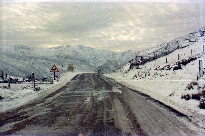
Cairnwell Pass

The Cairnwell Pass (Scottish Gaelic: Càrn a' Bhailg) is a mountain pass on the A93 road between Glen Shee, Perthshire, and Braemar, Aberdeenshire, in the...
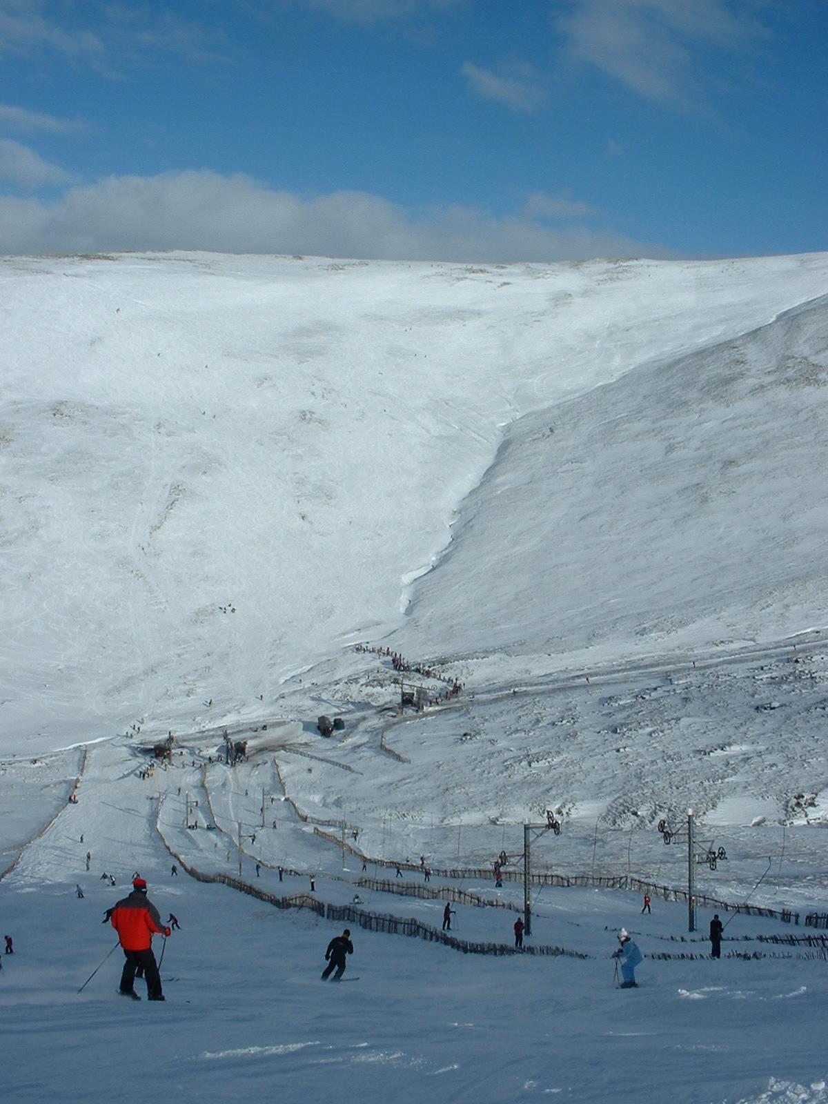
Glenshee Ski Centre

Glenshee Ski Centre is an alpine snowsports area in the Scottish Highlands. It is located above the Cairnwell Pass at the head of Glen Shee on either side...

Nearby Amenities

Located within 500m of 56.911901,-3.4925816
Carn Cruinn
Ele: 862
Natural: peak
Lat/Long: 56.9130326/-3.4965687
The data included in this document is from www.openstreetmap.org. The data is made available under ODbL.

Have you been to Carn Cruinn?

Leave your review of Carn Cruinn below (or comments, questions and feedback).