Colzium Hill

Hill, Mountain in Midlothian

Scotland

Colzium Hill

Birny Knowe from the air It looks like the strip wood <a href="https://www.geograph.org.uk/photo/1691510">NT0757 : Strip wood, Birny Knowe</a> has been felled. Harperrig Reservoir can be seen to the top left.
Birny Knowe from the air Credit: Thomas Nugent

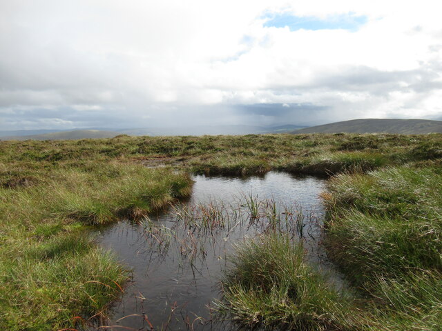
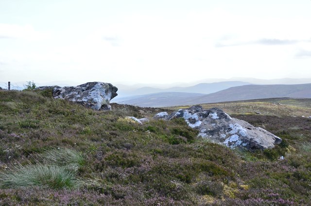
Colzium Hill is a prominent hill located in Midlothian, Scotland. It is situated near the town of Kilsyth and is part of the larger Colzium Estate. Standing at an elevation of approximately 157 meters (515 feet), it offers breathtaking panoramic views of the surrounding countryside and the nearby Campsie Fells.

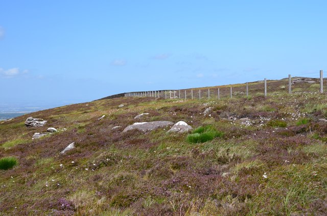
The hill is covered in lush green vegetation and is home to a diverse range of flora and fauna. It is a popular destination for hikers, nature enthusiasts, and photographers who are drawn to its serene beauty. The hill is crisscrossed with well-maintained walking trails, allowing visitors to explore its various paths and enjoy the tranquil atmosphere.

At the summit of Colzium Hill, there is a trig point, which serves as a marker for surveying purposes. This provides a great spot for walkers to rest and take in the stunning vistas that stretch as far as the eye can see.

The Colzium Estate, of which the hill is a part, also offers additional attractions such as Colzium House, a historic mansion that dates back to the 18th century. The estate is known for its well-manicured gardens, which feature beautiful flower beds, ornamental trees, and a picturesque walled garden.

Colzium Hill is easily accessible, with ample parking available for visitors. It is a popular destination for both locals and tourists alike, offering a peaceful retreat from the hustle and bustle of urban life. Whether it's for a leisurely stroll, a picnic, or simply enjoying the beauty of nature, Colzium Hill provides a tranquil escape for all who visit.

If you have any feedback on the listing, please let us know in the comments section below.
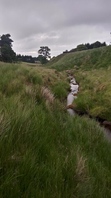
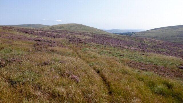
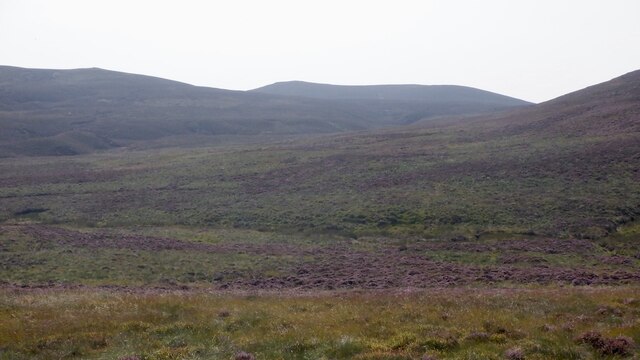
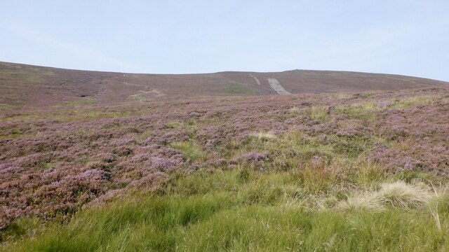
Colzium Hill Images

Images are sourced within 2km of 55.795295/-3.4504547 or Grid Reference NT0956. Thanks to Geograph Open Source API. All images are credited.

Birny Knowe from the air It looks like the strip wood <a href="https://www.geograph.org.uk/photo/1691510">NT0757 : Strip wood, Birny Knowe</a> has been felled. Harperrig Reservoir can be seen to the top left.
Birny Knowe from the air
It looks like the strip wood NT0757 : Strip wood, Birny Knowe has been felled. Harperrig Reservoir can be seen to the top left.
Rainbow at Wolf Craigs The Wolf Craigs are a group of small outcrops by the upper reaches of the Baddinsgill Burn.
Rainbow at Wolf Craigs
The Wolf Craigs are a group of small outcrops by the upper reaches of the Baddinsgill Burn.
West Burn, approaching Colzium I followed the course of this burn for about a mile. Not only is it quite picturesque in places, the going is fairly easy - certainly in comparison to a lot of the open country round here.
West Burn joins with Mid Burn just downstream of here. After another unnamed burn to the West (following the naming pattern round here it should really be called Wester, or Westmost Burn) joins the  flow it takes on its more famous name - Water of Leith - shortly before it enters Harperrig Reservoir, which starts around a mile North of this spot.
The name 'Colzium', to me anyway, always has a rather ancient and menacing feel to it. Maybe it is because it contains the letter 'z'; it gives it an almost biblical importance.
I have my doubts as to whether the origin of the name can really be the one which all online sources confidently suggest. Whilst the internet is a wonderful thing, this might be one of those instances in which one theory has just been copied and pasted by everybody since. Apparently it is a corruption of the old Gaelic word 'cuingleum' which is said to have meant 'gorge leap', which presumably means that in order to cross it you had to take a running jump over the water below.
My arguments against are:
(1) This is quite a big change in spelling/pronunciation over time. Spelling, however, varied enormously when literacy levels were low and there was no standardisation, so I am prepared to accept this might be wrong.
(2) It seems too small a watercourse to have such a feature. I will at some point follow its course further though, to hunt out the supposed gorge.
(3) Gaelic was rarely ever spoken round here.

It may be relevant that there is a more famous 'Colzium' in North Lanarkshire which maybe does have a narrow gorge nearby. And Gaelic was spoken there to a certain degree at various points I believe.
Online sources also differ in their guides to pronouncing it. These days - with this Colzium anyway - I have only ever heard it spoken as Coll-Zee-Um, with the stress on the first syllable.
West Burn, approaching Colzium
I followed the course of this burn for about a mile. Not only is it quite picturesque in places, the going is fairly easy - certainly in comparison to a lot of the open country round here. West Burn joins with Mid Burn just downstream of here. After another unnamed burn to the West (following the naming pattern round here it should really be called Wester, or Westmost Burn) joins the flow it takes on its more famous name - Water of Leith - shortly before it enters Harperrig Reservoir, which starts around a mile North of this spot. The name 'Colzium', to me anyway, always has a rather ancient and menacing feel to it. Maybe it is because it contains the letter 'z'; it gives it an almost biblical importance. I have my doubts as to whether the origin of the name can really be the one which all online sources confidently suggest. Whilst the internet is a wonderful thing, this might be one of those instances in which one theory has just been copied and pasted by everybody since. Apparently it is a corruption of the old Gaelic word 'cuingleum' which is said to have meant 'gorge leap', which presumably means that in order to cross it you had to take a running jump over the water below. My arguments against are: (1) This is quite a big change in spelling/pronunciation over time. Spelling, however, varied enormously when literacy levels were low and there was no standardisation, so I am prepared to accept this might be wrong. (2) It seems too small a watercourse to have such a feature. I will at some point follow its course further though, to hunt out the supposed gorge. (3) Gaelic was rarely ever spoken round here. It may be relevant that there is a more famous 'Colzium' in North Lanarkshire which maybe does have a narrow gorge nearby. And Gaelic was spoken there to a certain degree at various points I believe. Online sources also differ in their guides to pronouncing it. These days - with this Colzium anyway - I have only ever heard it spoken as Coll-Zee-Um, with the stress on the first syllable.
View towards the main Pentland Hills from Craigengar Craigengar is much less visited than the distant hills closer to Edinburgh. One of several cairns on its summit plateau is visible here.
View towards the main Pentland Hills from Craigengar
Craigengar is much less visited than the distant hills closer to Edinburgh. One of several cairns on its summit plateau is visible here.
View from Craigengar summit shelter down fenceline Another shower is sweeping in on a changeable day of weather.
View from Craigengar summit shelter down fenceline
Another shower is sweeping in on a changeable day of weather.
Balloon litter, Pentland Hills A twentieth birthday somewhere.  The "2" balloon deflated and brought down the heart and "0" right in front of me.  I tied the two surviving balloons to my pack for amusement on the way out.

What is not funny is the litter and the waste of helium. It ends up in space and there is only so much down here on Earth. What there is is thanks to radioactive decay of thorium and uranium - it is spent alpha particles.
Balloon litter, Pentland Hills
A twentieth birthday somewhere. The "2" balloon deflated and brought down the heart and "0" right in front of me. I tied the two surviving balloons to my pack for amusement on the way out. What is not funny is the litter and the waste of helium. It ends up in space and there is only so much down here on Earth. What there is is thanks to radioactive decay of thorium and uranium - it is spent alpha particles.
Moorland, Baddinsgill View towards Muckle Knock.
Moorland, Baddinsgill
View towards Muckle Knock.
Moorland, Baddinsgill View towards Craigengar.
Moorland, Baddinsgill
View towards Craigengar.
West Cairn Hill The south (Baddinsgill side).
West Cairn Hill
The south (Baddinsgill side).
Boggy pool on West Cairn Hill A shower of rain and hail is passing through.
Boggy pool on West Cairn Hill
A shower of rain and hail is passing through.
Fenceline on Byrehope Mount A relatively featureless hillside in the quieter end of the Pentland Hills.
Fenceline on Byrehope Mount
A relatively featureless hillside in the quieter end of the Pentland Hills.
Rock outcrops in the heather Very much the open heather moorland of the wilder part of the SW area of the Pentland Hills between West Cairn Hill, Byrehope Mount and Craigengar.
Rock outcrops in the heather
Very much the open heather moorland of the wilder part of the SW area of the Pentland Hills between West Cairn Hill, Byrehope Mount and Craigengar.
Boundary fence south of West Cairn Hill The boundary between Scottish Borders and South Lanarkshire on the moorland ridge.
Boundary fence south of West Cairn Hill
The boundary between Scottish Borders and South Lanarkshire on the moorland ridge.
Cairn on Colzium Hill On a rather brighter day than my last visit in 2009: <a href="https://www.geograph.org.uk/photo/1209194">NT0956 : Old cairn on Colzium Hill</a>. The black dot R of the cairn is a meadow pipit in flight.
Cairn on Colzium Hill
On a rather brighter day than my last visit in 2009: NT0956 : Old cairn on Colzium Hill. The black dot R of the cairn is a meadow pipit in flight.
West Cairn from Colzium Hill Rough going to reach the cairn from any direction as the ground is either heathery, boggy, tussocky or sown with semi-hidden stones and small outcrops. Enjoy the trip!
West Cairn from Colzium Hill
Rough going to reach the cairn from any direction as the ground is either heathery, boggy, tussocky or sown with semi-hidden stones and small outcrops. Enjoy the trip!
Heather moor with outcrops, Colzium Hill I was searching for the 'Ewe and Lamb' marked in this area, expecting to see gritstone outcrops rivalling a Henry Moore sculpture, but nothing very obvious was in sight. West Cairn Hill is in the background.
Heather moor with outcrops, Colzium Hill
I was searching for the 'Ewe and Lamb' marked in this area, expecting to see gritstone outcrops rivalling a Henry Moore sculpture, but nothing very obvious was in sight. West Cairn Hill is in the background.
The Ewe and Lamb, Colzium Hill I was searching for the 'Ewe and Lamb' marked in this area, expecting to see gritstone outcrops rivalling a Henry Moore sculpture, but nothing very obvious was in sight apart from these two modest boulders near the place marked. There are much more striking outcrops up on the ridge nearer West Cairn, but perhaps the name on the map here has some local story attached. Maybe the Ewe and Lamb are elsewhere, but not much else was evident.
The Ewe and Lamb, Colzium Hill
I was searching for the 'Ewe and Lamb' marked in this area, expecting to see gritstone outcrops rivalling a Henry Moore sculpture, but nothing very obvious was in sight apart from these two modest boulders near the place marked. There are much more striking outcrops up on the ridge nearer West Cairn, but perhaps the name on the map here has some local story attached. Maybe the Ewe and Lamb are elsewhere, but not much else was evident.
Boundary fence and Craigengar On the moorland south of West Cairn Hill.
Boundary fence and Craigengar
On the moorland south of West Cairn Hill.
Show me another place!

Colzium Hill is located at Grid Ref: NT0956 (Lat: 55.795295, Lng: -3.4504547)

Unitary Authority: West Lothian

Police Authority: The Lothians and Scottish Borders

What 3 Words

///ladders.swinging.televise. Near West Linton, Scottish Borders

Nearby Locations

Colzium Hill

Related Wikis

West Cairn Hill

West Cairn Hill is a hill in the Pentland Hills range of Scotland. With a height of 562 m (1,844 ft), it is the fifth highest elevation and lies on the...

Cauldstane Slap

Cauldstane Slap is a pass located in the Pentland Hills of Scotland. It marks the border between the neighboring council areas of West Lothian and Scottish...
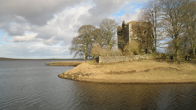
Cairns Castle

Cairns Castle is a ruined keep, dating from the 15th century. It is located on the northern slope of the Pentland Hills, around 6.5 miles (10.5 km) south...

Baddinsgill

Baddinsgill is a hamlet in the Scottish Borders area of Scotland. The Baddinsgill Reservoir is a few hundred metres north of the hamlet. == See also... ==

Have you been to Colzium Hill?

Leave your review of Colzium Hill below (or comments, questions and feedback).