Achinavish Hill
Hill, Mountain in Caithness
Scotland
Achinavish Hill

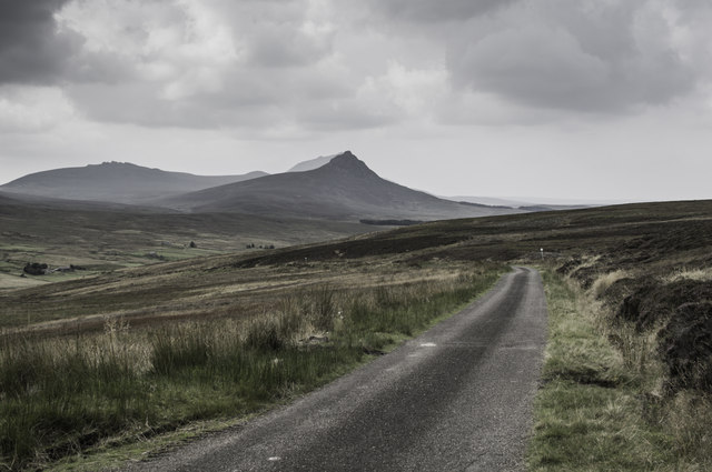
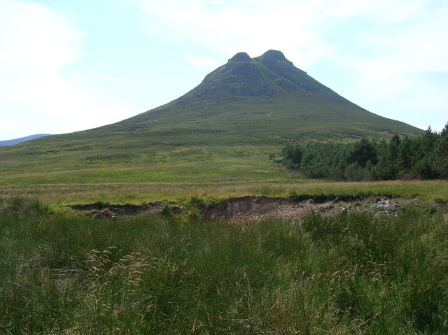
Achinavish Hill is a prominent landmark located in the county of Caithness, in the northeastern part of Scotland. With an elevation of approximately 1,093 feet (333 meters), it is classified as a hill rather than a mountain. The hill is situated near the coastal village of Lybster, about 14 miles (23 kilometers) south of the town of Wick.
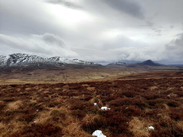
Achinavish Hill is known for its distinctive shape, featuring a steep and rugged terrain that offers breathtaking views of the surrounding landscape. The hill is predominantly composed of sandstone and is covered in heather, grasses, and scattered shrubs. Due to its elevated position, Achinavish Hill often experiences strong winds, particularly during the winter months.
The summit of the hill provides panoramic views of the North Sea and the surrounding countryside, including the nearby hills of Sarclet and Braemore. On clear days, it is possible to see as far as the Orkney Islands, which lie approximately 15 miles (24 kilometers) to the northeast.
Achinavish Hill is a popular destination for hikers and nature enthusiasts, who are drawn to its natural beauty and the opportunity to enjoy outdoor activities such as walking, birdwatching, and photography. The area surrounding the hill is also rich in wildlife, with species such as red grouse, curlews, and golden eagles often spotted in the vicinity.
If you have any feedback on the listing, please let us know in the comments section below.
Achinavish Hill Images
Images are sourced within 2km of 58.253301/-3.5513001 or Grid Reference ND0930. Thanks to Geograph Open Source API. All images are credited.


Achinavish Hill is located at Grid Ref: ND0930 (Lat: 58.253301, Lng: -3.5513001)
Unitary Authority: Highland
Police Authority: Highlands and Islands
What 3 Words
///dialects.forces.tolerable. Near Dunbeath, Highland
Nearby Locations
Related Wikis
Braemore
Braemore (Scottish Gaelic: Am Bràigh Mòr) is a location in Berriedale in the Highland council area of Scotland. It can be approached from the A9 road at...

Dunbeath air crash
The Dunbeath air crash involved the loss of a Short S.25 Sunderland Mk. III that crashed in the Scottish Highlands on a headland known as Eagle's Rock...
Maiden Pap, Caithness
The Maiden Pap is a hill located in Caithness, Scotland. It is an inselberg, formed of Devonian conglomerates, rising steeply out of the surrounding plain...

Scaraben
Scaraben (626 m) is a hill in the Northwest Highlands of Scotland. It lies in the Caithness region, in the far north. Taking the form of a long ridge over...

Balnabruich
Balnabruich (from Scottish Gaelic Baile na Bruaich) is a small hamlet on the east coast of Scotland, close to Dunbeath, Caithness, Scottish Highlands...
Ramscraig
Ramscraig is a small scattered crofting hamlet, located 2 miles southwest from Dunbeath, in eastern Caithness, Scottish Highlands and is in the Scottish...

Dunbeath
Dunbeath (Scottish Gaelic: Dùn Bheithe) is a village in south-east Caithness, Scotland on the A9 road. It sits astride the Dunbeath Water just before it...

Dunbeath Castle
Dunbeath Castle is located on the east coast of Caithness, 2 kilometres (1.2 mi) south of Dunbeath, in northern Scotland. Although a castle has stood here...
Have you been to Achinavish Hill?
Leave your review of Achinavish Hill below (or comments, questions and feedback).