Cnapan a' Mheirlich

Hill, Mountain in Banffshire

Scotland

Cnapan a' Mheirlich

River Avon Passing below The Bruach on the right and Leacann an Daimh ahead on the left.
River Avon Credit: Dorothy Carse

Cnapan a' Mheirlich is a hill located in Banffshire, Scotland. It is situated near the town of Keith and overlooks the surrounding countryside. The hill has a height of approximately 1,088 feet (331 meters) above sea level.

Cnapan a' Mheirlich is known for its rugged terrain and stunning views of the surrounding area. The hill is popular among hikers and outdoor enthusiasts, who come to explore its slopes and enjoy the panoramic vistas from the summit.

The hill is covered in heather and grasses, and is home to a variety of wildlife including birds of prey, deer, and other small mammals. The area surrounding Cnapan a' Mheirlich is also rich in archaeological sites, with ancient stone circles and burial mounds scattered throughout the landscape.

Overall, Cnapan a' Mheirlich offers a challenging but rewarding hike for those looking to experience the natural beauty of the Scottish countryside. Its remote location and peaceful atmosphere make it a popular destination for those seeking a tranquil escape from the hustle and bustle of everyday life.

If you have any feedback on the listing, please let us know in the comments section below.

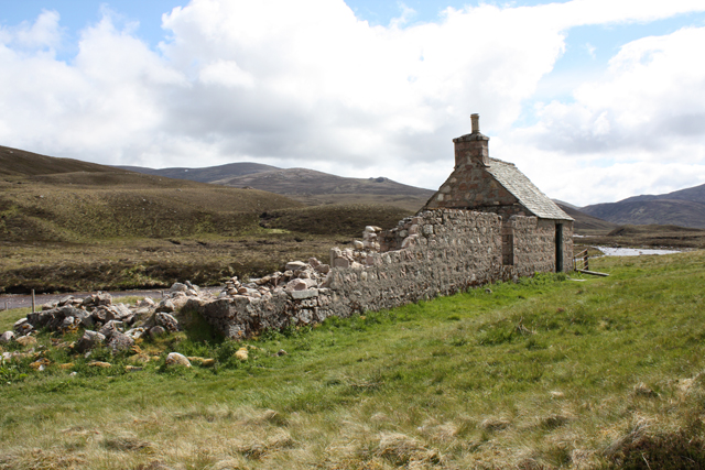
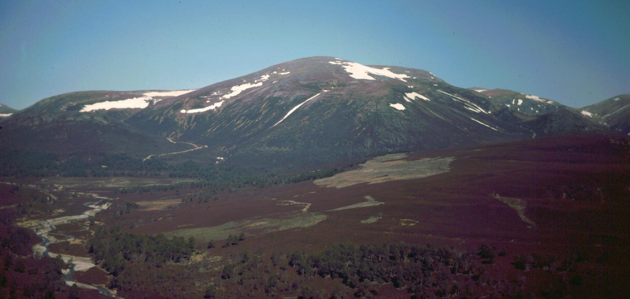
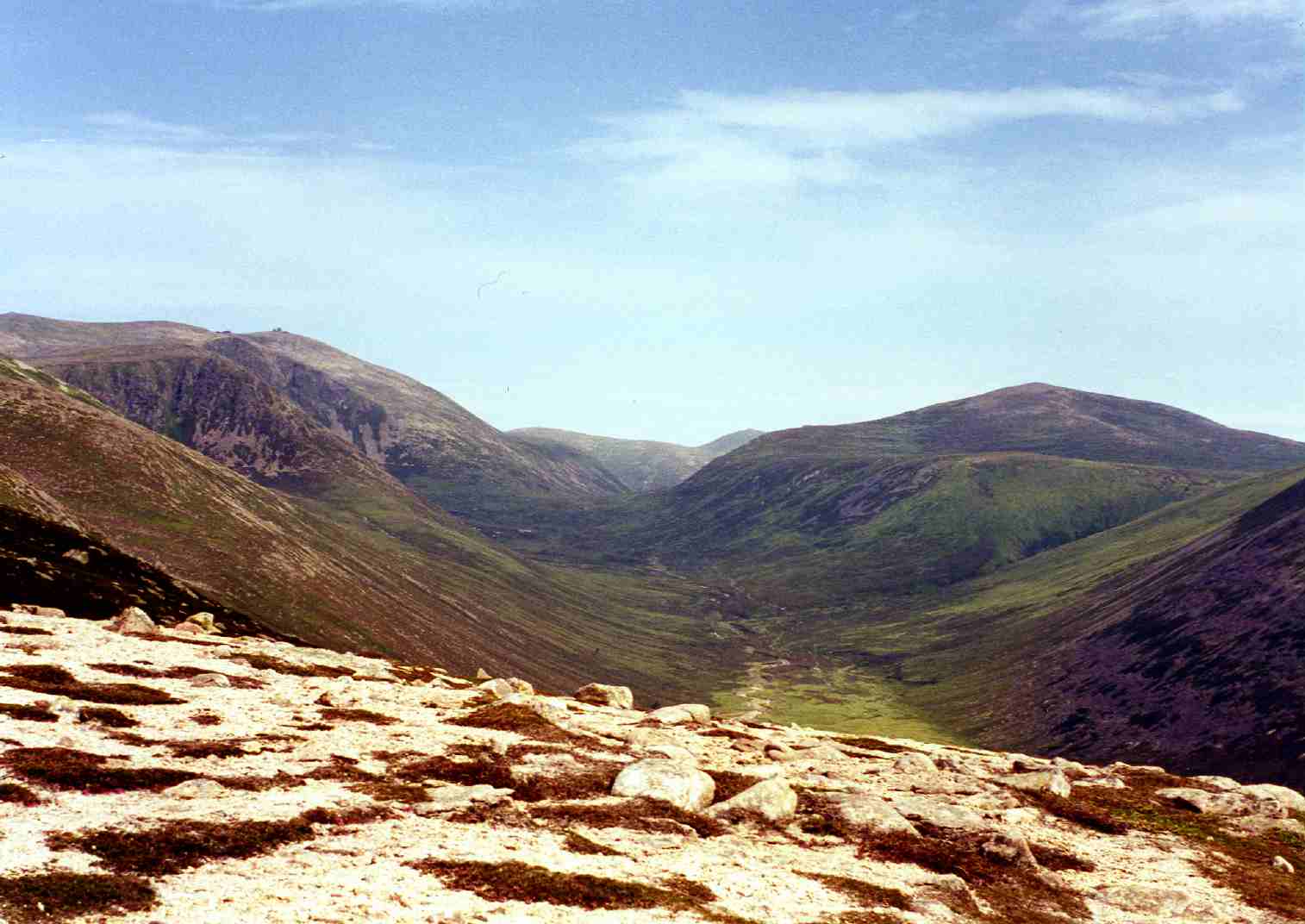
Cnapan a' Mheirlich Images

Images are sourced within 2km of 57.145271/-3.5054552 or Grid Reference NJ0907. Thanks to Geograph Open Source API. All images are credited.

River Avon Passing below The Bruach on the right and Leacann an Daimh ahead on the left.
River Avon
Passing below The Bruach on the right and Leacann an Daimh ahead on the left.
River Avon near Lagan a' Mheirlich The Faindouran track can be seen contouring round the hill on the left.
River Avon near Lagan a' Mheirlich
The Faindouran track can be seen contouring round the hill on the left.
Footbridge over the River Avon The river flows through a narrow rocky gorge here.
Footbridge over the River Avon
The river flows through a narrow rocky gorge here.
Track between boulders The track to Faindouran passes between two erratics.
Track between boulders
The track to Faindouran passes between two erratics.
Faindouran Bothy A nice bothy attached to the ruins of Faindouran Lodge.
Faindouran Bothy
A nice bothy attached to the ruins of Faindouran Lodge.
Footbridge over the River Avon
Faindouran Lodge bothy
Looking up Glen Avon From just off the path S.W. of Faindouran Lodge, looking further up Glen Avon. That could be Beinn Mheadhoin in the R.H. distance, and Beinn a' Chaorainn in the L.H. distance. The landrover track ended at Faindouran.
Looking up Glen Avon
From just off the path S.W. of Faindouran Lodge, looking further up Glen Avon. That could be Beinn Mheadhoin in the R.H. distance, and Beinn a' Chaorainn in the L.H. distance. The landrover track ended at Faindouran.
Grassy moorland above Glen Avon In the area marked Leacann a' Bhothain Dhuibh.
Grassy moorland above Glen Avon
In the area marked Leacann a' Bhothain Dhuibh.
Grassy moorland above Glen Avon From off the path, and west of Faindouran Lodge Bothy, looking further west over Caochan Craobh a' Chuimeneich.
Grassy moorland above Glen Avon
From off the path, and west of Faindouran Lodge Bothy, looking further west over Caochan Craobh a' Chuimeneich.
Grassy moorland west of Faindouran Lodge Bothy The valley in the distance is Feith an Dobhrain. Above it on the right, ( and out of the square is Cnap a' Dobhrain ).
Grassy moorland west of Faindouran Lodge Bothy
The valley in the distance is Feith an Dobhrain. Above it on the right, ( and out of the square is Cnap a' Dobhrain ).
Hillside north of Coire Riabhach Bheag A grassy area of hill to the north of Coire Riabhach Bheag.
Hillside north of Coire Riabhach Bheag
A grassy area of hill to the north of Coire Riabhach Bheag.
Peat hags north of Coire Riabhach Bheag Peat hags on the hill to the north of Coire Riabhach Bheag.
Peat hags north of Coire Riabhach Bheag
Peat hags on the hill to the north of Coire Riabhach Bheag.
A barren landscape north of Dagrum The relatively flat upland to the north of Dagrum is home to low heather and dispersed tussocks of grass, non of which is very tall or difficult to navigate.
A barren landscape north of Dagrum
The relatively flat upland to the north of Dagrum is home to low heather and dispersed tussocks of grass, non of which is very tall or difficult to navigate.
Barren upland landscape A barren upland landscape to the north of the minor top of Dagrum.
Barren upland landscape
A barren upland landscape to the north of the minor top of Dagrum.
Gently sloping upland landscape A gently sloping, barren upland landscape on the ridge to the north of Creag Mhor.
Gently sloping upland landscape
A gently sloping, barren upland landscape on the ridge to the north of Creag Mhor.
Unnamed Lochan A small lake in a small depression in the large and relatively featureless Cairngorms landscape.
Unnamed Lochan
A small lake in a small depression in the large and relatively featureless Cairngorms landscape.
North of Cnap an Dobhrain The heather and tussocks of grass to the north of Cnap an Dobhrain. The River Avon flows along the valley floor in the distance.
North of Cnap an Dobhrain
The heather and tussocks of grass to the north of Cnap an Dobhrain. The River Avon flows along the valley floor in the distance.
Show me another place!

Cnapan a' Mheirlich is located at Grid Ref: NJ0907 (Lat: 57.145271, Lng: -3.5054552)

Unitary Authority: Moray

Police Authority: North East

What 3 Words

///emulated.credible.flown. Near Inverey, Aberdeenshire

Nearby Locations

Cnapan a' Mheirlich

Related Wikis

Bynack More

Bynack More (Scottish Gaelic: A' Bheithneag Mhòr or Beinn Bheithneag) is a Scottish Mountain that is situated in the Cairngorms range, 16 kilometres east...

Beinn a' Bhùird

Beinn a' Bhùird is a Munro in the Cairngorm mountain range of Scotland. In Watson (1975) the author suggests the mountain should be named Beinn Bòrd -...

Ben Avon

Ben Avon (Scottish Gaelic: Beinn Athfhinn, 'mountain of the Avon') is a mountain in the Cairngorms of Scotland. It is a sprawling mountain with a broad...

Beinn a' Chaorainn (Cairngorms)

Beinn a' Chaorainn is a Scottish mountain in the heart of the Cairngorms range. It is quite a remote hill, being located roughly 19 kilometres south east...

Nearby Amenities

Located within 500m of 57.145271,-3.5054552
Cnap an Dobhrain
Ele: 693
Natural: peak
Lat/Long: 57.144804/-3.5136586
Cnapan a'Mheirlich
Ele: 686
Natural: peak
Lat/Long: 57.1443902/-3.5045563
The data included in this document is from www.openstreetmap.org. The data is made available under ODbL.

Have you been to Cnapan a' Mheirlich?

Leave your review of Cnapan a' Mheirlich below (or comments, questions and feedback).