Ardargie Hill

Hill, Mountain in Perthshire

Scotland

Ardargie Hill

Approaching the ruined Muckersie Chapel on the Invermay estate
Approaching the ruined Muckersie Chapel on the Invermay estate Credit: Gordon Brown

Ardargie Hill is a prominent hill located in the county of Perthshire, Scotland. It is part of the Ochil Hills range, which stretches across central Scotland. Standing at an impressive height of 365 meters (1,198 feet), Ardargie Hill offers breathtaking panoramic views of the surrounding countryside.

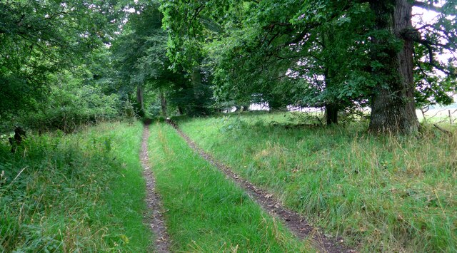
The hill is covered in heather and grass, making it a popular destination for hikers and nature enthusiasts. Its accessible location and well-marked trails attract both locals and tourists who seek a moderate challenge and a chance to immerse themselves in the natural beauty of the area.

Ardargie Hill is known for its diverse wildlife, including various bird species, such as red grouse and curlews. It is also home to a wide range of plant life, including lichens and mosses, which thrive in its moist and cool climate.

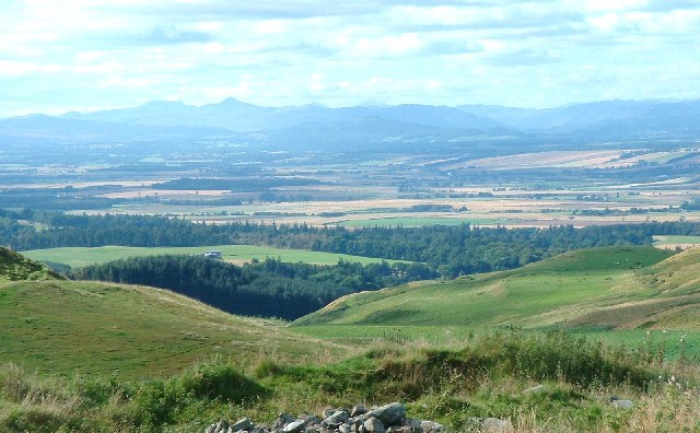
At the summit of Ardargie Hill, there is a cairn, a man-made pile of stones, which marks the highest point and provides a perfect spot for hikers to rest and take in the stunning vistas. On a clear day, one can see the lush green fields and rolling hills of Perthshire, as well as distant peaks in the Grampian Mountains.

Overall, Ardargie Hill is a picturesque and accessible hill in Perthshire, offering a rewarding outdoor experience for those who enjoy hiking, nature, and breathtaking views.

If you have any feedback on the listing, please let us know in the comments section below.

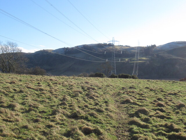
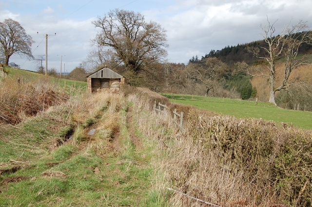
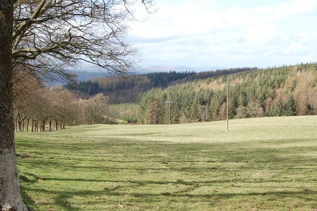
Ardargie Hill Images

Images are sourced within 2km of 56.318824/-3.4765523 or Grid Reference NO0815. Thanks to Geograph Open Source API. All images are credited.

Approaching the ruined Muckersie Chapel on the Invermay estate
Muckersie Chapel This ruin is sited on a bluff overlooking the Water of May.  It was used for worship until about 1638 when it fell into disuse.  It was refurbished in the mid 19th century to provide a mausoleum for the Belsches who had acquired the estate in 1717.
Muckersie Chapel
This ruin is sited on a bluff overlooking the Water of May. It was used for worship until about 1638 when it fell into disuse. It was refurbished in the mid 19th century to provide a mausoleum for the Belsches who had acquired the estate in 1717.
Entrance to the Ardargie housing estate
Road, Westhall
Road, Westhall
Westhall Hill The north side of the Ochil Hills.
Westhall Hill
The north side of the Ochil Hills.
New build at Ardargie One of the many new houses built at Ardargie.
New build at Ardargie
One of the many new houses built at Ardargie.
Road at Binzian Minor road heading northwards at Binzian.
Road at Binzian
Minor road heading northwards at Binzian.
Binzian Mill Looking down to Binzian Mill in the valley of the Water of May from the road to the south-west.
Binzian Mill
Looking down to Binzian Mill in the valley of the Water of May from the road to the south-west.
Power line, Dumbuils Between Perth and Kincardine on Forth.
Power line, Dumbuils
Between Perth and Kincardine on Forth.
Sunset over the Earn Valley Looking West from the road below Rossie Ochill
Sunset over the Earn Valley
Looking West from the road below Rossie Ochill
Westhall Hill (and Strathearn) Photo taken from western earthworks (foreground) of hill fort lying northeast of Culteuchar Hill. General view of Westhall Hill on right and looking west up Strathearn.  Pointed summit of Ben Vorlich (Loch Earn) on the horizon.
Westhall Hill (and Strathearn)
Photo taken from western earthworks (foreground) of hill fort lying northeast of Culteuchar Hill. General view of Westhall Hill on right and looking west up Strathearn. Pointed summit of Ben Vorlich (Loch Earn) on the horizon.
By Binzian Mill Grazing land by Binzian Mill.
By Binzian Mill
Grazing land by Binzian Mill.
Water of May Looking upstream from the bridge at Binzian/Torhill.
Water of May
Looking upstream from the bridge at Binzian/Torhill.
Cattle grazing by Eastfield Mostly sheep around here but there are some cattle too.
Cattle grazing by Eastfield
Mostly sheep around here but there are some cattle too.
By Rossie Ochill Looking out over much of the square from Rossie Ochill across the Kelty burn to Craigoway Hill.
By Rossie Ochill
Looking out over much of the square from Rossie Ochill across the Kelty burn to Craigoway Hill.
Lochan by Ardargie Looks like a new man made wildlife lochan has been constructed here recently as it's not on my maps.
Lochan by Ardargie
Looks like a new man made wildlife lochan has been constructed here recently as it's not on my maps.
By Torhill A mix of woodland and grazing on this steep ground above Torhill
By Torhill
A mix of woodland and grazing on this steep ground above Torhill
Farm Road to Westhall
Show me another place!

Ardargie Hill is located at Grid Ref: NO0815 (Lat: 56.318824, Lng: -3.4765523)

Unitary Authority: Perth and Kinross

Police Authority: Tayside

What 3 Words

///wants.uttering.pelted. Near Bridge of Earn, Perth & Kinross

Nearby Locations

Ardargie Hill

Related Wikis

Invermay

Invermay ( ) is a diffuse settlement in Perth and Kinross, Scotland. It is situated approximately 2 km southeast of Forteviot on the Water of May, some...

Forgandenny

Forgandenny (Scottish Gaelic Forgrann Eithne, 'Over-Bog of Eithne' [an ancient female Gaelic name]) is a small village in Perth and Kinross, Scotland,...

Strathallan School

Strathallan School is a private boarding and day school in Scotland for boys and girls aged 5-18. The school has a 153-acre (62-hectare) campus at Forgandenny...

Pitkeathly Wells

Pitkeathly Wells (spelling variants: Pitcaithly, Pitceathly, Pitkethley, etc.) is a hamlet in the Perth and Kinross area of Scotland, famed for its mineral...

Forteviot Bronze Age tomb

Forteviot Bronze Age tomb is a Bronze Age burial chamber discovered in 2009 at Forteviot near Perth, Scotland. The Bronze Age tomb is one of a number of...

Forteviot

Forteviot (Scottish Gaelic: Fothair Tabhaicht) (Ordnance Survey grid reference NO052175) is a village in Strathearn, Scotland on the south bank of the...

Forgandenny railway station

Forgandenny railway station served the village of Forgandenny, Perth and Kinross, Scotland from 1848 to 1956 on the Scottish Central Railway. == History... ==

Kilgraston School

Kilgraston School is a Scottish private boarding and day school offering primary school education for boys and girls aged from five to twelve years old...

Nearby Amenities

Located within 500m of 56.318824,-3.4765523
Ardargie Hill
Natural: peak
Lat/Long: 56.3189996/-3.4765484
Power: pole
Lat/Long: 56.3183249/-3.4844136
Power: pole
Lat/Long: 56.317988/-3.4837641
Power: pole
Lat/Long: 56.3175309/-3.4828935
Power: pole
Lat/Long: 56.317154/-3.4821765
Power: pole
Lat/Long: 56.3168054/-3.4815177
Power: pole
Lat/Long: 56.3161624/-3.4811825
Power: pole
Lat/Long: 56.3155143/-3.4808426
Power: pole
Lat/Long: 56.3176704/-3.4842157
The data included in this document is from www.openstreetmap.org. The data is made available under ODbL.

Have you been to Ardargie Hill?

Leave your review of Ardargie Hill below (or comments, questions and feedback).