Grike

Hill, Mountain in Cumberland Copeland

England

Grike

Weir at outflow of Ennerdale Water
Weir at outflow of Ennerdale Water Credit: Graeme Yuill

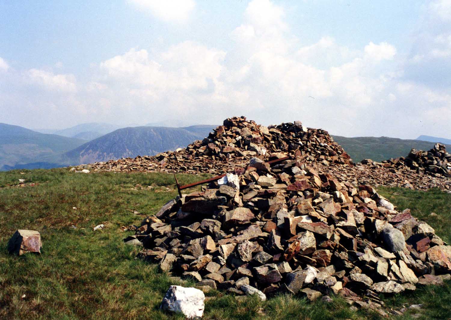
Grike is a hill located in the county of Cumberland, in the northwest region of England. It forms part of the larger Lake District National Park, renowned for its stunning natural landscapes. Standing at an elevation of 1,173 feet (358 meters), Grike is classified as a hill rather than a mountain but offers breathtaking panoramic views of the surrounding countryside.

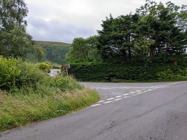
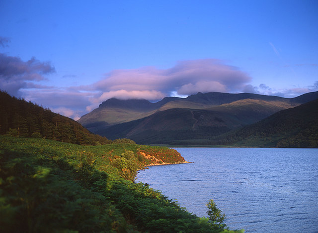
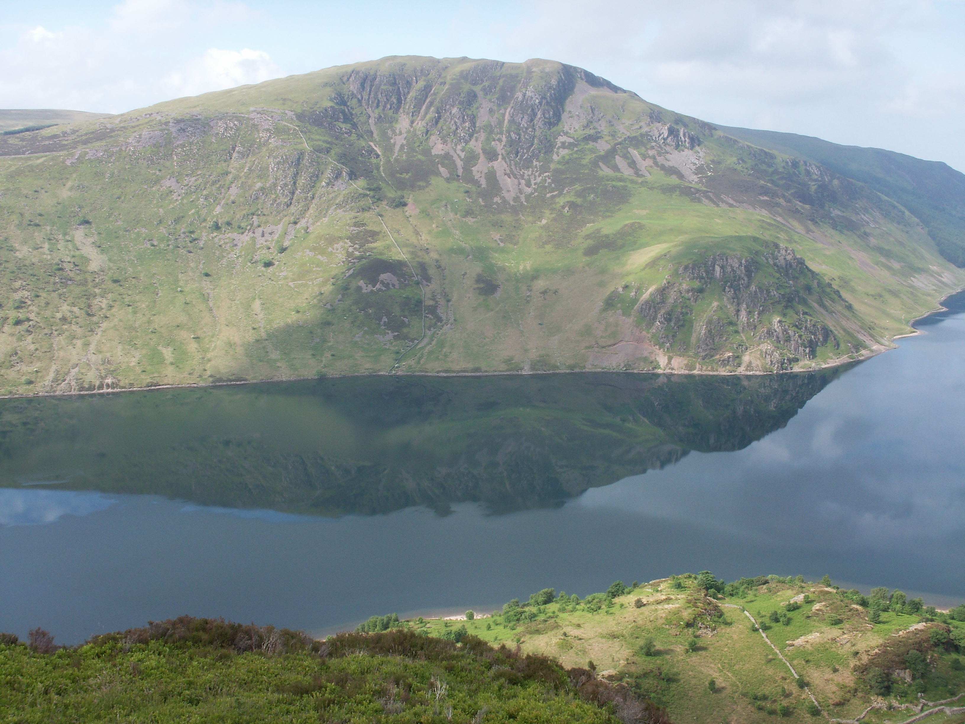
The hill is situated near the village of Ennerdale Bridge, approximately 8 miles (13 kilometers) southwest of the town of Cockermouth. Grike is part of a ridge that includes neighboring hills such as Crag Fell and Lank Rigg, making it a popular destination for hikers and hillwalkers who enjoy exploring the area's diverse terrain.

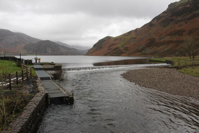
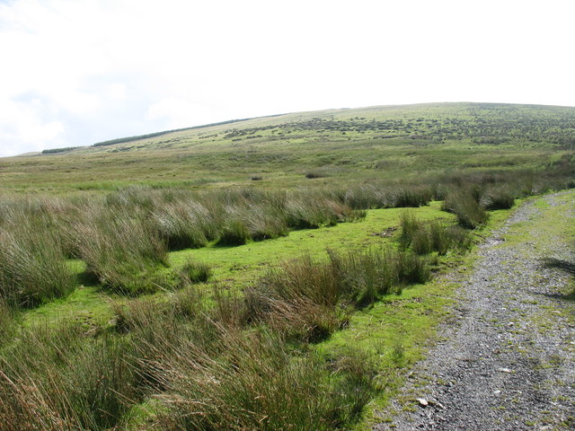
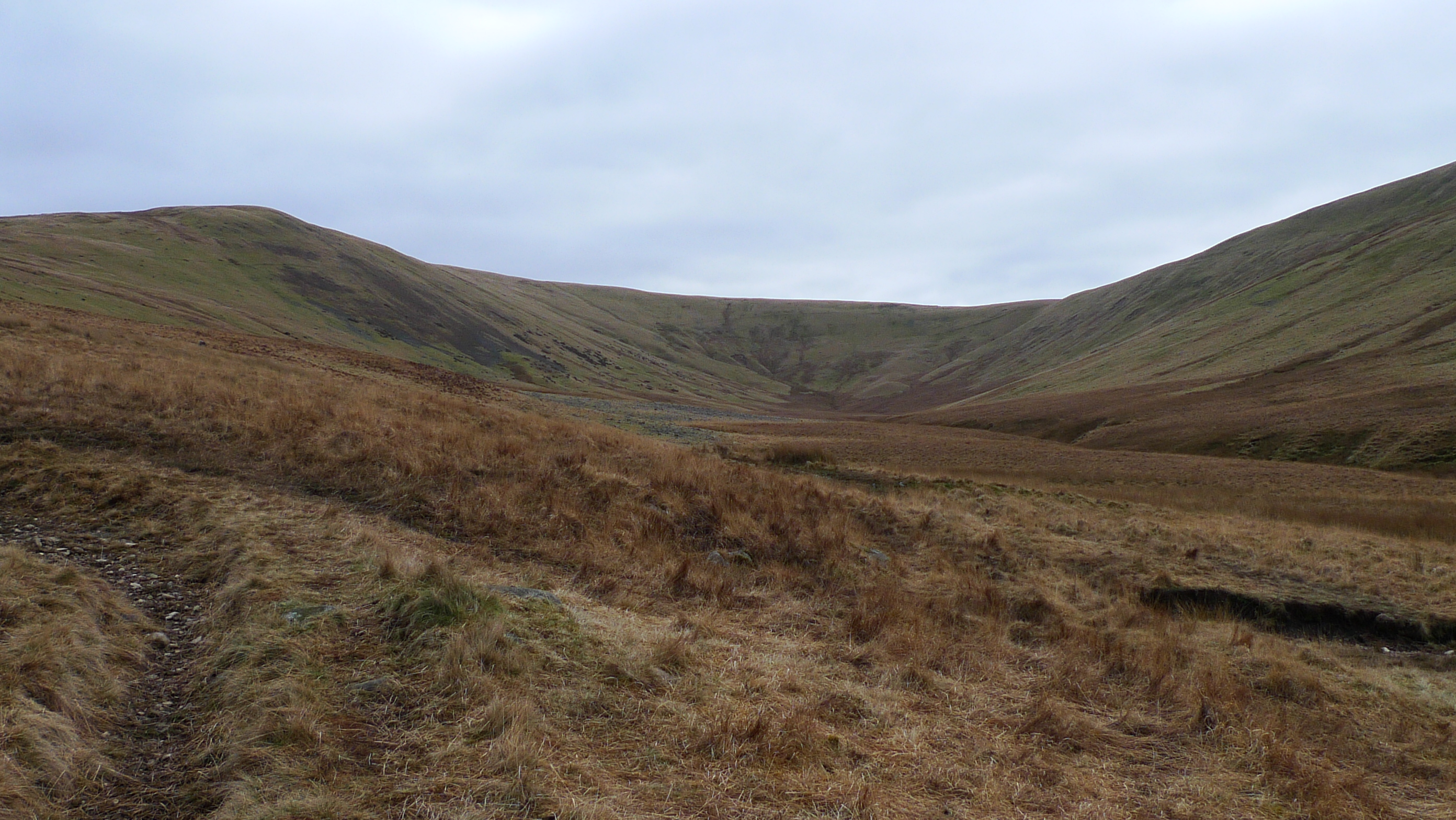
The ascent to Grike is relatively straightforward, with various paths and trails available to visitors. The hill is characterized by its grassy slopes and rocky outcrops, providing a challenging yet enjoyable climb. Once at the summit, hikers are rewarded with stunning vistas over Ennerdale Valley, the Irish Sea, and the surrounding fells.

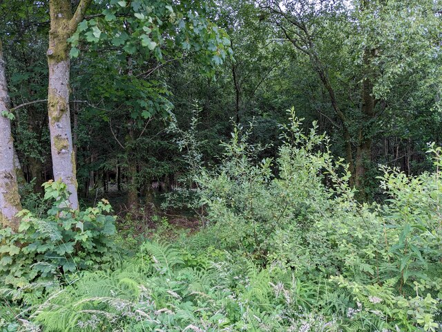
Grike is also home to an interesting array of wildlife, including a variety of bird species such as buzzards and peregrine falcons, as well as occasional sightings of red deer and mountain hares. The area is protected and managed by the National Trust, ensuring the preservation of its natural beauty and biodiversity.

Overall, Grike offers outdoor enthusiasts and nature lovers an opportunity to immerse themselves in the rugged beauty of the Lake District, with its picturesque landscapes and captivating wildlife.

If you have any feedback on the listing, please let us know in the comments section below.

Grike Images

Images are sourced within 2km of 54.513733/-3.4147888 or Grid Reference NY0814. Thanks to Geograph Open Source API. All images are credited.

Weir at outflow of Ennerdale Water
The Broadmoor Jubilee Trail
Junction with the road to Ennerdale lake
Vegetated verges on the edge of Broadmoor
Dense woodland in Broadmoor
Ennerdale Pano
Ennerdale Pano
Start of the River Ehan, Ennerdale Waters The river's source is at the west end of Ennerdale Water: it runs west through Ennerdale Bridge

<span class="nowrap"><a title="https://en.wikipedia.org/wiki/River_Ehen" rel="nofollow ugc noopener" href="https://en.wikipedia.org/wiki/River_Ehen">Link</a><img style="margin-left:2px;" alt="External link" title="External link - shift click to open in new window" src="https://s1.geograph.org.uk/img/external.png" width="10" height="10"/></span>
Start of the River Ehan, Ennerdale Waters
The river's source is at the west end of Ennerdale Water: it runs west through Ennerdale Bridge LinkExternal link
On Whoap Summit On the unmarked top looking towards Crag Fell. Few are fortunate enough to have climbed modest Whoap ten times as I have done over the years.
On Whoap Summit
On the unmarked top looking towards Crag Fell. Few are fortunate enough to have climbed modest Whoap ten times as I have done over the years.
Violet Ground Beetle By the Ennerdale fence under Whoap. The beetle though a common sight on the fells startled as it scurried over the grass  flashing violet.
Violet Ground Beetle
By the Ennerdale fence under Whoap. The beetle though a common sight on the fells startled as it scurried over the grass flashing violet.
Ascending Crag Fell Looking towards Boat How from the flanks of Crag Fell
Ascending Crag Fell
Looking towards Boat How from the flanks of Crag Fell
Above Revelin Crag The fellside falls away steeply 1300' above Ennerdale Lake
Above Revelin Crag
The fellside falls away steeply 1300' above Ennerdale Lake
Heckbarley Plantation The final cut for this plantation as trees are being felled here as part of a project to create more natural woodlands. Good news for nature lovers and hopefully the woodland will be more pleasing to the eye. The project fits in with the nearby 'Wild Ennerdale' scheme. Just hope I live long enough to enjoy the changes!
Heckbarley Plantation
The final cut for this plantation as trees are being felled here as part of a project to create more natural woodlands. Good news for nature lovers and hopefully the woodland will be more pleasing to the eye. The project fits in with the nearby 'Wild Ennerdale' scheme. Just hope I live long enough to enjoy the changes!
Weir at Enerdale Water
Angler's Crag Bowness Knott in the distance across Ennerdale Water
Angler's Crag
Bowness Knott in the distance across Ennerdale Water
Blakeley Raise
Blakeley Raise
On Blakeley Looking towards Grike
On Blakeley
Looking towards Grike
On Blakeley Raise Looking towards Swarth Fell
On Blakeley Raise
Looking towards Swarth Fell
Clearfell under Grike Large areas have been felled in the plantations around Red Moss
Clearfell under Grike
Large areas have been felled in the plantations around Red Moss
Show me another place!

Grike is located at Grid Ref: NY0814 (Lat: 54.513733, Lng: -3.4147888)

Administrative County: Cumbria

District: Copeland

Police Authority: Cumbria

What 3 Words

///captive.relished.uplifting. Near Frizington, Cumbria

Nearby Locations

Grike

Related Wikis

Grike (Lake District)

Grike is a hill in the west of the English Lake District, near Ennerdale Water. It is part of the Lank Rigg group, the most westerly Wainwright as the...

Ennerdale and Kinniside

Ennerdale and Kinniside is a civil parish in Copeland, Cumbria, England. At the 2011 census it had a population of 220.The parish has an area of 8,763...

Crag Fell

Crag Fell is a hill in the English Lake District. It is part of the Lank Rigg group, standing above Ennerdale Water in the Western Fells. The craggy northern...

Whoap

Whoap is a hill located near the western edge of the English Lake District, standing at 511 m. It is part of the Lank Rigg group and is separated from...

Nearby Amenities

Located within 500m of 54.513733,-3.4147888
Barrier: stile
Lat/Long: 54.5136433/-3.4160994
Barrier: stile
Lat/Long: 54.5130646/-3.4207858
Abandoned: yes
Historic: mine
Lat/Long: 54.5179963/-3.4158066
Grike
Ele: 488
Natural: peak
Wikidata: Q5609151
Wikipedia: en:Grike (Lake District)
Lat/Long: 54.5137445/-3.4148378
Man Made: mast
Lat/Long: 54.5132786/-3.4075962
Abandoned: yes
Man Made: adit
Lat/Long: 54.5177004/-3.4128595
The data included in this document is from www.openstreetmap.org. The data is made available under ODbL.

Have you been to Grike?

Leave your review of Grike below (or comments, questions and feedback).