Cnap an Dòbhrain

Hill, Mountain in Banffshire

Scotland

Cnap an Dòbhrain

River Avon near Lagan a' Mheirlich The Faindouran track can be seen contouring round the hill on the left.
River Avon near Lagan a' Mheirlich Credit: Dorothy Carse

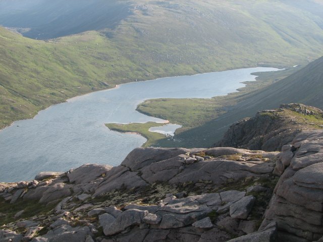
Cnap an Dòbhrain is a prominent hill located in Banffshire, Scotland. It is situated near the village of Tomintoul, which is known as the highest village in the Highlands. Cnap an Dòbhrain is part of the Cairngorms National Park, a vast and picturesque area renowned for its rugged landscapes and diverse wildlife.

Standing at an elevation of approximately 768 meters (2,520 feet), Cnap an Dòbhrain offers breathtaking panoramic views of the surrounding area. Its distinctive shape, resembling a rounded dome, adds to its charm and allure. The hill is composed mainly of granite, which contributes to its rugged and rocky terrain.

The ascent to the summit of Cnap an Dòbhrain is a popular activity for outdoor enthusiasts, including hikers and climbers. There are various routes to reach the top, catering to different levels of experience and fitness. The trail offers a mix of challenging sections and more gradual inclines, ensuring an enjoyable and rewarding adventure for all.

The hill is home to a variety of flora and fauna, including heather, bilberry, and deer, which can often be spotted grazing in the surrounding moorlands. Birdwatchers may also be treated to the sight of golden eagles soaring above, as the area is known for its diverse bird population.

Whether you are seeking a challenging hike, a chance to admire breathtaking views, or an opportunity to immerse yourself in the natural beauty of the Cairngorms National Park, Cnap an Dòbhrain is a must-visit destination for outdoor enthusiasts and nature lovers alike.

If you have any feedback on the listing, please let us know in the comments section below.

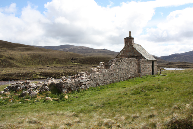
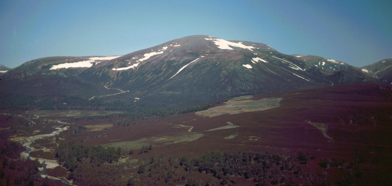
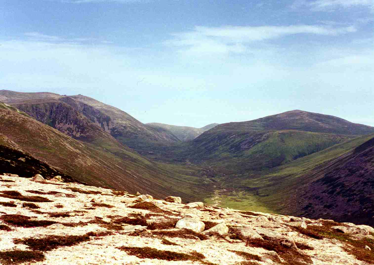
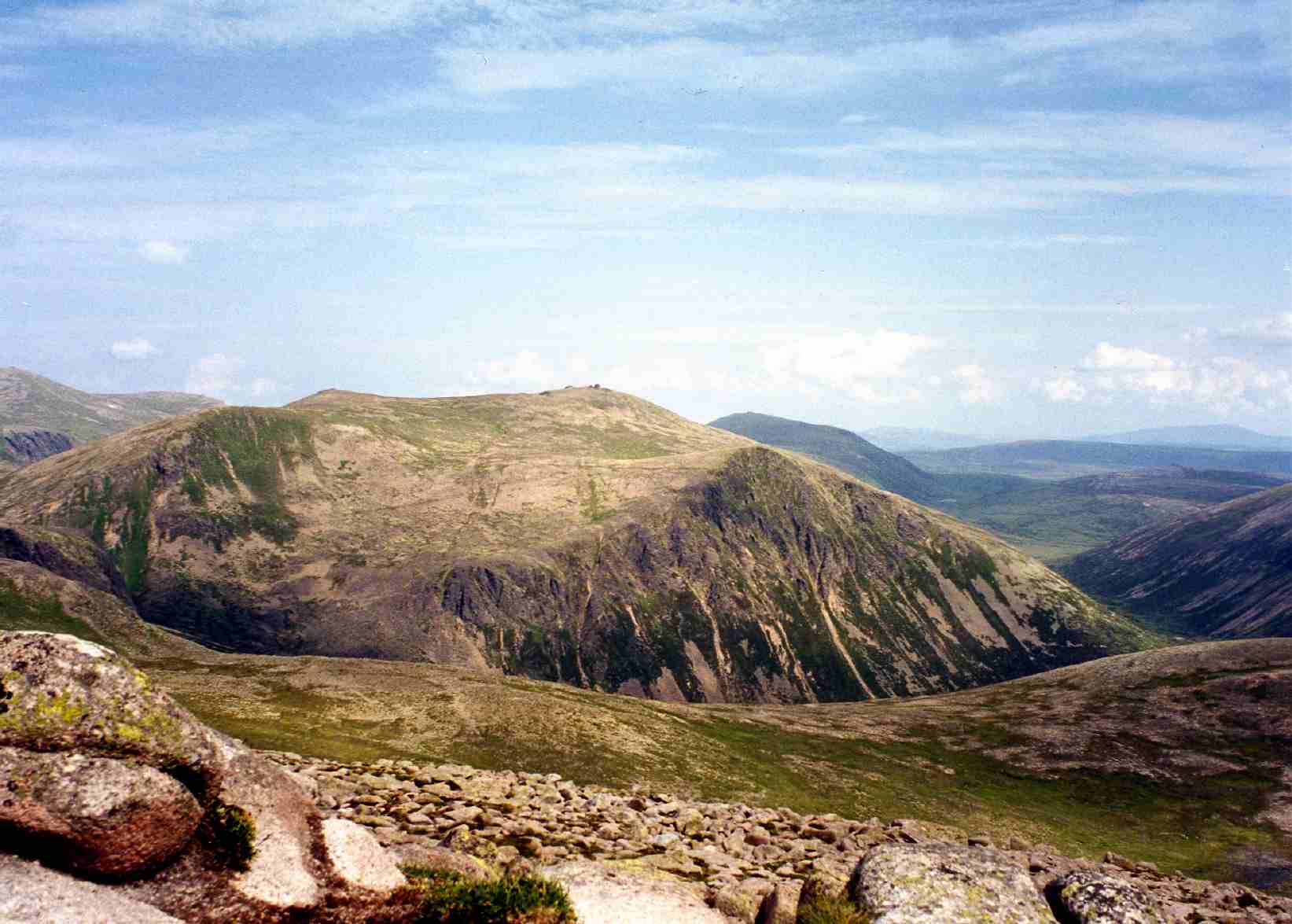
Cnap an Dòbhrain Images

Images are sourced within 2km of 57.144565/-3.5155744 or Grid Reference NJ0806. Thanks to Geograph Open Source API. All images are credited.

River Avon near Lagan a' Mheirlich The Faindouran track can be seen contouring round the hill on the left.
River Avon near Lagan a' Mheirlich
The Faindouran track can be seen contouring round the hill on the left.
Footbridge over the River Avon The river flows through a narrow rocky gorge here.
Footbridge over the River Avon
The river flows through a narrow rocky gorge here.
Track between boulders The track to Faindouran passes between two erratics.
Track between boulders
The track to Faindouran passes between two erratics.
Faindouran Bothy A nice bothy attached to the ruins of Faindouran Lodge.
Faindouran Bothy
A nice bothy attached to the ruins of Faindouran Lodge.
Footbridge over the River Avon
Faindouran Lodge bothy
Looking up Glen Avon From just off the path S.W. of Faindouran Lodge, looking further up Glen Avon. That could be Beinn Mheadhoin in the R.H. distance, and Beinn a' Chaorainn in the L.H. distance. The landrover track ended at Faindouran.
Looking up Glen Avon
From just off the path S.W. of Faindouran Lodge, looking further up Glen Avon. That could be Beinn Mheadhoin in the R.H. distance, and Beinn a' Chaorainn in the L.H. distance. The landrover track ended at Faindouran.
Grassy moorland above Glen Avon In the area marked Leacann a' Bhothain Dhuibh.
Grassy moorland above Glen Avon
In the area marked Leacann a' Bhothain Dhuibh.
Grassy moorland above Glen Avon From off the path, and west of Faindouran Lodge Bothy, looking further west over Caochan Craobh a' Chuimeneich.
Grassy moorland above Glen Avon
From off the path, and west of Faindouran Lodge Bothy, looking further west over Caochan Craobh a' Chuimeneich.
Grassy moorland west of Faindouran Lodge Bothy The valley in the distance is Feith an Dobhrain. Above it on the right, ( and out of the square is Cnap a' Dobhrain ).
Grassy moorland west of Faindouran Lodge Bothy
The valley in the distance is Feith an Dobhrain. Above it on the right, ( and out of the square is Cnap a' Dobhrain ).
Col north of Dagrum The relatively flat plateaux to the north of Dagrum. the high point ahead is unnamed on Ordnance Survey maps.
Col north of Dagrum
The relatively flat plateaux to the north of Dagrum. the high point ahead is unnamed on Ordnance Survey maps.
Flat landscape north of Dagrum A flat relatively flora free landscape to the north of Dagrum.
Flat landscape north of Dagrum
A flat relatively flora free landscape to the north of Dagrum.
Peat hag west of Coire Riabhach Bheag A peat hag in the gently sloping landscape.
Peat hag west of Coire Riabhach Bheag
A peat hag in the gently sloping landscape.
Hillside north of Coire Riabhach Bheag A grassy area of hill to the north of Coire Riabhach Bheag.
Hillside north of Coire Riabhach Bheag
A grassy area of hill to the north of Coire Riabhach Bheag.
Peat hags north of Coire Riabhach Bheag Peat hags on the hill to the north of Coire Riabhach Bheag.
Peat hags north of Coire Riabhach Bheag
Peat hags on the hill to the north of Coire Riabhach Bheag.
A barren landscape north of Dagrum The relatively flat upland to the north of Dagrum is home to low heather and dispersed tussocks of grass, non of which is very tall or difficult to navigate.
A barren landscape north of Dagrum
The relatively flat upland to the north of Dagrum is home to low heather and dispersed tussocks of grass, non of which is very tall or difficult to navigate.
Barren upland landscape A barren upland landscape to the north of the minor top of Dagrum.
Barren upland landscape
A barren upland landscape to the north of the minor top of Dagrum.
Gently sloping upland landscape A gently sloping, barren upland landscape on the ridge to the north of Creag Mhor.
Gently sloping upland landscape
A gently sloping, barren upland landscape on the ridge to the north of Creag Mhor.
Show me another place!

Cnap an Dòbhrain is located at Grid Ref: NJ0806 (Lat: 57.144565, Lng: -3.5155744)

Unitary Authority: Moray

Police Authority: North East

What 3 Words

///milk.processes.emerald. Near Inverey, Aberdeenshire

Nearby Locations

Cnap an Dòbhrain

Related Wikis

Bynack More

Bynack More (Scottish Gaelic: A' Bheithneag Mhòr or Beinn Bheithneag) is a Scottish Mountain that is situated in the Cairngorms range, 16 kilometres east...

Beinn a' Bhùird

Beinn a' Bhùird is a Munro in the Cairngorm mountain range of Scotland. In Watson (1975) the author suggests the mountain should be named Beinn Bòrd -...

Beinn a' Chaorainn (Cairngorms)

Beinn a' Chaorainn is a Scottish mountain in the heart of the Cairngorms range. It is quite a remote hill, being located roughly 19 kilometres south east...

Ben Avon

Ben Avon (Scottish Gaelic: Beinn Athfhinn, 'mountain of the Avon') is a mountain in the Cairngorms of Scotland. It is a sprawling mountain with a broad...

Beinn Mheadhoin (Cairngorms)

Beinn Mheadhoin or Beinn Meadhain (Scottish Gaelic for 'middle mountain') is a mountain in the Highlands of Scotland. It is a Munro with a height of 1...

Cairngorm Lochs

Cairngorm Lochs is a protected wetland area in the Cairngorms, in the Grampian and Highland regions of Scotland. With a total area of 173 hectares, it...

Loch A'an

Loch A'an is a remote freshwater loch set deep within the central Cairngorms plateau, in the Cairngorms National Park, located in the eastern Highlands...

Lairig an Laoigh

The Lairig an Laoigh ( LAR-ig ən LOO-ee; Scottish Gaelic: Làirig Laoigh) is a mountain pass through the Highlands of Scotland. In speech and sometimes...

Nearby Amenities

Located within 500m of 57.144565,-3.5155744
Cnap an Dobhrain
Ele: 693
Natural: peak
Lat/Long: 57.144804/-3.5136586
The data included in this document is from www.openstreetmap.org. The data is made available under ODbL.

Have you been to Cnap an Dòbhrain?

Leave your review of Cnap an Dòbhrain below (or comments, questions and feedback).