Glenlood Hill

Hill, Mountain in Peeblesshire

Scotland

Glenlood Hill

Glenharvie Craig A rare example of a small rocky outcrop in these rounded heathery hills.
Glenharvie Craig Credit: Alan O'Dowd

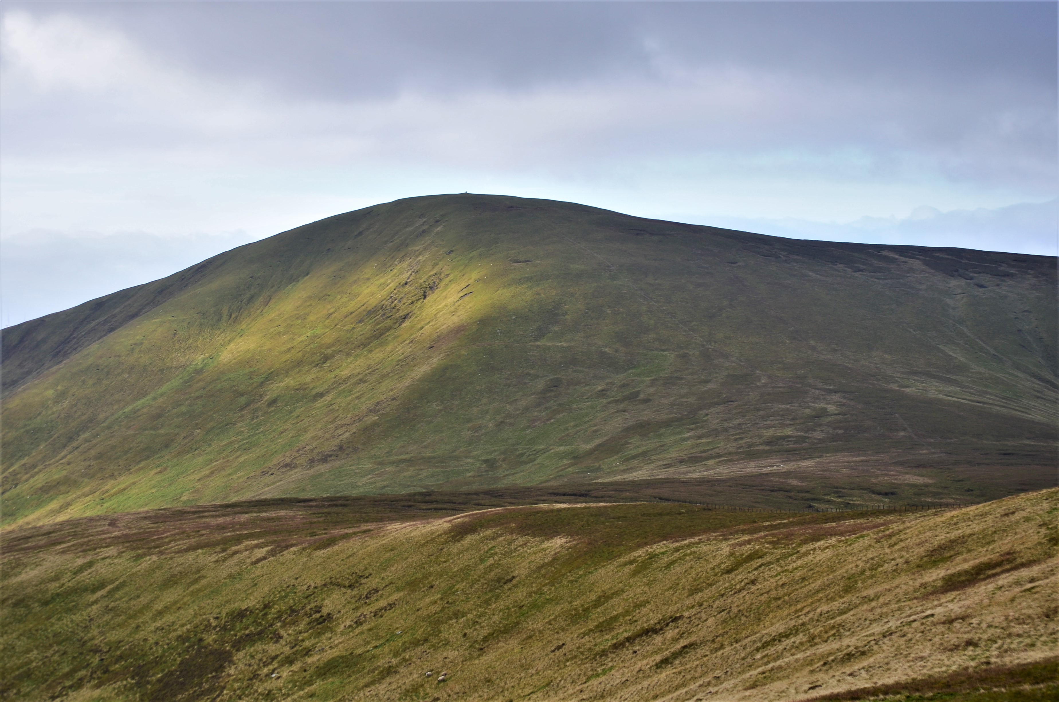
Glenlood Hill is a prominent geographical feature located in Peeblesshire, a historic county in the southern region of Scotland. It is considered a hill rather than a mountain, as it stands at an elevation of approximately 400 meters (1,312 feet) above sea level.

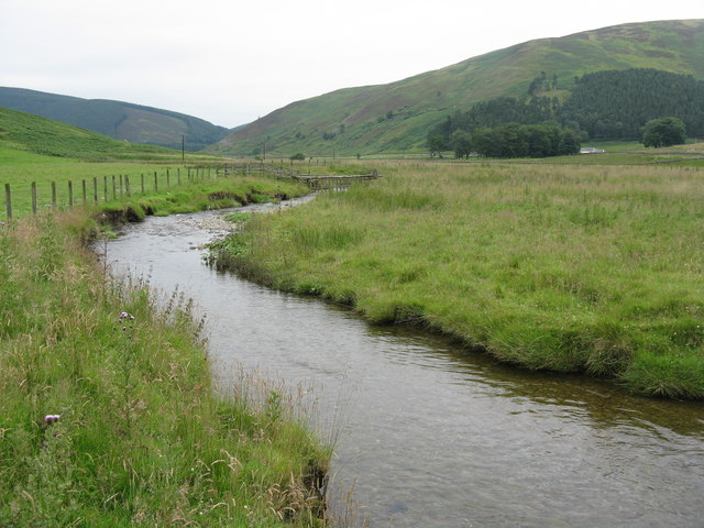
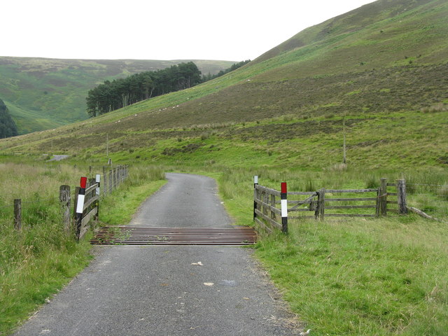
Situated within the picturesque Tweed Valley, Glenlood Hill offers breathtaking panoramic views of the surrounding natural landscape. Its location is ideal for those looking to explore the Scottish countryside and immerse themselves in its beauty. The hill is easily accessible, with several walking trails leading to its summit, making it a popular destination for hikers and nature enthusiasts.

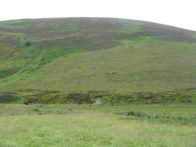
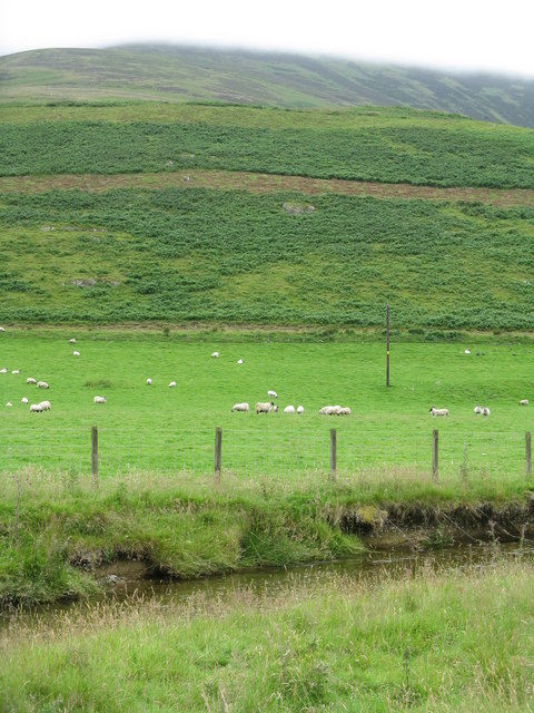
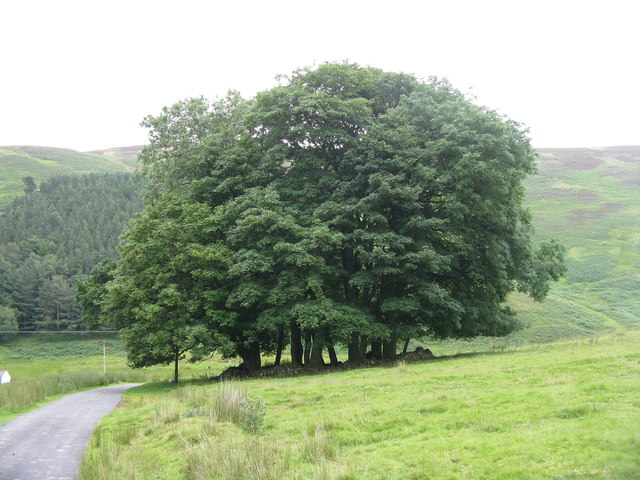
The terrain of Glenlood Hill is characterized by rolling hills, lush green meadows, and dense forestry. The hill is predominantly covered in heather and grass, providing a natural habitat for various wildlife species, including birds, rabbits, and deer. The flora and fauna found here add to the charm and tranquility of the area.

At the top of Glenlood Hill, visitors are rewarded with stunning vistas of the Tweed Valley, with the meandering River Tweed visible in the distance. On clear days, it is even possible to catch a glimpse of the nearby Southern Upland Way, a long-distance footpath that stretches across the Southern Uplands.

Overall, Glenlood Hill is a captivating natural landmark in Peeblesshire, offering a peaceful retreat for those seeking to connect with nature and enjoy the serene beauty of the Scottish countryside.

If you have any feedback on the listing, please let us know in the comments section below.

Glenlood Hill Images

Images are sourced within 2km of 55.538961/-3.458227 or Grid Reference NT0828. Thanks to Geograph Open Source API. All images are credited.

Glenharvie Craig A rare example of a small rocky outcrop in these rounded heathery hills.
Glenharvie Craig
A rare example of a small rocky outcrop in these rounded heathery hills.
Glenharvie Craig and Chapelgill Hill A view from Leishfoot Hill across the valley of the Glenharvie Burn, with Chapelgill Hill rising beyond the outlying slopes above Glenharvie Craig and Congrie Hill.
Glenharvie Craig and Chapelgill Hill
A view from Leishfoot Hill across the valley of the Glenharvie Burn, with Chapelgill Hill rising beyond the outlying slopes above Glenharvie Craig and Congrie Hill.
Holms Waterhead from Leishfoot Hill A view over improved grassland at the head of the Holms Water.
Holms Waterhead from Leishfoot Hill
A view over improved grassland at the head of the Holms Water.
Enclosure at Holms Waterhead Glenlood Hill rises behind the farm cottage.
Enclosure at Holms Waterhead
Glenlood Hill rises behind the farm cottage.
Sheepfold at Holms Waterhead A modern, corrugated iron sheepfold by the Glenharvie Burn.
Sheepfold at Holms Waterhead
A modern, corrugated iron sheepfold by the Glenharvie Burn.
Gate on track between Glenkirk and Holms Waterhead The public road ends at Glenkirk, but a track continues on to Holms Waterhead.
Gate on track between Glenkirk and Holms Waterhead
The public road ends at Glenkirk, but a track continues on to Holms Waterhead.
House at Holms Waterhead From this angle, the turbines of the Glenkerie Wind Farm on Glenlood Hill behind are hidden.
House at Holms Waterhead
From this angle, the turbines of the Glenkerie Wind Farm on Glenlood Hill behind are hidden.
Glenlood Hill With the valley of Nether Glenlood Burn.
Glenlood Hill
With the valley of Nether Glenlood Burn.
The gathering They suddenly came from nowhere, and were shepherded down the valley from Holms Waterhead.
The gathering
They suddenly came from nowhere, and were shepherded down the valley from Holms Waterhead.
Holms Waterhead The head of the glen.
Holms Waterhead
The head of the glen.
Bank erosion on the Holms Water Looking up the valley of the Nether Glenlood Burn.
Bank erosion on the Holms Water
Looking up the valley of the Nether Glenlood Burn.
Track in Glen Holm Looking down the valley of the Holms Water to Glenkirk.
Track in Glen Holm
Looking down the valley of the Holms Water to Glenkirk.
Barrow Rig from Glenkirk Looking southeast across the Holms Water.
Barrow Rig from Glenkirk
Looking southeast across the Holms Water.
The valley of the Hope Burn Cloud covers the top of Chapelgill Hill.
The valley of the Hope Burn
Cloud covers the top of Chapelgill Hill.
The Holms Water Looking downstream to Glencotho.
The Holms Water
Looking downstream to Glencotho.
Pasture by the Holms Water With bracken-covered lower slopes of Chapelgill Hill beyond.
Pasture by the Holms Water
With bracken-covered lower slopes of Chapelgill Hill beyond.
Cattle grid in Glen Holm Looking down the valley.
Cattle grid in Glen Holm
Looking down the valley.
Clump of trees at Glencotho Surrounded by a low circular wall.
Clump of trees at Glencotho
Surrounded by a low circular wall.
Show me another place!

Glenlood Hill is located at Grid Ref: NT0828 (Lat: 55.538961, Lng: -3.458227)

Unitary Authority: The Scottish Borders

Police Authority: The Lothians and Scottish Borders

What 3 Words

///width.vessel.seasons. Near Biggar, South Lanarkshire

Nearby Locations

Glenlood Hill

Related Wikis

A701 road

The A701 is a major road in Scotland that runs from Dumfries to Edinburgh. == Route == The A701 leaves Dumfries and travels north to meet the A74(M) east...

Culter Fell

Culter Fell is a hill in the Culter Hills range, part of the Southern Uplands of Scotland. It is the county top of the historic county of Lanarkshire,...

Gathersnow Hill

Gathersnow Hill is a hill in the Culter Hills range, part of the Southern Uplands of Scotland. It lies west of the village of Tweedsmuir on the border...

Crook Inn

The Crook Inn is an inn in the Scottish Borders, near the village of Tweedsmuir on the A701 road between Broughton and Moffat. It is one of many claimants...

Nearby Amenities

Located within 500m of 55.538961,-3.458227
Glenlood Hill
Ele: 565
Ele Ft: 1856
Natural: peak
Lat/Long: 55.5389801/-3.4572615
Designation: generator:source=wind
Generator Method: wind_turbine
Generator Source: wind
Generator Type: horizontal_axis
Power: generator
Lat/Long: 55.5348098/-3.458774
Generator Method: wind_turbine
Generator Source: wind
Generator Type: horizontal_axis
Power: generator
Lat/Long: 55.5367489/-3.4532246
The data included in this document is from www.openstreetmap.org. The data is made available under ODbL.

Have you been to Glenlood Hill?

Leave your review of Glenlood Hill below (or comments, questions and feedback).